
More on The North Bench: every guide we have published there, in one place.
The Alpine Loop is a roughly 20-mile scenic road that winds through the Wasatch Mountains between Provo Canyon and American Fork Canyon, passing through some of the most beautiful mountain terrain in Utah. It's the kind of drive where you'll stop the car five times in the first three miles — not because anything's wrong, but because the views keep getting better.
For Provo residents, the Alpine Loop is the go-to scenic drive. In fall, it's arguably the best foliage drive in the state. In summer, it's a gateway to hiking trails, Sundance Resort, and hidden natural attractions. It's close, it's free to drive, and on a clear day, it's genuinely stunning.
Two rules govern this road, and most guides mention neither. There is a 30-foot vehicle length restriction, and there is a standing ban on roadside camping and campfires along the whole corridor. Both are covered in detail below, because both are the sort of thing you want to know in the valley rather than at 8,000 feet with nowhere to turn around.
Route Overview
The Alpine Loop — officially State Route 92, and signed by the Forest Service as the Alpine Scenic Loop Backway — runs from the mouth of American Fork Canyon to the junction with U.S. 189 in Provo Canyon, or vice versa. The Forest Service calls it the most popular scenic drive on the whole Uinta-Wasatch-Cache National Forest, which is a large claim on a forest that also contains the Mirror Lake Highway.
The climb is the part people underestimate. The route begins at about 5,000 feet at the mouth of American Fork Canyon and crests near 8,000 feet before dropping toward Provo Canyon. That 3,000-foot gain is why the color turns at the top a week or more before it turns at the bottom, why the summit can be sleeting while the valley is warm, and why the road is a seasonal one at all.
From Provo: Head up Provo Canyon on U.S. 189, pass Sundance Resort, and turn onto the Alpine Loop road (UT-92) heading north. The road climbs through the mountains, passes Cascade Springs and several trailheads, then descends through American Fork Canyon back to the valley. Turn south on I-15 to return to Provo.
From Orem/American Fork: Enter American Fork Canyon heading east, drive past Timpanogos Cave National Monument, and continue onto the Alpine Loop heading south. Exit through Provo Canyon.
Direction tip: driving from American Fork Canyon to Provo Canyon (north to south) tends to put the most dramatic drop-offs on the passenger side, which some drivers strongly prefer. Both directions are beautiful; pick the one your passengers will enjoy.
The 30-Foot Rule
This is the correction worth making loudly, because the polite version — "large vehicles should be prepared for tight turns" — is not what the managing agencies actually say.
SR-92 over the Alpine Loop carries a 30-foot vehicle length restriction. The Forest Service states it directly in the site information for Mt. Timpanogos Campground, which sits on the loop itself: the road outside the campground has a 30-foot limit and longer vehicles will not be allowed on the road. Utah Valley's own tourism office frames it as a strong recommendation against anything over 30 feet, on the grounds that the road is simply too narrow.
Read together, the practical meaning is unambiguous. A 34-foot Class A motorhome, a long fifth-wheel, or a truck-and-boat-trailer combination does not belong on this road, and "we'll go slowly" is not a plan — there are switchbacks where a long rig physically cannot make the turn without crossing the oncoming lane on a blind corner.
If you are over the limit, the good news is that the two best destinations are reachable without the loop. Drive up American Fork Canyon to Timpanogos Cave National Monument and turn around, or come up Provo Canyon on U.S. 189 to Sundance and turn around there. Both are wide, maintained approaches. You lose the summit; you keep the day.
Camping and Campfires: A Ban, Not a Guideline
The other thing this road does not advertise well: you cannot camp along it.
A Uinta-Wasatch-Cache closure order prohibits overnight camping and any campfire, wood stove fire or similar within a quarter mile of State Route 92 through American Fork Canyon and the Alpine Loop, the North Fork road (Forest Road 144), and Forest Road 010 — plus the horse transfer station and day-use area. The stated purpose is to prevent water-quality damage, vegetation loss, litter, fire scars and trampling around the reservoirs, streams and roadway. The order was signed 30 June 2022 and runs through 30 June 2027.
That quarter-mile buffer is wide enough to rule out essentially every pullout, gravel spur and pretty meadow you will drive past. It is a common and expensive misunderstanding: the corridor looks exactly like the national-forest land where dispersed camping is normally fine, and it is national-forest land, and it is still closed to it.
What is allowed: designated sites in the developed campgrounds along the corridor, booked through recreation.gov. Mt. Timpanogos Campground sits at about 7,600 feet in dense aspen, maple and pine — cool in August, and the closest developed camping to the Aspen Grove trailhead.
If dispersed camping is what you actually want, it exists nearby under different rules — our dispersed camping guide covers where it is legal and the stay limits that apply, and our camping near Provo guide covers the developed options and how far ahead the reservation windows open.
Best Stops Along the Way
Sundance Mountain Resort
Near the Provo Canyon junction
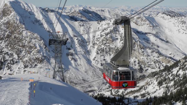
Even if you're not skiing or riding, Sundance is worth a stop. The Tree Room is the destination restaurant; the Foundry Grill is the version you can walk into in hiking clothes; the Owl Bar is the one with the history. In summer the scenic lift runs, and in fall the aspens around the resort are among the first to turn. Our full Sundance Mountain Resort guide covers the mountain in every season.
Cascade Springs
Signed side road off the loop
One of the most underrated natural attractions in Utah. A short boardwalk system — roughly three-quarters of a mile if you walk all the loops — winds through spring-fed pools stepping down over terraced travertine, surrounded by unexpectedly lush vegetation. The springs run year-round and the area stays shaded and cool on hot days. It is flat, boardwalked and genuinely accessible in a way almost nothing else up here is, which makes it the reliable stop when the group includes a stroller or someone who is not hiking today. Our Cascade Springs guide has the details.
One heads-up: the access road is a separate spur off the loop, and it is unpaved for part of its length. It is fine for an ordinary car in dry conditions and unpleasant after rain.
Stewart Falls Trailhead
Near Sundance / Aspen Grove
A roughly 3.5-mile round trip with about 650 feet of gain through shaded forest to a two-tiered waterfall — the most rewarding moderate hike in this corridor, and reachable from both the Sundance side and the Aspen Grove side. See our Stewart Falls hiking guide.
Timpanogos Cave National Monument
American Fork Canyon side
The cave tour is the marquee attraction on the north half and the one that most needs planning. Reaching the entrance is a strenuous paved climb of roughly 1.5 miles with about 1,000 feet of gain before the guided underground portion begins, and the tours visit three connected caves — Hansen, Middle and Timpanogos — linked by man-made tunnels. Timed tickets are limited, sell out in summer, and are booked at recreation.gov. Prices change and stale figures circulate, so take the current rate from recreation.gov rather than from a blog. Our Timpanogos Cave guide covers the tour types and the gear rules that turn people away at the trailhead.
Mount Timpanogos Trailheads
Aspen Grove and Timpooneke
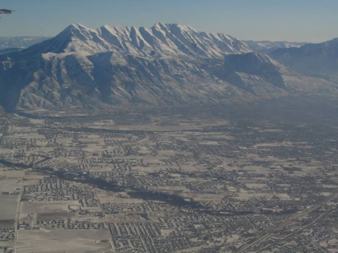
The Alpine Loop passes both trailheads for Mount Timpanogos — the crown jewel of Wasatch hiking, and a serious full-day undertaking from either side. The lower portions of both trails make excellent shorter walks with outstanding scenery. See our complete hiking guide for the full picture.
Tibble Fork and Silver Lake Flat
Up the North Fork junction, off the loop proper
Turn at the North Fork junction rather than continuing over the summit and you reach Tibble Fork Reservoir, the blue-water reservoir with the beach that fills on summer weekends, with the quieter Silver Lake Flat further up a rougher road. Worth knowing that this is a detour off the loop, not a stop on it — plan the extra time.
The quieter trailheads
Pine Hollow, Salamander Flat, Horse Flat, Scout Falls
The loop passes several trailheads that never appear on a top-ten list. Pine Hollow and Horse Flat trade views for solitude; Salamander Flat is a short, easy stop; Scout Falls is the shorter turnaround for parties who started up Timpooneke and reconsidered. All of them are dramatically emptier than Stewart Falls on an October Saturday.
Fall Foliage: Read It as Elevation, Not a Date
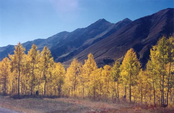
The Alpine Loop in fall is a bucket-list Utah experience — golden aspens, deep red maples, orange oaks against dark evergreens and gray rock.
The single most useful way to think about the timing is that color is an elevation staircase rather than a date on a calendar. The high sections near the summit turn first; the canyon mouths turn last, often by a couple of weeks. In a normal year the drive is at its best from late September into mid-October, but "peak" is different at 8,000 feet than at 5,000 feet on the same afternoon, which is exactly why the loop works — you drive through several weeks of autumn in an hour. Our fall in Provo guide goes into the staircase in more detail.
Crowds are the real constraint. On peak-color weekends this is a two-lane road with limited passing, full pullouts, and drivers stopping wherever the view is best. Go on a weekday if you possibly can, or start before about 10 a.m. on a weekend. Morning light is better anyway.
Practical Information
Season and road status
SR-92 over the loop is a UDOT seasonal road, closed through the winter — typically from about November until late May or June — and not maintained while closed. The target in a normal year is to have it open for Memorial Day weekend, and UDOT has said as much, but the target is not a promise: in 2024 crews needed extra time to clear mud and debris and the road opened on the evening of Thursday, 30 May.
The reliable move is to check UDOT's seasonal roads page the morning you go. It lists SR-92 American Fork Canyon / Alpine Loop by name alongside Guardsman Pass, the Mirror Lake Highway and Wolf Creek Summit, and it is updated as roads open and close. Note that the Nebo Loop to the south is not a UDOT-maintained route, so its status has to be checked separately — UDOT says so explicitly on the same page.
Fees
There's no fee to drive the Alpine Loop itself, and that is the Forest Service's own position rather than a loophole: no fee for non-stop travel along the backway, and none for gravel turnouts not associated with a developed recreation site. American Fork Canyon is a designated recreation fee area, and the pass requirement attaches to stopping at a developed site — trailhead, campground, picnic area, reservoir — where it must be on display in your vehicle while parked. The pass is sold in multi-day and season tiers rather than as a single daily rate, and federal America the Beautiful / interagency passes are honored in place of paying. Published amounts have changed over the years and stale figures circulate widely, so we are not going to quote one as current — confirm the rate with the Uinta-Wasatch-Cache National Forest or at the station before you go, and note that payment on site has historically been cash or check, with a digital pass available online.
Where to buy one in person: the information stations on the Alpine Loop road, the Timpanogos Cave National Monument visitor center, and the Pleasant Grove Ranger District Office at 390 North 100 East, Pleasant Grove (801-785-3563) — worth knowing if you want the pass in hand before the canyon, or if you are buying an annual pass rather than a day pass. Provo Canyon access is free. Our American Fork Canyon guide covers how the passes work.
Road conditions
The road is paved but narrow and winding, with steep grades and tight switchbacks. It's not difficult in a standard car, but it requires attention — especially on the American Fork Canyon side where the road narrows along cliff edges. See the 30-foot rule above before bringing anything large.
Cell service is spotty to nonexistent through much of the loop. Download maps before you go, and do not count on being able to look up a trailhead, a reservation or a road closure once you are past the fee station.
Time needed
The drive itself takes about an hour without stops. With Cascade Springs, a short hike and a meal at Sundance, plan three to five hours. A day that includes Stewart Falls or a cave tour fills itself.
Seasonal Highlights
Summer (June–August): Hiking season in full swing. All trailheads accessible, Sundance summer operations running, wildflowers in the high meadows, Cascade Springs at its most lush. Afternoon thunderstorms build at elevation — start early and be off exposed ridges by early afternoon.
Fall (September–October): Peak foliage and the main event. Combine the drive with a hike and a meal. Weekdays are dramatically less crowded, and the road can close on short notice once the first real storm arrives.
Late spring (late May–early June): The road opens as the snow goes. Waterfalls run hard, trails at elevation still hold snow patches, and the mountains are green and unphotographed. The best ratio of scenery to crowds all year.
Winter: The loop is closed. The lower reaches of both canyons stay open — American Fork Canyon to a point, and Provo Canyon to Sundance — but the road over the top is not an option, and treating a closed gate as a suggestion is how people end up on the news.
If you are driving it as part of a longer trip
The loop is a natural link in a bigger route rather than a destination in itself, and it connects at both ends — American Fork Canyon to the north, Provo Canyon and US-189 to the south. Open Road Guide traces the Alpine Loop end to end as a scenic byway, with the stops sequenced in driving order, which is the useful format if you are threading it into a day that starts or finishes somewhere else in Utah.
Related Guides
- The Alpine Loop With Kids: The Short-Legs Version — the same road as a drive with short stops, ranked by how far small legs have to walk
- Sundance in Summer: Lift Rides, the ZipTour and Full-Moon Nights
- Wildflower Hikes in the Wasatch: Where and When
- Complete Provo Hiking Guide
- Sundance Mountain Resort Guide
- American Fork Canyon Guide
- Timpanogos Cave Guide
- Bridal Veil Falls Visitor Guide
- Day Trips from Provo
- Fall in Provo: Foliage & Seasonal Guide
- Mirror Lake Highway and the Uintas from Provo
- Utah Valley Hike Finder — filter every trail by difficulty, length, season, dogs and fees
- Canyon & commute conditions — which agency closes which gate, and why UDOT's page lists only this one
- Provo Canyon photo spots
- Where to See Moose, Elk and Deer Around Utah Valley
- Sundance Oktoberfest and the Harvest Mini Markets: the resort's autumn, and what changed this year
Last updated: August 2026. Road opening and closing dates vary every year, and the Forest Service closure order and fee structure can change — check UDOT for road status and the Uinta-Wasatch-Cache National Forest for current orders and rates before you drive the Alpine Loop.
Frequently Asked Questions
How long does the Alpine Loop drive take?
Is there a vehicle size limit on the Alpine Loop?
Can you camp along the Alpine Loop?
When is the best time to drive the Alpine Loop?
Is the Alpine Loop free?
When does the Alpine Loop open and close each year?
What are the best stops on the Alpine Loop?
Is the Alpine Loop hard to drive?