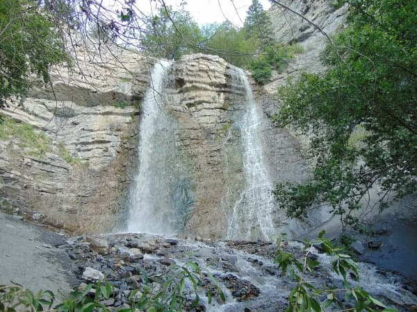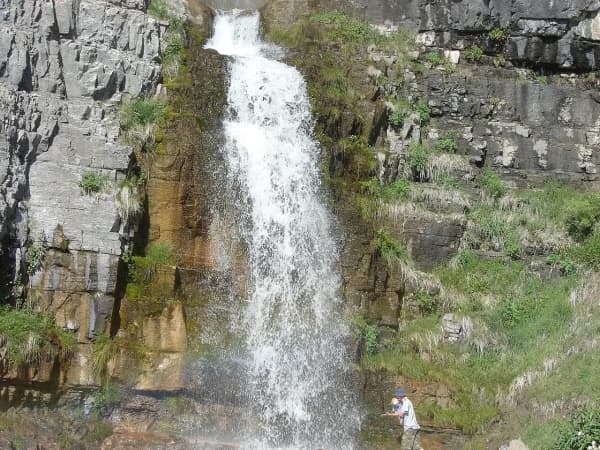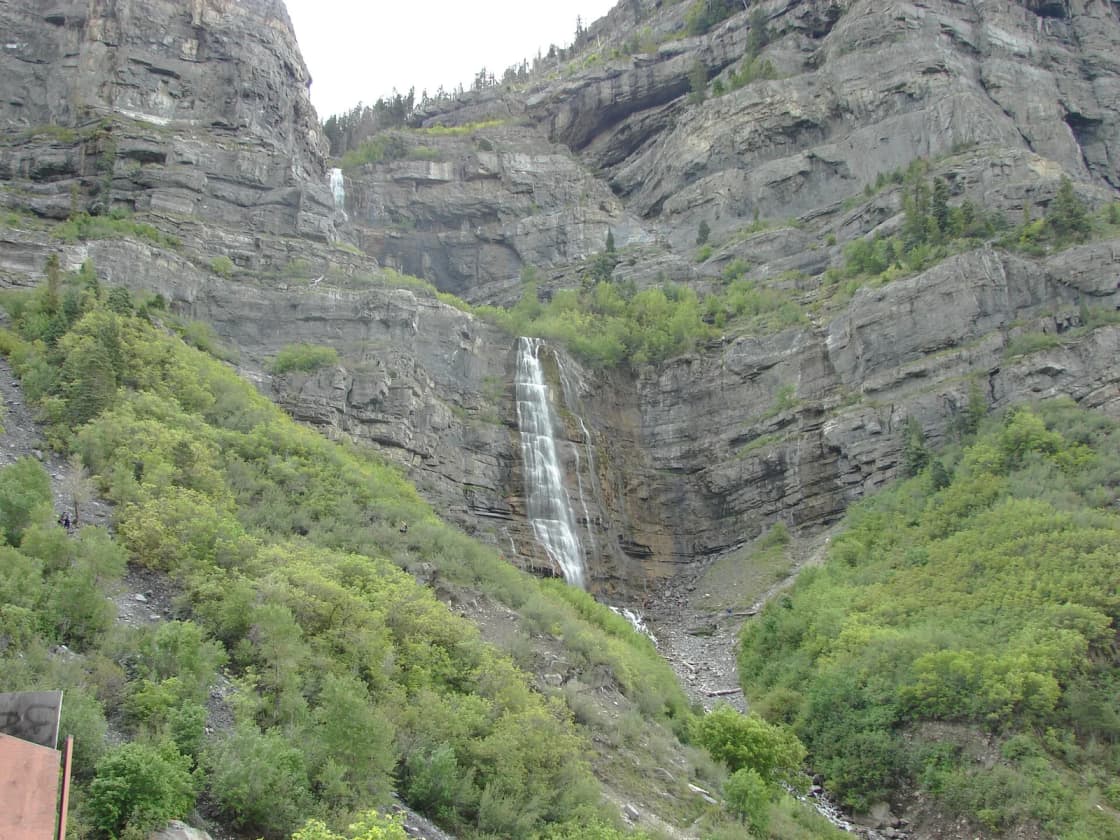

Bridal Veil Falls is the most recognizable natural landmark in Utah Valley: a 607-foot, two-tiered waterfall that drops down the south wall of Provo Canyon in full view of US-189. It is the place locals take visitors, the first hike of a lot of freshman years, and one of the few dramatic waterfalls in the American West that you can reach on a paved path in sneakers.
It is also, right now, a construction site. Utah County is midway through a two-year, $7 million rebuild of everything around the falls, and the falls themselves have a stranger history than the picnic-spot reputation suggests: a lost cliff-top restaurant, a tram that avalanches destroyed twice, a private development fight that ended in a conservation easement, and a winter ice season that is one of the least-publicized things in the valley.
This guide covers how to visit during construction, what happened up there, and the specific hazards that make this beautiful, easy, family-friendly spot the one that emergency crews get called to.
Quick facts
- Height: 607 feet (about 185 meters), in two tiers
- Location: Provo Canyon, a few miles up US-189 from the canyon mouth
- Walk to the viewing area: roughly half a mile, paved and flat
- Fee: none
- Managed by: Utah County, with a conservation easement held by Utah Open Lands
- Status: Bridal Veil Falls State Monument, designated by the Utah Legislature in 2022
- Dogs: allowed on leash
- Best light: morning through early afternoon; the canyon wall shades the falls early
Access during the reconstruction
This is the part that changes your visit, so it goes first.
In September 2025 Utah County began a $7 million, two-phase reconstruction of the area around the falls. The waterfall is untouched. Everything around it is being rebuilt.
Phase 1 (September 2025 to about July 2026) closed the lower parking lot and the bridges leading to the falls trail, while roadway and parking work went on. Visitors were directed to the upper lot and to Nunn's Park across the highway, both of which fill early on summer weekends.
Phase 2 (scheduled from July 2026 into 2027) is the bigger disruption: the county's plan closes the trail at the base of the falls for a complete reconstruction, and reroutes bike traffic on the Provo River Parkway across the river to get cyclists around the work zone.
One caution worth stating plainly, because it is the kind of thing that quietly makes a guide wrong. Press accounts do not agree on when Phase 2 ends. Utah County's spokesman described completion as late summer or early fall 2027, which matches the county's own "two years of construction" framing from a September 2025 start; at least one outlet printed a Phase 2 completion of October 2026. We are not going to resolve that by picking the tidier number. Check Utah County's current notice the week you go.
When it is finished, the plan calls for a grass park with a pavilion and picnic area on the opposite side of the river from the falls, a splash area at the base, separated bike and pedestrian paths, an upgraded hiking trail, expanded parking and riverbank improvements.
Why the county is spending $7 million on a viewpoint
Because the current setup is unsafe, and the reason is a specific piece of weather.
In January 2023 an avalanche came down the falls route, covered the entire base, pushed snow onto US-189 and dammed the river. It also buried the wide footbridge that had been the natural gathering place where the water pools. What replaced it is a narrow, makeshift bridge — and that single bottleneck is why summer afternoons at the base now feel like a crush. Walkers, runners, cyclists and families with strollers funnel through one pinch point on a trail that also carries through-traffic on a regional bike route. Bike-and-pedestrian collisions are common. So are injuries on the unsanctioned scramble routes up the rock.
That is the problem the rebuild is designed to solve: not scenery, geometry.
Getting there
From I-15, take the University Parkway or 800 North exit in Orem and follow US-189 east into Provo Canyon. The Bridal Veil turnoff is signed on the right a few miles into the canyon.
Parking options:
- Falls-side lot — closest, small, and directly affected by the construction phases. Do not count on it.
- Nunn's Park — larger, on the opposite side of the highway, and the more reliable option on a busy day. It is also the standard access point for canyon ice climbing in winter.
- Highway pullout — a viewing pullout further up-canyon lets you see the falls from a distance without committing to the whole stop. Good enough for a photo if you are passing through.
You can also arrive without a car at all: the falls sit directly on the Provo River Parkway, so it is an eight-mile round trip by bike from the canyon-mouth trailhead at Orem's 800 North, mostly on a gentle grade.
The two trails, and why the difference matters
Visitors talk about "the hike to Bridal Veil Falls" as if it is one thing. It is two, and the gap between them is the single most useful thing to understand before you go.
The paved approach (easy)
About half a mile of the Provo River Parkway takes you from the parking area to the viewing area at the bottom of the falls. It is paved, close to flat, shaded in stretches, and works for strollers and wheelchairs under normal conditions. This is the walk that gives the postcard view. Most people should stop here.
The dirt scramble (steeper, and the one that hurts people)
From the pool, an unofficial dirt path climbs roughly a fifth of a mile toward the first cascade. It is short. It is also loose, wet, steep and crowded, and it is where the accidents happen. Falls here are not isolated cases, and fatalities have occurred on the routes above.
Three things make this terrain worse than it looks:
- The rock is wet by design. Spray keeps the surface slick even on a hot, dry August afternoon.
- October and November are the trap months. Fast day-to-night temperature swings put thin, nearly invisible ice on rock that looks merely damp.
- There is no top. The scramble does not lead to a summit, a viewpoint or a loop. It leads to steeper rock. People keep going because there is no obvious place to stop.
The reconstruction includes a properly built trail at the base for exactly this reason.
The tram, the lodge, and the two avalanches
Look up and right of the water and you can still make out where things used to be.
A Swiss-built aerial tramway carried visitors from the canyon floor up to the Eagle's Nest Lodge, a restaurant built on the cliff at the top of the falls and reachable no other way except by helicopter. The tram was small — four passengers at first, later six — and was widely billed as the steepest aerial tramway in the world, with a maximum pitch published at somewhere between 62 and 66 degrees depending on the source. From 1976 it operated mainly as a special-event venue: weddings, receptions, class reunions. In the summer of 1993, more than 27,000 people rode it.
Then it ended, twice.
A smaller avalanche damaged the tram in 1986. The one that finished it came down on New Year's Day 1996, destroying the base terminal, the tram equipment and the lodge. Owner David Grow, whose family had held the property since 1971, wanted to rebuild. A fire in July 2008 burned what was left of the mountaintop structure; authorities called it human-caused but never determined whether it was deliberate, and Grow said publicly he believed it was arson. In August 2008 the sheriff's office asked that the surviving cable be taken down, specifically so people would stop trying to climb the rock face using it. Demolition of the last remnants began in 2017.
One date is contested and we are not resolving it. The county-side Provo Canyon Parks material, contemporary Daily Herald reporting quoting Grow, and BYU-based local history all give the tram's opening as 1961. Wikipedia — and the very large number of pages that copy Wikipedia — say 1967. Both figures are live on the internet right now. Where sources this close to the subject disagree with the most-copied source, the honest thing is to print both and say which is which.
Older visitors also remember the falls as a stop on the Heber Creeper tourist railroad, which ran past here until the late 1980s. That matters more than nostalgia: when the tracks came out, the grade became trail. The stretch of Parkway you walk to reach the falls is, in part, a rail-trail.
The railroad itself did not die. It still runs as the Heber Valley Railroad out of Heber City, on the far side of the canyon — it simply no longer comes down past the falls. If somebody told you that you could take a train to Bridal Veil Falls, they were describing a route that ended around forty years ago. Our guide to Heber Valley and Midway covers what the railroad does today.
The pool at the bottom is not entirely natural
The shallow pond where everybody puts their feet in is a built feature, and it has been rebuilt in living memory.
After the January 2023 avalanche buried the base of the falls and dammed the river, the Central Utah Water Conservancy District carried out construction to restore the pond and repair the avalanche damage to the Provo River Parkway; the district announced that work complete in November 2023. Crews had earlier removed debris and cleared an ice bridge that had formed across the Provo River out of frozen avalanche deposit.
The same district is one of the funders of the current reconstruction, alongside Utah County's tourism, recreation, cultural and convention funds, state grants including the Utah Department of Natural Resources, and Provo City. The U.S. Forest Service has assisted with permitting, and Utah Open Lands holds the conservation easement.
It is an unusual arrangement for a picnic spot: a county park, on partly federal ground, under a private land trust's easement, with a water district maintaining the pond and a state monument designation on top. That tangle is exactly what the county says slows repairs down — before the conveyance, work touching Forest Service land could take 12 to 18 months just to get approval.
Where it sits among the county's other falls
Bridal Veil is the largest and easiest to reach, but it is not the only one. Our guide to waterfalls in Utah Valley sorts every fall in the county by how much effort each one costs.
Photographing the falls
The single most useful fact is about light, and it is a canyon fact rather than a camera fact. Bridal Veil faces roughly north out of a south-wall canyon, and the canyon rim shades the base early. Late afternoon flattens quickly and the water goes gray.
- Late morning to early afternoon is the reliable window for the falls lit and the canyon behind them still readable.
- Spring runoff gives you volume and mist; a mid-range shutter speed keeps texture in the water rather than turning it into a white blur.
- Winter is the most distinctive shot available in Utah Valley: the whole cascade as blue-white columns. It also has the fewest people in frame.
- Do not climb for the angle. Every widely published photograph of these falls is taken from the ground.
Our guide to photography spots around Provo covers the rest of the valley's light.
How Bridal Veil Falls nearly became private
In 2015 Utah County bought the falls and land around them, with preservation as the stated purpose. Several years later the community learned of a proposal from developer Richard Losee to put an addiction treatment lodge at the top of the falls, reached by a new tram that the public would sometimes be able to pay to ride.
The reaction was immediate and large. Utah County's commission placed the county-owned land under a conservation easement, with Utah Open Lands designated as steward, and Provo's City Council backed it. Losee sued the county, arguing the commissioners had given away the land's useful value and improperly declared it surplus; he dismissed the lawsuit in January 2021. The nonprofit Conserve Utah Valley organized in response to the episode and pushed for further protection.
The Legislature followed. It appropriated $1.2 million in 2021 for a feasibility study and improvements, and in 2022 it designated Bridal Veil Falls a state monument — a status created by 2019 legislation and used only a handful of times.
The detail that most write-ups skip is why monument and not park. A state park funds maintenance through visitor fees. A state monument does not. Keeping the falls free was the point, and the designation was chosen to protect that. Utah County still manages the site and has committed matching funds.
The land question is not finished. The county has been trying to acquire roughly 39 acres of U.S. Forest Service ground at the base — the land around the viewing area itself. An earlier proposal to swap county land near Vivian Park for the federal ground gave way to a straight conveyance of nearly 39 acres, which requires congressional approval. As of the most recent reporting, that legislation was still working through Washington, which is precisely why the county split its construction into two phases: it could permit the trail work now and had to wait on the rest.
Season by season
Spring (April to June) is peak water. Snowmelt makes the falls loudest, widest and most impressive, and it also makes the spray zone bigger and the rock wetter. Expect mud on the dirt sections and a cold microclimate at the base.
Summer (July to September) is peak people. The flow drops but never disappears, and the base becomes the most crowded outdoor space in Provo Canyon on a Saturday afternoon. Go before 10 a.m. or after 6 p.m.
Fall (late September to October) is the best combination the canyon offers: maples turning on the slopes, thinner crowds, comfortable temperatures. It is also the start of the thin-ice window on the rocks.
Winter (November to March) is when the falls become something else entirely. In a cold year the cascade freezes into blue-white columns, and the canyon becomes a serious ice climbing venue rather than an occasional curiosity. The paved approach is usually walkable with traction devices; the dirt scramble is not a reasonable objective. Avalanche paths cross this terrain — the 2023 slide reached the highway — so treat winter storm cycles as a reason to stay on the pavement and check the Utah Avalanche Center forecast before going anywhere off it.
Combine it with the rest of the canyon
- Provo River Parkway — the falls sit directly on it; ride up from the canyon mouth and coast back.
- Upper Falls — a short walk further up the Parkway reaches a smaller cascade most visitors never notice.
- Sundance Mountain Resort — about ten minutes further up-canyon, and the natural lunch stop.
- The Alpine Loop — seasonal, and the best fall-color drive in the valley.
- Rock and ice climbing in Provo — what this canyon is in January.
- Winter activities in Provo — sledding, snowshoeing and the rest of the cold-weather list.
Practical tips
- Go early. Parking is the constraint, not the trail, and construction has removed capacity.
- Bring water. There is no reliable drinking water at the falls.
- Wear real shoes if you plan to leave the pavement. Sandals on wet rock account for a large share of the minor injuries here.
- Watch for bikes. The Parkway is a regional cycling route, not a footpath, and the pinch point at the falls is where conflicts happen.
- Do not climb to reach a better photo. The published photographs you have seen are taken from the ground with a long lens.
- Check access the week you go. During a two-year rebuild, last month's information is not current information.
Related guides
- Provo River Parkway Trail: The Complete Guide
- Rock and Ice Climbing in Provo
- Sundance Mountain Resort Guide
- Alpine Loop Scenic Drive
- Winter Activities in Provo
- Day Trips from Provo
- Battle Creek Falls: The Complete Hike Guide (2026)
- Lesser-Known Hikes Near Provo: Six Trails Past the Famous Five (2026)
- Stewart Falls: The Complete Hike Guide (2026)
- Rock Canyon Trail Guide: Provo's Best Canyon Hike (2026)
- The Complete Provo Hiking Guide (2026)
- Y Mountain Trail: The Complete Hiking Guide (2026)
- Eating in Provo Canyon and at Sundance
- Utah Valley Hike Finder — filter every trail by difficulty, length, season, dogs and fees
- Canyon & commute conditions — Provo Canyon is maintained year-round, unlike almost everything above it
Frequently Asked Questions
Is Bridal Veil Falls open right now?
How tall is Bridal Veil Falls?
How long is the walk to the falls?
Was there really a tram at Bridal Veil Falls?
Can you swim at Bridal Veil Falls?
Can you ice climb at Bridal Veil Falls?
Is there a fee to visit Bridal Veil Falls?
Are dogs allowed at Bridal Veil Falls?
Sources
The facts in this guide were checked against these sources. Hours, fees and rules change, so confirm anything time-sensitive with the source before you go. How we make Provo.com.
- Bridal Veil Falls Flow Restoration Project - CUWCD, Central Utah Water Conservancy District. Checked October 12, 2026.
- H.C.R. 13 Concurrent Resolution Approving the Bridal Veil Falls State Monument (2022, enrolled), Utah State Legislature. Checked October 12, 2026.
- The Legend and History of Bridal Veil Falls, Intermountain Histories (Charles Redd Center for Western Studies, BYU). Checked October 12, 2026.
- Bridal Veil Falls $7M reconstruction project begins, limiting public access for 2 years, KJZZ. Checked October 12, 2026.
- Construction set to begin on $7 million Bridal Veil Falls improvement project, Daily Herald (heraldextra.com). Checked October 12, 2026.
- Utah County has big plans for this scenic attraction ... if it can get the land, Deseret News. Checked October 12, 2026.
- Utah developer drops lawsuit to build waterfall development, The Daily Universe (BYU). Checked October 12, 2026.