
Rock Canyon is the trail Provo uses. It opens directly onto the east bench, the drive from downtown is measured in minutes rather than tens of minutes, and it works as a twenty-minute walk, a half-day climb to the upper basin, or anything in between. That flexibility is the reason it stays busy in every season.
It is also a trail where almost every published number disagrees with every other published number, where the rules change partway up without a sign announcing it, and where two different parks share nearly the same name. This guide is organized around those practical problems rather than around adjectives.
The One Fact That Explains Most of the Rules
Rock Canyon is two jurisdictions, and the boundary sits close to the parking lot.
The mouth of the canyon — the parking, the restrooms, the pavilion and the amphitheater — is owned and maintained by Provo City. Everything above that is national forest, administered by the Pleasant Grove Ranger District. Provo City maintains the trailhead; the Forest Service maintains the trail.
That single split is the answer to a surprising number of questions. It is why dog rules differ between the bottom of the trail and the middle of it. It is why fire restrictions at the trailhead are posted under Provo City Code while restrictions higher up follow Forest Service orders. It is why the city can rebuild a parking lot without touching the trail, and why a question about trail conditions and a question about the pavilion go to two different phone numbers.
When something on this trail seems to have two contradictory answers, this is usually why.
Trail Details
| Detail | Info |
|---|---|
| Distance | Depends on the segment — see below |
| Elevation gain | ~1,400 to 1,700 feet to the upper basin |
| Difficulty | Easy at the bottom, moderate-hard at the top |
| Time | 30 minutes to a half day |
| Trailhead | End of N Temple Dr (mapped as E 2300 N), Provo |
| Parking | 137 regular, 4 ADA and 2 bus stalls since the 2024 rebuild, plus street overflow |
| Dogs | Leashed in the city park; forest rules above |
| Fee | Free |
| Toilets / water | Restroom and drinking fountain at the trailhead |
| Best season | Year-round |
Getting There, and the Two-Parks Problem
Provo City's trails page describes the trailhead as the end of North Temple Drive. Mapping services, business listings and most trail apps use an East 2300 North address instead, because 2300 North is the road you drive in on as it climbs the bench. Both descriptions land in the same place, and knowing that in advance saves a confused moment when your phone and the city's website appear to disagree.
The more expensive mistake is the name. Rock Canyon Trailhead Park and the Park at Rock Canyon are two different sites, and the second one — the large grassy hill locals call The Bowl — is not where the trail starts. Both the trail's own community site and the major trail apps carry an explicit warning about this, which tells you how often it happens. If you have arrived somewhere with a playground and a lawn and no canyon in front of you, you are at the wrong park.
The simplest landmark: the trailhead sits directly east of the Provo Utah Temple. Point yourself at the canyon mouth and keep going.
What is at the trailhead: Provo rebuilt it and reopened it in October 2024 with an expanded lot, a year-round restroom building, a drinking fountain, a pavilion available for reservation, an amphitheater, a small climbing wall called the Kitchenette, interpretive signs and short interpretive loop trails. It is a well-provisioned trailhead by Utah Valley standards, and it is the reason the first mile is full of people who never intended to hike.
The Distance Question, Answered Honestly
Published figures for this trail run from about 5.7 miles to 6.2 and beyond, and you will find shorter numbers on any given app depending on where its recorded track stops.
They are not competing measurements of the same thing:
- To the first bridge and back — roughly a mile, half an hour at a stroll. This is what most visitors do.
- The standard out-and-back — roughly 5.7 to 5.8 miles with about 1,400 to 1,700 feet of gain, three to three and a half hours. This is the figure our complete Provo hiking guide carries and the one most trail apps report.
- Trailhead to Rock Canyon Campground — 6.2 miles, per Provo City's own trails page. That is a longer, one-way measurement that finishes at the campground on the road above.
Name the segment, and plan by time rather than by mileage. This is the same problem the Bonneville Shoreline Trail has, and for the same reason: a long trail with many reasonable stopping points does not have a single length.
⚠ One naming point worth carrying. Provo City's trails page still refers to the road above as Squaw Peak Road. That feature was renamed Kyhv Peak Road following the federal renaming, which our Kyhv Peak guide covers in detail. The official host is not always the current page — a recurring lesson on Utah trail information, and worth remembering when a government site and a map disagree.
What to Expect, Section by Section
The first half mile — busy and unshaded
A paved path at the park gives way to wide, well-graded dirt following the creek toward the canyon mouth. The surprise for first-timers is that this opening stretch has very little shade. The canyon walls have not closed in yet, and on a July afternoon this is the hottest part of the walk, not the coolest. Behind you, the view opens over the valley toward Utah Lake.
There is a split in the trail early on; either branch works, and they rejoin.
The narrows — where the canyon earns its name
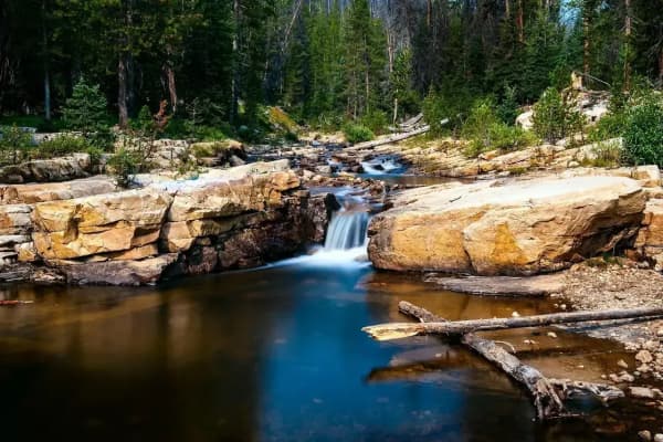
Past the gate and the first bridge the walls rise and the corridor tightens. Shade becomes near-continuous, the creek runs close to the trail, and the temperature drops noticeably. This is the section that makes Rock Canyon a good summer hike while the valley bakes.
Most of the climbing routes are concentrated here and on the walls just below, so expect to walk past people on ropes.
Mid-canyon — where the crowds stop
The trail steepens gradually and the volume of people falls away sharply. Bridges carry you back and forth across the creek. Higher up, the canyon opens toward the upper basin and the surrounding ridgeline, and the tread becomes rougher, with loose rock underfoot.
There is a cave on this trail that most guides never mention. Rock Canyon Cave sits off the route partway up — low-ceilinged, dark, and not something to enter on a phone torch. If you intend to look at it, bring a real headlamp, and treat a low, dark space with the caution it deserves rather than as a novelty.
Climbing in Rock Canyon
Rock Canyon is one of the most developed climbing venues in Utah County, and it is unusually accessible: the approach from the car is measured in minutes.
The geology is the thing to understand first. Climbing sources describe the canyon as yellow and reddish quartzite nearer the mouth, giving way to gray limestone farther up. It is not a blended mixture — it is a sequence you walk through. That is why descriptions of Rock Canyon vary so much depending on which wall the writer visited, and why the friction, hold shapes and route character change between crags a few hundred meters apart. Sources that call it purely a limestone crag are describing part of it.
Where people start. The first significant wall you reach walking in is generally called the Red Slab — well-bolted, broadly in the 5.6 to 5.10 range, and a well-regarded place to learn to lead without the terrain fighting you.
Route counts are published in the hundreds and vary considerably between sources. We are not printing a single hard figure, because the number moves as routes are added and the sources do not agree on what to include.
Our rock climbing guide is the authority on this and goes deeper — including two walls worth knowing by name, the grade range, and why Rock Canyon has a place in the history of American sport climbing.
If you are hiking rather than climbing: give climbers room, do not walk directly beneath anyone on a route, and keep dogs well clear of the base of a wall, where dropped gear and rockfall land.
Dogs, Fires and the Rules That Change as You Walk
Dogs. Provo City's own parks rules are unambiguous: dogs are allowed in all city parks on a leash, and the city's only designated off-leash park is at Bicentennial Park, which is nowhere near here. That governs the trailhead park. Above it, in the national forest, expectations differ and posted signage governs. This is why trail apps sometimes describe Rock Canyon as a place dogs can run off-leash — they are describing the upper canyon, not the park you parked in. Our dog and pet guide covers Provo's leash and licensing rules in full, including the city license requirement that catches new residents.
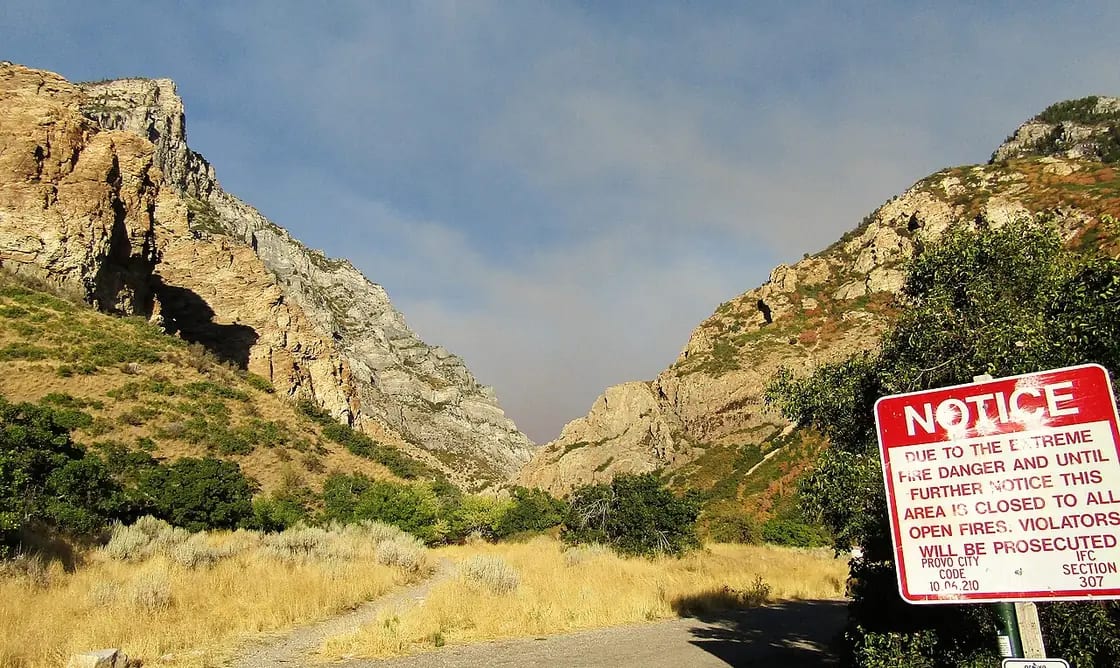
Fire and camping. Restrictions are posted at the trailhead under Provo City Code. Above it, a Forest Service order in effect from June 15, 2026 to June 15, 2031 bans camping and campfires within a quarter mile of the trail for about 3.3 miles up the canyon, to protect the watershed. Seasonal fire restrictions come on top of that, so don't assume them from a previous visit. Read the board at the trailhead — it is there precisely because the answer moves.
Bikes and horses. This is a shared corridor. Expect trail runners moving fast downhill on narrow sections, and stay right.
When to Go
Summer. The canyon's shade is the whole argument. Once past the open first half mile, the narrow corridor stays markedly cooler than the valley floor. Early morning and evening are best, partly for heat and partly for parking. One caution worth taking seriously: Utah's ozone season runs roughly May through September and peaks in the afternoon and early evening, so a morning start serves your lungs as well as your schedule.
Autumn. The best light of the year, with cottonwoods turning gold against gray and rust canyon walls. October weekends are the busiest of the year at this trailhead.
Winter. Open and pleasant, with the canyon quiet. Ice forms on north-facing sections and around the stream crossings — microspikes from roughly December through March. Sledding on the lower trail is a local tradition, which is charming right up until you meet it coming the other way on a narrow corridor.
Spring. Snowmelt makes the creek substantial and loud, the canyon greens up, and the lower slopes carry wildflowers, including poppies on the bench below the mouth. Expect mud on the lower trail in early spring.
Practical Notes
Parking is the constraint, not the trail. The 2024 rebuild expanded the lot to 137 regular, 4 ADA and 2 bus stalls. Even so, on a Saturday morning from late spring through October that fills, and the overflow parks on the street below and walks up. Weekdays are a different trail entirely.
Carry water; do not drink the creek. There is a fountain at the trailhead. Above that, the creek is untreated water.
The first bridge is not the destination. The canyon gets better past it, and the crowd thins by an order of magnitude. If you have an hour rather than twenty minutes, keep going.
Cell coverage degrades in the narrows. Download your map before you leave the car.
The Rock in Rock Canyon
The canyon is named for what it is made of, and unusually for a local trail, the geology is documented in academic detail — Rock Canyon has been written up as a geologic field laboratory, and BYU's geology department describes it as a site known to geologists and climbers alike as one of the best in the state. That is why the trailhead has interpretive signs rather than just a map board.
The short version you can see from the trail:
The orange-tan rock at the base is Tintic Quartzite. It is the distinctive, gently dipping formation you walk past in the first stretch and see at the foot of the peak to the north. Above and beyond it sit gray Paleozoic dolomites and limestones — the Maxfield Limestone, the Fitchville Dolomite and the thin Pinyon Peak Formation between them are all mapped in the canyon, and the contacts between them are visible enough that the canyon gets used to teach the sequence.
The best detail is a trace fossil. The Tintic Quartzite carries Skolithos — rusty-colored vertical burrows left by animals in what was once a shallow Cambrian seafloor. They read as narrow tubes running through the rock. You are looking at the tracks of something that lived here when this was a beach, tilted up on end and turned to stone.
This is also the practical explanation for the climbing. Quartzite near the mouth and limestone farther up are not a stylistic description — they are two different rocks with different friction, different hold shapes and different failure behavior, which is exactly why route character changes as you walk up the canyon.
⚠ A caution that follows directly from the geology. The canyon holds mineral deposits, and a number of old shafts and tunnels remain from prospecting. There are also several caves, at least two of them gated. Abandoned workings and unlit caves are not exploration opportunities; they are the two most reliably dangerous features in this canyon and neither is maintained for visitors.
What Happened Here
Rock Canyon is not a blank recreational space, and the interpretive marker at the trailhead says so directly.
For thousands of years the canyon supplied Utah Valley. The marker records that Fremont and Numic peoples relied on it for bighorn sheep, mule deer and other culturally significant animals. Pictographs still survive in the canyon.
In February 1850, the Timpanogos — who revered the canyon — were forced up it as an escape route from a military campaign to remove them from the valley, following the conflict at Fort Utah. Settlers then named the peak north of the canyon in memory of Chief Big Elk's wife, who fell from a cliff during the conflict. That name stood for more than a century and a half, and the peak is now Kyhv Peak, from a Ute word for mountain.
The peak has since been renamed Kyhv Peak, and our Kyhv Peak guide is the right page for the full story of the rename.
It is worth knowing this before you walk up. The canyon that reads today as Provo's convenient morning trail is also the place a community was driven into in winter, and the sign at the car park is more candid about that than most trail literature manages.
Wildlife. Deer are common and bighorn sheep are present — the same animals the canyon's earliest recorded users came here for.
Connecting Trails
Rock Canyon ties into the wider Bonneville Shoreline Trail network running along the Wasatch foothills, with access toward Y Mountain to the north and Big Springs to the south. Those connections make longer loops possible for hikers and runners who want more than an out-and-back.
The Big Springs and lesser-known hikes guide covers the southern approach, and is also the right page for the several Provo trail names that mean more than one thing.
Related Guides
- Wildflower Hikes in the Wasatch: Where and When
- Complete Provo Hiking Guide
- Rock Climbing & Bouldering in Provo
- Y Mountain Trail Guide
- Bridal Veil Falls Guide
- Kyhv Peak Guide
- Camping Near Provo
- Dog Parks & Pet Life in Provo
- Free Things to Do in Provo
- The New Provo Temple, Explained: The Rock Canyon Rebuild
- Hiking Mount Timpanogos: The Complete Summit Guide
- Provo Peak: The Mountain Behind the Y, and Why the Road Is the Hard Part
- Dog-Friendly Hikes Near Provo
- Utah Valley Hike Finder — filter every trail by difficulty, length, season, dogs and fees
- Canyon & commute conditions — which roads above Provo are gated in winter, and who gates them
- Snowshoeing Near Provo — walking this canyon in winter
- Utah Valley Hidden Gems: 25 Places Locals Keep to Themselves
- Hikes for Kids Under 8 Near Provo, and the Stroller Test
Last updated: August 2026. Trail conditions, fire restrictions and parking availability all change through the season — read the board at the trailhead. Distances are given by segment because this trail does not have a single length.
Frequently Asked Questions
How long is the Rock Canyon trail in Provo?
Where is the Rock Canyon trailhead and what is the address?
Is Rock Canyon hard to hike?
Can you hike Rock Canyon in winter?
Are dogs allowed in Rock Canyon?
What kind of rock is Rock Canyon, and is it good for climbing?
Is there drinking water on the Rock Canyon trail?
Is Rock Canyon free, and is there enough parking?
Sources
The facts in this guide were checked against these sources. Hours, fees and rules change, so confirm anything time-sensitive with the source before you go. How we make Provo.com.
- Trails | Provo, UT, Provo City Parks and Recreation. Checked October 12, 2026.
- Rock Canyon Trailhead Re-Opens with Expanded Amenities (press release, Oct. 23, 2024), Provo City. Checked October 12, 2026.
- Park Rules | Provo, UT, Provo City Parks and Recreation. Checked October 12, 2026.
- Rock Canyon-Dry Fork Trail #060b, USDA Forest Service, Uinta-Wasatch-Cache National Forest. Checked October 12, 2026.
- Rock Canyon Camping and Campfire Restrictions (Order 04-19-26-729), USDA Forest Service, Uinta-Wasatch-Cache National Forest. Checked October 12, 2026.
- Rock Canyon Trail, AllTrails. Checked October 12, 2026.