New this season in Eagle Mountain
Opening, closing or changing
- EPIC Sports Park — Open for free drop-in play through mid-October, and host of the USYS Boys National Championships in July.
Everything dated across the valley sits on the events calendar, and openings and closings are tracked at openings and closings. Neither is a scrape: an entry appears on the tracker only when this site has already published the reporting behind it.

More on Eagle Mountain: every guide we have published there, in one place.
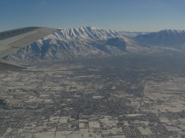
Eagle Mountain feels different from the rest of Utah Valley — and that's the point. Spread across the wide-open Cedar Valley at the base of the Lake Mountains, it trades strip malls and crowds for big skies, horse property, Pony Express history, and some of the darkest stargazing in the region.
What most visitors don't realize is how much of that is deliberate. The dark skies are protected by ordinance. The deer that cross the road in spring and fall are crossing a corridor the city mapped and set aside. The city employs a wildlife biologist and an arborist, and it runs public education nights about raptors, pollinators and — genuinely — scorpions. For a place that did not exist as a municipality thirty years ago, Eagle Mountain has been unusually intentional about what it wanted to be.
Here's a local's guide to the best things to do here.
How a city appeared in an empty valley
It helps to know that almost none of this existed thirty years ago.
In 1994, a trio of investors — a Florida real-estate developer and two physicians, all of whom had houses in Park City — bought roughly 8,000 acres of the Cedar Valley at a bankruptcy auction. Essentially nobody lived on it. To incorporate, they needed residents, so they worked with a local landowner and took the question to two small existing communities several miles away, Cedar Pass Ranch and Harvest Haven. Those residents agreed, and the Town of Eagle Mountain was incorporated on 3 December 1996 at about 24 square miles, with Debbie Hooge as its first mayor. It was reclassified as a city in 2001, annexed further land in 2011, and now covers a little over 50 square miles.
Two things follow from that history and both are visible on a visit. First, the city is enormous and discontinuous — driving from one end to the other takes longer than driving from Provo to Orem, and the two ends do not look or feel alike. Second, because the whole thing was planned rather than accreted, the city has been able to make decisions ordinary towns cannot: a lighting ordinance, a wildlife corridor, a street grid built around a parkway. Most Utah Valley cities inherited their shape. This one chose it.
The city sits at about 4,885 feet, several hundred feet above Provo. That is part of why the nights are colder.
Cory Wride Memorial Park
If you're bringing kids, start at Cory Wride Memorial Park — easily one of the best parks in the valley. It's packed with the features families rave about: a chair zipline, a big splash pad (typically running from Memorial Day to Labor Day, closed Sundays), an all-abilities play area with wheelchair-friendly surfacing, oversized swings and spinners, a turf-covered hill with big slides, plus baseball diamonds, pickleball, basketball and tennis courts, pavilions and a festival field. The pavilions are roomy but short on shade, so bring sunscreen and your own canopy and go early to beat the heat.
The park doubles as the hub for many of the city's community events through the year, from the Easter egg hunt to Christmas Village.
The name on the sign, and the name on the road
The park was originally Mid-Valley Park. It carries its current name because of what happened on 30 January 2014, when Sgt. Cory B. Wride of the Utah County Sheriff's Office Eagle Mountain division stopped on SR-73 to check on a pulled-over pickup he took to be a stranded motorist, and was shot and killed without warning. He was 44, and a year short of twenty years with the sheriff's office.
The city renamed the park on the first anniversary of his death. A few months after he was killed, the state renamed SR-73 the Cory B. Wride Memorial Highway — and SR-73 is the road most visitors use to get here. There is a memorial along the highway near the site, between Eagle Mountain and Cedar Fort, with two American flags and his name and badge number; it was expanded on the tenth anniversary in 2024 with benches and a plaque, and a memorial case is kept at City Hall.
It is worth knowing before you go, because a splash pad and a fallen officer are a strange pair to encounter without context — and because the sheriff's office has said plainly that its concern, as the city fills with people who never knew him, is that residents will use the park and drive the highway without ever learning whose name they are saying.
Pony Express Days and the rodeo
Eagle Mountain's biggest event by far is Pony Express Days, the city's flagship festival, named for the historic trail that crosses the Cedar Valley. It lands in late May, with a grand parade, carnival rides, boutique vendors, food trucks, concerts in the park and fireworks filling out the days across Cory Wride Memorial Park and Nolen Park.
The rodeo is a separate event in June, not part of the May festival weekend — that trips up visitors every year. The Pony Express Days Rodeo is a PRCA event at the Pony Express Memorial Arena that has repeatedly been named Rodeo of the Year in the PRCA Wilderness Circuit. What makes it worth the drive is how local it is: the rodeo's board is made up entirely of Eagle Mountain resident volunteers, which is not how most PRCA rodeos are run.
If you're chasing rodeos, the calendar works in your favor — Eagle Mountain's runs in mid-June and Lehi's Round-Up, a fixture since 1937, follows roughly two weeks later. Dates for both move, so confirm before building a trip around the pair. For everything else across the valley week to week, the Provo.com events calendar is the place to look.
Stargazing, and why the ordinance exists
One of Eagle Mountain's most distinctive draws costs nothing: the night sky.
Eagle Mountain City approved its Dark Skies Initiative in 2014, and follows lighting standards recommended by the International Dark-Sky Association — shielded fixtures, height limits, controls on illuminated signage. The city asks residents to report non-compliant exterior lighting to its neighborhood improvement officers, which tells you it is an enforced policy rather than a slogan.
Here is the part that almost never gets printed. When the ordinance was being debated, the case made for it was not only about stargazers. Contemporary reporting quoted the mayor citing a second beneficiary: light spill makes night training harder for soldiers and helicopter crews at nearby Camp Williams, whose training area sits just north of the city. Eagle Mountain's dark sky is partly a byproduct of being next door to a military installation that needs the dark as much as any astronomer does.
Practically: the open western and southern edges of the Cedar Valley give you the widest, darkest horizons, and the Lake Mountains do useful work blocking the glow off Provo and Orem. Bring a red light, give your eyes twenty minutes, and dress for colder than you expect — see the note on the city's two climates below. Our stargazing near Provo guide covers the rest of the valley's dark-sky options and the seasonal timing.
The wildlife programs, which are the strangest thing about this city
Most Utah Valley cities have a parks department. Eagle Mountain has a parks department, a certified arborist and forester, and a wildlife biologist — and the city claims to be the first in Utah to have hired one, and the first to implement a municipal wildlife corridor.
The corridor is real infrastructure, not signage. Working with the Utah Division of Wildlife Resources, the city mapped the routes a large mule deer population uses to move through the area every spring and fall, then set aside a designated Mule Deer Migration Corridor and backed it with restricted development in key areas, planting chosen to support deer forage, and roadside signage aimed at cutting deer-vehicle collisions. If you are driving SR-73 or Pony Express Parkway at dawn or dusk in April or October, that is the corridor you are crossing, and it is the single most useful thing to know about driving here.
The rest of the program is unusually public-facing:
- Wildlife and Nature Education classes, run through the year on subjects like migratory raptors, pollinator gardens, edible native plants, and the rodents everybody sees and nobody can name.
- Monarch City USA enrollment since spring 2024, with milkweed and nectar planting through the city's parks — which means the pollinator beds you walk past are deliberate.
- Tree City USA recognition from the Arbor Day Foundation since 2018.
The scorpion hunt
And then there is the scorpion hunt, which is exactly what it sounds like.
The city has hosted a public Scorpion Hunt in partnership with a local pest-control company and the Eagle Mountain Nature and Wildlife Alliance. It starts with a mandatory in-class safety briefing at City Hall — nobody joins without it — after which participants are given the location for the hunt itself. The kit list is the giveaway that this is a real field exercise rather than a novelty: flashlight, black-light flashlight, long pants, closed-toed shoes, leather gloves, and a bucket. Scorpions fluoresce a bright green-white under ultraviolet light, which is why a UV torch turns an apparently empty stretch of desert into something else entirely.
It is a summer event, it is not on the calendar every week, and it is the single most unusual free thing to do in Utah Valley. Check the city's event calendar.
Trails, parks, and Pony Express heritage
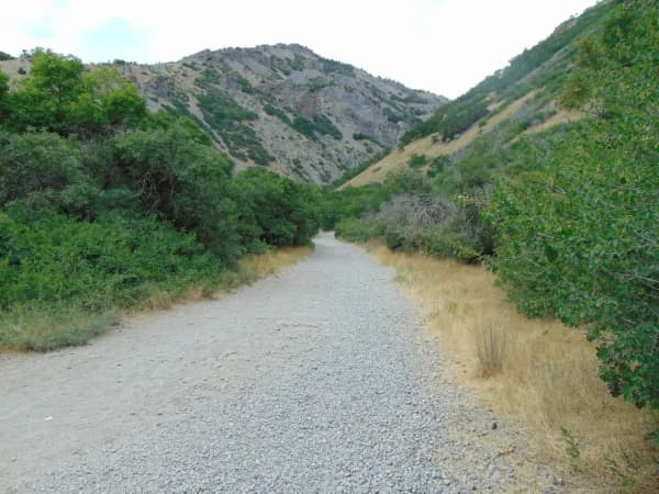
Eagle Mountain is laced with trails. The paved Pony Express Parkway Trail links neighborhoods to parks and is a good easy walk, run or bike ride, while the surrounding open land draws mountain bikers, horseback riders, OHV users and birdwatchers. The city's rural character — big lots, room for animals, open country at the edge of town — makes it one of the most outdoors-friendly places in the valley.
Beyond Cory Wride, the city maintains a growing network of parks, including Nolen Park with its own splash pad, and two skate parks — Pony Express Skate Park and Smith Ranch Skate Park. There's a public library running community programs, a seasonal farmers market, and a calendar that keeps going through the cold months: a Fourth of July fireworks show, Movie in the Park nights, a Turkey Trot, and the December Christmas Village.
The Pony Express heritage underneath all of it is genuine. The relay mail route ran across the Cedar Valley in 1860–61, and its corridor passes through the modern city. Follow it southwest and you reach Fairfield, where Camp Floyd briefly held the largest concentration of US Army troops in the country before the Civil War pulled them east — our guide to Cedar Fort and Fairfield covers the two small towns at the far end of the valley and what survives out there.
Older than any of that: there is Fremont-era rock art in the area, carved into stone by people who were here well over a thousand years before the mail riders. We are deliberately not publishing directions. Unstaffed petroglyph panels in Utah get damaged by visitors far more often than they get protected by them, and the ones that survive tend to be the ones nobody wrote a route to. If you want to see rock art properly interpreted and properly looked after, that is a case for a guided visit rather than a map pin.
One thing about the weather
Eagle Mountain is two climates in one city, and visitors consistently get caught by it.
The Ranches area in the northeast sits closer to the Utah and Salt Lake valleys and to the moderating bulk of the Great Salt Lake, and runs noticeably milder. The City Center area, out toward Fairfield, sits in the Cedar Valley proper, screened from that effect — so it gets substantially colder nights, less precipitation and more sunshine than the other end of the same city.
For a summer daytime visit this is academic. For a stargazing evening, a shoulder-season hike, or anything in winter, it is the practical difference between comfortable and miserable. Dress for the colder half.
Getting there, and what there isn't
There is no freeway exit for Eagle Mountain and no rail station, and that single fact explains most of what the city is like.
From Provo it is roughly 30 miles and 35 to 45 minutes, usually out through Lehi or Saratoga Springs and west on SR-73 — the Cory B. Wride Memorial Highway. From Salt Lake City, the common approach is south on I-15 and then west, or around through Camp Williams. Either way the last stretch is a two-lane highway across open country, and it is the part of the drive where the valley opens up and you understand why people move out here.
Two practical points. Fuel and groceries thin out as you go west — the City Center end of town has far less commercial development than the Ranches end, and there is essentially nothing between Eagle Mountain and Fairfield. And SR-73 is the deer corridor: dawn and dusk in spring and fall are exactly when the mule deer are moving, and this is a highway where that matters more than it does on I-15.
Cell coverage is reliable across the developed parts of the city and gets patchy out on the open ground west and south, which is worth knowing if you are heading out to stargaze and navigating by phone.
If you only have three hours
Three hours is not really enough for Eagle Mountain, and it is honest to say so. From Provo it is roughly 30 miles and 35 to 45 minutes each way out through Lehi or Saratoga Springs on SR-73, which means a three-hour budget is half drive. If three hours is genuinely all you have, spend them somewhere closer.
If you are going anyway, make it one thing. Cory Wride Memorial Park is the stop — a chair zipline, a large splash pad, an all-abilities play area with wheelchair-friendly surfacing, oversized swings and spinners, and a turf-covered hill with big slides. It is one of the best parks in the valley and it absorbs three hours easily.
Know whose name is on it before you arrive. The park was originally Mid-Valley Park. It carries its current name because Sgt. Cory B. Wride of the Utah County Sheriff's Office stopped on SR-73 on 30 January 2014 to check on what he took to be a stranded motorist and was shot and killed without warning. He was 44. The city renamed the park on the first anniversary, and the state renamed SR-73 the Cory B. Wride Memorial Highway — which is the road you will drive to get there. A splash pad and a fallen officer are a strange pair to meet without context, and the sheriff's office has said plainly that its worry is people using the park and driving the highway without ever learning whose name they are saying.
The better three hours here is an evening one. Come out for the dark sky instead — see below. That is the thing this city has that no other city in the valley does.
Eagle Mountain with kids
Cory Wride Memorial Park is the reason to bring children to Eagle Mountain, and it is worth the drive on its own.
The features families name first: the chair zipline, the splash pad, the turf-covered hill with big slides, and an all-abilities play area with wheelchair-friendly surfacing, oversized swings and spinners. There are also baseball diamonds, pickleball, basketball and tennis courts, pavilions and a festival field. Two practical notes: the splash pad typically runs Memorial Day to Labor Day and is closed Sundays, and the pavilions are roomy but short on shade — bring sunscreen and your own canopy, and go early to beat the heat.
Nolen Park has its own splash pad, and there are two skate parks — Pony Express Skate Park and Smith Ranch Skate Park — which the skate parks guide sets against the county's others. The paved Pony Express Parkway Trail links neighborhoods to parks and works well for small bikes. There is a public library running community programs and a seasonal farmers market.
The wildlife programs are the genuinely unusual offer. The city employs a wildlife biologist — it claims to be the first in Utah to have hired one — and runs public Wildlife and Nature Education classes through the year on migratory raptors, pollinator gardens, edible native plants and the rodents everybody sees and nobody can name. It has been enrolled in Monarch City USA since spring 2024, so the pollinator beds you walk past are deliberate rather than decorative.
And then there is the scorpion hunt, which is exactly what it sounds like: a public hunt starting with a mandatory in-class safety briefing at City Hall, after which participants get the location. The kit list — flashlight, black-light flashlight, long pants, closed-toed shoes, leather gloves and a bucket — tells you it is a real field exercise rather than a novelty.
Eagle Mountain on a Sunday
Sunday is simple here, because Eagle Mountain's attractions are overwhelmingly outdoor, free and ungated.
The one fixed closure to know: the splash pad at Cory Wride Memorial Park is closed Sundays during its Memorial Day to Labor Day season. The rest of the park — zipline, slides, all-abilities area, courts and fields — is open.
The trails and the open country do not keep a calendar. The Pony Express Parkway Trail, Nolen Park, both skate parks, and the surrounding open land used by mountain bikers, horseback riders and birdwatchers all run as normal.
The dark sky is at its best on the night nobody else is out. Sunday evening is as good as any for stargazing, and the city's Dark Skies Initiative means the sky is the same seven nights a week.
Two Sunday-specific cautions, both about the drive. Fuel and groceries thin out as you go west — the City Center end has far less commercial development than the Ranches end, and there is essentially nothing between Eagle Mountain and Fairfield. On a Sunday, when fewer places are open anyway, fill up before you head west. And SR-73 is the mule deer corridor: dawn and dusk in spring and fall are when the deer are moving, and that matters far more on this highway than it does on I-15.
Eagle Mountain in winter
Winter is the best season for the thing Eagle Mountain is actually best at.
The dark sky is a winter attraction. The city approved its Dark Skies Initiative in 2014 and follows International Dark-Sky Association lighting standards — shielded fixtures, height limits, controls on illuminated signage — and it asks residents to report non-compliant lighting, which tells you it is enforced rather than aspirational. Long winter nights mean you do not have to wait until eleven for full dark. The open western and southern edges of the Cedar Valley give the widest, darkest horizons, and the Lake Mountains do useful work blocking the glow off Provo and Orem. Bring a red light and give your eyes twenty minutes. The stargazing guide covers seasonal timing across the valley.
The reason the sky is dark is not only astronomy. When the ordinance was debated, the case included a second beneficiary: light spill makes night training harder for soldiers and helicopter crews at nearby Camp Williams, whose training area sits just north of the city.
The two-climate problem is a winter problem. Eagle Mountain is two climates in one city. The Ranches area in the northeast sits closer to the Utah and Salt Lake valleys and the moderating bulk of the Great Salt Lake and runs noticeably milder. The City Center end, out toward Fairfield, sits in the Cedar Valley proper and gets substantially colder nights, less precipitation and more sunshine. For a summer afternoon this is academic. For a winter stargazing evening it is the difference between comfortable and miserable — dress for the colder half. The city also sits at about 4,885 feet, several hundred above Provo, which is part of why the nights are colder.
The city's calendar keeps going through the cold months — a Turkey Trot and the December Christmas Village, both anchored at Cory Wride Memorial Park.
Two winter driving cautions. Cell coverage gets patchy on the open ground west and south, which matters if you are heading out to stargaze and navigating by phone. And there is no freeway exit and no rail station — the last stretch is a two-lane highway across open country, which is a different proposition in a storm than it is in June.
Six places in Eagle Mountain, in one list
Everything below is a place you can go in Eagle Mountain. Every entry points at a guide already published on this site that names the place and states an Eagle Mountain location — the same rule every other city list here runs under.
Six is a short list and it is the honest number. Eagle Mountain is not short of things to do; it is short of places on this site that own a page or a section of their own, which is the bar a numbered row has to clear. The stargazing ordinance, the wildlife programs and the city's trail network are described on this page and nowhere else, and a list that cites the page it sits on is not a source, so none of them is a row. Each needs a guide of its own before it can be rowed.
Four candidates were cut on the stated city, not on judgment. The Place Pizza and the Talons Cove clubhouse both read as west-side options, but our own guides place both in Saratoga Springs. Camp Floyd is the one people expect most, and our hidden-gems guide is explicit that the drive goes past Eagle Mountain into Cedar Valley to reach Fairfield, where Camp Floyd actually is. Five Mile Pass is filed here by habit; our guide puts it about fourteen miles west of the city, on Cedar Valley BLM ground rather than in Eagle Mountain. Pony Express Skate Park is left out for a softer reason: our skate-park guide places it "out toward the Eagle Mountain and Saratoga Springs side," and toward is not in.
One absence is real rather than an oversight. Eagle Mountain has no recreation center, and our rec-center comparison says so directly — Lehi's Legacy Center is the de facto rec center for both Eagle Mountain and Saratoga Springs, at the nonresident rate. That is a fact about the city, not a gap in the list. Hours and prices are left out of every row on purpose, because both move.
Make a day of it
A good Eagle Mountain day: start the morning at Cory Wride Memorial Park — playground first, splash pad once it warms up — pack a picnic, spend the afternoon on the Pony Express Parkway Trail or out on the open trails, and if you can stay late, finish under the dark sky once your eyes have adjusted. Time the visit for late May and you can fold in the parade and carnival of Pony Express Days; come back in June for the rodeo.
If you would rather not pack the picnic, the food trucks are a better option than they sound — our guide to restaurants in Eagle Mountain covers the two clusters they park in.
Because Eagle Mountain is spread out and rural, it rewards a relaxed pace. This isn't a pack-in-ten-stops kind of place; it's a slow-down-and-breathe one. If you want to pair it with something busier, Saratoga Springs is directly east on the lake and trades the open valley for shoreline, and Lehi beyond it has Thanksgiving Point and the outlets.
Thinking about living here?
A lot of people come out for a park day or a night under the stars and start wondering what it costs to live somewhere with this much room. Our complete guide to living in Eagle Mountain covers housing, schools, the much-discussed commute, and what daily life out on the west side is actually like.
Eagle Mountain is the one city in Utah Valley where the most interesting thing on offer is what the city has chosen not to build: no light where it isn't needed, and a strip of undeveloped ground running through the middle so the deer can still get through.
Related Guides
- Things to Do in Spanish Fork, Utah (2026)
- Things to Do in Orem, Utah: A Local's Guide (2026)
- Things to Do in American Fork, Utah (2026)
- Five Mile Pass: Utah County's OHV Playground
Frequently Asked Questions
What is there to do in Eagle Mountain, Utah?
When is Pony Express Days in Eagle Mountain?
Is Eagle Mountain good for stargazing?
Who was Cory Wride, and why is the park named for him?
What is the Pony Express Trail?
Does Eagle Mountain really run a scorpion hunt?
What should I know before visiting in winter?
How far is Eagle Mountain from Provo?