New this season in Saratoga Springs
Coming up
- Saratoga Splash Days 2027 — See the organizer for daily times
Everything dated across the valley sits on the events calendar, and openings and closings are tracked at openings and closings. Neither is a scrape: an entry appears on the tracker only when this site has already published the reporting behind it.

More on Saratoga Springs: every guide we have published there, in one place.
Saratoga Springs is one of Utah's youngest and fastest-growing cities, and its appeal is written straight into the landscape: it wraps around the northwest shore of Utah Lake, with the Wasatch rising across the water to the east and open sky in every direction. For families especially, it has become one of the best places in the valley to get outside — lake access, dozens of parks, golf and trails, in a city that is still wide open.
It is also a city named after something that isn't in it, which is a better story than it sounds. Here's a local's guide.
The name is a dot on a map
Most fast-growing suburbs are named for a developer's idea of a nice word. Saratoga Springs is named for a cartographic accident, and the people who did it have said so.
The hot springs near the mouth of the Jordan River were known to settlers from the earliest years of the Utah Valley. John Beck, a German-born miner and farmer, developed the site into a resort that opened in the 1880s and named it after the famous mineral-springs spa town of Saratoga Springs, New York. For more than a century, Beck's Saratoga Springs — later just the Saratoga Resort — was one of the busiest places on Utah Lake: hot pools, two large plunge baths, midway rides, boating, dancing, concerts. Utah families drove out here the way they now drive to a waterpark.
It ended slowly. A fire in the late 1960s took the main building, and the owners cleared the debris and reopened for the season three weeks later. What finished it was lake flooding, water damage and a long decline in attendance; the buildings came down in the 1990s and the land went to developers.
Then comes the part worth keeping. When the new community was being planned in the mid-1990s, roughly seventeen people lived in what was then farmland west of Lehi. There was no town on any Utah road map — but every one of those maps marked the Saratoga Springs resort with a dot. The planner has said publicly that this is why the name was kept: it was the only thing anybody could point to.
So the city is named after a resort that no longer exists, which was named after a town in New York, and which sat on springs that — as the next section explains — are not inside the city at all.
The hot springs, and what the city actually says about them
This is the single most searched-for thing in Saratoga Springs, and almost every write-up gets it slightly wrong. So here is the primary source.
Saratoga Springs City's own parks and trailheads listing describes the Saratoga Hot Springs as natural hot springs outside the city boundary, and states that only the trailhead is within city limits. The springs sit roughly a quarter-mile south of Inlet Park, reached on a short paved-then-dirt walk from the parking area.
Read that again, because it is genuinely odd: the feature the city is named for is not in the city.
There are also two different things sharing the name, which is where most of the confusion comes from:
- The historic resort pools. Piped from the springs, on the old resort site, now inside a private development. There is a restored green picnic pavilion and a heated outdoor pool there, and they are for residents and their guests. If a listing describes a year-round heated pool under a view of Mount Timpanogos, that is what it is describing, and you cannot walk in.
- The undeveloped springs in the wetlands. Free, open, no gate, no staff. This is what people mean when they say they soaked at Saratoga.
What the free ones are actually like: warm rather than hot, with pockets of hotter water, shallow, muddy underfoot, and carrying a distinct sulfur smell. There are no facilities and no lifeguards. Locals bring a tarp to keep belongings out of the mud and a towel they do not care about. They are popular year-round and busiest on cold, clear winter evenings, which is when the setting genuinely earns it. Third-party listings commonly mention overnight closure hours and bans on alcohol and nudity; treat posted signage at the trailhead as the authority rather than anything you read in advance.
For how these compare with the rest of the region's options — Fifth Water, Meadow, Homestead Crater — see our hot springs near Provo guide.
Get out on Utah Lake
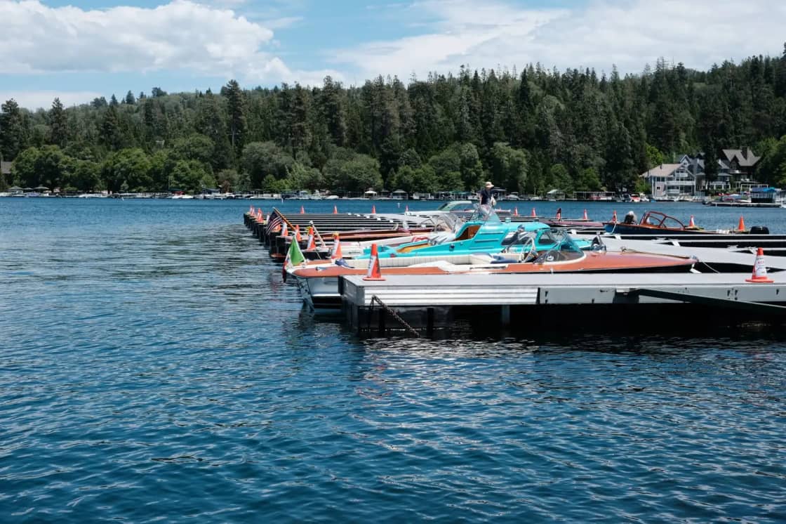
The lake is the heart of it. Saratoga Springs sits directly on Utah Lake, the largest freshwater lake in the state, and the water is the city's biggest recreational draw. You can launch a boat at Marina Park, paddleboard or kayak along the shoreline, or fish for the lake's warm-water species. Summer evenings here are the thing people move for — sunsets over open water with the Wasatch lit up behind them.
If you would rather stay on land near the water, the Pelican Bay Trail follows the lake's edge in the southeast of the city, near Marina Park, giving walkers, runners and cyclists open-water views without getting in a car.
The birds are better than people expect. Utah Lake is a serious stop on the Pacific Flyway, and the shallow, marshy northwest shore is the productive end of it. American white pelicans work the open water in summer — the headland that marks the city's southern limit is called Pelican Point for a reason — and the wetlands around the inlet hold herons, egrets, grebes and waterfowl through the year. Bring binoculars on the shoreline trail and the walk becomes a different activity.
The bigger project is worth knowing about. The Utah Lake Shoreline Trail is a multi-use path that the lake's surrounding cities are collaborating to build around the entire perimeter of Utah Lake — a shoreline that runs to roughly 98 miles. It is not finished and will not be for a long time, but the Saratoga Springs and Lehi sections are among the completed stretches, running paved and easy from North Lake Park in Lehi down along the shore. If you have ever wondered why the trail signage in this part of the valley seems more ambitious than the trail, that is why.
A word on lake levels: Utah Lake is shallow and its surface elevation moves a great deal between wet and dry years, which affects boat ramps and how far the water sits from a given parking lot. Check current conditions before towing a boat out.
Neptune Park and the city's parks
Saratoga Springs has invested heavily in parks — around 30 of them, spanning roughly 260 acres — and a few stand out as destinations in their own right.
- Neptune Park is the showpiece: a large lakeside park with a splash pad, a distinctive climbing pyramid, an inclusive playground, a pier and wide lawns for picnicking. It gets busy on summer afternoons, so come early to claim a spot.
- Patriot Park is a baseball-themed complex with fields dedicated to US military and first responders, plus a playground with oversized baseballs and a glove-shaped slide — a hit with younger kids.
- Harvest Hills Park and a run of neighborhood parks round out the network, many with their own trailheads.
- Inlet Park, at the south end near the lake, is the one visitors most often want and least often find on a list. It is the trailhead for the hot springs, and it is where you leave the car for them.
With this much green space, you are rarely more than a few minutes from a playground or a stretch of trail anywhere in the city. It is also the clearest sign of how the city was planned: parks arrived with the subdivisions rather than being retrofitted into them, which is why so many of them back directly onto open ground rather than onto more houses.
Golf at Talons Cove
Talons Cove Golf Club is the city's premier golf destination — a championship-style public course laid out above Utah Lake with the Wasatch as a backdrop. It is well regarded for conditioning and for views, with greens that hold up through the hot, dry heart of summer. There's a clubhouse, a pro shop and on-site dining, and tee times can be booked online.
For disc golfers, the city also has a course for a more casual round — our guide to disc golf in Utah Valley covers the rest of the county's courses, most of which are free.
Hiking and trails
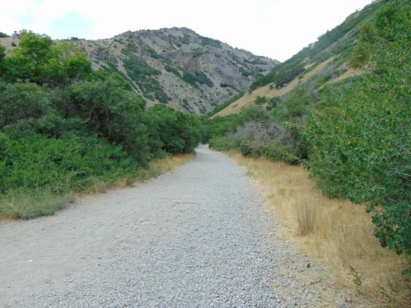
Beyond the lakeshore, Saratoga Springs backs onto the Lake Mountains, and the trail access is genuinely good for a city this new.
The Israel Canyon Trail climbs into the hills for valley and lake views and is the most-walked route in the city — mild by Wasatch standards, popular with hikers, trail runners and riders. The Saratoga Hot Springs Trail runs from near Inlet Park down to the springs described above. Multiple trailheads scattered through the city's parks make it easy to grab a quick hike close to home.
Two honest cautions. The open foothills see target shooters — this comes up constantly in trail reports, and it is the main reason to stick to established, signed routes rather than improvising a line up the hillside. And much of the open ground west of the city is shared with OHVs and mountain bikes, so expect company on the wider tracks.
One thing to ignore: several trail aggregators file Jacob's Ladder under hikes in Saratoga Springs. It is not here. It is the main trailhead for Lone Peak, over in Draper on the other side of the valley, and it appears on these lists purely because it falls inside a search radius. It is a serious climb and starting it on the assumption that it is a local Saratoga Springs walk would be a bad afternoon.
Getting there, and why the city feels so spread out
Saratoga Springs is an awkward shape, and knowing that in advance saves you a lot of driving.
By the city's own account it covers over 21 square miles in a linear form, running from Pelican Point on the west side of Utah Lake more than eleven miles north to the Camp Williams training area. It is a ribbon, not a blob. Two destinations that are both "in Saratoga Springs" can be a fifteen-minute drive apart with nothing much in between, and the northern and southern ends of the city do not share a downtown, a character or even a view.
That shape is a direct result of how the place was assembled: landowners around the old resort and up in the Lake Mountain foothills sought incorporation in the 1990s because Utah County's land-development rules at the time were not urban enough for what they wanted to build, and the city has annexed steadily northward ever since. Incorporation is usually dated to late December 1997 — you will see both the 30th and the 31st in print, and it is not worth resolving.
Practically:
- There is no I-15 exit for Saratoga Springs. From Provo, the usual approach is Redwood Road or Pioneer Crossing; from Salt Lake City, Mountain View Corridor or Redwood Road south. Budget about 30 minutes from Provo, and more in the evening commute, which is heavy in this direction.
- Decide which end you are visiting before you set off. Neptune Park, Marina Park, Inlet Park and the hot-springs trailhead are all in the south, near the lake. Much of the newer housing, retail and the temple are further north.
- Parking is free and generally easy, with the exception of Neptune Park on a hot Saturday afternoon and the Inlet Park lot on a clear winter evening, which is when everybody has the same idea about the springs.
Community events
For a young city, Saratoga Springs has built a warm community calendar. Saratoga Splash Days is the signature summer celebration, and the Christmas Tree Lighting anchors the holiday season. The Saratoga Springs Arts Council runs community orchestra and theater programs, and a seasonal Trail of Treats sends families around local businesses at Halloween. The Saratoga Springs Utah Temple, dedicated in 2023, has become a point of interest for visitors who admire its grounds and architecture.
For what's happening week to week across the valley, check the Provo.com events calendar.
A few minutes from more
One of the underrated perks of Saratoga Springs is what's nearby. Thanksgiving Point in Lehi — gardens, dinosaur museum, children's museum — is a short drive away and makes an easy add-on; things to do in Lehi covers the rest of what's over there. Directly west, Eagle Mountain trades the lake for open Cedar Valley country and a dark-sky ordinance that gives it some of the best stargazing in Utah Valley. And American Fork Canyon, with Timpanogos Cave, Tibble Fork Reservoir and the Alpine Loop, is a straightforward drive east through Lehi; our things to do in Utah Valley hub has the rest.
Twenty-two places in Saratoga Springs, in one list
Everything below is a place you can go, inside Saratoga Springs. Every entry points at a guide already published on this site that names the place in its own title or in a section of its own — the same rule the Orem and American Fork lists run under — so nothing here is rounding the number up. The list stops at twenty-two because twenty-two is what the coverage honestly supports today.
Israel Canyon, Jacob's Ladder and Pelican Bay are all genuinely here and none has a guide or a section of its own on this site yet, so none is a numbered row. They need their own coverage before they can be numbered rows here. Hours and prices are left out on purpose: both move, and a list carrying them is wrong within a season while still looking authoritative.
If you only have three hours
Three hours in Saratoga Springs is really a question of which end of the city you are in, and it has to be answered before you set off rather than on arrival.
The city runs as a ribbon — more than eleven miles from Pelican Point north toward Camp Williams — so two places that are both "in Saratoga Springs" can be a fifteen-minute drive apart. Three hours here is a south-end trip. Everything a visitor wants is down by the lake.
The standard three hours: park at Inlet Park, walk the short paved-then-dirt path to the hot springs, then drive five minutes to Neptune Park for the lakeshore and the pier. Add the Pelican Bay Trail along the water's edge if the light is good. That is a full, unhurried three hours and it is the best of the city.
Two corrections worth having in advance. The springs are warm rather than hot, shallow, muddy underfoot and smell of sulfur — bring a towel you do not care about. And they are outside the city limits; only the trailhead is in Saratoga Springs, which is the single oddest fact about a city named for them. If you were expecting the restored resort pool with the Timpanogos view, that one is inside a private development and you cannot walk in.
Do not let a trail app send you to Jacob's Ladder on the assumption it is a local walk. It is the main trailhead for Lone Peak, over in Draper, and it appears on Saratoga Springs lists purely because it falls inside a search radius.
Saratoga Springs with kids
This is one of the strongest cities in the valley for young children, and the reason is planning rather than luck: the parks arrived with the subdivisions instead of being retrofitted into them. There are around 30 parks across roughly 260 acres, so you are rarely more than a few minutes from a playground.
Neptune Park is the one to drive to. Lakeside, with a splash pad, a climbing pyramid, an inclusive playground, a pier and wide lawns. It is genuinely busy on a hot Saturday afternoon — come early or come on a weekday. Patriot Park is the other destination park and the better pick for baseball-minded children: fields dedicated to military and first responders, plus a playground built around oversized baseballs and a glove-shaped slide.
The destination playgrounds guide sets both against the rest of the county's best, and the paved trails guide covers the lakeshore stretches that work for small bikes.
Be honest with yourself about the springs and children. They are shallow and warm, which sounds ideal, but there are no facilities, no lifeguards and no staff, the footing is mud, and the walk in is short but unshaded. Plenty of families do it. Go in knowing it is an undeveloped wetland rather than a facility.
Out on the water, Utah Lake is the city's front yard — and the birds are the underrated part. The shallow northwest shore is a productive stretch of the Pacific Flyway, and pelicans work the open water in summer, which is why the headland is called Pelican Point. Binoculars turn the shoreline walk into a different activity for a curious child.
Saratoga Springs on a Sunday
Sunday is straightforward here, because almost everything worth doing in this city is outdoors and ungated.
The springs have no gate, no staff and no opening hours — though third-party listings commonly mention overnight closures, so treat the signage at the trailhead as the authority rather than anything you read in advance. Neptune, Patriot, Harvest Hills and Inlet Parks are all open air and open all week. The Pelican Bay Trail and the completed stretches of the Utah Lake Shoreline Trail run the same on a Sunday as any other day.
The lake does not keep a calendar. Boat launching at Marina Park, paddling, and fishing all run normally. What does move is the water itself: Utah Lake is shallow and its surface elevation shifts a lot between wet and dry years, which changes how usable a given ramp is. Check conditions before towing a boat, whatever the day.
Talons Cove and the retail at the north end keep their own schedules — check rather than assume. The city has no I-15 exit, so a Sunday supply run means Redwood Road or Pioneer Crossing toward Lehi. The valley-wide Sunday guide covers what stays open across the county.
Saratoga Springs in winter
This is the city that gets better in winter, and it is the only one in the valley you can say that about honestly.
The free springs are busiest on cold, clear winter evenings, and that is not contrarianism — it is when the setting actually earns itself. Warm water, open sky, the Wasatch behind you and steam coming off the wetland. The Inlet Park lot fills on exactly those nights, which is worth knowing before you drive down expecting solitude.
Utah Lake in winter is a different lake. Being shallow, it freezes in a way the deeper reservoirs do not, and the ice draws anglers out onto it — the ice fishing guide covers which water freezes, which does not, and how to tell. This is not a judgment to make by eye from the shore.
Two winter cautions specific to this city. The open foothills west of town see target shooters year-round, which is the main reason to stay on established, signed routes on the Israel Canyon Trail rather than improvising a line up the hillside. And the city's linear shape punishes bad weather — there is no compact core to retreat into, and a storm means a long drive between the north and south ends rather than a short one.
For everything indoors, the city is thin and the answer is the wider valley: the rec centers guide compares the county's facilities, the indoor activities guide covers cold-day options, and the winter activities guide covers the season across Utah Valley. The Christmas Tree Lighting is the city's own winter fixture.
Make a day of it
A strong Saratoga Springs day for families: morning at Neptune Park's splash pad, lunch in town, an afternoon paddling or walking the shoreline trail, and sunset from the water's edge. Golfers swap in a round at Talons Cove; hikers trade the splash pad for Israel Canyon.
For a cold-weather version, invert it: hike in the low sun of the afternoon, then walk down from Inlet Park to the springs at dusk. A warm soak with snow on Timpanogos across the water is the single best thing this city offers, and it costs nothing.
Thinking about moving here?
Plenty of people come for the lake and the parks and start wondering what it is like to live in one of the fastest-growing cities in Utah. Our complete guide to living in Saratoga Springs covers the housing market, the schools, the much-discussed commute, and what daily life on the west side is really like. Just to the west, the wide-open spaces and Pony Express heritage of Eagle Mountain make an interesting comparison.
Saratoga Springs is proof that a brand-new city can feel like a getaway — and that the oldest thing about it, the water it is named for, is still sitting out there in the reeds, free, exactly where it always was.
The city annexed its way to this shape, and the rules explain the map
The guide above notes that Saratoga Springs has annexed steadily northward and that this is why the place feels so spread out. That is the practice. The rule behind it is Utah Code Title 10, Chapter 2, Part 8, and once you know what it requires, the strange outline of this city on a county map stops being strange.
Contiguity is the constraint that shapes everything
Section 10-2-804 allows a city to annex an unincorporated area only if that area is contiguous in itself, is contiguous to the city, sits inside the city's adopted expansion area, and will not leave or create an unincorporated island or unincorporated peninsula — county land encircled, or nearly encircled, by city.
Contiguity is why a city on a lake shore with mountains behind it grows in long fingers rather than in circles. Each annexation has to touch what came before, so the boundary advances along whatever is developable, and the result is a city whose driving distances feel out of proportion to its population. That is not poor planning. It is the geometry the statute requires, applied to a valley floor with a lake on one side and the Lake Mountains on the other.
There are narrow exceptions. Under Section 10-2-804(3) a city may create an island or peninsula if the area is in its expansion area, the county and the city both agree, the area is not inside another city's annexation policy plan unless that city agrees too, and the annexation meets the further conditions the subsection sets out. And Section 10-2-812 allows a city to annex an existing island or peninsula without a petition at all, on notice and after a hearing — which is how leftover pockets eventually get absorbed.
What the city had to publish before any of it
Under Section 10-2-803, the planning commission prepares and the council adopts an annexation policy plan before the first annexation. It must include a map of the expansion area and a statement of the criteria that will guide annexation decisions, covering the character of the community, the need for municipal services in developed and undeveloped unincorporated areas, the city's plans for extending service, how that will be financed, an estimate of the tax consequences to residents inside the boundary and in the expansion area, and the interests of all affected entities. It has to justify excluding any area with urban development within half a mile of the boundary.
For anyone weighing a move out here, that document is more informative than a listing description. It tells you which direction the city expects to grow, what services it expects to extend, and what it thinks that will cost.
Ownership signs the petition, not residents
Annexation is normally started by petition under Section 10-2-806, and the signature test is a property test: owners of private real property covering a majority of the private land area in the proposed area, whose land is worth at least a third of the total value of private real property there, plus 100% of any rural real property. Before filing, the intending petitioner has to file a notice of intent with the city and send a copy to each affected entity, and the county then mails notice to every property owner inside the area and every owner within 300 feet of it.
Section 10-2-806(3)(d) then requires the bold notice on every signature page saying there will be no public election, because Utah law does not provide for one, and explaining the 30-day signature withdrawal window.
Protest, and the commission that hears it
Under Section 10-2-810, protest is available to the governing body of an affected entity, to an owner of rural real property in the area, and to an owner of private property in a mining protection area. It is filed with the county clerk within 30 days of certification. Once filed, the city may deny the petition at its next regular meeting within 30 days — or, if it does not, it may take no further action until the boundary commission rules (Section 10-2-811). The county must stand a commission up within 30 days of the protest if it has not already (Section 10-2-809).
And a city can lose land as well as gain it
Less famously, Part 5 runs the other way. Section 10-2-501 lets property owners request disconnection — removal of territory from a city — with the request heard by the municipal legislative body under Section 10-2-502.5 and court review available under Section 10-2-502.7. It is rare, and it is harder than annexation, but the door exists.
City limits, expansion areas and annexation proposals change. Confirm current boundaries with Saratoga Springs City and the Utah County Recorder rather than relying on a mapping app, which is frequently a year or more behind out here.
Related Guides
- Things to Do in Lindon, Utah: A Local's Guide (2026)
- Things to Do in Vineyard, Utah: A Local's Guide (2026)
- Things to Do in Springville, Utah (2026)
Frequently Asked Questions
What is there to do in Saratoga Springs, Utah?
Are the Saratoga hot springs actually in Saratoga Springs?
Can you soak in the Saratoga hot springs, and are they free?
What happened to the original Saratoga Springs resort?
Why is the city called Saratoga Springs?
Is Talons Cove a good golf course?
Is Saratoga Springs good for families?
How far is Saratoga Springs from Provo?