More on The North Bench: every guide we have published there, in one place.
There is a version of this page that would be dishonest, and it is worth naming before we start.
Highland, Alpine and Cedar Hills sit shoulder to shoulder on the bench at the north end of Utah Valley, and if you ask what there is to do in them, the answer that comes back is almost entirely American Fork Canyon — Timpanogos Cave, the Alpine Loop, the Timpooneke trailhead, waterfalls. All of that is real, all of it is close, and none of it belongs to these three cities in any meaningful sense. The canyon mouth is in American Fork. Battle Creek Falls climbs out of Pleasant Grove. Writing those up again here, as though they were Highland's or Alpine's, would produce a longer page and a worse one.
So this is a router. The first section tells you where the big stuff is and points you at the guides that already cover it properly. Everything after that is what is genuinely, locally on the bench — and there is more of it than the reputation suggests, including one city-owned trail network that most of the valley has never set foot in.
First, the geography that explains everything else
The three cities occupy a shelf of high ground between American Fork and the mountains, and they are small: Cedar Hills covers about 2.73 square miles, Alpine and Highland are larger but still compact, and you can drive across all three in under fifteen minutes. Mount Timpanogos fills the eastern sky from every one of them.
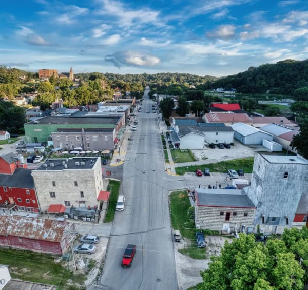
What they share is a position — high, dry, residential, and sitting directly at the mouth of the valley's best canyon. What they conspicuously lack is a downtown. There is no historic main street here, no museum district, no commercial core. That is not an oversight; it is how these cities were zoned and it is much of why people move to them. Our guides to Highland, Alpine and Cedar Hills each go into that trade-off at length.
The practical consequence for a visitor is simple. You come here to be outside. If it is raining, go to American Fork or Lehi instead.
The big attractions, and where they live
Everything in this section is within about fifteen minutes of all three cities, and every one of them has a full guide on this site. Use this as the index.
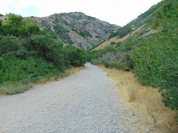
American Fork Canyon is the parent article — the canyon as a whole, its fee structure, Tibble Fork and Silver Lake Flat, and what is open when.
Timpanogos Cave National Monument is the marquee attraction of the whole north valley: timed tour tickets, a 1.5-mile trail that is steeper than people expect, and four different tour types. Book ahead; this is not a walk-up.
The Alpine Loop scenic drive is the seasonal road over the shoulder of Timpanogos toward Sundance and Provo Canyon. It closes in winter and the reopening date moves every year.
Mount Timpanogos — the summit hike, most often started from the Timpooneke trailhead up the canyon. This is a serious day. On Saturdays, Sundays and holidays from July through October, parking at Timpooneke also needs a Recreation.gov timed-entry ticket for arrivals between midnight and noon, on top of the recreation pass.
Battle Creek Falls leaves from Kiwanis Park in Pleasant Grove, not from the bench, but it is the short waterfall hike everyone here does with visiting family.
Dry Canyon is covered in our lesser-known hikes guide, and it comes with a quirk worth knowing: its trailhead sits where Orem's 2000 North and Lindon's 200 South are the same road, which is why directions to it name different cities and both are correct.
That is the canyon accounted for. Now the local material.
Lambert Park, Alpine — the one nobody outside Alpine knows
This is the north bench's best-kept piece of recreation, and it is local: a large tract on the northeast edge of Alpine, owned by the city, sitting at the base of East Mountain with Lone Peak and Dry Creek Canyon in view.
It is deliberately undeveloped. There is no playground, no splash pad, no manicured anything. What there is instead is a dense web of singletrack through scrub oak, maple and sage, used by mountain bikers, trail runners, hikers and horses. Trail names you will see on signs and maps — High Bench, River, Middle, Corkscrew, Flank, Luge, Poppy, Ziggy — interconnect enough that the same afternoon can be ridden a dozen different ways.
On mileage, the sources do not agree with each other, and one of them disagrees with itself. The same well-known Utah mountain biking reference describes Lambert as eleven miles of singletrack loops in one place and "over 16 miles" in another. The honest answer is that the network has grown over the years and nobody has recounted it recently. Plan by time, not distance.
Three things worth knowing before you go:
It dries early. The southern and lower portion, south of Box Elder Drive, sits on an open sage hillside and can be rideable by early March — often weeks before the shaded northern trails, and well before anything up the canyon. In a wet spring this is the reason to come here rather than anywhere else on the bench.
The southeast corner was rebuilt in 2022 with flow trails, which sit in deliberate contrast to the narrow cross-country character of the rest of the park. If you have riders of mixed ability, that corner is where to put the less confident one.
A broad hiking-only loop crosses the bike trails. The intersections have good sight lines, but the hierarchy is not ambiguous: bikes yield to walkers. Alpine City has also banned motorized vehicles in the park indefinitely, with enforcement by the Lone Peak Police Department and a substantial fine attached. Box Elder Drive, the paved roads to the rodeo grounds and the Bowery, and the parking area entrances are the exceptions.
One real trap: the network keeps changing. The city built three new trails on the south end and a 2-mile walking-only loop in 2022, so an older printed map will not match the ground. Check the current Lambert Park trail map on the city's facility page. An unofficial updated map has been maintained by the Alpine Nature Center. If you are navigating from a printed city map, you are navigating from a twenty-year-old document.
Running north from the park, the Lone Peak Wilderness Trail — locally the Lambert Access Trail — covers about 2.6 miles between the mouth of American Fork Canyon and the upper edge of Lambert. It is mostly a trail-runners' connector. Its rules around bikes changed after a federal boundary adjustment a few years ago, so check the signage at the trailhead rather than assuming either way. For the wider picture, our mountain biking guide puts Lambert in context with the rest of the valley's networks.
Highland Glen Park and its pond
Highland's central green space sits just west of Lone Peak High School, with its main entrance off Alpine Highway, and it is built around a pond — which is what makes it different from every other city park on the bench.
The pond is stocked, and regularly: rainbow trout most reliably, along with channel catfish and bluegill, and largemouth bass that anglers are encouraged to release rather than keep. Standard Utah fishing regulations apply. It is a good first-fishing spot for small children, partly because it is small enough to see across.
Non-motorized boats are welcome and there is a modest ramp — kayaks, paddleboards and canoes all turn up on warm evenings. Around the water there is a playground, a large covered pavilion, a sand volleyball court, restrooms, picnic tables and grills, a beach area, and short trails that loop the pond and connect out to the Murdock Canal Trail.
On swimming, be careful what you read. There are no lifeguards, and the sources conflict: some describe swimming as permitted at your own risk, one regional trail database calls it a swimming pond outright, and at least one listing advises against it on water-quality grounds. We are not going to pick one. Look at the posted signage the day you are there and let the city's current guidance decide it.
Cedar Hills Golf Course, with a caveat that matters
Cedar Hills' signature amenity is its golf course, on Clubhouse Drive at the mouth of American Fork Canyon. It opened in 2003 to a Robert Muir Graves and Damian Pascuzzo design, and the terrain does most of the talking: the opening tee shot drops something close to 200 feet, the front nine plays links-style across open ground, and the back nine climbs into genuine mountain golf. The high point at the 14th green sits around 5,253 feet, with the American Fork River several hundred feet below.
Here is the caveat. Course management issued a notice dated June 15, 2026 stating that ongoing construction means the course will not be available for full 18-hole play during the 2026 season. Nine holes are open, the short course stays open all season, part of the course is cart-path only, and there is an explicit invitation to play the same nine twice if you want eighteen — with a request to leave two and a half hours between tee times. The notice also asks players to check with the pro shop for current information on which holes are in play at any given time, and that is the part worth carrying: the specific nine moves, and the club's own homepage describes both a front-nine and a back-nine configuration in different places on the same page. For what it is worth, the city's press release back on February 27, 2026 expected full 18-hole play to return during July and August; the June notice overtakes it. Essentially every third-party golf directory still lists a straightforward 18-hole round. Call the pro shop at (801) 796-1705 before you drive over. Published yardage varies between roughly 6,400 and 6,700 depending on which listing you read, and one directory has it filed as private when the operator says public, so the pro shop is the only source worth trusting here.
A small navigational note in the same family: at least one major booking site files the course's Clubhouse Drive address under Pleasant Grove rather than Cedar Hills. Search the course name, not the city.
Our Utah Valley golf guide covers the north-county cluster — Cedar Hills alongside Fox Hollow in American Fork and Thanksgiving Point in Lehi.
The Murdock Canal Trail, which is the thread
If one piece of infrastructure defines the bench, it is this. The Murdock Canal Trail opened in May 2013, paved over the top of an irrigation canal that dates to the early 1900s, was enlarged in the 1940s, and was buried inside a steel pipe between 2010 and 2012, and it now runs the length of the valley's east side through seven communities — Orem, Lindon, Pleasant Grove, Cedar Hills, American Fork, Highland and Lehi.
For Highland and Cedar Hills residents it functions as an actual car-free corridor rather than a novelty. It is marked every quarter mile and carries a separate dirt path alongside for horses. Facilities vary: some trailheads sit inside city parks with restrooms and water, others are little more than a gate and a sign, so carry your own water rather than counting on finding it. Highland has two trailheads on it — one at Highland Glen Park, one at Mitchell Hollow Park.
Its length is published five different ways, which is worth explaining rather than papering over. You will see 17 miles, 18, 18.3, 20 and 20.8, and the spread comes from where each source puts the ends: the official southern trailhead in Orem, the mouth of Provo Canyon a little beyond it, or the northern tie-in to the Jordan River Parkway at Ashton Gardens, which has no formal trailhead at all. Seventeen is the most commonly published figure and the one used elsewhere on this site, including in our running routes guide. Our full Murdock Canal Trail guide covers the trailheads one by one and what is buried underneath it.
At its ends it joins the Provo River Parkway to the south and the Jordan River Parkway to the north, which makes it a segment of the Golden Spoke network running more than a hundred miles from Ogden down to Provo. In Lindon it meets the Lindon Heritage Trail; in Lehi, a rail trail toward downtown.
Three city festivals, deliberately not on the same weekend
Each of the three cities runs its own summer celebration, and between them they cover a remarkable stretch of the calendar.
Cedar Hills Family Festival comes first, in late spring — May 30 to June 6 in 2026, centered on Cedar Hills Drive. Most of it is free, with a few ticketed pieces: a swim night, a Friday dinner, the carnival.
Highland Fling is the one with the best name and it leans into it — Highland games, a parade, Irish dancers and fireworks. In 2026 it ran July 30 to August 1.
Alpine Days is the longest, running August 8 to 15 in 2026 under a theme marking the nation's 250th year. It is centered largely on Lambert Park, which is where the rodeo grounds and the Bowery are. The week mixes a rodeo, a boutique running over two days, a pet show, a sidewalk chalk competition, tours of the Daughters of the Utah Pioneers collection, and a community star party at the Bowery with telescopes supplied by the Utah Valley Astronomy Club.
One structural thing to know if you are not a resident: Alpine sells its rodeo tickets in two phases, with an early window open only to Alpine households — verified through their city utility account — before remaining tickets go on general sale. Popular nights sell out inside that window. Several other events across all three festivals also require advance registration. Check the individual city's site rather than a roundup, including this one, because the dates and the ticketing rules both move year to year. Our August events guide covers the rest of the valley's calendar that month.
Eating, honestly
There is not much, and the three cities' own guides all say so independently.
Highland has a small cluster of restaurants and Cedar Hills has a handful, mostly around the 4700–4800 West corridor and one at the golf course clubhouse. Address-verified searching turns up no restaurants inside Alpine's city limits at all — residents there drive to Highland or American Fork for dinner, and always have.
That is not a criticism of anywhere. It is a consequence of how the bench was zoned. Our north bench restaurant guide covers what exists, including a trap worth knowing about before you go searching, and American Fork and Lehi carry the real options a few minutes down the hill.
How to spend a day here
If you ride or run: Lambert Park in the morning, ideally in spring when it is dry and everything above it is not. Eat in American Fork. Ride or walk a stretch of the Murdock Canal Trail in the evening when the light comes off Timpanogos.
If you have small children: Highland Glen Park with fishing rods, then the canyon in the afternoon if it is hot — the water at Tibble Fork is a different temperature entirely.
If you golf: call the pro shop first, then plan the rest of the day around whatever they tell you.
If it is the second week of August: go to Alpine Days and let the schedule make your decisions.
And if you are here in deep winter, be straightforward with yourself — the canyon road is shut, Lambert is under snow apart from the fat bikers, and the bench is a place to live rather than visit. For the rest of the valley in that season, our things to do in Utah Valley guide and the day trips roundup will serve you better.
Frequently Asked Questions
What is there to do in Highland, Alpine and Cedar Hills, Utah?
Which city festival happens when?
Is Lambert Park worth the drive?
Can you play 18 holes at Cedar Hills Golf Course?
How long is the Murdock Canal Trail?
Where do you eat on the north bench?
Sources
The facts in this guide were checked against these sources. Hours, fees and rules change, so confirm anything time-sensitive with the source before you go. How we make Provo.com.
- Facilities: Lambert Park, Alpine City. Checked October 12, 2026.
- Alpine Newsline, October 2022, Alpine City. Checked October 12, 2026.
- Highland Fling, Highland City. Checked October 12, 2026.
- Alpine City: Alpine Days, Alpine City. Checked October 12, 2026.