
There is a line on a map, and which side of it your house sits on determines whether a lender makes you buy a policy. That is the entire mechanism, and it is worth understanding for one reason above all others:
The line is about who is required to buy. It is not a statement about who will flood.
Nearly one-third of National Flood Insurance Program claims from 2014 to 2024 (29%, by FEMA's count) came from properties outside the mapped high-risk zones — properties where nobody was required to buy anything, and most owners did not.
The short version
Homeowners insurance excludes flood. Always. It is a separate policy.
Special Flood Hazard Area — zones starting with A or V. One percent annual chance.
Zone X — lower risk. Coverage available, usually cheaper, not mandated.
Mandatory purchase is a lender requirement, tied to a federally backed mortgage.
Thirty-day waiting period. You cannot buy this when the forecast turns.
Basements are barely covered. Structural and service equipment yes; contents and finishes largely no.
Why the exclusion exists, and where the line falls
Flood is excluded from homeowners policies because of adverse selection: if only the people who expect to flood buy the coverage, the pool cannot fund the losses. That is why the federal government created a national program to write it instead, and why a separate market has since grown alongside it.
The exclusion in your homeowners policy is drawn broadly — rising water, surface water, runoff, overflow of a body of water, and typically mudflow.
Meanwhile your homeowners policy generally does cover sudden and accidental discharge of water from a plumbing system inside the house.
So: a supply line bursts in the laundry and floods the basement — homeowners. Snowmelt overwhelms a window well and fills the same basement — flood, and excluded unless you bought a separate policy. Identical damage, identical cleanup, different answer.
The related exclusions worth knowing: groundwater seepage and sewer or drain backup are commonly excluded from both policies. Backup is often available as a homeowners endorsement for a modest premium, and in a valley with a high water table in places and heavy spring loading on sewer systems, it is one of the better-value endorsements available.
Reading the map
FEMA publishes Flood Insurance Rate Maps, and every parcel has a designation.
Zones A and AE — Special Flood Hazard Areas. One percent or greater annual chance of flooding. AE zones have a determined base flood elevation; plain A zones do not.
Zone AO — shallow flooding, typically sheet flow, with a stated depth.
Zone X (shaded) — moderate risk, between the one percent and the 0.2 percent annual chance areas.
Zone X (unshaded) — minimal mapped risk.
Two phrases cause most of the misunderstanding.
"Hundred-year floodplain" describes a one percent annual probability. It does not mean once a century. Two such events can occur in consecutive years, and the probability resets every year regardless of what happened last year.
"Minimal risk" means minimal mapped risk. Maps model specific sources — a river, a stream, a defined drainage. They are not good at urban stormwater, at a culvert that plugs with debris, or at a drainage whose behavior changed after a wildfire.
Maps are also periodically revised as topography is resurveyed, as development changes runoff, and as modeling improves. Provo's mapping was updated in the recent past, and our Wire coverage of that revision sets out what changed at the time.
Who has to buy it
The mandatory purchase requirement is a lender obligation, not a state law and not a FEMA rule directed at homeowners.
If a structure sits in a Special Flood Hazard Area and secures a federally backed or federally regulated loan, the lender must require flood insurance for the term of the loan, in an amount tied to the loan balance or the building's replacement value, whichever is relevant under the rules.
Three consequences follow:
Cash buyers are outside the requirement entirely. No mortgage, no lender, no mandate — and identical physical risk.
The required amount protects the loan, and may be well below what it would cost to rebuild. Owners frequently discover this after a loss.
A map revision can trigger the requirement mid-loan. If your parcel is redrawn into a high-risk zone, the lender's letter will follow. Newly mapped properties may be eligible for particular rating treatment if coverage is obtained within a defined window after the map takes effect, which is a good reason to act on a map change rather than wait for the letter.
The thirty-day wait
A new National Flood Insurance Program policy generally does not take effect for thirty days.
The exceptions are narrow — coverage obtained in connection with making, increasing, extending or renewing a loan, and certain circumstances following a map revision.
This single provision defeats the way most people would naturally approach the decision. You cannot watch the snowpack build through March, conclude in April that this is the year, and buy coverage that responds in May. By then the window for that runoff season has closed.
If you are going to carry flood coverage in Utah Valley, the time to put it in place is autumn or early winter, before anyone is talking about runoff at all.
What the policy covers, and the basement problem
National Flood Insurance Program coverage comes in two parts, bought separately: building coverage and contents coverage. A policy with only building coverage pays nothing for your possessions.
Then the provision that matters most here.
Areas below the lowest elevated floor, including basements, are heavily restricted. Covered in a basement: structural elements, and certain service equipment — furnace, water heater, electrical panel, sump pump, and similar. Not covered: most personal property stored there, and most finished improvements including drywall, flooring, ceilings and cabinetry.
Utah Valley finishes basements as a matter of course. A finished basement is bedrooms, a family room, a bathroom, storage and frequently a rental unit. Under a flood policy, most of that is outside the coverage even though the water reached it.
This is not a reason to skip the policy. It is a reason to know what it does before rather than after, and to price the finished-basement exposure as something you are carrying yourself.
Private flood insurers write terms that differ from the federal program, sometimes with higher limits and different basement treatment. If your exposure is concentrated in a finished lower level, the private market is worth a comparison.
What floods here
Utah Valley's flood mechanics are not coastal, and the drivers are seasonal and local:
Snowmelt timing. Our guide to spring runoff and flood risk makes the central point at length: total snowpack is less important than how fast it comes off. A large snowpack melting gradually is manageable. A moderate snowpack hit by sustained warmth and rain is not.
Rain on snow. The classic Wasatch Front flood driver.
Stream and canal capacity. The valley is threaded with natural drainages and constructed canals, many older than the subdivisions around them. Our guide to secondary water explains how that network is organized.
Urban stormwater. More roofs and pavement mean more water arriving faster at systems sized for an earlier era.
Debris flows off burn scars. This is the one most people miss. A wildfire strips vegetation and changes soil behavior, and a drainage above a burn scar can produce debris flows from rainfall that would previously have been unremarkable — for years afterward. A property's practical exposure can change after a fire without any map being redrawn. Our defensible space guide covers the fire side of that same slope.
Challenging your zone
Where a structure sits on naturally high ground above the base flood elevation, the owner may apply for a Letter of Map Amendment. Where fill has been placed to raise it, the equivalent is a Letter of Map Revision Based on Fill.
Both require an elevation certificate prepared by a licensed surveyor or engineer, establishing the elevation of the lowest floor relative to the base flood elevation.
If granted, the determination removes the federal mandatory purchase requirement for that structure. Two caveats: the lender may still require coverage as a matter of its own policy, and the physical risk is exactly what it was the day before. An amendment changes a mapping determination, not a drainage.
An elevation certificate is also worth having even where you are not challenging anything, because rating and mitigation decisions both depend on knowing your elevations.
A short protocol
- Look up your zone before you need to know it. Ask the county or your insurer.
- Ask whether the map has been revised since you bought, and whether a revision is pending.
- If you are buying, ask the flood question during due diligence alongside the inspection and appraisal — a zone determination is ordinarily part of a financed purchase, but a cash buyer must ask for it.
- Decide in autumn, because of the thirty-day wait.
- Buy contents coverage as well as building coverage if you buy at all.
- Add sewer and drain backup to your homeowners policy separately. Different peril, different endorsement, usually cheap.
- Do not store anything you care about in a basement in a flood-exposed property. The policy will not pay for it.
What it costs, and what drives the price
Flood premiums are not priced the way most people assume. The mapped zone is one input among several rather than the whole answer.
The factors that move a National Flood Insurance Program premium include the elevation of the structure relative to the expected flood level, the type of foundation, whether there is a basement or enclosed area below the lowest floor, the distance to the flooding source, the replacement cost of the building, and the coverage amounts and deductibles selected. Two houses on the same street in the same zone can price very differently because one sits two feet higher.
That has a practical implication worth acting on: an elevation certificate can pay for itself. Prepared by a licensed surveyor or engineer, it establishes where your lowest floor sits. Where a property is higher than the mapping assumes, that document is the evidence, and it is also the prerequisite for any map amendment application.
Deductibles apply separately to building and to contents coverage, so a single flood event can produce two deductibles. Choosing them is the same exercise as anywhere else: set them where you could absorb the loss, and buy the coverage for the event that would damage you.
Mitigation that changes the outcome
Some of the most effective things a Utah Valley household can do about flood risk cost very little and are unrelated to insurance.
Elevate the mechanical equipment. Furnace, water heater, electrical panel. Where these sit on a basement floor, a few inches of water destroys them; where they sit on a platform, the same water is an inconvenience. This is also one of the few basement items the federal program does cover, which makes protecting it doubly sensible.
Install and maintain a sump pump, and consider a battery backup. Flooding and power loss arrive together more often than not.
Fix the grading. Soil sloping toward the foundation is the single most common water defect on Utah Valley homes and one of the cheapest to correct. Our guide to home inspections and appraisals covers it as an inspection finding.
Extend the downspouts well away from the foundation. Not to a splash block two feet out.
Clear window wells, and fit covers. Window wells are the entry point for most Utah Valley basement water events, and a well full of leaves is a bucket.
Do not store what you cannot lose below grade. Photographs, documents, instruments, anything irreplaceable. This is the mitigation that costs nothing at all and the one people most regret skipping.
Know where the water goes on your street. Walk it during a heavy melt. The low point, the storm drain that plugs, the neighbor's regrade that changed the flow — all of it is visible in March and invisible in September.
Buying, renewing and the questions to ask
Flood coverage is sold through ordinary insurance agents rather than directly, which surprises people who expect to deal with a federal office.
Who to ask. Your existing homeowners agent can usually write it. If they cannot, an independent agent with a flood book can. Ask whether they can quote both the federal program and private carriers, because the two price and cover differently and a quote from only one is half an answer.
What to have ready. The property address, the year built, the foundation type, whether there is a basement or enclosed area below the lowest floor, and — if you have one — the elevation certificate. Having the certificate in hand frequently changes the quote materially.
Questions worth asking:
Is this building coverage, contents coverage, or both? A great many policies are written building-only because nobody asked.
What are the two deductibles?
What is the coverage limit, and how does it compare to what rebuilding would cost? Federal program limits are capped, and on a larger home the cap can sit below replacement cost, which is one reason to look at the private market.
How is basement content treated under this specific policy?
When does it take effect? Confirm the waiting period applies or does not, in writing.
At renewal, check whether your zone has changed, whether the map has been revised, and whether your building has changed in a way that affects rating — a finished basement, an addition, a raised mechanical platform.
Keep the policy and the elevation certificate together, somewhere that is not in the basement. This sounds like a joke and is not.
What to do in the days around an event
Flooding in Utah Valley is usually forecastable within a window, which is an advantage most flood-prone regions do not have.
Before, when a heavy melt or a rain-on-snow event is coming: clear window wells and storm drains near your property, move anything valuable off the basement floor, check the sump pump runs, and photograph the property in its normal state.
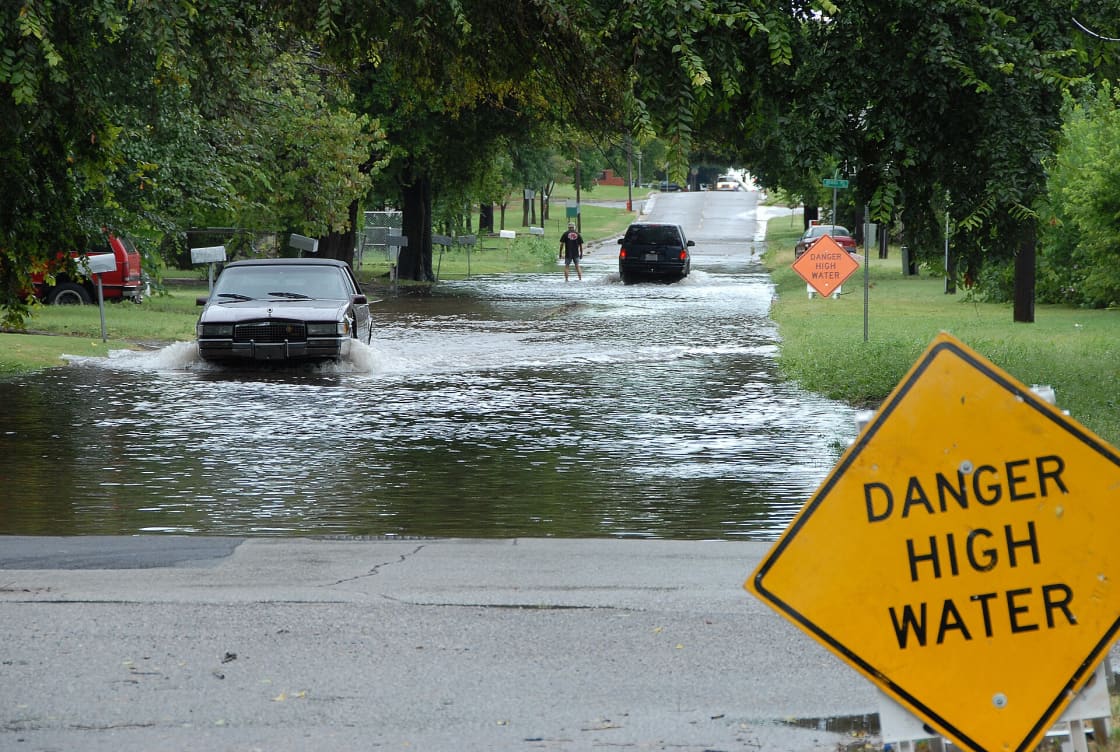
During: safety first, and never drive into moving water. The depth is not the danger — moving water is, and the road under it may not be there.
After: photograph everything before removing anything, contact the insurer promptly, and keep every receipt for emergency mitigation. Document the water line on the wall with a dated photograph, because the height of the water becomes the central fact in the claim.
Then wait on the permanent repairs until the adjuster has seen it, but do not wait on drying. Water damage compounds fast, and mitigation is both permitted and expected.
Related Guides
- Homeowners Insurance in Utah Valley — the policy that excludes this one
- Spring Runoff and Flood Risk in Utah Valley — why snowpack is not the number that matters
- New FEMA Flood Maps Take Effect in Provo — the most recent revision, as it happened
- Secondary Water in Utah Valley — the canal network the maps sit on top of
- Wildfire Defensible Space — burn scars and the debris flows that follow
- Home Inspections and Appraisals in Utah Valley — when to ask the flood question during a purchase
Frequently Asked Questions
Does homeowners insurance cover flooding in Utah?
Am I required to buy flood insurance in Utah County?
What is a Special Flood Hazard Area?
How long does it take for a flood policy to take effect?
Does a flood policy cover my basement contents?
What happens if the flood maps change and my house is now in a zone?
Can I challenge my flood zone designation?
Is flood the main water risk in Utah Valley?
Sources
The facts in this guide were checked against these sources. Hours, fees and rules change, so confirm anything time-sensitive with the source before you go. How we make Provo.com.
- What is My Flood Risk, FEMA / FloodSmart (NFIP). Checked October 12, 2026.
- Floods Can Happen Anywhere - Be Prepared with Flood Insurance, FEMA. Checked October 12, 2026.