
More on Provo: every guide we have published there, in one place.
Utah Valley has four canyons its residents use regularly. Three of them you walk into. Provo Canyon is the one you drive, and it is the reason a city of this size has a mountain highway running out the top of it.
That dual identity is the thing to understand before anything else. Provo Canyon is simultaneously a recreation area and a US highway corridor carrying commuter traffic between two counties. Everything strange about it — the pullouts that fill by nine on a Saturday, the bike path that runs beside a 65-mile-an-hour road, the fights over what gets built at the bottom — comes from those two facts sharing one narrow space.
First, sort out which canyon people mean
More confusion attaches to this name than to any other place name in the valley, and it costs people whole afternoons.
- Provo Canyon is the large one with US-189 in it, running northeast from the Orem–Provo bench toward Heber City. This page is about that.
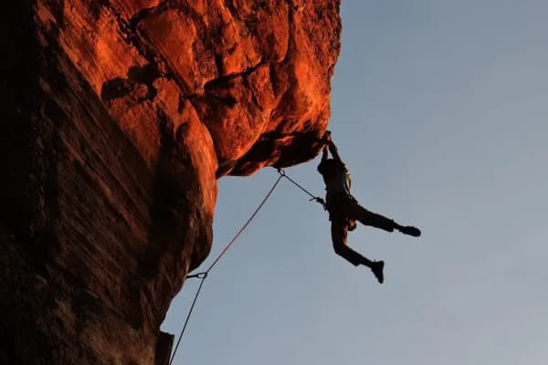
- Rock Canyon is a foot-access canyon above the Provo bench with a trailhead, no through road, and a completely different character. It is the one climbers mean.
- Slate Canyon is the quiet one at the south end of the city.
- American Fork Canyon is a separate canyon fifteen miles north, on the far side of Mount Timpanogos.
The reason Provo Canyon and American Fork Canyon get mixed up constantly is that they are joined at the top by the Alpine Loop, so a single drive can start in one and finish in the other. They are still two canyons.
The shape of the place
The canyon runs between two very large mountains, and knowing which is which orients everything else.
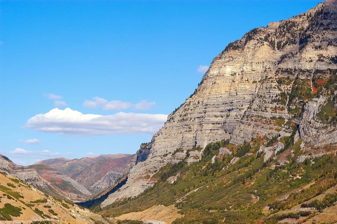
On the northwest side stands Mount Timpanogos, the 11,700-foot wall that dominates every photograph anyone takes here. On the southeast side is the Cascade Mountain massif. The Provo River runs down the floor between them, and US-189 runs beside the river.
US-189 itself is a much longer road than the canyon suggests — it begins in Provo as University Avenue and runs more than 300 miles north into Wyoming, ending in Jackson. The portion between Provo and Heber City carries the state's Provo Canyon Scenic Byway designation, about 26 miles of it.
The lower canyon is genuinely narrow, with rock immediately above the road on both sides. It opens up above Vivian Park, and by the time you reach Deer Creek you are in a different landscape altogether.
Every stop, in order, going up
This is the sequence most guides scramble. Going up-canyon from the mouth:
Canyon Glen Park. The first park inside the canyon, owned by Provo City rather than the county, with pavilions, grass and river access, and the one that fills first for family gatherings because it is closest to town.
Nunn's Park. A smaller riverside park a little further up, and the usual staging area for ice climbers in winter.
Bridal Veil Falls. The landmark, a 607-foot two-tiered waterfall on the south wall, visible from the road. It is also in the middle of a multi-year, multi-million-dollar county reconstruction of everything around it, so access changes — our dedicated guide carries the current picture and the tram history, which is stranger than the picnic-spot reputation suggests.
Upper Falls. A smaller day-use area just above.
Vivian Park. The hinge point of the whole canyon, about twelve miles from Provo. South Fork joins the main canyon here, the Heber Valley Railroad stops here, the tubing outfitters work from here, and the paved Provo River Parkway ends here.
The Provo Canyon tunnels. Short bores through a rock spur above Vivian Park. If you have gone through a tunnel, you are in the upper canyon.
The Wildwood junction. Where SR-92 leaves US-189 and climbs to Sundance and over the Alpine Loop. It sits just west of the Utah–Wasatch county line, above the tunnels.
Deer Creek Reservoir. The top. Boat ramps, wind, and a completely different set of activities — covered in our Deer Creek and Jordanelle guide.
South Fork: the canyon inside the canyon
Turn south at Vivian Park and you leave the highway entirely. South Fork is a side drainage with its own road, its own campgrounds, its own park, and a completely different atmosphere from the corridor you just left.
This is where a lot of the valley's group camping and family reunions actually happen, because South Fork Park has reservable pavilions and the drive up the fork is short. It is also where the Big Springs trailheads sit, which put you on some of the gentlest forest walking anywhere near Provo — a meaningful thing in a valley where most trails go straight up.
Two practical warnings. Cell coverage drops off up South Fork in a way it does not in the main canyon, so tell someone where you are going. And the fork is a cold-air drainage: it runs noticeably cooler than the highway, which is delightful in August and unpleasant in October if you packed for the valley.
The train in the canyon
Running alongside US-189 for much of its length is a narrow ribbon of track that a lot of drivers never register until a train is on it.
The Heber Valley Railroad — known for generations as the Heber Creeper — operates excursion trains between Heber City and Vivian Park, following the river down the canyon. It is a tourist operation now rather than freight, and it runs themed seasonal services that sell out well in advance, particularly around the holidays.
For canyon visitors the relevant fact is simply that Vivian Park is a station. You can ride down the canyon and back without driving it, which is a genuinely different way to see a place most people only experience through a windscreen at highway speed.
What it costs, and where the fees start
The canyon corridor is one of the better free amenities in the state, and it is worth being precise about where that stops.
Free: US-189 itself, the Provo River Parkway, roadside pullouts, Bridal Veil Falls access, and the county parks along the corridor for ordinary day use. Keeping Bridal Veil free was an explicit part of the public argument during the fight over its future.
Paid: reserved pavilions at the county parks, developed Forest Service campgrounds, Deer Creek State Park day use and boat launching, tubing outfitter rentals, and the American Fork Canyon recreation fee if your Alpine Loop drive continues down the far side.
Rates move and agencies differ, so confirm with the managing agency rather than with any guide, this one included. The useful durable rule is that the corridor is free and the destinations are not.
What to actually do, by activity
Walk or ride the paved path. The Provo River Parkway is the canyon's best free asset — a paved trail running from Utah Lake through the city and up the canyon floor to Vivian Park. It is flat by canyon standards and it gets you to the falls without a car.
Float the river. Tubing and rafting the Provo is the summer ritual, generally run downstream from Vivian Park. Flows are governed by reservoir releases, not by the weather, so the river can be pushy on a mild day and mellow on a hot one.
Fish. The Provo is Blue Ribbon water and people travel to fish it. The canyon section fishes differently from the more famous stretches above Deer Creek.
Hike. Most of the canyon's hiking is up the side drainages rather than the main corridor: Stewart Falls, the long approach to Mount Timpanogos, and the Big Springs trails up South Fork. Our full hiking guide sorts them by effort.
Camp. Developed campgrounds sit in South Fork and along the corridor; our camping guide covers reservations, which fill absurdly early for summer weekends.
The seasons, honestly
Summer is the canyon at maximum load. Parking at the popular stops is gone by mid-morning on a weekend, the river is full of tubes, and the highway backs up on holiday weekends in a way that is genuinely difficult. Go early or go on a weekday; there is no third option that works.
Autumn is the best time and everyone knows it. The Alpine Loop turns first, which means the SR-92 side trip is bumper to bumper on the peak weekends. The main canyon holds color longer and is far less crowded than the Loop.
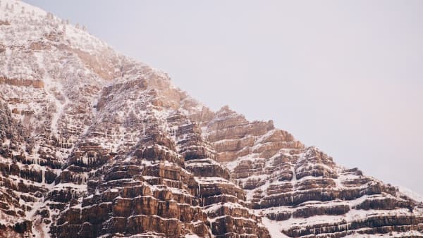
Winter changes the canyon's character completely. The Alpine Loop closes. The falls freeze into ice-climbing formations. US-189 stays open and plowed but becomes a road where winter tires matter — canyon driving in Utah is its own skill and the shoulder seasons catch people out.
Spring brings runoff. The river runs high and cold, waterfalls are at their loudest, and avalanche debris can still be sitting in the drainages well into the season.
Driving it without becoming a statistic
A few things that a scenic-byway description will not tell you.
There is no fuel in the canyon. Fill up in Orem, Provo or Heber. This catches out visitors regularly.
The speed limit is highway speed, and the stops are not. Traffic moves fast between the pullouts and slowly at them. Most of the near-misses here come from someone braking hard for a turnoff they spotted late.
Left turns across traffic are the hazard. Several of the popular access points require crossing an oncoming lane. If you miss the turn, continue up and come back down rather than stopping in the road.
Winter closures are for avalanche control, not convenience. When UDOT closes a canyon road it is because something can slide onto it. In January 2023 an avalanche came down the Bridal Veil route, crossed US-189 and dammed the river. This is not theoretical terrain.
Cyclists share the corridor. The shoulder is a designated cycling route, and the Parkway crosses under and around the highway at several points.
The fight at the mouth
You cannot write about this canyon in 2026 without addressing what is proposed at the bottom of it.
A private development called Vesper Amphitheater — a 20,000-seat outdoor venue with a hotel, restaurants and retail — has been proposed on a long-running gravel pit and adjacent city-owned land at the canyon mouth. It is backed by members of the Osmond family. In June 2026 the Provo Planning Commission voted to recommend denial of the required amendments; the City Council holds the decision on the general plan and zone map changes, and had not voted as this page was written.
We are not going to characterize the outcome before it happens. Our neutral explainer on the Vesper proposal lays out what is actually on the table, who is arguing what, and what the remaining steps are.
The reason it matters to a canyon guide is that the argument is fundamentally about the dual identity described at the top of this page. A canyon that is both a recreation area and a transport corridor has a finite amount of both, and the question in front of the council is how much of each Provo wants.
Where this canyon sits in the valley
Provo Canyon is the connective tissue of Utah Valley recreation. It is the road to Sundance, the route to Heber and Park City, the access to Timpanogos from the south, the corridor for the valley's best paved trail, and the drainage that most of the region's water comes down.
It is also the thing residents point at when they explain why they live here. Fifteen minutes from a university campus, you are in a canyon with a river in it. Very few cities this size can say that, and the pressure the canyon is currently under is entirely a function of how many people have noticed.
Three plans, by how much time you have
One hour. Drive to Bridal Veil Falls, walk the paved path at the base, drive back. This is the version people do with visiting parents and it is not a lesser experience — the falls are the landmark for a reason.
Half a day. Drive to Vivian Park first, get out and stand by the river where South Fork joins, then work back down: Upper Falls, the falls themselves, Nunn's Park, and a walk on the Parkway. Doing it top-down means every left turn becomes a right turn, which on this road is worth more than it sounds.
A full day, in season. Float the river from Vivian Park in the morning, eat in the canyon or back in Orem, then take SR-92 up toward Sundance in the afternoon and either turn around or commit to the whole Alpine Loop. Confirm the Loop is open before you plan around it.
The mistakes people make here
Assuming the canyon is a park. It is a highway with parks along it. Cross the road with the same care you would on any 55-to-65-mile-an-hour route.
Planning around the Alpine Loop in the wrong month. Half the disappointed visitors we hear about drove up expecting the Loop and found a gate.
Treating river flows like weather. The Provo is a managed river. What the sky is doing tells you almost nothing about what the water is doing.
Arriving at eleven on a Saturday in July. The parking situation at the popular stops is decided by nine.
Underdressing. The canyon runs meaningfully cooler than the valley floor, and the side drainages cooler still. A summer evening at Vivian Park is not a summer evening in Provo.
Trusting any single source on current construction. The Bridal Veil area has been under active reconstruction, and published completion dates have not agreed with one another. Check the county's current notice in the week you go.
Where this leaves you
For a first visit, the sequence that works is simple: drive to Vivian Park, come back down to the falls, walk a section of the Parkway, and pick a season to return in. For a fuller day out of the valley, our day trips guide uses this canyon as the starting point for half the routes on it, and our things to do in Provo guide places the canyon in the context of everything else the city offers.
The canyon rewards repetition more than most destinations. It looks like a different place in October than it does in July, and different again under ice in February — which is the argument for treating it as somewhere you return to rather than somewhere you tick off.
Related Guides
-
Vesper Amphitheater vote: earliest September 8 — the proposal at the canyon mouth, current status
-
Jolley's Ranch: Camping in Hobble Creek Canyon, Twenty Minutes from Provo
-
RV Parks & Hookups Around Provo: How Camping With a Rig Actually Works Here
-
Unique Places to Stay in Utah Valley: Historic Inns, Canyon Lodges and the Hines Mansion
-
Utah Valley Hike Finder — filter every trail by difficulty, length, season, dogs and fees
-
Canyon & commute conditions — US-189 stays open all winter; the roads leading off it mostly do not
-
Buying a Cabin or Second Home Near Provo: Sundance, Hobble Creek, Woodland Hills and Timber Lakes
-
Big Springs Park and the South Fork: Provo Canyon's Quiet Side
Frequently Asked Questions
Where is Provo Canyon and how long is it?
Is Provo Canyon the same as Rock Canyon or American Fork Canyon?
What are the stops in Provo Canyon in order going up?
Is the Alpine Loop open in winter?
Do you need a fee or a pass for Provo Canyon?
Can you swim or float the Provo River in the canyon?
Is there cell service in Provo Canyon?
What is the amphitheater proposed at the mouth of Provo Canyon?