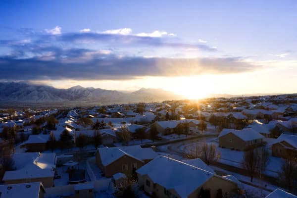

Drive the length of Utah Valley and you will cross municipal boundaries perhaps thirty times without noticing one of them. There is rarely a sign. The pavement does not change. And in several places you will pass through land that belongs to no city at all — parcels the growth went around rather than through.
Those boundaries are not fixed, they are not drawn by a mapmaker, and they do not move by referendum. They move because property owners petition to move them, one area at a time, and because cities decide whether the arithmetic works.
For anyone buying land, building on it, or wondering why the neighbor across the street has a different set of rules, this is the machinery.
The short version
Unincorporated means no city. The county governs.
Annexation is petition-driven. Owners file; cities accept or decline.
Thresholds are measured in acreage and assessed value, not headcount.
Contiguity is required. Outside narrow statutory exceptions, a city cannot leap over intervening land.
A policy plan must exist first. No plan, no annexation.
Islands and peninsulas are treated differently, because fragmented boundaries serve nobody.
Your mailing address is not your jurisdiction.
Why Utah County looks the way it does
Most of the Wasatch Front was settled as a string of agricultural towns, each with a compact platted core and a wide agricultural apron around it. Those cores incorporated early. The aprons did not.
For a century that arrangement was stable, because the apron was farmland and farmland does not need sewer. What changed was the growth of the last three decades, which arrived not as expansion of the cores but as subdivision of the aprons — and subdivisions do need sewer, and streets that get plowed, and fire response within a few minutes rather than a few dozen.
So the boundaries began to move. They moved parcel by parcel, in whatever order owners chose to petition, which is why the resulting map looks less like a set of tidy municipal polygons and more like something spilled. Cities interlock. Boundaries run down the middle of streets and occasionally through buildings. And pockets of unincorporated land remain, surrounded on all sides, because their owners never asked to join and no mechanism forced them.
If you have ever wondered why one side of a road has city garbage collection and the other does not, this is the answer.
What being unincorporated means
The practical differences are larger than most people expect.
Land use and permits. Utah County's development code applies, not a city's. County zoning is generally more permissive on lot size, animal keeping and accessory structures, and generally less prescriptive on design. Permits come from the county rather than from a city building department, which is a different counter, a different fee schedule and a different inspection sequence than the one described in our Provo building permits guide.
Law enforcement. The Utah County Sheriff, not a city police department. Response times over distance are what they are.
Fire and emergency medical. Usually a district or an interlocal arrangement. Worth confirming specifically, because insurance rating is sensitive to the distance from a responding station.
Roads. County roads, county plowing priorities, county maintenance schedules.
Water and sewer. This is the one that decides most annexations. Unincorporated parcels are commonly served by a special district, a private water company, or a well and septic system. Where a subdivision is proposed, the septic question usually forces the issue, because lot yields under septic are far lower than under sewer.
Secondary water. Utah Valley's pressurized irrigation systems are organized around districts and companies whose boundaries do not match city boundaries at all. Our guide to secondary water in Utah Valley covers how that system is structured.
Taxes. A different set of taxing entities levies against the parcel. Not necessarily more or less in total — a different set.
The petition mechanism
Utah's annexation framework has one organizing idea: the initiative belongs to the landowners, and the acceptance belongs to the city.
Step one: the policy plan. Before a municipality may accept an annexation petition, it must have adopted an annexation policy plan identifying the areas it anticipates annexing — its expansion area. This is a public document, and if you want to know whether your parcel is on a city's list, this is where to look. Land outside every city's declared expansion area is land no city currently intends to take.
Step two: contiguity. Under Section 10-2-804, the area proposed for annexation must ordinarily be contiguous to the annexing municipality and within the expansion area in its policy plan. A city cannot ordinarily annex a detached island of territory across intervening unincorporated land, which is why annexations proceed outward in bands rather than by leapfrog.
Step three: the signatures. A petition must be signed by owners representing specified proportions of the private land area within the proposed area, and of the assessed value of that land. The precise fractions and the qualifying conditions are set by statute and are worth reading in the current text rather than taking secondhand.
The critical structural point is that the threshold is measured in land and value, not in people. One owner of a large, valuable parcel can carry more weight than a dozen owners of small ones. This is the opposite of how most people assume local decisions work, and it is the single most important thing to understand about Utah annexation.
Step four: certification and notice. The petition goes to the city recorder, who checks whether it meets the requirements, and notice is given to affected entities — the county, districts, and others whose interests are touched.
Step five: the protest window. There is a defined period in which certain entities and owners may file a protest. A protest does not automatically defeat an annexation, but it routes the matter differently and can trigger review by a boundary commission.
Step six: the ordinance. If the petition survives, the municipal legislative body adopts an annexation ordinance, and the new boundary is recorded and filed with the state.
The whole sequence takes months in the straightforward case and considerably longer where there is opposition or a boundary commission gets involved.
The holdout problem
Here is the situation that produces most of the genuine anger.
An owner is content in the county. Lower fees, fewer rules, an outbuilding that a city would never allow. Neighbors on the surrounding acreage decide to petition for annexation because they want sewer for a development. Their acreage and assessed value clear the statutory thresholds. The holdout parcel sits inside the proposed boundary.
The holdout gets annexed. They did not sign, and they were not required to. The main exception is land the statute treats as rural real property: Section 10-2-806 requires the petition to cover all of it, so an owner of qualifying rural property does have to sign.
This is not a loophole; it is the design. A boundary drawn to exclude every unwilling parcel would be unworkable, and the Legislature chose thresholds measured in land and value precisely so that a small minority could not veto a coherent boundary. But it means that if you value being in the county, watching what your neighbors are doing is not optional. By the time an ordinance is on an agenda, the decision is effectively made. The moment to engage is when the petition is circulating.
Islands and peninsulas
Some unincorporated parcels are not merely adjacent to a city — they are inside one, geographically speaking.
An island is an unincorporated area entirely surrounded by municipal territory. A peninsula is unincorporated land surrounded on most sides, still tenuously connected to other unincorporated land.
These exist in Utah County in reasonable numbers, and they are a genuine service problem. A sheriff's deputy driving through three miles of city to reach one house. A county road crew maintaining two hundred feet of pavement in the middle of a city's street grid. A fire district responding past a city station.
Utah law treats islands and peninsulas under distinct provisions, on the reasoning that the ordinary petition process cannot resolve a situation that everyone other than the island's owner would prefer to see resolved. If your parcel is an island, the rules that apply to you are not the ordinary annexation rules, and that is worth knowing before you assume the status quo is permanent.
What changes the day the ordinance takes effect
Zoning. The county's designation stops and the city's begins. A city assigns a zone to annexed territory, and that zone may not correspond to what you had. Uses lawful under county rules can become legal nonconforming uses — permitted to continue, but not to expand, and often lost if discontinued or destroyed. Animal keeping, large accessory buildings, home occupations and commercial vehicle parking are the usual casualties. Our Provo zoning guide shows how much detail a city ordinance carries compared with a county one.
Building rules. New permits come from the city. Any existing unpermitted structure is now unpermitted in a jurisdiction that did not previously know about it.
Utilities. Connection may become mandatory within a defined distance of a main, and connection fees plus impact fees are due at the point of development. Those charges are covered in our impact fees guide — they are a one-time cost that can run into five figures on a new house.
Services. City police, city plowing, city garbage. Usually an improvement, and usually reflected in the levy.
Elections. You vote in city elections and can serve on city bodies. Nobody thinks about this at the time and it matters more than they expect.
Addressing. Utah County's grid addressing is coordinated, but annexation sometimes brings a renumbering, which means a new address on everything from your driver license to your insurance policy.
If you are buying land
Three questions, asked before the offer rather than after.
Which jurisdiction is this parcel in? Ask for the answer from the county parcel record, not from the listing and not from the mailing address. An address that reads "Provo, UT" tells you which post office serves the property and nothing about which government does.
Is it inside any city's annexation policy plan? If so, annexation is a matter of when rather than whether, and you should price the eventual connection and impact fees into what you pay for the land.
What serves it now, and what would serve it after? Water, sewer, fire, roads. Get each answer from the entity that provides it. A septic-served parcel with no sewer within reach is a different asset than one where a main runs down the street.
The same questions apply, with different emphasis, if you are buying a house rather than land — and the title work will disclose some of it. Our guide to title insurance and closing costs explains what the exception schedule does and does not tell you about a parcel's status.
Why the map keeps changing
Utah County has been among the fastest-growing counties in the country for most of two decades, and annexation is the mechanism by which the map absorbs that growth. Every subdivision on former farmland is a story about somebody needing sewer, petitioning, and a city deciding the arithmetic worked.
There is also a quieter competitive dimension. Where two cities' expansion areas overlap or abut, the same unincorporated ground can be attractive to both, and which one ends up with it depends on who can extend infrastructure, what zoning each would apply, and what owners prefer. This is not usually dramatic, but it is real, and it is one reason a city's annexation policy plan is a more revealing document than its length suggests.
The end state, if growth continues, is a valley with very little unincorporated land left in the developable areas. That is roughly what has happened along the northern corridor already.
The boundary commission, and what happens when it is contested
Not every annexation goes smoothly, and Utah provides a forum for the ones that do not.
Where a protest is filed within the statutory window by an entity entitled to protest, the matter can be routed to a county boundary commission rather than being resolved by the annexing city alone. The commission's function is to weigh the competing interests — the petitioners, the municipality, the county, and any special districts whose service territory or revenue is affected — and to approve, modify or deny.
The considerations that carry weight are practical rather than sentimental: whether the annexation produces a sensible service boundary, whether the municipality can deliver the services it proposes to provide, whether the county or a district is left with a fragment it cannot serve efficiently, and whether the proposal creates or resolves an island or peninsula.
Two points a property owner should take from this. A protest is not a veto — it changes the forum, not necessarily the outcome. And the protest window is short, which means that if you intend to object, the time to have obtained legal advice is before the petition is certified rather than after.
What this means for a city's finances
The reason a city might decline territory becomes clearer once you look at the arithmetic from its side.
Annexing land brings new property tax base and, where the city operates utilities, new ratepayers. It also brings obligations: roads to maintain and plow, mains to extend, fire and police response to provide, and eventually capital replacement on all of it.
Whether a given annexation pays for itself depends heavily on what gets built. Dense residential development on a small area generates revenue against a compact service footprint. Large-lot residential spread across a wide area generates less revenue across more road miles and more pipe, which is why cities are frequently more enthusiastic about annexing land they can zone for compact development than land already subdivided into acreages.
This is also why the annexation policy plan and the zoning that will be applied are effectively one conversation. A city agreeing to annex is agreeing to serve, and it will want the land use pattern that makes serving it viable. An owner petitioning for annexation while expecting to keep county-style large-lot zoning is likely to be disappointed, and finding that out early is much cheaper than finding it out late.
Disconnection, the reverse operation
Utah law also provides a process by which territory can be removed from a municipality, which surprises people who assume boundaries only ever expand.
Disconnection is petition-driven, like annexation, and it is considerably harder to accomplish. The petitioner must satisfy the statutory requirements, and the city has an interest in resisting the loss of tax base and of the territory its infrastructure was extended to serve. Courts and boundary commissions weigh whether disconnection would leave either the city or the disconnected territory unable to function sensibly — an island of unincorporated land created deliberately is exactly the outcome the annexation framework tries to avoid.
The practical takeaway for a property owner is that annexation should be treated as effectively permanent. It is far easier to remain in the county than to leave a city afterward. If you value county jurisdiction, the moment that matters is when a petition is circulating in your area, not after an ordinance has been adopted.
Interlocal agreements, and the quiet middle ground
Not every service question is resolved by moving a boundary, and a great deal of Utah Valley's actual service delivery runs on agreements between governments rather than on jurisdiction.
Cities contract with each other and with the county for fire response, for dispatch, for animal control, for building inspection, for library access and for a long list of other functions. Special districts cross municipal lines entirely, delivering water, sewer or fire protection to territory belonging to several jurisdictions at once.
Two consequences follow.
Your service provider may not be your government. The fire engine that responds may belong to a district or a neighboring city under an agreement, and the ambulance may be someone else again. Knowing who responds is more useful than knowing whose boundary you sit inside.
Annexation may change less than you expect. Where a district already provides your water and a neighboring city already provides fire response by agreement, joining a municipality may alter your zoning and your tax rate more than it alters the trucks that turn up. That is worth establishing before treating service improvement as the reason to petition.
The place to establish it is the entities themselves. Ask the fire district, the water district and the city directly, and get the answers in writing.
Related Guides
- Provo Zoning Explained — how much more detailed a city ordinance is than a county one
- Building Permits in Provo — the city permit counter you would move to
- Impact Fees in Utah Valley — the connection cost that arrives with development
- Secondary Water in Utah Valley — districts whose boundaries match nothing else
- Title Insurance and Closing Costs in Utah — what the record discloses about a parcel
- Detached ADUs and H.B. 477 — a state mandate that binds cities but not counties
Frequently Asked Questions
What does it mean if my property is unincorporated in Utah County?
Who starts an annexation in Utah, the city or the property owner?
Can a city annex my land without my consent?
What is an island or peninsula of unincorporated land?
How do I find out which city I am in?
Does annexation raise my property taxes?
What happens to my zoning when I am annexed?
Can a city refuse to annex land that wants to join?
Sources
The facts in this guide were checked against these sources. Hours, fees and rules change, so confirm anything time-sensitive with the source before you go. How we make Provo.com.
- Utah Code Title 10, Chapter 2, Part 8 Annexation (index), Utah Legislature. Checked October 12, 2026.
- Utah Code 10-2-804 Annexation -- Limitations, Utah Legislature. Checked October 12, 2026.
- Utah Code 10-2-806 Annexation petition -- Requirements, Utah Legislature. Checked October 12, 2026.
- Utah Code 10-2-803 Annexation policy plan, Utah Legislature. Checked October 12, 2026.
- Utah Code 10-21-304, Utah Legislature. Checked October 12, 2026.