
Ask someone who grew up in Provo to name the fancy part of town and you will hear the same answer nearly every time. Then ask them where it starts and stops, and watch the answer fall apart.
The Riverbottoms is the neighborhood everyone in Provo can name and very few can draw. It is genuinely the city's prestige address, it is genuinely one of the most attractive places in Utah Valley to own a house, and almost everything written about it online is a real estate listing with adjectives attached. This is an attempt at the other thing: what it actually is, where it actually is, why it looks the way it does, and what living there is genuinely like, including the parts nobody puts in a brochure.
Start with the name, because the name is the geography
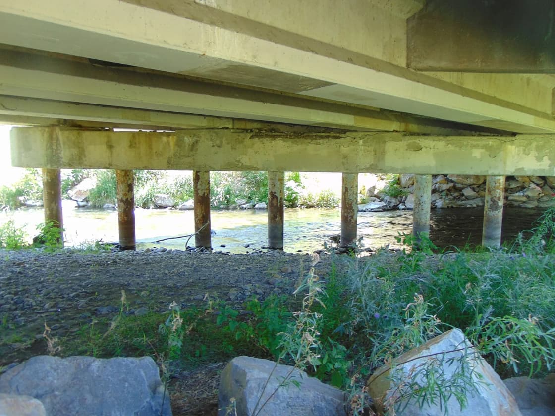
A river bottom is the low, flat land a river has laid down over time. That is not a metaphor here. This neighborhood sits in the Provo River's bottomland, where the river comes out of Provo Canyon and spreads across the north end of the valley floor before running west toward Utah Lake.
Which produces a small irony worth enjoying. The most expensive residential ground in Provo is named after the fact that it is the lowest and wettest part of the city. The name predates the money by a long way.
Locals almost always say the Riverbottoms rather than just Riverbottoms. If you want to sound like you have been here a while, use the article.
The boundaries, as precisely as anyone can honestly give them
Provo organizes itself into thirty-five official neighborhoods, which are then grouped into districts for the purpose of the city's Neighborhood District Program. Riverbottoms is one of the thirty-five, and it sits in the North District, formerly known as Neighborhood District 1, together with North Timpview, Sherwood Hills, Riverside, Edgemont, Indian Hills, Rock Canyon and Pleasant View.
In practical terms the neighborhood is the river corridor at the north end of the city, running roughly from the 3700 North area toward the Orem line and the canyon mouth, on both sides of the north end of University Avenue.
Two clarifications that matter more than they sound:
Neighborhood districts are not council districts. Provo redraws council districts every ten years to follow precinct lines and population. Neighborhood districts follow historical neighborhood boundaries and are grouped by shared concerns. They are different maps with different purposes, and a resident who conflates them will show up to the wrong meeting.
The city's map is the authority. Everyday usage is looser than the official line. People say Riverbottoms about addresses that the map assigns to Riverside or Edgemont, and the higher ground east of the corridor shades into the bench neighborhoods without an obvious visual break. If a boundary question has money attached to it — a zoning question, a school question, a district-meeting question — get the answer from Provo City rather than from a listing.
Our complete guide to Provo neighborhoods maps all thirty-five and how the districts group them.
Why the houses are so big
The housing stock here is unusual for Provo, and there is a straightforward reason.
Most of Provo was platted on the Mormon grid: square blocks, regular lots, houses built for households rather than for display. Near campus that stock was then adapted, subdivided and rented, which is how the BYU-area neighborhoods ended up looking the way they do. Downtown got density. The Tree Streets got early-twentieth-century character on small lots.
The Riverbottoms got large parcels of low-lying river ground that were agricultural for a long time and were not chopped into standard city lots when the rest of the city was. When residential development did arrive, it arrived on that parcel geometry: big lots, mature cottonwoods along the water, and room for houses that do not fit anywhere else in Provo.
The result is a mix rather than a monoculture. Mid-century estates on very large lots sit near newer luxury construction, and there are upscale townhomes clustered around the Riverwoods end. What holds it together is scale and tree cover rather than a single architectural period.
Riverwoods is the front porch
The Shops at Riverwoods sits at the edge of the neighborhood and functions as its commercial center, which is unusual — most Provo neighborhoods do not have one.
Riverwoods is an outdoor village-style center with restaurants, boutiques, a cinema and a heavy seasonal program, most famously its winter lights. It also means that a neighborhood otherwise short on retail has dinner, coffee and a movie within a short walk or a two-minute drive for a good part of its population. Our Shops at Riverwoods guide covers what is there and how to use it, and Provo Beach, the indoor surf and family entertainment park, is in the same complex.
The trade-off is traffic. A regional shopping and entertainment destination generates it, and the lights season generates a lot of it, on the same roads residents use.
The design corridor almost nobody mentions
Here is the piece of local knowledge that essentially no other guide to this neighborhood carries.
Provo City Code establishes a North University Avenue Riverbottoms Design Corridor, and development within it is subject to additional design regulation — including, for example, the height rules that apply to monument signs under section 14.38.085. Proposed amendments to those rules go through the North District neighborhood meeting process before the council sees them.
Why it exists is not hard to work out. The north end of University Avenue is simultaneously a major commercial approach into Provo from the canyon and Orem directions, and the visible edge of an expensive residential neighborhood. A corridor overlay is how a city reconciles those two facts.
Why it matters to you depends on who you are. If you are buying a house on a residential street, it is background. If you are opening a business along that stretch, putting up a sign, or planning anything that changes what the corridor looks like, it is a live constraint and the standard citywide assumptions will not hold. Confirm scope and current requirements with Provo Development Services rather than with any summary, including this one — our Provo zoning explainer documents a case where a commercial zoning-information website published the opposite of what the city code actually says.
The river is the amenity and the caveat
The Provo River Parkway trail runs through the neighborhood, and this stretch is the prettiest in-town section of it: cottonwoods, water, and a paved path that goes east into Provo Canyon and west across the city toward Utah Lake. Our Provo River Parkway guide covers the full length.
Practically, this means residents here have a genuine car-free route to the canyon, which almost nobody else in the valley has. It also means Bridal Veil Falls is a bike ride rather than a drive, and that the canyon trailheads are minutes away rather than a planned outing.
The caveat belongs in the same paragraph rather than buried later. This is low ground beside a river at the mouth of a canyon, in a state where snowpack and spring runoff vary dramatically from year to year. That is not a prediction about any particular property; runoff behavior is governed by upstream reservoir operations, channel work and local drainage, and it varies street by street. It is a reason to ask specific questions about a specific address — flood zone designation, insurance requirements, historical drainage — rather than treating the river purely as a view.
Getting around
By car, University Avenue runs straight south from the neighborhood into the rest of Provo and toward campus and downtown. US-189 heads east into the canyon toward Sundance and Heber. Orem's University Parkway corridor and the tech corridor beyond it are just across the river. I-15 is a short drive west.
The traffic reality is that you are living on the Provo Canyon corridor. Summer weekends, fall foliage weekends, ski traffic and every Sundance-bound car pass through. Locals learn the timing.
By transit, expect to drive to it. The UVX line runs the University Parkway and University Avenue spine well to the south, and FrontRunner departs from Provo Central Station downtown. Neither is at the end of the street.
By bike, unusually good, because of the parkway. A rider can get a long way through north Provo and Orem without meeting a stroad.
Who it actually suits
It suits you if you want space, mature trees and quiet, you can absorb the price of entry, you value canyon and river access more than walkable retail, and you are buying with a long horizon. Inventory here is thin and turnover is slow, which is a feature if you plan to stay and a frustration if you are shopping on a deadline.
It suits you less if you want to walk to a grocery store, you need to be near campus daily, you are shopping the entry level of the Provo market, or you want a neighborhood with a lot of turnover and a lot of young households moving through. Edgemont to the east offers the family-bench version of north Provo at a different price point; the west side of the city is where most new construction and most new inventory is.
A note for buyers from out of state: Utah does not publish sale prices. Non-disclosure means the numbers you see on national listing sites are estimates generated by models, not records of transactions. In a thin-inventory neighborhood with highly variable lot sizes, those estimates are less reliable than usual. Our buying a home in Provo guide covers what that means for making an offer.
Day to day: what is actually close
This is the section listing sites skip, and it is the one that decides whether you like living somewhere.
Groceries. There is no full grocery store inside the neighborhood. Residents drive, most often north into Orem or south into the rest of Provo. Our grocery store guide covers what is where across both cities.
Eating out. Riverwoods is the immediate answer and a genuinely good one for a residential neighborhood. Beyond it, north Orem's University Parkway corridor is minutes away, and downtown Provo is a straight run down University Avenue. The best restaurants in Provo and best restaurants in Orem guides cover both directions.
Outdoors. This is the neighborhood's strongest suit by a distance. The parkway trail, the canyon, the Bonneville Shoreline Trail on the bench above, Rock Canyon to the south, and the waterfalls up US-189 are all within a short drive or, in several cases, a bike ride.
Everything else. Errands, big-box retail, medical appointments and the airport all involve getting in the car. That is not unusual for Utah Valley, but it is a real contrast with downtown Provo, and people who move here from a walkable city notice it in the first month.
What happens at the canyon mouth is a Riverbottoms question
One live civic issue sits geographically closer to this neighborhood than to any other in Provo, and it belongs in an honest guide.
The proposed Vesper Amphitheater would occupy ground at the mouth of Provo Canyon — the same corridor that carries traffic past the north end of this neighborhood. Updates on the proposal have appeared on North District agendas, which is the district the Riverbottoms belongs to, and the arguments made against it publicly have clustered on canyon traffic, noise and precedent, while the arguments for it have centered on city revenue and on the fact that the site is disturbed industrial ground rather than untouched hillside.
This guide takes no position and, more importantly, does not report an outcome. Provo City's own timeline has moved more than once, and a scheduled council discussion is routinely mistaken locally for a scheduled vote. Our Vesper Amphitheater coverage tracks the actual procedural state, and our council-following guide explains how to check it yourself rather than relying on a summary that may be weeks stale.
The general point stands regardless of how that particular proposal resolves: if you buy in the Riverbottoms, the canyon corridor is your corridor, and what gets approved at its mouth affects your commute, your evening noise floor and your weekend traffic more than it affects anyone else in the city.
How it compares to the alternatives
If the Riverbottoms is on your list, these three usually are too, and they are genuinely different propositions.
Edgemont is the northeast bench directly east and south. It is the family-optimized version of north Provo: established streets climbing toward the foothills, strong school proximity, ramblers and two-stories from the 1960s onward, heavily owner-occupied. You get the same canyon and trail access, less lot size, and a lower price of entry.
North Timpview sits above roughly 2600 North east of University Avenue, below Timpview High. It is quieter still, turnover is slow, and it is one of three neighborhoods covered by the city's Northeast Neighborhoods Plan. It is what people picture when they say established Provo family neighborhood.
Riverside is the belt near the river west of the Riverbottoms. Same river-corridor character, same trail access, mostly single-family with far fewer purpose-built rentals, and homes that trade rarely.
The honest summary is that all four are north Provo neighborhoods sharing a river and a mountain, and the Riverbottoms is the one that trades walkability and price for lot size and proximity to the canyon mouth.
The civic layer, which is more active here than most places
The Riverbottoms sits inside the North District, and that district meets regularly at City Hall with a Zoom option, open to all district residents. Agendas routinely carry zone changes, lot-line adjustments and code amendments affecting the neighborhood directly, alongside city-wide items.
This is worth knowing for two reasons. First, if you live here, that meeting is where you find out about the thing being built behind your house before it is built. Second, if you are considering buying here, the district agendas are a free and underused source of information about what is actually proposed nearby. Our guide to following Provo City Council explains how the meeting structure works, including the common mistake of reading a scheduled discussion as a scheduled vote.
The short version
The Riverbottoms is Provo's prestige neighborhood, occupying the Provo River's bottomland at the north end of the city between roughly 3700 North and the canyon mouth, in the city's North District. It has the largest houses and lots in Provo because it was large agricultural parcels rather than platted city blocks when the rest of the grid filled in. The Shops at Riverwoods functions as its commercial front porch, the Provo River Parkway gives it a car-free route into the canyon, and a specific design corridor in city code regulates how the University Avenue frontage develops. The trade-offs are real and unglamorous: you drive for groceries, you live on the canyon traffic corridor, and you are on low ground beside a river, which is a set of questions to ask about a specific address rather than a reason to stay away.
Related Guides
- The Complete Guide to Provo Neighborhoods
- The Shops at Riverwoods
- Provo River Parkway Trail
- Provo Canyon: The Complete Guide
- Buying a Home in Provo
- Provo Zoning, Explained
- West Provo
- Best Schools in Provo & Orem
Frequently Asked Questions
Where exactly is the Riverbottoms in Provo?
Why is it called the Riverbottoms?
Is the Riverbottoms the most expensive neighborhood in Provo?
What schools serve the Riverbottoms?
What is the North University Avenue Riverbottoms Design Corridor?
Is the Riverbottoms walkable?
What is the downside of living in the Riverbottoms?
Is the Riverbottoms a good place for students?