
More on Pleasant Grove: every guide we have published there, in one place.
Pleasant Grove is the city that got its school district by subtraction.
When Alpine School District was broken up by the 2024 ballot measure, two of the three successor districts were the point of the exercise. Aspen Peaks was proposed. Lake Mountain was proposed. Timpanogos — the district that Pleasant Grove now belongs to, along with Orem, Lindon and Vineyard — was named in neither proposition. It is what was left over once the other two were carved out of the map, and it took until early 2026 to even get a name.
That is a strange origin for the institution that will run your children's schools, and it is a useful way into the city itself, because Pleasant Grove has a habit of being defined by what happened around it. It was named after a fight it did not choose. It is nicknamed for its trees. It sits between two much-discussed growth stories — Lehi to the north, Orem and Provo to the south — and quietly holds a position better than either.
This guide is the area-by-area companion to our broader guide to living in Pleasant Grove.
The one thing to know before you compare neighborhoods
Pleasant Grove has no official neighborhoods.
Provo City does. It runs a formal Neighborhood District Program with 35 mapped neighborhoods grouped into five districts and volunteer boards approved by the City Council, and our Provo neighborhoods guide is built on that structure because the structure exists.
Pleasant Grove has nothing equivalent. What people here call a neighborhood is a subdivision name, a historic reference, or a piece of plain geography — "up by the canyon," "the west side," "downtown." The fuller backstory is in a short history of Pleasant Grove.
Those are useful. They are not civic units. They have no fixed edges, no legal meaning, and no relationship to the things that govern a property: zoning, HOA status, water shares, animal rights and school assignment are all parcel-level facts and none of them can be read off an area name.
This guide describes the areas as patterns, and points you at the real boundaries instead.
Pleasant Grove at a glance
The city sits in the established north-central part of Utah County, at the base of Mount Timpanogos, with I-15 to the west and the mountain wall to the east.
It was settled in 1849 and originally called Battle Creek, after a violent encounter at the mouth of the canyon in March of that year. It was renamed Pleasant Grove in 1851. Both names still describe something true about the city: Battle Creek is a real canyon that still shapes the east side, and the grove is still there in the form of the tree canopy that gives the city its nickname.
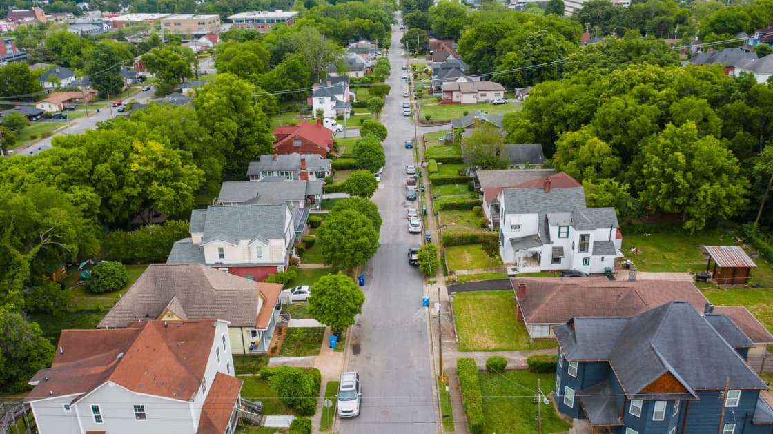
That nickname — Utah's City of Trees — is the fastest way to understand what makes Pleasant Grove different from its western neighbors. Where the fast-growing west-county boomtowns are still filling in bare ground, Pleasant Grove's older streets are lined with decades-old trees. It reads as a settled place because it is one.
The modern city adds things the pioneers would not recognize: doTERRA is headquartered here, I-15 access is central and convenient, and the foothills carry a growing supply of newer large-lot housing.
The two canyon mouths, which explain the east side
Most Utah Valley cities have one canyon. Pleasant Grove has two coming down into it — Grove Creek and Battle Creek — and the space between and around them is what the eastern half of the city is built on.
This matters more than it sounds like it should. Canyon mouths dump water, they dump alluvial fans of rock and soil, and they dictate where a street can go. On the bench, the tidy pioneer grid that governs the older part of town gives way to streets that curve to follow topography. Two houses that look close together on a map can require dropping down off the bench and climbing back up to get between them.
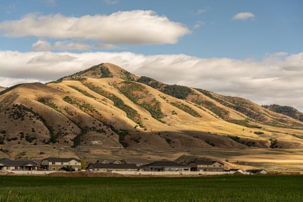
The canyons also give the city its recreation. Battle Creek Falls is the popular hike, starting from the Kiwanis Park trailhead, and the 'G' on the foothills above town is the visible landmark that tells you where the mountain front begins. Trail access from the east side of Pleasant Grove is a doorstep amenity rather than a drive.
And they give the city its weather. The bench holds snow longer, sees more of it, and gets canyon wind that the west side does not.
The areas
The old grid and the historic core
This is the Pleasant Grove that earned the nickname. Laid out on the pioneer grid, platted early, and filled in over more than a century, the older central part of the city has the deepest tree canopy, the widest range of build eras on a single street, and the walkable civic core.
Housing here is mixed. Early cottages sit next to mid-century ranches sit next to infill built in the last twenty years. Lots are modest by bench standards but often generous by modern subdivision standards, and mature trees are the defining feature — which is a real amenity and also a real maintenance obligation that newer buyers sometimes underestimate.
This is also where Strawberry Days happens. The parade route, the rodeo and the carnival are a June fixture that has run since the early 1920s, and living near the route is a genuine consideration in both directions: some people buy for it, some people leave town for it.
Reads as: oldest, greenest, most walkable, most mixed.
The foothill bench
East of the old grid, the ground climbs toward Mount Timpanogos, and this is where most of the city's newer construction has gone.
The bench is where you find the larger lots, the newer builds, the mountain views and the trail access. It is also where the streets stop following the grid, because the canyon drainages and the slope dictate the layout instead. Subdivision names carry more weight here than anywhere else in the city, simply because there is no older geography to refer to.
The trade-offs are the standard bench trade-offs and they are all real. More snow. Colder mornings. Steeper approaches. Everything is a few minutes further from the freeway. Wildfire exposure is a consideration at the mountain interface, as it is along the whole Wasatch front.
What you get is the reason people pay for it: quiet, space, views, and being able to walk to a trailhead.
Reads as: newest, largest lots, best views, most winter.
The west side and the freeway corridor
West of the old grid, the ground flattens out toward I-15, and the character changes again.
This is the most convenient part of the city for a commuter and the most conventional in built form — flatter, newer than the historic core but denser than the bench, and closest to the commercial corridor and the freeway interchange. It is generally the most affordable part of Pleasant Grove, and it is where a buyer who wants the city's position without the bench's premium tends to end up.
The trade is the obvious one. You are closer to the freeway, which is good for the commute and less good for quiet, and you are furthest from the mountain and the trees that give the city its identity.
Reads as: flattest, closest to I-15, most affordable, least distinctive.
The commercial and employment spine
Running through the city is the corridor of commercial and employment uses that includes doTERRA's headquarters. This is not a residential neighborhood, but it shapes the residential ones around it — it is a traffic generator, it is a large local employer, and its presence is part of why Pleasant Grove's daytime population behaves differently from a pure bedroom community's.
If you work there, the commute case for living in Pleasant Grove is close to unbeatable. If you do not, it is a thing you drive past and around.
The district story, told properly
Pleasant Grove's district situation is the most interesting in the valley, and it is worth understanding rather than skimming.
What happened: the 2024 ballot measure split Alpine School District, one of the largest districts in the country by enrollment. Alpine dissolves on 30 June 2027, and three successor districts become operational on 1 July 2027 for the 2027–28 school year. Our guide to the Alpine School District split covers the full reorganization.
Where Pleasant Grove landed: Timpanogos School District, with Orem, Lindon and Vineyard.
Why that is odd: neither ballot proposition named Timpanogos. The propositions carved out what became Aspen Peaks and what became Lake Mountain. Timpanogos is the remainder — the part of Alpine that nobody proposed to change, left standing on its own after the parts that were proposed had been removed. The name was selected in early 2026, well after the vote that created the district.
Being formed by subtraction is not a defect. Timpanogos inherits Orem, which is the largest city in the group and brings a substantial established tax base with it. But it does mean this district started life without a campaign, without a founding argument and without the constituency that the other two built while they were being proposed.
The complication that affects buyers: some Pleasant Grove students currently attend American Fork High School — and American Fork High lands in Aspen Peaks, not Timpanogos.
That is a new district line cutting straight across an existing attendance pattern, and it is materially different from the situation in most of the valley. Elsewhere, the reorganization changes governance while leaving attendance alone. Here, it creates a genuine question, because a student cannot attend a school in a district they are not in as a standing arrangement.
We are not going to predict how it resolves. Two boards that do not yet exist will decide it. What we will say is that if you are buying in Pleasant Grove and the high school assignment matters to you, this is a live open question and it deserves a direct call to the district about the specific address rather than an inference from the city name. Our guide to two high schools, one district explains why the district question and the school question have to be asked separately.
Reading the building eras
You can date most of Pleasant Grove by looking at the street.
Straight grid, mature canopy, mixed house ages — the historic core, platted early and filled in over generations.
Straight grid, thinner canopy, consistent mid-century stock — the first ring of post-war expansion outward from the core.
Curving streets, larger lots, young trees — the foothill bench, subdivided as the city grew east toward the mountain.
Flat, regular, denser, newest — the west side toward the freeway.
The canopy is the single most reliable tell. Trees take decades and cannot be faked, so the depth of the canopy on a street is a fairly accurate proxy for when that street was built.
What differs between these areas
Four things, and everything else follows from them:
Elevation. East is up, west is flat. This drives snow, views, street layout and price.
Canopy age. The old grid has it, the bench does not yet, the west side is in between.
Distance to I-15. West side closest, bench furthest, old grid in the middle.
Street geometry. Grid in the old city, topography-driven curves on the bench.
School district is the same across the whole city — Timpanogos from 1 July 2027 — and high school assignment is an address-level question everywhere in it.
Renting in Pleasant Grove
Rental supply is moderate and concentrated. There is more of it on the west side and around the commercial corridor than there is on the bench, and the bench in particular is very much an ownership product with rentals appearing mostly as individual houses and accessory units rather than complexes.
The older core has some good rental stock in the form of houses and converted units, and it comes with the same trade as buying there: character and trees against older systems and older maintenance.
Renters anywhere in the city should read our guide to Utah renters' rights. The rules are the same statewide, and small landlords renting a single house are less likely to have them at their fingertips than a management company is.
What the map doesn't tell you
Strawberry Days is a real week. Every June since the early 1920s. If you live near the parade route or the rodeo, plan around it.
The trees are an obligation as well as an amenity. Mature canopy over an old street means roots, means limbs, means autumn, and means a genuine relationship with the city's urban forestry rules. It is a large part of why people love the old grid and it is not free.
doTERRA changes the traffic. A large employer headquartered inside the city means the traffic pattern is not a simple commuter-out-in-the-morning shape.
The bench and the old grid are different climates. Not metaphorically. More snow, later melt, colder mornings, canyon wind.
Utilities and emergency response have their own boundaries. As everywhere in the north county, who provides your water, power and emergency response is worth checking rather than assuming from the city name. Our living in Pleasant Grove guide walks through the local arrangements.
Choosing in one pass
- You want the trees, the walkability and the history → the old Battle Creek grid.
- You want space, views and a trailhead → the foothill bench, and go look at the street in February.
- You want the freeway and the lowest entry point → the west side.
- You want the shortest possible commute to Lehi or to Provo → Pleasant Grove generally, because its position works in both directions, which is unusual.
- The high school assignment matters to you → call the district about the parcel before you offer. In this city specifically, do not skip it.
The 'G' and what the foothills are
Above the eastern edge of town, the letter 'G' sits on the foothills — the local version of a tradition you see across Utah, where a hillside letter marks the community below it. In Pleasant Grove it doubles as a navigational fact: if you can see the G clearly and it is above you, you are on the bench side of the city.
The foothills it sits on are more than scenery. They are the interface between a built city and a mountain, and that interface has consequences that a buyer should understand rather than admire.
Wildfire exposure is real along the entire Wasatch front interface, and properties at the mountain edge sit in it. Defensible space around a structure is not decorative landscaping; it is the practical difference in an event. This is worth reading about before buying at the interface, not after.
Drainage off a mountain front is fast and concentrated, particularly out of canyon mouths, and the alluvial ground the bench sits on is what those flows built over thousands of years. Where water goes in a heavy event is a question worth asking about a specific parcel.
Trail access is the upside and it is genuine. From the eastern side of the city, the Battle Creek Falls hike from the Kiwanis Park trailhead is a doorstep amenity rather than a drive, and the wider trail network on Mount Timpanogos runs from there.
Utilities, response and the things nobody asks about
In the north county, who provides your services is drawn separately from the city limit, and Pleasant Grove is no exception. Water, power, refuse and emergency response each have their own arrangements, and a newcomer's assumption that "the city does all of it" is not reliably true anywhere in this part of the valley.
The practical advice is the same as everywhere on this side of the county: ask, for the specific address, who provides culinary water, who provides secondary irrigation water if any is available, who bills for power, and which agency responds to a 911 call. Our living in Pleasant Grove guide sets out the current arrangements in detail.
The doTERRA effect
A large employer headquartered inside a city of this size changes it in ways that do not appear on a map.
It means a meaningful share of the working population commutes into Pleasant Grove rather than out of it, so the traffic pattern is not the simple outbound-morning shape of a pure bedroom community. It means the city has a daytime population and the businesses that serve one. It means a local employment option that does not require getting on I-15 at all, which for a two-earner household can be the difference that makes the whole location work.
It also means the city's commercial corridor carries more traffic than its residential population alone would generate, which is worth knowing if you are choosing between a house near it and a house away from it.
Related Guides
- Living in Pleasant Grove
- Timpanogos School District
- The Alpine School District split, explained
- Two high schools, one district: Lone Peak vs American Fork High
- Orem neighborhoods
- American Fork neighborhoods
- Highland, Alpine and Cedar Hills neighborhoods
- Living in Lindon
- Lindon neighborhoods
Frequently Asked Questions
What are the best neighborhoods in Pleasant Grove Utah?
Which school district will Pleasant Grove be in?
Do Pleasant Grove students attend American Fork High School?
Are these official neighborhoods with defined boundaries?
What is Strawberry Days?
How do the two canyon mouths affect the city?
Is Pleasant Grove a good commute to Silicon Slopes?
Why doesn't this guide publish home prices for Pleasant Grove?
Sources
The facts in this guide were checked against these sources. Hours, fees and rules change, so confirm anything time-sensitive with the source before you go. How we make Provo.com.
- Neighborhood District Program | Provo, UT, Provo City Council. Checked October 12, 2026.
- Voters approve split of Alpine School District, Eagle Mountain City. Checked October 12, 2026.