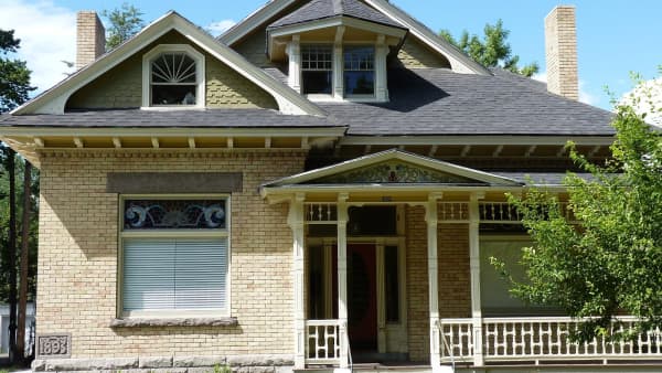

Most guides to Provo are, quietly, guides to about a third of Provo. They cover the BYU blocks, downtown, and the benches climbing toward the mountains — the parts of the city with the restaurants, the older architecture and the view. Everything west of the freeway gets a sentence about the airport and a note that it is more affordable.
That coverage gap has been getting less defensible every year, because West Provo is where the city is happening. The newest housing is here. The new high school is here. The last farmland inside the city limits is here, and it is converting. If you want to know what Provo will look like in fifteen years, the honest answer is that it will look more like Lakeview North than like Joaquin.
This is a guide to the whole west side: what the six neighborhoods are, what living in each is like, what the trade-offs are, and what is about to change.
The six neighborhoods
Provo groups its neighborhoods into districts, and the West District is a clean six: Lakeview North, Lakeview South, Fort Utah, Sunset, Lakewood and Provo Bay.
Worth saying plainly: in conversation, West Provo usually means something broader than that — anything on the far side of University Avenue, which would fold in Franklin, Franklin South and Dixon. Those three are formally Central District and they have a different character, older and denser and closer to downtown. This guide follows the city's own lines, and mentions the others where they matter.
Lakeview North — the construction frontier
If any part of Provo is being built right now, it is this one. Lakeview North is the city's northwest corner, historically farmland, and now the address on a continuous run of subdivision approvals, annexations and zone changes along Geneva Road and Lakeview Parkway.
The single biggest change was Provo High, which opened its new campus here in 2019 at 1199 North Lakeshore Drive. Moving a comprehensive high school to a mostly agricultural edge of the city was a bet on where the population was going, and it reorganized the neighborhood's center of gravity in a way that is still working through — traffic patterns, which streets get built next, where families with teenagers choose to look.
The boundaries run roughly from the Provo–Orem border in the north to I-15 on the east, West 820 North to the south, and about 3000 West on the western side — with the caveat that development keeps pushing that western edge. Housing is the newest in Provo: recent single-family subdivisions, townhomes and workforce-housing projects, with agricultural parcels still converting between them. Garages, yards and modern layouts are the default rather than the exception, which is not true anywhere else in the city.
Lakeview South — the quieter half
Lakeview South is the same geography with a different tempo. Less brand-new subdivision energy, more of west Provo's older pattern: larger lots, established homes, agricultural remnants that have not converted and may not soon.
It sits close to the Provo River corridor and to Utah Lake, and it is one of the few places left in Provo where a large parcel changes hands. Rental stock is limited, which matters if you are looking to rent on this side — most of the west-side rental inventory is in Franklin, Franklin South and Sunset rather than out here.
Fort Utah — the oldest name in the city
Fort Utah carries the name of the thing Provo grew out of. The original fort went up in April 1849 near the Provo River, and the settlement around it became the city. What the neighborhood is now is much less dramatic and much more livable: a settled, well-kept west-side family area of modest homes on wide streets.
The centerpiece is Fort Utah Park, which holds a replica fort and the Provo skate park. The city is replacing the aging skate park with a modern All-Wheels Park and upgrading the parking, playground and restrooms, so check the city's parks projects page for what is open before you go. The park is free and public. The replica is what you can walk through; the 1849 original is gone.
Housing is mostly later-twentieth-century single-family homes on regular lots, with newer subdivisions filling in toward the river. Owner-occupancy is the norm. The neighborhood runs west from about 1600 West around Center Street toward the river and the lake side of the city.
Sunset — small, functional, organized around a school
Sunset is compact west-central Provo, built around Sunset View Elementary at 1520 West 600 South and the park beside it. It sits in the 300–900 South band west of roughly 1000 West.
It is unshowy in the best sense. Houses from the 1960s through the 1990s that families live in, duplexes and small multi-family buildings on the bigger streets, a school within walking distance for most of the neighborhood, and a fast run to both the freeway and downtown. The owner–renter mix is mixed here in a way it is not further west, and long-term renters are a real part of the neighborhood rather than a transient layer.
Paul Ream Wilderness Park sits just east, which is a strange and welcome thing to have on the edge of a residential grid.
Lakewood — the other construction front
Lakewood is Provo's southwest quadrant and, like Lakeview North, a neighborhood in the middle of becoming something else. Recent city approvals here include new single-family subdivisions and townhome projects, the kind of run that visibly reshapes a housing mix inside a decade.
It generally runs south of about 1000 South and west of University Avenue toward the lake. The current mix is older single-family homes and agricultural parcels alongside new subdivisions and townhomes, and it is one of the more realistic places in the city to find recent construction without north-side pricing. What it does not yet have is retail. The walk-to list for Lakewood is short: new subdivision streets, trails, nearby parks, and little else.
Provo Bay — the one that is barely residential
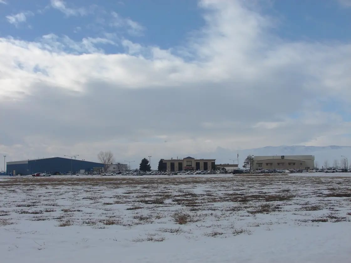
Provo Bay is the least residential neighborhood in Provo and the most distinctive. It is dominated by Provo Municipal Airport and by the shoreline and wetlands of Utah Lake's Provo Bay, with agricultural land and light-industrial flex space filling most of the rest.
Lakeview Parkway — the road most people still call the West Side Connector — was built through here, with wetland mitigation attached, and it is the single piece of infrastructure that opened this corner of the city to anything at all. Housing is sparse: scattered homes and agricultural properties, not subdivisions. Anyone house-hunting on this side of town is realistically looking at Lakewood or Lakeview South and using Provo Bay as the place they drive to.
What it does have is birds. The Provo Bay wetlands are a genuine birding area, and the fact that almost nobody treats them as a destination is more a marketing failure than a quality one.
Getting around
The west side's transit story changed in April 2025, and most people have not noticed.
UTA On Demand now runs a curb-to-curb microtransit zone covering roughly 8.6 square miles of west Provo and Orem. You hail a van from an app, you pay $2.50, and the fare includes a transfer to bus, TRAX or FrontRunner within two hours. The zone runs north from Lakeview Parkway to the south side of University Parkway, and the destinations it was explicitly built to serve read like a west-side directory: Provo Airport, a sports park, Provo High School, Centro Hispano, Provo City Hall, and both the Provo and Orem Central FrontRunner stations.
That last item is the one that matters. The historic problem with living out here without a car was not the lake — it was the two miles between a west-side subdivision and Provo Central Station. That gap now costs $2.50.
Conventional bus service is thinner but real, and the fixed routes that reach the west side are not frequent enough to plan a life around.
For anything self-powered, the Provo River Parkway and the Lakeview Parkway trail do a lot of work. The west side is flat, the grid is wide, and the trail network connects more of it than the road map suggests.
Why the west side developed last
It is a fair question. Provo started at Fort Utah, which is on the west side, and then spent a century and a half growing away from it. The reasons are geographic and infrastructural rather than social, and understanding them explains why the pattern is now reversing.
The land nearest Utah Lake is low, wet and in places wetland. That is excellent for birds, farming and flood storage, and awkward for subdivisions — it constrains what can be built, where, and at what cost, and it attracts a mitigation requirement when anything major goes through. Provo Bay is the clearest case: the airport and the shoreline take most of it, and what is left is farmed.
Then there is the road network. For most of the city's modern history there was no continuous north–south arterial west of I-15, which meant every trip from a west-side parcel funnelled back east through a handful of intersections. That is a hard ceiling on how much development a corridor can absorb. Lakeview Parkway changed the arithmetic, and the profile of Provo Bay says so directly: it is the thing that opened the southwest corner to anything at all.
Add a new comprehensive high school in 2019 and the picture is complete. Land, a road and a school arrived within a few years of each other, in the only part of Provo with room, at the moment Utah County's housing pressure peaked. What looks like sudden growth is the delayed release of a constraint.
Which of the six is right for you
A short, opinionated sorting, on the understanding that any of these can be wrong for a specific street.
You want the newest possible house: Lakeview North, then Lakewood. These are the two active construction fronts, and they are the only places in Provo where new single-family stock appears in quantity rather than one infill lot at a time.
You want a large lot: Lakeview South. It is the most likely place in the city to find a big parcel still changing hands, and the agricultural remnants have not all converted.
You want an established neighborhood at a west-side entry point: Fort Utah or Sunset. Both are built out, both are walkable to a park and a school, and neither is going to be reshaped around you.
You want to rent: Sunset has the most realistic mix, with duplexes and small multi-family buildings alongside the houses. Lakeview South and Lakewood have very little. If renting on the west side is the requirement, widen the search into Franklin and Franklin South, which are Central District but function as part of the same side of town.
You have a teenager: Lakeview North puts Provo High inside the neighborhood. Everywhere else on this side is a drive or a bus.
You want quiet and open land and do not mind driving for everything: Provo Bay, with the caveat that housing there is scattered rather than offered.
Parks, water and open space
This is where the west side beats the rest of the city outright, and residents know it even when the guidebooks do not.
Utah Lake State Park is here. So are Harbor Park, Lakeview Park, West Park, Sunset View Park, Paul Ream Wilderness Park and Fort Utah Park, the last of these under construction for its All-Wheels Park rebuild. The Provo River Parkway runs the length of the district on its way to the lake. The Provo Bay wetlands sit at the southwest corner.
The Provo River Delta restoration has also been reshaping the river's last mile into the lake, adding fishing platforms and boat access as it goes — a project whose value lands disproportionately on this side of town.
What West Provo does not have is the dining, music and nightlife layer. There are neighborhood markets, a run of good, unglamorous places on Center Street, and then a drive east. That is the actual trade, stated plainly: more sky, more yard, more trail, fewer restaurants within walking distance.
What to check before you buy out here
Three things, in order of how often they catch people.
The field is inventory. Open land adjacent to a west-side subdivision is very unlikely to stay open. Provo's development tracker records approvals, denials and pending applications with dates, and it is the correct place to look before assuming a view is permanent.
Agriculture is still active. Parts of Lakeview South, Lakewood and Provo Bay sit beside working farmland, which means seasonal smell, equipment noise and early hours. Most people adapt. Some do not, and it is better to know in April than in July.
School boundaries move. The district redraws attendance areas as the west side fills in, and it has been redrawing them regularly. Provo City School District is the only authority on which school an address feeds, and confirming it directly costs one phone call.
And the airport is a real neighbor. Provo Municipal has been growing — more routes, larger aircraft, a push toward more gates — which is good for the county's connectivity and is also a thing you can hear from parts of Provo Bay and Lakewood.
The honest summary
West Provo is the part of the city with the most new housing, the most open space, the least retail, and by far the most change ahead of it. It suits people who want a house rather than an apartment, who value a yard and a trail over a walkable restaurant block, and who are comfortable living somewhere that is still being finished.
It does not suit people who want the Provo of the guidebooks. That Provo is four miles east and, increasingly, more expensive.
How the west side became Provo, legally
The section above describes the west side as the last part of the city to develop, and notes the steady run of subdivision approvals, annexations and zone changes that brought Lakeview and Lakewood into their current shape. Worth knowing what an annexation actually is, because it is the step that decides whose rules apply to a field out here, and it is nothing like what most people picture.
Annexation is a property-owner process, not an election
The controlling law is Utah Code Title 10, Chapter 2, Part 8. Under Section 10-2-806, the process starts with a petition filed with the city recorder, signed by owners of private real property inside the proposed area. The threshold is measured in land and value, not headcount: owners covering a majority of the private land area, whose property is equal in value to at least one-third of the value of all private real property in the area, plus 100% of all rural real property in it.
Before the petition is filed, the person intending to file must give the city a notice of intent and send a copy to every affected entity. The county then mails notice to each owner inside the proposed area and each owner within 300 feet of it — which is why neighbors on the far side of a fence line often hear about an annexation before the wider neighborhood does.
Section 10-2-806(3)(d) requires each signature page to carry, in bold, a notice stating substantially that there will be no public election on the annexation, because Utah law does not provide for annexation to be approved by voters at a public election. The same notice explains that a signer may withdraw in writing up to 30 days after the city receives notice of certification.
If you have ever heard a longtime west-side resident say the map changed without anyone asking them, this is the reason, and it is not a complaint about Provo in particular. It is how the state wrote the statute.
The rules that shaped the boundary out here
Section 10-2-804 requires an annexed area to be unincorporated, contiguous in itself, and contiguous to the city, and generally forbids annexation that would leave or create an unincorporated island or peninsula. It also requires the area to be inside the city's adopted expansion area.
Under Section 10-2-803 that expansion area is not improvised. A city's planning commission prepares, and the council adopts, an annexation policy plan containing a map of the expansion area and the criteria that will guide future decisions — the character of the community, the need for municipal services in developed and undeveloped unincorporated areas, the plan for extending services, how they will be financed, the tax consequences for current residents and for people in the expansion area, and the interests of affected entities. It must justify excluding any urban development within half a mile of the boundary.
For a buyer looking at the last open parcels on the west side, that plan is a better predictor of the next ten years than any conversation with a listing agent.
Protest, and who holds it
Section 10-2-810 limits protest to the governing body of an affected entity, an owner of rural real property in the proposed area, or an owner of private property in a mining protection area. It is filed with the county clerk within 30 days of certification, not with the city. Note what is absent from that list: a neighboring homeowner who simply objects has no statutory protest right. Their route is the public hearing the city must hold under Section 10-2-810(7) before approving an unprotested petition, noticed as a class B notice under Section 63G-30-102 for at least seven days.
Where a protest is filed, a county boundary commission hears it (Sections 10-2-809 and 10-2-811), and the city may take no further action on the petition until that decision comes back — unless it denies the petition outright at its next regular meeting within 30 days.
Two consequences worth carrying into a purchase
Bonds and property taxes do not vanish at the line. Section 10-2-816 provides that outstanding bonds are not affected by annexation and addresses the payment of property taxes across the change. Annexation moves jurisdiction; it does not erase obligations that already attached to the land.
Utility service can carry a reimbursement question. Section 10-2-817 deals with electric utility service in an annexed area and reimbursement for the value of facilities. If you are buying acreage on the edge of the city rather than a finished lot in a platted subdivision, that is a question for the title company, not a detail to discover later.
Boundaries and annexation proposals in this part of the city continue to move. Confirm the current city limit for a specific parcel with Provo City and the Utah County Recorder before you rely on it — and see our building permits guide for what applies once the parcel is inside.
Related Guides
- The Complete Guide to Provo Neighborhoods
- BYU Area Neighborhood Guide
- Downtown Provo Neighborhood Guide
- UTA On Demand in Utah County
- Utah Lake: The Complete Guide
- Best Schools in Provo & Orem
- Buying a Home in Provo
- Flying from Provo Airport (PVU)
- Is Provo Safe? Crime, Neighborhoods & What to Know
- The Riverbottoms Neighborhood Guide
Frequently Asked Questions
What counts as West Provo?
Is West Provo cheaper than the rest of Provo?
Which schools serve West Provo?
Is West Provo a good place to buy a house?
How do you get around West Provo without a car?
What is Fort Utah and can you visit it?
Is there anything to do in West Provo?
Is West Provo going to keep growing?
Sources
The facts in this guide were checked against these sources. Hours, fees and rules change, so confirm anything time-sensitive with the source before you go. How we make Provo.com.
- Neighborhood District Program, Provo City. Checked October 12, 2026.
- Provo City Timeline, Provo City Library. Checked October 12, 2026.
- NCES CCD school search (Provo High, Shoreline Middle, Lakeview, Westridge, Sunset View, Amelia Earhart), National Center for Education Statistics. Checked October 12, 2026.
- Parks Projects, Provo City. Checked October 12, 2026.
- Utah Code 10-2-806 and 10-2-810, Utah State Legislature. Checked October 12, 2026.
- UTA On Demand West Provo/Orem announcement, Utah Transit Authority. Checked October 12, 2026.