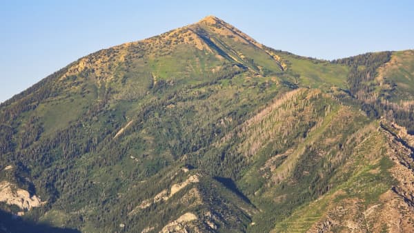
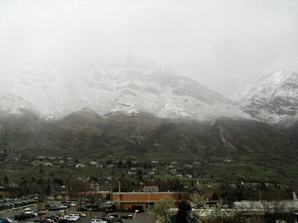
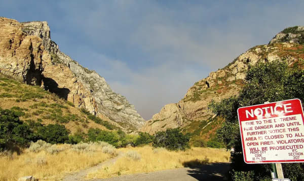
Almost everyone in Utah Valley has looked at the Bonneville Shoreline Trail without knowing it. Stand anywhere on the valley floor, look east at the Wasatch, and you will see a flat step in the foothills — a bench where the slope pauses before continuing up. That step is a beach. It is the shoreline of Lake Bonneville, the freshwater sea that filled this basin during the last ice age, and the trail is named for it because it runs along it.
That is the good part. Here is the part that trips people up.
It is not one trail, and that explains everything else
Search for the Bonneville Shoreline Trail and you will be told it is 280 miles long, or 100 miles long, or 6.8 miles long, or 2.8 miles, or 10.8 miles and rated hard. All of those numbers appear in reputable places and none of them is wrong.
The BST is a long-term project, not a finished path. The full vision runs roughly 280 miles from the Idaho border to Nephi. Somewhere just over 100 miles is currently built and officially designated. The rest is gaps — private land, unbuilt sections, places where the bench is under a subdivision. What exists today is a set of completed segments, several of them excellent, connected in some places and simply not connected in others.
Provo City's own figure for the length through Provo is about 6.8 miles.
So when you see a difficulty rating for "the Bonneville Shoreline Trail," it is describing one segment, and the segments are not alike. This is the single most useful thing to understand before you go: pick a segment, not a trail.
It also has federal ambitions. In March 2025 Utah's senators introduced a bill (S. 1135) directing the Interior Department to study designating the BST, described as about 280 miles from the Idaho border to Nephi, under the National Trails System Act.
The bench you are walking on is a beach
It is worth spending a paragraph on what the trail is built on, because once you see it you cannot unsee it, and it changes how the whole valley looks from the car.
Lake Bonneville was an enormous freshwater lake that filled this basin during the last ice age, covering a substantial share of what is now western Utah and reaching depths of many hundreds of feet over the ground where Provo and Orem sit today. Utah Lake and the Great Salt Lake are what is left of it.
A lake that size, standing at one level for a long time, does what any lake does: it cuts a shoreline. Wave action carved a terrace into the mountainside and built up sediment along it, and when the lake eventually fell — dramatically, in the case of the Bonneville flood, which breached at the north end and dropped the water level enormously — that terrace was left stranded high on the slope.
That stranded beach is the bench. It is the flat step you can see from anywhere on the valley floor, running along the foot of the Wasatch at a consistent elevation, and it is why a trail can run level for miles across a mountain range that otherwise offers nothing level at all.
The BST follows it because the lake did the engineering first. That is also why the walking is easy in a way that no canyon trail here is: you are on lakebed sediment and wave-cut terrace, not on talus and scree.
Once you know what you are looking at, the drive up I-15 gets more interesting. The bench is continuous, visible for most of the Wasatch Front, and it sits at roughly the same elevation the whole way — because it was all the same waterline.
The segments worth your time
Here is how the Provo and Orem stretches break down, with the caveat that published mileages vary by a few tenths depending on where the measurer started.
Springville to Rock Canyon — the long one. The long stretch north from Springville to Rock Canyon, on fairly wide gravel with good footing. It is the classic long trail run in the county. You do not have to do all of it — you can join or leave at the Slate Canyon, Y Mountain and Rock Canyon trailheads, which effectively turns it into three shorter outings. The flattest part is south of Slate Canyon.
Orem, aqueduct section — the easy one. A short, gentle stretch north of Provo Canyon Road under Mount Timpanogos. Good footing throughout. This is the segment to start with if you have never been on the bench.
Orem to Pleasant Grove — the connector. Roughly 4.5 miles linking the mouth of Provo Canyon to Battle Creek Canyon, with about 650 feet of gain starting around 5,100 feet. Expansive valley views the whole way. Two honest warnings from people who ride and hike it: some stretches have a steep side-slope that makes beginners and kids nervous, and there is talus — broken rock — toward the Orem end. The scenery is foothill scrub, grass and sagebrush with stands of scrub oak, so this segment is about the views outward rather than the trail itself.
Cascade Drive to Battle Creek Falls. A steady climb from the Cascade Drive trailhead in Orem. This one connects the bench directly to Battle Creek Falls in Pleasant Grove, which makes a satisfying point-to-point if you can arrange a car at each end.
Provo Canyon section — the hard one. About 10.8 miles round trip with roughly 1,400 feet of gain by AllTrails users' count, generally rated hard, accessed from the Bridal Veil and Nunn's Park area at the mouth of the canyon. It climbs steadily for the first mile, then runs long and rolling. This is a half-day.
The winter rule that catches people out
This is the part almost no trail write-up mentions, and it is the most useful thing on this page.
Part of the Orem-to-Provo-Canyon stretch crosses the Timpanogos Wildlife Management Area, land managed by the Utah Division of Wildlife Resources rather than by a city or the Forest Service. Utah WMAs are not multiple-use land in the way national forest is, and Timpanogos carries a seasonal closure through winter and early spring — reported windows have run from around December into mid-April, with DWR extending them in hard winters to protect deer surviving on stored fat.
The critical detail: the Bonneville Shoreline corridor itself has consistently been kept open when the rest of the wildlife area closes. DWR's closure announcements have repeatedly carved the BST out by name. Access rules for WMAs have also been in flux — reporting in early 2026 described hiking, biking and running on the Timpanogos BST as not requiring a hunting or fishing license, while that requirement remained in place on other area WMAs.
What this means in practice: on the BST itself in January, you are fine. Wander off onto a side trail across the wildlife area and you may not be. Stay on the designated trail through that stretch, and check current Utah DWR notices before you plan a winter outing around it — this is an area where the rules have moved in the last two years.
The WMA also carries a scar worth knowing about. The Range Fire in October 2020, started by target shooting, burned roughly 3,500 acres including the great majority of the DWR-owned wildlife area. The vegetation you walk through on that stretch is recovering ground.
What the walking is like
The BST is the anti-canyon trail. Where Rock Canyon and Y Mountain climb hard into shade and rock, the bench runs long and level-ish across open foothill.
That produces a specific set of conditions. Footing is easier than almost anything else in the county — wide gravel and packed dirt on most segments, with the talus near Orem as the exception. The grade is forgiving, which is why it is the local default for trail running and for hikers building fitness before a summit attempt.
And there is essentially no shade. This is the trade. Foothill scrub does not shelter anyone. In July, the bench in the middle of the afternoon is a bad idea; go early, go late, or go in October. Bring more water than the distance suggests, because the exposure does the work that elevation would elsewhere.
The reward is the view. You are two hundred feet above the valley on a natural terrace, looking west across Utah Lake with the whole grid of the valley laid out underneath. It is the best cheap sunset in Utah County, and at the north end you are doing it in the shadow of Timpanogos.
Sharing it, and the etiquette that matters here
The BST carries hikers, trail runners, mountain bikers, dog walkers and, on some segments, horses — often on singletrack with a side-slope and no room to step aside. That combination produces more friction here than on the canyon trails, where everyone is going the same two directions at the same slow speed.
Three things keep it civil.
Bikes yield to everyone, and downhill yields to uphill — but the practical version is that whoever has the easier place to stop should stop, and on a bench trail with a drop on one side, that is usually not the person going up. Riders coming down the Orem segments arrive faster than a hiker expects, because the grade is gentle enough to carry real speed.
Leash your dog on the shared stretches even where you technically need not. The trail is narrow, the side-slope is steep in places, and a loose dog meeting a bike at speed on a sidehill is how both of them end up down the slope.
Do not cut the switchbacks or brace new lines. The bench is loose sediment. It erodes, and the volunteer crews who maintain these segments spend their season repairing shortcuts.
Segments here are supported in part by the Utah Valley Trails Alliance, and the wider route by the Bonneville Shoreline Trail Coalition. Given that much of the trail's unbuilt mileage is stalled on land access rather than on money, those organizations are doing the part that determines whether the gaps ever close.
Getting the timing right
The BST has a daily rhythm as much as a seasonal one, and getting it wrong is the most common way to have a bad time out there.
Summer: early morning or evening, not the middle of the day. The exposure is the whole story — there is no shade to retreat into and the bench holds heat off the rock. Sunrise on the bench in July is lovely and about thirty degrees more pleasant than the same trail at 3 p.m.
Fall: the best season here without much competition. The scrub oak on the foothills turns a deep red that the canyon maples do not do, temperatures behave, and the light across the valley in the late afternoon is the reason so many local photographs of Utah Lake are taken from this bench.
Winter: usable, which is the trail's quiet advantage. The elevation is low enough that it often clears while the canyons are still deep, and a cold clear day gives you the whole valley under an inversion or above it. Traction devices are worth carrying — south-facing stretches thaw and refreeze into ice. Mind the wildlife-area note above.
Spring: the worst of it. The bench is sediment, and sediment plus snowmelt is mud that will pull your shoes off and that damages the tread when you walk it. Give it a week after a thaw.
Fitting it into the rest of the network
The BST's real function locally is as a spine. It runs along the bench and the canyon trails hang off it.
From the bench you can reach Rock Canyon, the Y Mountain trail, Slate Canyon, and at the north end Battle Creek. That means a BST segment can be an outing in itself or the approach to something steeper, and several of the county's better long days are BST-plus-a-canyon rather than either alone.
It also overlaps the valley's other flat-and-long option without duplicating it. The Provo River Parkway runs paved along the river on the valley floor; the BST runs unpaved along the bench above it. Parkway for strollers, road bikes and winter certainty; bench for dirt, views and solitude. Riders link the two at the mouth of Provo Canyon regularly.
For where it sits among everything else, our complete Utah Valley hiking guide ranks the county's trails, and running routes in Provo covers the BST's role in the local running scene specifically.
The practical block
Access — Provo: Rock Canyon, Y Mountain and Slate Canyon trailheads. Access — Orem: Cascade Drive trailhead on the northeast side; mouth of Provo Canyon at 800 North for the canyon segment; Bridal Veil and Nunn's Park for the south canyon section.
Fees: None at the city trailheads. Note that land management changes underneath you as you walk — city, Forest Service, state wildlife area and private easement can all occur inside a few miles, and signage is the authority wherever you are standing.
Season: Effectively year-round on the bench, which is unusual here. Mud in spring thaw. See the wildlife-area note above for the winter caveat.
Dogs: Allowed on the segments generally, leash rules vary by segment and land manager. Check the sign at your trailhead.
Bikes: Yes on most of it, and it is popular for riding.
Shade: None to speak of. Plan around the sun, not around the distance.
Maintenance: Segments here are supported in part by the Utah Valley Trails Alliance, and the wider route by the Bonneville Shoreline Trail Coalition. Both are worth a donation if you use this trail often.
The BST rewards a specific kind of local knowledge: not which trail to hike, but which piece of it to hike, and when. Pick a segment that matches the day you have, start before the sun gets high, and the bench will give you the best view-to-effort ratio in Utah Valley.
Nobody can charge you to walk the bench, and the reason is worth knowing
The trail crosses city, county, state trust, Forest Service and private land in the space of a few miles, frequently without a sign to mark the transition. That raises an obvious question for a long walk: can any of those owners start charging?
For the federal segments, the answer is set by statute and it is a firm no for the walking itself.
The Federal Lands Recreation Enhancement Act, 16 U.S.C. Chapter 87 — rewritten by the EXPLORE Act in January 2025 — authorizes federal recreation fees and then constrains them tightly. On Forest Service, Bureau of Land Management and Bureau of Reclamation land, no standard or expanded amenity recreation fee may be charged for general access unless specifically authorized, nor solely for parking, undesignated parking, or picnicking along roads or trailsides, nor for dispersed areas with low or no investment, nor for persons walking through, hiking through or horseback riding through federal recreational lands without using the facilities and services.
A shoreline traverse is close to the statutory definition of walking through without using facilities. It is also, along most of its length, exactly what the Act means by a dispersed area with low investment: a bench-line path with no developed site attached to it.
Nor can an agency simply designate a trailhead as a fee site to get around that. To charge a standard amenity fee at a general recreation area the Forest Service needs significant recreation opportunities, substantial federal investment, efficient collection, and all six of designated developed parking, a permanent toilet, a permanent trash receptacle, an interpretive sign, exhibit or kiosk, picnic tables, and security services. Most BST access points in Utah County fail that test on several counts at once.
The Act adds one more constraint that matters on a trail crossing many jurisdictions: agencies are directed to establish the minimum number of recreation fees and to avoid multiple or layered fees for similar uses.
Where the federal statute stops
FLREA reaches federal land and nothing else, which on this trail is a minority of the mileage. The city segments, the county segments, the state trust parcels and the private crossings are each governed by their own owner.
For the non-federal stretches the operative rule in Utah is a different statute entirely. Utah Code § 57-14-201 provides that an owner of land owes no duty of care to keep the land safe for a person entering for a recreational purpose, and no duty to warn of a dangerous condition on it. Utah Code § 57-14-102 lists hiking, mountain biking, walking, running, jogging and equestrian activity among the recreational purposes, and defines "owner" to include the possessor of any interest in the land, public or private, including a lessee. Utah Code § 57-14-401 extends the same protection to developed or improved land in urban or semi-rural areas opened to the general public without charge, naming trails specifically.
That immunity is conditioned on access without charge — Utah Code § 57-14-202 — and it disappears where an owner charges, under Utah Code § 57-14-204. Which sets up the quiet bargain holding this trail together: private owners along the bench tolerate a public path because the Legislature made tolerating it nearly costless, and charging for it would forfeit exactly that protection.
The practical reading for a walker is short. The trail itself is free and is going to stay free. What can carry a fee is a developed site you choose to use. And the reason the gaps in the route are gaps is not money, it is consent.
Related Guides
- Lesser-Known Hikes Near Provo: Six Trails Past the Famous Five (2026)
- Provo Peak: The Mountain Behind the Y, and Why the Road Is the Hard Part
- Kyhv Peak (Formerly Squaw Peak): The Complete Guide (2026)
- Stewart Falls: The Complete Hike Guide (2026)
- Utah Valley Hike Finder — filter every trail by difficulty, length, season, dogs and fees
Frequently Asked Questions
What is the Bonneville Shoreline Trail?
Where can I access the Bonneville Shoreline Trail in Provo?
How hard is the Bonneville Shoreline Trail?
Is the Bonneville Shoreline Trail open in winter?
Can you bike the Bonneville Shoreline Trail?
Do you have to pay to hike the Bonneville Shoreline Trail?
Could the Forest Service start charging at a BST trailhead?
Who is liable if you are injured on a segment crossing private land?
Sources
The facts in this guide were checked against these sources. Hours, fees and rules change, so confirm anything time-sensitive with the source before you go. How we make Provo.com.
- Trails | Provo, UT, Provo City Parks and Recreation. Checked October 12, 2026.
- S. 1135 (119th Congress): Bonneville Shoreline Trail study, U.S. Senate via GovInfo. Checked October 12, 2026.
- Bonneville Shoreline Trail: Provo Canyon Section, AllTrails. Checked October 12, 2026.
- Bonneville Shoreline Trail: Y Mountain-Rock Canyon, AllTrails. Checked October 12, 2026.
- Bonneville Shoreline Trail: Y Mountain-Springville, AllTrails. Checked October 12, 2026.