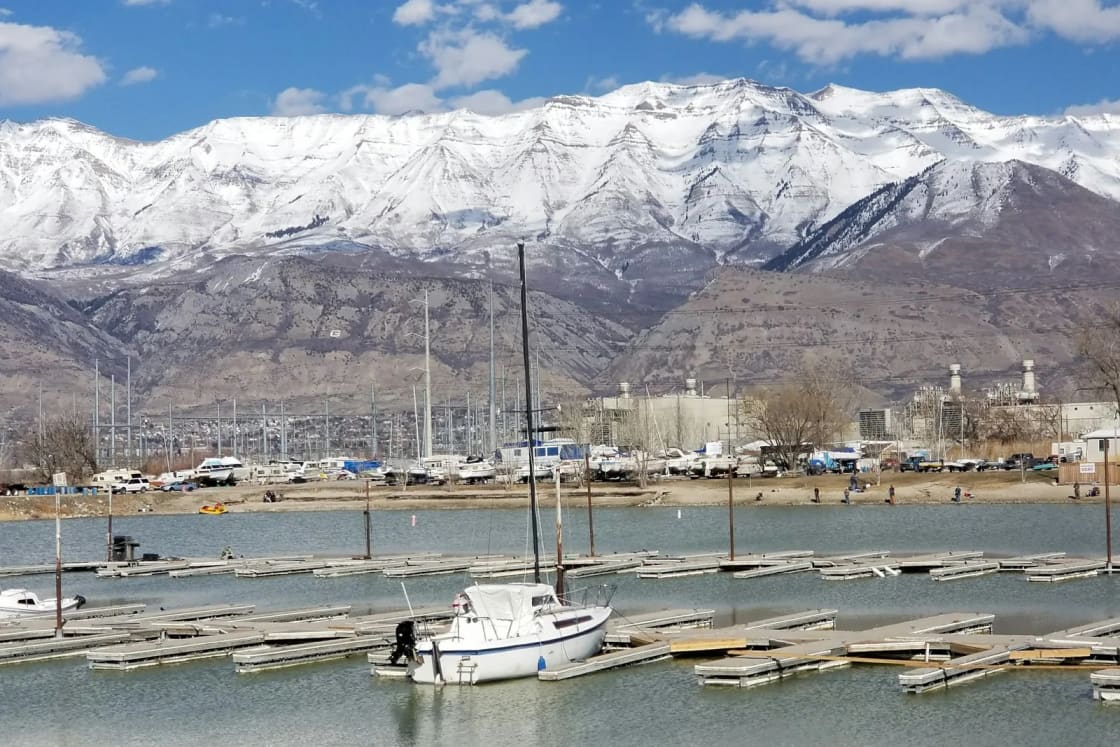

Utah Lake has six real boat launches, and they are not interchangeable. The state park at the end of Center Street in Provo is the only one with fuel and the deepest set of ramps. American Fork's rebuilt harbor is the cheapest family beach day on the north shore. Saratoga Springs runs two city marinas on one inexpensive launch pass. Lindon is private. Lincoln Beach, on the far south shore, is the quiet county option. Everything else on the shoreline is a gravel ramp, a hand-carry beach or a walk through the reeds.
This page compares them for the person holding a trailer hitch or a paddle and asking one question: where do I put in today? For the lake itself (why it is brown, the carp, the June sucker, the island fight), start with our Utah Lake guide. For the state park in depth, see our Utah Lake State Park guide.
First, the water level, because it decides everything this fall
Utah Lake is a shallow natural lake used as a reservoir, and in a dry year the shoreline walks away from the ramps.
The federal snow survey's water supply outlook for October 1, 2026 listed Utah Lake at 442,000 acre-feet of an 870,000 acre-foot capacity, about 50 percent full, against 72 percent on the same date a year earlier. (Utah State Parks' own park page showed a different figure, about 57 percent, in mid-October; the two are calculated differently, and both say the same thing: low.)
The Utah Lake Authority explains how to read the number. Its live gauge reports the lake against the compromise elevation of 4,489.045 feet, the legal "full" line set in the 1985 compromise agreement; a reading of minus 3.5 means the lake is three and a half feet below full. Water levels, the authority notes, almost always fall through the hot months, because evaporation and releases to the Jordan River outrun inflow once the snowmelt is over.
What that means at the ramp:
- Utah State Parks reported all of its Utah Lake ramps open "weather permitting" in October, and flagged the south ramp as the shallowest.
- Saratoga Springs posts its launch as a "launch at your own risk" facility and says late-season conditions "present well-known challenges for most marinas on Utah Lake, often leading to shallow depths and mud accumulation near the launch areas."
- The Utah Lake Authority's standing boater advisory asks boaters to call the marina they plan to use and ask about current depth before they tow.
The marina's own staff is the only source current on the day you go. Every number below is a starting point for that phone call.
The six launches at a glance
| Launch | Best for | Posted launch or entry fee | Watch for |
|---|---|---|---|
| Utah Lake State Park, Provo | Fuel, sailboats, the most ramps | $20 per vehicle (Apr to Oct) | South ramp is the shallowest |
| Lindon Marina, Vineyard | Small-craft rentals, a quick east-shore launch | Set by the private owner | Danger advisory at its beach on Sept. 30 |
| American Fork Beach and Boat Harbor | A sand beach plus a launch on the north shore | $10 launch (Utah Lake Authority) | Two sources list different car fees |
| Saratoga Springs South Marina | Cheap launches, a swim beach, jetty fishing | $8 per launch | Beach restrooms close Oct. 15 |
| Saratoga Springs North Marina | A newer northwest launch | Same $8 city pass | New in 2026, few amenities |
| Lincoln Beach, south shore | Camping and a quiet ramp | County rates | Longest algae history on the lake |
Utah Lake State Park: the full-service harbor
4400 West Center Street, Provo. About 4.5 miles and 10 minutes from downtown Provo by an OpenStreetMap routing estimate.
This is the harbor most people mean when they say "Provo Harbor," and it is the default for anyone towing a boat for the first time. Utah State Parks describes two marinas. The inner marina has four boat ramps, courtesy docks, a fueling dock with a marine pump-out and lease docks, and it is where the park's concessionaire rents motorized and non-motorized craft. The outer marina has a sandy beach and is open to swimming, paddleboarding and kayaking, which keeps swimmers out of the boat traffic.
Utah State Parks' ramp report names five ramps in the park: Northwest, North Center, Northeast, the South Ramp at the marina, and a Provo River ramp. In October the park listed all of them open, with the reminder that the South Ramp is the shallowest. The Utah Lake Authority adds two details nobody else on the lake can match: it is the only public marina with a refueling station, and it has a mast crane for sailboats.
Fees, as listed by Utah State Parks in October 2026: $20 per vehicle from April through October ($10 for Utah seniors 65 and older, $5 per person walking in), and $10 per vehicle from November through March ($4 walk-in). An annual Utah State Parks pass is accepted.
Slips: seasonal slips run $650 to $950 from April 1 to October 31, with an annual pass required. The park says every slip for 2026 is rented, and it keeps two first-come waiting lists for 2027 (boats up to 27 feet, and large slips for boats up to 52 feet) with a $30 application fee that is good for one April-to-April cycle.
Mussels: the park requires boaters to certify their boat is mussel free every time they launch. If the boat has been to Lake Powell or out of state, it has to be professionally decontaminated or self-decontaminated: cleaned, drained, and dried for 7 days in summer, 18 days in spring and fall, 30 days in winter, or 3 days if winterized or freezing. The park offers free professional decontamination by appointment at 801-375-0731.
The park is open 6 a.m. to 10 p.m. from April through October and 6 a.m. to 8 p.m. from November through March. It is a no-fly zone for drones because the Provo airport sits next door.
Lindon Marina: private, east shore, built around rentals
4400 West Vineyard Road, Vineyard, as Google lists it. About 10.7 miles and 17 minutes from downtown Provo.
The address is the first thing to get right. Our Utah Lake guide has flagged it before: the marina carries Lindon's name, sits on a Vineyard address, and is filed under Orem by some apps. The Utah Lake Authority describes it as privately owned and operated, and it does not set its prices on any public page we could read, so check the marina's own site for launch and entry fees.
What the Utah Lake Authority lists: restrooms, boat launching, picnic tables and rentals at the water's edge of kayaks, pedal boats, stand-up paddleboards and small sailboats, plus a life jacket loaner station. That makes Lindon the easiest place on the lake to try a small sailboat or a pedal boat without hauling anything.
Two notes for this fall. The Utah Department of Environmental Quality's September 30, 2026 update put Lindon Marina Beach under a danger advisory, its highest level, with high toxin levels and a "keep out" notice; its August updates had also found E. coli above recreational thresholds there. And the marina is the parking area for the Battle Creek walk-in access, a state sportsman site reached on foot north along the path behind the boat storage area, for anglers and birders who want a quieter shoreline.
American Fork Beach and Boat Harbor: the rebuilt north-shore beach
About 14.8 miles and 23 minutes from downtown Provo. The Utah Lake Authority's directions are simply to search "American Fork Boat Harbor" in Google Maps or "American Fork Beach and Boat Harbor" in Apple Maps.
The harbor reopened in 2025 after a rebuild. The Utah Lake Authority says the work, completed in June 2025, upgraded the parking lot and amenities and was funded mainly by grants from the State of Utah and Utah County, and it puts the figure at $3.3 million. The Lehi Free Press, reporting the reopening in May 2025, cited the city's own figure of $3.9 million and listed a new parking lot, restroom, welcome building, a larger beach, cornhole courts, a trail, a playground and better fishing access. The new beach, by the authority's count, took 800 tons of sand.
Fees, where the sources disagree: the Utah Lake Authority's access-point listing (updated September 2026) shows a $10 daily launch, $10 to drive in, $5 to walk in through the harbor, and free use of the beach itself once you are in. The Lehi Free Press's 2025 report listed free walk-in or bike-in entry, $5 per vehicle per day, a $10 launch and annual passes of $80 for residents and $100 for nonresidents. Both agree on the $10 launch. Expect to pay something to park, and confirm the current car fee at the gate.
The Utah Lake Authority also notes the jetties are popular with anglers, and in winter the ice stacks that pile up along the shore are a photography draw. On algae: the state's September 30 updates kept warning advisories at both the American Fork beach and the marina.
Saratoga Springs: two city marinas, one cheap pass
The city's launch fee is the lowest on the lake, and it covers both of its marinas.
South Marina Park (also called Pelican Bay Marina), Harbor Park Way. About 26.7 miles and 38 minutes from downtown Provo. The city lists it as open all year, 6 a.m. to 10 p.m. daily, with picnic shelters (first come, first served), a reservable pavilion with nine tables, BBQ grills, fire pits, outside showers, a sandy beach and swimming area, a fish-cleaning station and jetty fishing. Fishing is not allowed along the swimming area to the north. (The city's page gives the street number as 156 Harbor Park Way and Google lists 1566; search the park name rather than the number.)
North Marina Park. About 19.3 miles and 28 minutes from downtown Provo. The city says it opened in summer 2026. The Utah Lake Authority lists a concrete boat ramp, restrooms, picnic areas and paved parking, and little else yet.
Fees, as the city posts them: $8 per launch or day pass, $50 for a resident annual pass, $75 for a nonresident annual pass, paid at the self-pay machine at the park or at City Hall. The pass works at either marina. The city is explicit that there is no fee for fishing, swimming, or launching small craft such as paddleboards and kayaks that do not use the boat ramp.
At the South Marina, the restrooms near the boat launch stay open year round, and the beach-side restrooms close October 15 to April 15. On algae, the state's September 30 update kept a warning at the Saratoga Springs marina.
Lincoln Beach: the county's south-shore marina
4700 South Lincoln Beach Road, near Spanish Fork. Roughly 21 miles from downtown Provo.
Lincoln Beach is the public marina Utah County manages on the lake's south end, at the northern tip of West Mountain. The Utah Lake Authority lists a dredged boat channel, a concrete boat launch, a floating dock, a fish-cleaning station, campsites with water access near a restroom, a large group pavilion and smaller pavilions that are first come, first served. It is the only public marina on the lake where you can camp beside the ramp.
It also has the longest record of harmful algal bloom advisories on Utah Lake, and the state's September 30 update kept a warning there. Our Lincoln Beach guide covers the campground, the winter ice warning and the drive in detail.
The small ramps and hand-carry launches
Beyond the six marinas, the Utah Lake Authority's map of public access points (updated September 3, 2026) lists more than 30 sites. Most are sportsman access points built for anglers and waterfowl hunters, and a few work for small boats:
- Mill Race, south Provo. A gravel boat ramp for small, shallow-draft boats, with a channel leading into Provo Bay and a life jacket loaner station. No fee. Our Provo Bay paddling guide covers it.
- Swede Lane, south shore. A small gravel ramp for shallow-bottomed boats and parking for about 10 vehicles. No fee. The Utah Water Ski Club's slalom course sits just to the north.
- Skipper Bay trailhead, Provo River Delta. Non-motorized launching beside the restrooms, part of the federally managed delta restoration. Fishing and camping are not allowed at this site. No fee.
- Sandy Beach, near Spanish Fork. Hand-carried boats only, no trailers, limited parking, no fires. No fee. See our Sandy Beach guide.
- The Knolls, west shore. A small boat launch, a life jacket loaner station and a small parking area, beside BLM land where camping is allowed. No fee.
- Vineyard Beach and the Vineyard street-end accesses. Carry-in kayaks and canoes from small lots off the Utah Lake Shoreline Trail. No fee.
None of these is a substitute for a concrete ramp with a dock, and several sit on soft roads that the authority warns turn muddy when wet. They are, however, the reason a kayaker never has to pay to get on Utah Lake.
Which launch should you use?
- First time towing, or you need fuel: Utah Lake State Park. Four ramps in the inner marina, a fuel dock and staff on site.
- A sailboat with a mast to step: the state park, for the crane. Our sailing guide covers the wind.
- A family beach day with a boat in the mix, north end: American Fork, where the beach is free once you are through the gate.
- The cheapest launch, and you live on the west side: Saratoga Springs, $8 or a $50 resident season pass.
- Renting a small boat with no trailer at all: Lindon Marina, once its beach advisory clears.
- Camping beside the ramp: Lincoln Beach.
- Glassy water for skiing: whichever ramp is closest to the protected water you plan to ski, early in the day. Our wakeboarding, waterskiing and tubing guide has the hour-by-hour wind numbers.
Before you go
- Call the marina and ask about the depth at the ramp. In a 50 percent year this is not optional.
- Check the Utah DEQ Utah Lake page for the site you are visiting. Boating is generally still considered acceptable under a warning; swimming and water contact are not.
- Certify mussel status and carry proof, especially if the boat has been anywhere else this year.
- Watch the wind. When it blows, Sgt. Ray Ormond of the Utah County Sheriff's Office told the Daily Herald after a June 2025 capsizing, lake waves can become "very treacherous and dangerous very quickly." Rescue crews that evening launched from Saratoga Springs, American Fork, Lindon and the Provo harbor, which is a reminder that every one of these marinas is also a rescue base.
For rentals at the lake and the reservoirs up the canyon, see our boat, jet-ski and paddle rental guide. For the bigger reservoirs within two hours, our reservoir guide compares them.
Frequently Asked Questions
How many marinas are on Utah Lake?
What does it cost to launch a boat on Utah Lake?
Which Utah Lake marina has gas?
Is Utah Lake too low to launch a boat right now?
Can I launch a kayak or paddleboard for free on Utah Lake?
Can I rent a slip at Utah Lake State Park?
Do I need the mussel course to launch on Utah Lake?
Is it safe to swim at the Utah Lake marinas?
Sources
The facts in this guide were checked against these sources. Hours, fees and rules change, so confirm anything time-sensitive with the source before you go. How we make Provo.com.
- Utah Water Supply Outlook Report, October 1, 2026, USDA NRCS. Checked October 19, 2026.
- Water Levels and compromise elevation, Utah Lake Authority. Checked October 19, 2026.
- Utah Lake State Park, Utah State Parks. Checked October 19, 2026.
- Utah Lake State Park: Park Fees, Utah State Parks. Checked October 19, 2026.
- Utah Lake State Park: Boating and Decontamination, Utah State Parks. Checked October 19, 2026.
- Utah Lake State Park: Current Conditions, Utah State Parks. Checked October 19, 2026.
- Boat Ramp Conditions, Utah State Parks. Checked October 19, 2026.
- Utah Lake Public Access Points (story map, updated Sept. 3, 2026), Utah Lake Authority. Checked October 19, 2026.
- Things to Do at Utah Lake, Utah Lake Authority. Checked October 19, 2026.
- South Marina Park, City of Saratoga Springs. Checked October 19, 2026.
- Public Marinas, City of Saratoga Springs. Checked October 19, 2026.
- Utah Lake harmful algal bloom updates, Utah Department of Environmental Quality. Checked October 19, 2026.
- American Fork Beach and Boat Harbor now open following renovation, Lehi Free Press. Checked October 19, 2026.
- Crews conduct simultaneous rescue efforts on Utah Lake, Daily Herald. Checked October 19, 2026.
- Google Places listings (addresses, hours, coordinates), Google Places. Checked October 19, 2026.
- OSRM routing (OpenStreetMap data), Project OSRM. Checked October 19, 2026.