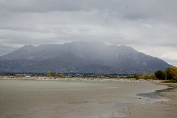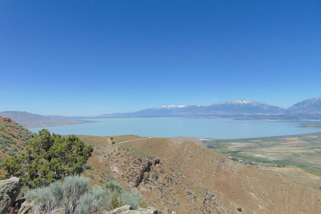

Sandy Beach is the free Utah Lake beach that people in Provo drive past without knowing it is there. It sits on the southeast shore near Spanish Fork, at the end of a tree-lined road beside the mouth of the Spanish Fork River, about 12 miles from downtown Provo. There is no gate and no fee. There is also no boat ramp, no trailer parking and no fire, and its size depends on how much water is in the lake.
A quick correction before the details. Sandy Beach is sometimes lumped in with "the west side" of the lake, as our own Utah Lake guide once did before we corrected it. It is not on the west side. The empty shoreline across the lake, below the Lake Mountains and West Mountain, is a separate trip with its own rules, and this page covers both. If you want a beach with paved parking, showers and a campground, our Utah Lake State Park guide is the better fit.
Sandy Beach: what is there
The Utah Lake Authority's map of public access points, updated September 3, 2026, describes Sandy Beach this way:
- Used for: fishing, birding, swimming, waterfowl hunting, and launching small boats that can be carried by hand.
- No trailers. Parking is limited.
- The road in is the birding. The last half-mile of the tree-lined road to the beach is, in the authority's words, "a well-known birding location." Our Utah Lake birdwatching guide covers the lake's other birding sites.
- The river mouth is the fishing. Anglers work the spot where the Spanish Fork River enters the lake.
- No fires, and pack out your garbage.
- Amenities: limited parking, restrooms and the sand beach. Utah County manages the site and, with partners, is working on road upgrades, picnic benches and restrooms.
- Fee: none.
How to get there: the authority's directions are simply to search "Sandy Beach" in a maps app. Google places it off West 3600 South in Spanish Fork. From Center Street and University Avenue in Provo it is about 12 miles and 26 minutes by an OpenStreetMap routing estimate.
The beach grows and shrinks with the lake
The authority's listing puts it plainly: in lower-water years the beach area is much larger; otherwise, the road ends at the lake.
2026 is a lower-water year. The federal snow survey's October 1 table put Utah Lake at about 50 percent of capacity, against 72 percent a year earlier. That means more sand, a longer walk to the water and, at the edge, the kind of soft lakebed mud that swallows sandals. If you are carrying a kayak, scout the walk from the car to the water before you unload.
Before you swim
The Utah Department of Environmental Quality monitors a Spanish Fork River Inlet site, which is the water in front of Sandy Beach. On July 30, 2026 the state put all of Utah Lake under a warning advisory, and under a warning the state's guidance is not to swim, to keep dogs out of the water, and to clean any fish thoroughly. By September 30 the state's site updates still showed warnings at most of the lake's marinas. Check the DEQ Utah Lake page for the current status the day you go. Our algal bloom explainer covers what each level means.
Bring bug spray in warm months. Utah State Parks warns that midges and mosquitoes are active along the lake from mid-spring through early fall.
Hunting season changes the mood
Sandy Beach and nearly every quiet access point on the south and west shores are also waterfowl hunting access. In 2026, Utah's general duck season runs October 3 to January 16 in the northern zone (and October 10 to January 23 in the southern zone), according to the Division of Wildlife Resources' season announcement. Fall and winter weekends start before dawn here. Hikers, birders and photographers share the shoreline with hunters legally; it helps to know they are there.
Across the lake: the west and south shores
The west shore, below the Lake Mountains and West Mountain, has no marina and almost no development. What it has is a string of state, county and federal access points, most built for anglers and hunters, all free. The Utah Lake Authority's descriptions, in the order it lists them around the south end and up the west side:
| Access | What it is | Best for | Getting in |
|---|---|---|---|
| Mulberry Beach | Small, quiet beach near Goshen Bay | Shore fishing, kayaks, fall and winter sunsets | Pull-off loop parking |
| Goose Point North and South | Dirt roads along the shore at Goose Point | Shore fishing, birding, hunting | Roads turn soft and muddy when wet |
| Tower View Point | Fishing spot in the Goshen Bay area | Fishing, kayaks | Steep bank; stay on the dirt road |
| LeBaron Point | Fishing access with a steep bank | Shore fishing, carry-down kayaks | Carry boats carefully down the bank |
| Mile Post 13 (Mosida) | Hunting and fishing access | Anglers in waders | Water about 50 yards through tall vegetation; no beach |
| The Knolls | Small boat launch beside BLM land | Paddling, wading, camping nearby | Small parking area; no fires |
| Big Cove | BLM sportsman access on a wetland shore | Solitude, wildlife watching | Dirt road; no facilities |
A few details from the authority's listings are worth carrying with you:
- Goose Point: in low-water years, the road along the shore connects the north and south accesses. Stay on the established road and the designated pull-offs.
- Mile Post 13: the authority notes a small population of burrowing owls that can be seen with binoculars on the private property on both sides of the access road. Watch from the road; do not trespass.
- The Knolls: the site provides access to nearby Bureau of Land Management land where camping is allowed, and has a life jacket loaner station. Fires are not permitted at the access point.
- Everywhere: pack out your trash, and pick up other people's if you can. The authority asks this at nearly every west-shore site, which tells you what the problem is.
Drive times from Center Street and University Avenue in Provo, by OpenStreetMap routing (no traffic, and these rural roads are slow): Mulberry Beach about 24 miles and an hour; LeBaron Point about 27 miles and an hour; The Knolls about 33 miles and 50 minutes; Mosida about 40 miles and an hour. None of these is a quick after-work trip from Provo. They are a half-day, and they reward people who bring everything they need.
Camping on BLM land near The Knolls
If you plan to stay overnight, BLM Utah's dispersed camping rules apply on its land: a 14-day limit at any one campsite, travel only on designated routes, camp only in previously disturbed sites, stay at least 300 feet from range improvements such as corrals and livestock water, and pack out all trash. Campfires depend on current restrictions, posted at utahfireinfo.gov, and require an existing ring or a fire pan. Dispersed camping on BLM land in Utah is free unless posted otherwise. Our guide to camping when everything is booked covers BLM options around the valley.
The north and east shores, briefly
If what you want is a free place to sit by the water close to town, three city sites on the east and north shores are easier than any of the above:
- Vineyard Beach, with covered picnic tables and a wheelchair ramp down to the sand, but no restrooms.
- Inlet Park, Saratoga Springs, with restrooms, a reservable pavilion, the Utah Lake Shoreline Trail, and the walk to the Saratoga hot springs about half a mile away. Our hot springs guide covers the springs.
- Lincoln Beach, Utah County's south-shore marina about 3.5 miles west of Sandy Beach, if you want a ramp, restrooms and a campground.
- Saratoga Springs South Marina, where the city charges nothing for swimming, fishing or launching a kayak, and only charges for trailer launches.
A Sandy Beach evening, done well
- Check the DEQ page for the Spanish Fork River Inlet site.
- Arrive an hour before sunset, when the light comes across the lake from the west.
- Walk the last half-mile of the road slowly with binoculars; that is the birding.
- Carry the kayak, not tow it, and test the mud before you commit.
- Leave nothing. No fire, no trash.
For the full picture of where to launch a boat on the lake, our marina guide compares every ramp, and our Provo Bay paddling guide covers the sheltered water just north of Sandy Beach.
Frequently Asked Questions
Where is Sandy Beach on Utah Lake?
Does Sandy Beach cost anything?
Can I launch a boat at Sandy Beach?
Are fires allowed at Sandy Beach?
Is there a bathroom at Sandy Beach?
Can you camp on the west side of Utah Lake?
Is it safe to swim at Sandy Beach?
Is there hunting near Sandy Beach?
Sources
The facts in this guide were checked against these sources. Hours, fees and rules change, so confirm anything time-sensitive with the source before you go. How we make Provo.com.
- Utah Lake Public Access Points (story map, updated Sept. 3, 2026), Utah Lake Authority. Checked October 19, 2026.
- Utah Lake harmful algal bloom updates, Utah Department of Environmental Quality. Checked October 19, 2026.
- Utah Water Supply Outlook Report, October 1, 2026, USDA NRCS. Checked October 19, 2026.
- BLM Utah Dispersed Camping guidance, Bureau of Land Management. Checked October 19, 2026.
- South Marina Park, City of Saratoga Springs. Checked October 19, 2026.
- Utah Lake State Park: Current Conditions, Utah State Parks. Checked October 19, 2026.
- Daily news: All of Utah Lake is under a harmful algal bloom advisory, Utah Public Radio. Checked October 19, 2026.
- Utah waterfowl season opens with dry conditions, lower bird numbers, TownLift (DWR release). Checked October 19, 2026.
- Google Places listings (addresses, hours, coordinates), Google Places. Checked October 19, 2026.
- OSRM routing (OpenStreetMap data), Project OSRM. Checked October 19, 2026.