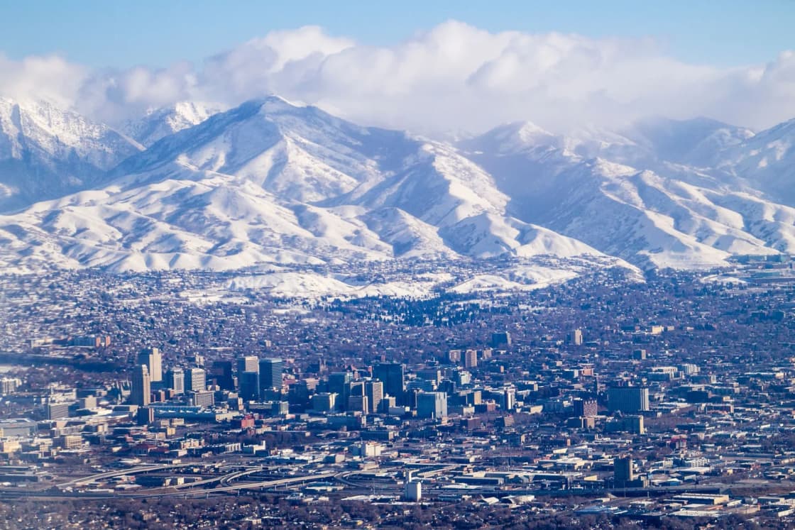
Moving from Provo to Salt Lake City, or from somewhere else into the capital, mostly comes down to two decisions: which kind of neighborhood fits how you live, and how you will get to work. Salt Lake City is not one place. The city's own pages describe a set of older neighborhoods with distinct personalities, spread across seven council districts, and each one has a different relationship to transit, freeways, canyons and campus.
This guide is written from Utah Valley's side of the Point of the Mountain. It covers the neighborhood types a newcomer will meet, how the commute logic works whether you are moving up the interstate or staying in Provo and traveling north, and what tends to surprise people used to Provo's grid and pace. It deliberately leaves out home prices and rents. Utah does not publish sale prices as public records, and asking figures change fast, so use a current agent or listing source for money questions and use this page for the fit questions that come first. For the county-level picture, start with Salt Lake County or Utah County? and for a city-to-city comparison see Provo vs Salt Lake City.
Quick facts
| Topic | What to know | Where to confirm |
|---|---|---|
| Commuter rail | FrontRunner links Provo, Salt Lake Central and Ogden. Monday to Saturday, no Sunday service | UTA Route 750 timetable |
| Light rail | TRAX Blue, Red and Green lines, 42.5 miles and 50 stations, running every day | UTA TRAX page |
| Streetcar | S-Line links Sugar House with Central Pointe Station in South Salt Lake | UTA |
| Freeway lanes | I-15 Express Lanes are free for two or more occupants, tolled for solo drivers with a pass | UDOT Express Lanes |
| City governance | Community councils in every council district, registered under City Code 2.60 | slc.gov boundary map |
| Schools | Five districts in Salt Lake County, including Salt Lake City School District | District finder |
Who this guide is for
Four kinds of readers from Utah Valley tend to be weighing Salt Lake City.
Graduates and early-career workers. BYU and UVU graduates whose first jobs are downtown, at the University of Utah, in health care or in the airport and logistics areas often decide a daily I-15 drive is not what they want. Living in Salt Lake County puts them near that work and near the rail network.
Couples who work in different directions. One partner in Provo or Orem and the other downtown is the classic split. The answer is rarely a single "right" city; it is a matter of whose commute is longer and who can use transit.
Families who want older, established streets. Salt Lake City's neighborhoods are older on average than the newest subdivisions on Utah County's west side, with mature trees, smaller lots in many areas and a mix of housing types. That suits some families and frustrates others who want a large yard and new-build floor plans.
Newcomers from out of state. If you are not tied to a church ward, a campus or a family base in Utah County, you are choosing more freely. The parent guide covers the religious-makeup and culture differences; Moving to Provo When You're Not LDS is the Utah Valley side of that conversation.
The neighborhood types
Salt Lake City's own district pages are the best primary description of what the neighborhoods are. They are written by council offices rather than marketers, which shows: they describe history and features rather than selling points. Here is what they say, grouped by type of living.
Walkable, historic and close to downtown
The Avenues. The city's District 3 page calls it Salt Lake City's first neighborhood, dating to the 1850s, between downtown and the Wasatch Mountains, with a name that comes from its grid of closely laid-out roads. Expect older housing, steep streets as you climb toward the foothills, and a short trip to downtown.
Capitol Hill. Home to the Utah State Capitol Building, close to downtown and the foothills, with the Ensign Peak trailhead above it. Expect hillside streets, and test them in winter.
Marmalade. The city describes it as a modest, well-preserved neighborhood named for apricot and pear orchards planted in the early twentieth century, with traces of those orchards in its historic parks and street names.
Guadalupe. Founded as an agricultural village by Mormon settlers soon after their 1847 arrival and laid out in ten-acre blocks, according to the city. It lies between North Temple and 600 North, from Interstate 15 to the railroad tracks at 500 West. That puts it right beside the freeway and the rail corridor, which is convenient for commuting and relevant to noise.
Federal Heights. In the city's northeast corner, below the "Block U" on the foothills, built in the 1900s when the federal government upgraded nearby Fort Douglas. It sits next to the University of Utah side of the city.
Village-style and mixed-use
Sugar House. The city's District 7 page describes it as "a unique and wonderful part of the urban fabric" of Salt Lake City, with a village-like character that reflects neighborhoods built before cars set the distances between places. The page lists a business district with long-standing family businesses alongside newer ones, the 21st and 21st commercial node, and 110.5 acres at Sugar House Park, with trails and bike paths in warm months and sledding and cross-country skiing in cool ones. It also names Parley's Trail, the S-Line, Sprague Library, Fairmont Aquatic Center and two municipal golf courses. For someone coming from Provo, this is the closest analog to a walkable downtown neighborhood with a big park, and it is also the part of Salt Lake City with the clearest streetcar link.
District 7 covers the southeast part of the city, roughly from about 500 East to Foothill Drive and from 2100 South to about 2900 South, with some exceptions, per the city.
The west side
Glendale. District 2's page calls it a "cultural crossroads" with an ethnically diverse population. It began as the Glendale Gardens housing project for families who came to Utah during World War II. The page lists the Glendale Library, described as the largest City Library branch, and the Glendale Golf Course.
Poplar Grove. Described as the second-largest neighborhood in Salt Lake City, named for a grove of poplar trees planted in the late 1800s, multi-ethnic in character, with Spanish influence visible in locally owned markets and restaurants.
River District. Also called the West Side, known for locally owned small businesses, restaurants, bakeries, specialty stores and urban farms.
The city says District 2 as a whole is in the southwest corner of Salt Lake City, with many large residential lots, urban farming, many families and some of the city's most diverse communities. These are neighborhoods where the housing stock and lot sizes often look different from the Avenues, and where proximity to I-15, rail and the airport can shape both convenience and noise.
Suburbs outside the city limits
A large share of people who say they are moving to Salt Lake City end up in Salt Lake County cities with their own governments, schools and police. The parent guide notes that Draper, Bluffdale and Herriman sit on the Salt Lake side of the Point of the Mountain, and that the school districts are separate from Salt Lake City School District. This distinction matters in practice: your mailing address, your city, your school district and your community council are four different questions. Verify each one for any address you are serious about.
How community councils work
Salt Lake City recognizes community organizations that give input and information to city departments, and the city says they are registered under City Code 2.60. Every council district has community councils. The city's Community Council Boundaries page has an interactive map that shows, for an address, the district, the community council and the City Council member. The page itself does not list the councils by name, so use the map.
For a newcomer, the practical reason to care is that these are the meetings where zoning requests, street changes and neighborhood concerns get discussed first. If you are weighing two neighborhoods, reading the agendas of their councils tells you what is changing there better than any brochure.
Commute logic from Utah Valley
The same I-15 that makes the trip feasible is also the reason it varies. Three modes matter.
Driving and the Express Lanes
I-15 has Express Lanes, which UDOT describes as a single lane in each direction. According to UDOT's FAQ, two or more people in a vehicle can use them without an Express Pass. The Express Pass is a transponder mounted inside the windshield: set to HOV mode for free carpool travel, or Toll mode when driving alone. Tolls range from $0.25 to $2 per zone depending on congestion. UDOT warns that driving alone without a pass in Toll mode may result in a fine of $337 or more. You must enter and exit at the access points marked with dashed white lines; crossing the double white lines is one of the common violations UDOT and the Utah Highway Patrol named when they launched an education and enforcement campaign on June 16, 2026.
UDOT's own numbers for that campaign: about 30,000 active transponders, more than 1.6 million trips in fiscal year 2025, up to 72 percent more people carried at peak than in adjacent general-purpose lanes, and commute speeds about 10 mph faster in the morning and evening. Those are UDOT figures, and your own trip will vary with crashes, construction and weather.
Two cautions. First, UDOT's FAQ and the agency's other pages disagree on the length of the corridor (one gives Riverdale to Spanish Fork, another about 72 miles from Spanish Fork to Layton), and the page does not list hours of operation. Do not assume the lane rules are the same around the clock; read the signs. Second, the FAQ still describes clean-vehicle permits for solo drivers, while the permit program relied on federal authority that, reportedly lapsed in September 2025. Treat the clean-vehicle question as unresolved until you confirm it with UDOT before buying or relying on a decal.
Whatever the lane rules, check live conditions before a first commute. UDOT's traffic tools are the place to see incidents. A drive that is routine at 10 a.m. can be a different trip at 5 p.m.
FrontRunner
FrontRunner is UTA's commuter rail. UTA's service page describes an Ogden-to-Provo corridor of roughly 83 miles and 15 stations, though another section of the same page gives 82 miles and 16 stations, so treat the exact counts as approximate. Service runs Monday through Saturday, every 30 minutes during weekday peak periods and every 60 minutes during weekday off-peak hours and on Saturdays. The page mentions no Sunday service, and UTA's airport page states directly that FrontRunner does not operate on Sundays.
On the route page, UTA lists the maximum one-way fare from Provo to Ogden as $9.70, with Vineyard and North Temple exempt from the additional-station charge. A trip to Salt Lake Central is a shorter ride and a lower fare; the fare table PDF linked from UTA's FrontRunner page has exact amounts. Published figures for the Provo-to-Salt Lake Central ride vary by source, so use the current timetable or UTA's trip planner rather than a number from memory.
Salt Lake Central is also a TRAX transfer point. UTA's materials show the Blue Line starting there and running toward Draper.
TRAX and the S-Line
TRAX has three lines, according to UTA: Blue (Draper to Salt Lake City), Red (South Jordan to the University of Utah) and Green (West Valley to Salt Lake City International Airport). Together they cover 42.5 miles and 50 stations, with trains about every 15 minutes at peak and service every day of the week. For specific hours, UTA points to each line's schedule page.
The S-Line is the streetcar that links Sugar House with Central Pointe Station in South Salt Lake. UTA's site lists an S-Line extension project and disruptions, so confirm current service before building a commute around it.
TRAX is the reason car-light living is feasible in Salt Lake County and not in Utah County: the parent guide notes that TRAX runs only in Salt Lake County. The practical implication is that Salt Lake City neighborhoods near a station give you options a Provo address does not.
The airport
TRAX Green Line serves Salt Lake City International Airport, with the Airport Station just outside the terminal and service daily from 5:21 a.m. to 11:21 p.m., per UTA. UTA says riders can transfer between the airport and FrontRunner at North Temple Station for Ogden or Provo. Because FrontRunner does not run Sundays, a Sunday arrival still needs a plan: a ride, a rental or TRAX to a destination in the county. For Provo's own small airport and when it makes sense, see PVU or SLC.
Costs, in the sense that is not a price
You will find housing figures elsewhere. The costs to model before a move are different.
- Commute cost. Tolls of $0.25 to $2 per zone add up for a solo driver, and a pass has account rules. Compare that against a FrontRunner fare for a regular rider, and against the cost of parking at your destination.
- A second car. Salt Lake City neighborhoods near rail make it possible to drop to one car, which is harder in Provo. Car Ownership in Utah Valley covers the Utah Valley baseline.
- Time. If you drive alone on I-15 five days a week, the time cost is larger than the toll. Count it.
How a Provo household decides
Use a short sequence.
- Write down the destination, not the city. Downtown, the U, the airport area, Lehi and Draper tech campuses and Provo each imply a different answer. The tech corridor is covered in Silicon Slopes, Explained.
- Test the commute twice. Once at a weekday peak, once off-peak, in the direction you will drive. Add a Saturday if you plan to rely on FrontRunner.
- Pick a neighborhood type, then a neighborhood. Historic and hilly (Avenues, Capitol Hill), village-style and park-centered (Sugar House), or west-side with larger lots and strong local business (Glendale, Poplar Grove). Visit each on a weekday evening and a weekend morning.
- Check the school district separately. The five Salt Lake County districts do not follow city lines neatly. Ask the district to confirm an address.
- Look up the community council. Use the city's boundary map and read recent agendas.
Timing: when to move and when to scout
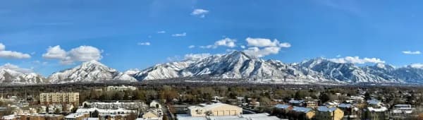
Winter is the season that changes the picture most. The Avenues and Capitol Hill sit against the foothills, and winter driving deserves a test run. The parent guide notes that both valleys share hot, dry summers, snowy winters and, for a few weeks most winters, temperature inversions. If you are choosing a neighborhood from Provo, visit in January as well as in June.
For a commute test, avoid school holidays. A week when universities and school districts are on break will understate a normal Tuesday.
What to bring when you scout a neighborhood
- A printed or saved copy of the UTA Route 750 timetable and a fare plan if you intend to use FrontRunner.
- An Express Pass if you intend to drive alone in the lanes, set up before you need it.
- A list of the schools, church buildings, clinics and grocery stores you use now, so you can check each against the new address.
- The address you are considering, entered into the city's boundary map and the school district's lookup.
- Winter tires or traction readiness if you are touring in the cold months.
Who should skip it
Salt Lake City is not the right move for everyone, and some of the reasons are plain.
- If your life is centered on a Provo campus, ward or family. The move trades proximity for options that you may not use.
- If you want the newest construction and large yards. Many Salt Lake City neighborhoods are old by Utah standards. Newer subdivisions are more common in other parts of the Wasatch Front.
- If you will commute back to Utah Valley by car every day. A reverse commute may be lighter in some directions but is still an interstate commute. Test it before signing a lease.
- If you rely on Sunday transit. FrontRunner does not run on Sundays.
Safety and conditions
Neighborhood safety varies block by block, and no single page can settle it. Use the Salt Lake City Police Department's public resources and the community council meetings. Visit at night. Ask neighbors what the street is like in winter.
On the road, the safety item UDOT stresses is lane discipline: enter and exit the Express Lanes only at dashed-line access points. For transit, UTA's customer service line is 801-RIDE-UTA (801-743-3882), staffed Monday through Saturday 6 a.m. to 9 p.m. and Sunday 8:30 a.m. to 5 p.m. per its airport page.
What to check before you commit
- UTA Route 750 timetable and fare table, for the current season.
- UDOT Express Lanes pages, for the current pass rules, the status of clean-vehicle permits and any enforcement campaign.
- Salt Lake City's Community Council Boundaries map, for the council and district.
- The school district, for the address.
- Your own commute test, in both directions, at peak.
- Parking and permits for the building or street you are considering. Rules differ by city and by street.
Related guides
- Salt Lake County or Utah County?
- Provo vs Salt Lake City
- Getting Around Provo by FrontRunner
- PVU or SLC
- Silicon Slopes, Explained
Frequently Asked Questions
Is there a train from Provo to Salt Lake City?
Does TRAX go to the airport?
Can I use the I-15 Express Lanes if I drive alone?
Which Salt Lake City neighborhoods are closest to downtown?
What is Sugar House like?
How do I find which community council covers an address?
Is Salt Lake City a different school district from the rest of Salt Lake County?
Should I move to Salt Lake City or stay in Utah Valley and commute?
Sources
The facts in this guide were checked against these sources. Hours, fees and rules change, so confirm anything time-sensitive with the source before you go. How we make Provo.com.
- Utah Transit Authority: FrontRunner, Utah Transit Authority. Checked November 5, 2026.
- Utah Transit Authority: TRAX, Utah Transit Authority. Checked November 5, 2026.
- 750 FrontRunner schedule and fares, Utah Transit Authority. Checked November 5, 2026.
- Airport Travel, Utah Transit Authority. Checked November 5, 2026.
- Express Lanes FAQ, Utah Department of Transportation. Checked November 5, 2026.
- UDOT, UHP launch Express Lane education and enforcement campaign, Utah Department of Transportation. Checked November 5, 2026.
- Community Councils, Salt Lake City Corporation. Checked November 5, 2026.
- About District 7, Salt Lake City Corporation. Checked November 5, 2026.
- About District 3, Salt Lake City Corporation. Checked November 5, 2026.
- About District 2, Salt Lake City Corporation. Checked November 5, 2026.