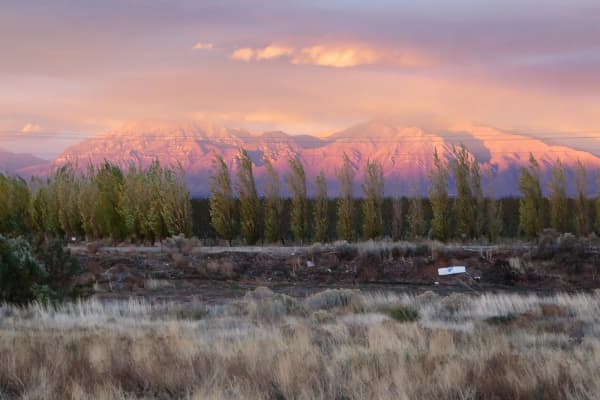

Pleasant Grove's first name was a battle, and its downtown sits where the town once kept its cattle. Both facts are still visible if you know where to look: the canyon above town is still called Battle Creek, and the one-block business district on Main Street grew out of the corral in the middle of an 1853 fort. No other town in Utah is known to have done that.
This is the short version of how a settlement named after a killing became Utah's Strawberry City, and then a suburb whose pioneer street plan you can still trace on foot.
March 1849: the fight that named the creek
The violence came before the settlers did.
In the winter of 1848 and 1849, cattle were going missing from the Salt Lake Valley settlements, including at least fourteen head from Willow Creek, the area that is now Draper. Pleasant Grove's own published history says a local leader named Little Chief, who was on good terms with the Mormon settlers, reported that a group led by Roman Nose had taken them. Brigham Young ordered a company of fifty men to go after the thieves. Thirty-five went, under John Scott, with Dimick Huntington and Barney Ward as interpreters.
The city's account gives a day-by-day timeline. The company left Cottonwood on March 1, came into Utah Valley through the Narrows on March 3, searched without success, woke on March 4 to two inches of snow, and at dawn on March 5 surrounded a camp at the mouth of the canyon. Roman Nose was killed. Blue-shirt was shot many times as he tried to escape. Thirteen women and children surrendered. No militiamen were hurt. The women and children were taken to the Salt Lake Valley, where, in the city's telling, the settlers fed and cared for them.
The details are where the sources part ways. A 1999 Daughters of Utah Pioneers marker on 200 South says three men were killed. Our Battle Creek Falls hiking guide notes that most accounts say four, and lays out the disagreement over the toll, and over whether to call the morning a battle, a skirmish or a massacre, and this article will not settle what the record leaves open. What the sources do agree on is the order: the fight came first, and the place was settled the next year. The Timpanogos name for the spot, recorded on the city's page as Mepah, or Little Water, did not survive on the map. Battle Creek did.
For the Timpanogos side of this period, including the much larger fight at Fort Utah in Provo the following winter, read the Timpanogos people of Utah Valley.
September 1850: a grove by a stream
On September 13, 1850, a group of families sent south by Brigham Young arrived on the bench below the canyon. The date is firm; the head count is not. The Daughters of Utah Pioneers marker says seven extended families, and other accounts say eight. What drew them, in the city's words, was a small grove of trees, the kind of sign that meant water and decent soil underneath.
For a short while the settlement used the name of the creek and the fight. Then it took the name of the trees. The city's history says simply that the official name came later, and the DUP marker credits the first settlers themselves with the change. The marker also says the first winter was mild, which let the families keep building through it, so that by the summer of 1851 there was a working village.
The National Register nomination records that George A. Smith, a church apostle, located the town site in 1852.
1853: the fort that became a downtown
The town's layout comes from the Walker War. On July 17, 1853, a quarrel at a settler's cabin near Springville ended with a relative of the Ute leader Wakara (often spelled Walkara) dead, and fighting spread through central Utah. Brigham Young and Daniel Wells told settlers to leave small outlying places and gather into larger communities with forts. Pleasant Grove built one that year, and its design is why the town looks the way it does.
The National Register nomination for the Pleasant Grove Historic District describes the plan in detail. Smith laid out fifteen lots, each three rods by ten, along each of the four sides, with a large public corral in the middle and four big corner lots set aside for public buildings. The walls were only about four feet high. They were less a defensive barrier than a gathering line. The nomination calls the result a "square doughnut," with livestock driven along the interior road around the central corral at night. Families who had built homes out on their farms moved them inside, and the fort filled so fast that a second survey of new blocks had to be laid out to the north.
Then the town did something no other Utah settlement is known to have done. Instead of moving its stores out to a new main street once the danger passed, Pleasant Grove let its business district grow out of the lower part of the public corral. The first church house stood at the corral's southwest corner, in what is now the city park at 200 South and Main. The George H. A. Harris store went up in the late 1850s, the Pleasant Grove Cooperative Mercantile and the United Order Hall in 1869. The United Order Hall is the first documented building in town made of the soft local stone that turns up in so many Pleasant Grove houses.
You can still feel the fort's outline in the streets. The old fort roads, 200 South, 200 East, Main and Center, are wider than their neighbors and narrow where they meet the later grid. The Union Square militia building, from about 1865, still stands at 64 North 200 East.
A city, a school and a skirmish
The territorial legislature approved Pleasant Grove's incorporation on January 19, 1855. The first city election was held that May, and Henson Walker became the first mayor.
The early years were hungry. The city's history records famine in those first winters, and a fire that destroyed the meeting house, which was also the town storehouse, too late in the year to restock before the snow.
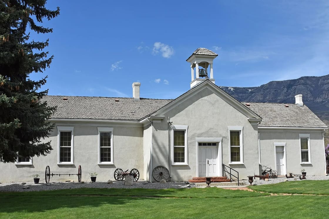
Schooling followed the same pattern of building, losing and rebuilding. The town's first schoolhouse, adobe, went up in 1852 and came down when families moved into the fort; a second burned. The third, now called the Old Bell School, was built partly from adobe salvaged from the first two. Its construction date depends on who you ask: the building's National Register nomination says 1861, while the 1946 marker in front of it and the later historic district nomination say about 1864. Henry Greenhalgh planned it with an arched ceiling that gave the hall good acoustics, and it served as a school, a church, a theater and a dance hall, with a middle room and stage added around 1880 and an east room around 1886 and 1887. It later held the high school and then the public library.
In April 1863, with the country at war, the fort's walls were used against the people who built them. A marker placed in 2017 by an Eagle Scout and the Timpanogos Chapter of the Sons of the Utah Pioneers tells the story. A squad of the 3rd California Volunteer Infantry, the federal troops posted at Camp Douglas in Salt Lake City to guard the mail and telegraph routes, reached Pleasant Grove with a howitzer on April 11. The next day Ute fighters used the old fort walls to close in. The gunners took refuge in the Green family home outside the fort, and at one point, the marker says, the shooting paused so Mrs. Green could go back in for her baby. The fight ended around 8 p.m. when the attackers left with the soldiers' remaining mules. No soldiers died; Ute losses are unknown. Cavalry arrived on April 13 and followed the attackers into Spanish Fork Canyon. The marker notes that the fight appears in a federal compilation of Civil War battles and skirmishes, which is why it is described as a Civil War engagement at all.
Two years later the Black Hawk War began in Manti and ran on for years across central Utah. Pleasant Grove was not one of its battlegrounds, but it lived through the same long struggle over land, cattle and survival that had started at the mouth of its own canyon. The state's History To Go account of the Walker War notes that the Ute claims to the land were never purchased and the dispute was not settled until the Indian Claims Commission ordered payment after the Second World War.
Little Denmark, rails and soft rock
Between 1870 and 1890, converts to the Church of Jesus Christ of Latter-day Saints from Scandinavia arrived in numbers, and the part of town where many settled picked up the nickname Little Denmark. The city's history preserves two more neighborhood names from that era with some affection: Monkey Town, after young people who gathered at "fog corner" and "monkeyed" around to their elders' alarm, and Mud Hole, the center of shopping and entertainment where the better-off families were said to live.
The railroad reached Pleasant Grove in 1873. By about 1900, packing companies had gathered near the depot at 200 West and 200 South to ship the town's fruit. A second line came in the 1910s: the electric interurban that the valley called the Orem, after its promoter Walter C. Orem. A marker at the station site says the Pleasant Grove station was built in 1914 of concrete slabs cast in Salt Lake and shipped down by train, and stood at 169 West 200 South with a waiting room, ticket window and a two-bedroom apartment for the agent. (The historic district nomination dates the interurban depot to 1913.) The line closed on March 1, 1946. Our history of the Orem interurban railroad tells that story in full.
Much of what stands downtown went up in those railroad decades. The historic district nomination says about 80 percent of its buildings date from 1865 to 1920. A few worth knowing: the Pleasant Grove Town Hall at 107 South 100 East (1887), soft rock with Victorian trim; the Clark Brothers Store at 43 South Main (1895); the Bank of Pleasant Grove at 2 South Main (1917), in the low, horizontal Prairie School style; and the Alhambra Theater at 20 South Main (1927), in Spanish Revival. In 1928 the city leased Cornelius Baxter's commercial building at 3 East Center, added double doors and a concrete ramp, and made it the town's first permanent firehouse, home to a surplus army truck converted into Pleasant Grove's first motor-driven fire engine.
Utah's Strawberry City
The gravelly soil and sheltered bench that the 1850 settlers liked turned out to suit berries. From the 1920s through the 1950s, Pleasant Grove was one of Utah's major strawberry producers and called itself Utah's Strawberry City.
In 1921 the Wasatch Club started a mid-June Strawberry Day to promote the crop. In a 2023 interview with KUER, the festival's committee chair described it as having grown from "a little evening celebration" into a nine-day event. The city calls Strawberry Days the longest-continuing community celebration in Utah; our festival page explains why "continuing" is the important word in that claim.
The berries themselves are gone. The same KUER report said the festival now buys its strawberries from California, about 1,400 cases a year, and a Utah State University fruit specialist explained that commercial strawberry growing consolidated into longer-season states between the 1960s and the 1980s while development took Utah's fields.
Steel, subdivisions and a Supreme Court case
Two twentieth-century events reshaped the town. In 1924, Lindon, the farming district to the south, incorporated as its own town, taking a large piece of agricultural land with it. And during the Second World War the Geneva steel plant went up on the lakeshore a few miles southwest. The Utah History Encyclopedia notes that Geneva, which it dates to 1942, drew many Pleasant Grove farmers into wage work, and after the Second World War their fields were subdivided into housing. Our history of Geneva Steel covers the plant. Pleasant Grove became a bedroom town for jobs elsewhere, which it largely still is.
Growth since then has been steady rather than explosive. The federal census counted 23,468 residents in 2000, 33,509 in 2010 and 37,726 in 2020.
One modern episode put the town's oldest park in front of the nation's highest court. Pioneer Park, the block around the Old Bell School, held fifteen permanent displays, including a Ten Commandments monument the Fraternal Order of Eagles donated in 1971. When a religious group called Summum asked to place a monument of its own there and the city declined, the case went to the U.S. Supreme Court. In Pleasant Grove City v. Summum, decided February 25, 2009, the Court ruled without dissent that a permanent monument in a public park is government speech, so the city could choose which ones to accept.
See it today
Pleasant Grove's history is unusually walkable, because so much of it fits inside the old fort square. Allow an hour.
The Old Bell School and Pioneer Park. The adobe schoolhouse stands on 100 East between Center and 100 South; the city lists the Daughters of Utah Pioneers museum at 55 South 100 East, and the building's National Register nomination gives 65 South 100 East. The DUP's 1946 Pioneer Relic Hall marker is in front. The city's history page says the DUP museum opens Thursdays and Saturdays from 1 to 5 p.m. in summer and during Strawberry Days; it also lists a separate Pioneer Museum collection with the Herron Cabin and Nelson Granary, open June and July on Thursday afternoons, with tours by appointment at 801-669-6971. Check those hours before a trip outside the summer months.
The Civil War marker. On South 100 East at about number 107, the old Town Hall's address. It says the original Green homesite monument is about three blocks south on the east sidewalk of 100 East.
Main Street, Center to 100 South. The business block that grew out of the fort corral, with the Clark Brothers Store, the bank and the Alhambra. Around the corner at 3 East Center is the old firehouse, with a 1998 Utah State History marker.
The fort corners. Small markers stand at the northwest corner (100 North and 100 West), the northeast corner (100 North and 300 East) and the southwest corner (300 South and 100 West). Walk between two of them and you have walked a fort wall.
The founding marker. The 1999 DUP marker on the settlement of Pleasant Grove is at 455 East 200 South.
The train station marker. On East 100 South near 100 East, with three panels on the interurban's rise and fall.
The Tithing Office. At 7 South 300 East, a brick building from about 1908 that is listed on the National Register; our things to do in Pleasant Grove guide explains what a tithing office did.
The Battle Creek monument. Drive east of 1500 East to the Battle Creek trailhead at Kiwanis Park, park at the end of the road and walk about 100 feet up the trail. The marker, an Eagle project from 1997, calls the 1849 fight the first armed engagement between the pioneers and the people of Utah Valley and "a reminder of the extreme sacrifice given by both people." The falls are farther up the same trail.
For the city as it is now, see living in Pleasant Grove. Its northern neighbor's story is in a short history of American Fork.
Frequently Asked Questions
Why was Pleasant Grove first called Battle Creek?
How many people died at Battle Creek in 1849?
When was Pleasant Grove settled and incorporated?
What is unusual about Pleasant Grove's downtown?
When did Strawberry Days start?
Was there a Civil War skirmish in Pleasant Grove?
What is the Old Bell School?
Where can I see Pleasant Grove's history today?
Sources
The facts in this guide were checked against these sources. Hours, fees and rules change, so confirm anything time-sensitive with the source before you go. How we make Provo.com.
- Pleasant Grove City: History, Pleasant Grove City. Checked October 20, 2026.
- Daughters of the Utah Pioneers Museum, Pleasant Grove City. Checked October 20, 2026.
- Pleasant Grove Historic District, National Register nomination, National Park Service. Checked October 20, 2026.
- Pleasant Grove School House (Old Bell School), National Register nomination, National Park Service. Checked October 20, 2026.
- The Walker War, Utah Division of State History, History To Go. Checked October 20, 2026.
- Pleasant Grove City v. Summum, 555 U.S. 460 (2009), Justia. Checked October 20, 2026.
- Pleasant Grove (DUP marker 514), Historical Marker Database. Checked October 20, 2026.
- Battle Creek monument, Historical Marker Database. Checked October 20, 2026.
- Pioneer Relic Hall (DUP marker 90), Historical Marker Database. Checked October 20, 2026.
- Civil War Skirmish at Pleasant Grove, Historical Marker Database. Checked October 20, 2026.
- Old Pleasant Grove Fort, N.W. corner, Historical Marker Database. Checked October 20, 2026.
- Old Pleasant Grove Fort, S.W. corner, Historical Marker Database. Checked October 20, 2026.
- Old Pleasant Grove Fort, N.E. corner, Historical Marker Database. Checked October 20, 2026.
- History of Pleasant Grove Train Station, Historical Marker Database. Checked October 20, 2026.
- Baxter Building / Firehouse, Historical Marker Database. Checked October 20, 2026.
- Pleasant Grove (Utah History Encyclopedia), University of Utah Press / Utah Education Network. Checked October 20, 2026.
- As Utah urbanizes, fruit fests celebrate heritage rather than what's grown here, KUER. Checked October 20, 2026.
- 2020, 2010 and 2000 Decennial Census redistricting data (P1), U.S. Census Bureau via USAFacts connector. Checked October 20, 2026.