
The Dugway Geode Beds are free BLM land where you dig geodes out of soft lake sediment with a shovel. No permit, no fee, no reservation. The Utah Geological Survey (UGS) puts the turnoff 50.1 miles west on the Pony Express Road, with the digging 1 to 2 miles north of it. From Utah Valley, the BLM's directions to the Pony Express road are I-15 to Exit 279 (Lehi), then west on SR-73 for about 25 miles.
The paved part is easy. OSRM routing puts Provo to the start of the Pony Express Road near Faust at about 56 miles and an hour and a half (OpenStreetMap data, no traffic). After that it is 50-plus miles of graded gravel each way, which the routing service cannot time reliably. At gravel speeds, budget at least another hour and a half each way, and treat this as a full day.
Our rockhounding guide introduces the geode beds alongside Topaz Mountain and the trilobite quarries. This page is the trip itself.
Why there are geodes in the middle of the desert
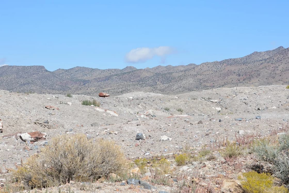
The UGS explains it in two steps. About 6 to 8 million years ago, volcanic eruptions in western Utah laid down rhyolite, a volcanic rock full of gas bubbles. Groundwater circulating for millions of years deposited minerals inside those cavities, growing crystal-lined spheres. Then, roughly 32,000 to 14,000 years ago, Lake Bonneville covered the area. Its waves eroded the rhyolite and redeposited the geodes several miles away as lake sediment.
That second step is why this is a family-friendly dig. You are not chipping geodes out of solid rock. You are digging them out of soft gray ground.
What is inside: mostly quartz, in clear rock crystal, purple amethyst and pink rose, according to the BLM. The UGS says most geodes are hollow and lined with small crystals that look sugary, while some are filled solid with banded quartz.
The route, step by step
- Provo to Lehi. I-15 north to Exit 279.
- SR-73 west through Cedar Valley and over Five Mile Pass, about 25 miles per the BLM, to the Pony Express road. (The UGS gives the same turn from the north as "the dirt road just past Faust" on Highway 36.)
- Pony Express Road west. This is the BLM's Pony Express National Backcountry Byway, a maintained gravel road along the 1860 to 1861 mail route. Set your trip odometer where the gravel begins.
- Simpson Springs is on the way, with a BLM campground and a replica Pony Express station.
- At 50.1 miles (UGS), turn north (right) on the dirt road to the geode beds. The UGS warns that people have missed the turn when the sign was missing, which is why the odometer matters. The BLM describes this last stretch as about 2 miles of unimproved road.
- Look for recent diggings about 1 to 2 miles in.
Fuel: fill up before you leave pavement. The UGS names Dugway as the nearest gas station to the beds.
Stay off the military land. The Army's Dugway Proving Ground occupies a large part of this desert (the BLM's Simpson Springs page notes it was established during World War II). The UGS lists military reservations among the federal lands closed to collecting, and signed boundaries mean what they say.
How to find them
From the BLM and the UGS:
- Dig where others have dug. The BLM says the best place to look is in areas that have already been excavated. The UGS describes two main excavation pits managed by the BLM, signed as you drive in, but says collecting is not limited to the pits.
- Find the right layer. Start in an old pit and dig until you hit the horizon where geodes are.
- Know what you are looking for. Dark gray, hard, round, and about 2 to 4 inches across (BLM). The UGS says most are 2 to 3 inches, and that they stand out for being round and light for their size, because they are hollow.
- Check every stone. Geodes look like ordinary lumps until you pick them up.
- Some are in the harder material. The BLM says to look for rounded shapes there; you may need a pick and hammer.
The one safety rule that matters: the soft material can collapse at any time. The BLM says tunneling is unsafe and not permitted. Dig open pits, not holes under ledges, and keep children out of the pit walls.
Opening them
The BLM's four methods:
| Method | Result |
|---|---|
| Cloth sack, smash on a hard surface | Fast; may break into many pieces |
| Hammer and chisel or center punch | Opens with a rough edge |
| Rock saw (carbide-tipped blade) | Clean cut; best for polishing |
| Soil pipe cutter | Clean break; sometimes rentable |
The UGS adds a fifth option: take whole geodes to a rock shop and have them cut. For kids, the sack and hammer is the fun part. Wear safety glasses either way; unconfined geodes throw sharp fragments.
The rules
- No permit or fee for recreational collecting here (UGS).
- Personal-use limits: the UGS says the BLM sets "reasonable" amounts at up to 25 pounds per day plus one piece, with 250 pounds per year. That covers minerals, common invertebrate fossils, semiprecious gemstones and other rocks.
- No commercial collecting without a BLM permit.
- Hand tools only. No explosives or power equipment.
- Vertebrate fossils and artifacts stay put. The UGS says dinosaur and other vertebrate fossils may not be collected on federal or state land without a permit for accredited institutions, and arrowheads, pottery and any prehistoric human-modified stone are off-limits without a permit.
- Don't camp on the pits. Camping is allowed and free, per the UGS, but not on the excavations.
Late October notes
- Fish Springs is not a bathroom stop right now. The UGS names Fish Springs National Wildlife Refuge as the nearest bathrooms and running water. The refuge's own page said in October 2026 that public bathrooms and drinking water are unavailable until further notice. Plan on no services at all.
- Waterfowl season is open at Fish Springs. The refuge listed the general Southern Zone waterfowl hunt from October 10, 2026 to January 23, 2027. Expect hunters if you drive out to the refuge.
- Weather decides the day. Fall storms turn clay roads to mud. Check the forecast, and if it has rained hard, go another week.
- Short days. With three-plus hours of driving, a late-October trip leaves little margin before dark. Start early.
Make it a West Desert rockhound day
Wonderstone, a detour on Highway 36. The UGS describes banded maroon, cream and yellow-brown wonderstone in the Vernon Hills in Tooele County, reached by a dirt road off Highway 36 about 4.5 miles past the town of Vernon, measured heading south from Tooele. Check it on a map against your SR-73 route before adding it to the day. Part of the area is a private mining claim, so the UGS says not to collect from marked claims or piles showing recent mining. It recommends four-wheel drive.
Topaz Mountain is the classic pairing, and our rockhounding guide covers it, along with the trilobite beds west of Delta.
Pony Express history. Simpson Springs and the other station sites along the byway have interpretive displays. Eagle Mountain's Pony Express Days celebrates the same route closer to home.
What to bring
- Shovel, pick, rock hammer and safety glasses (UGS list)
- A cloth sack for breaking geodes, and buckets or boxes for the drive home
- Plenty of water, food and sun protection
- A working spare tire (UGS)
- Paper or offline maps; cell coverage in the West Desert is poor
- A full tank of gas from pavement
Where to sleep
Simpson Springs Campground, on the Pony Express road about 12 miles south of Dugway, has 20 sites open year-round at $15 a night, with vault toilets and seasonal water, according to the BLM. It sits next to a Civilian Conservation Corps camp site from the late 1930s and a Pony Express station replica.
Dispersed camping is allowed at the geode beds (UGS). Our dispersed camping guide covers the general BLM rules.
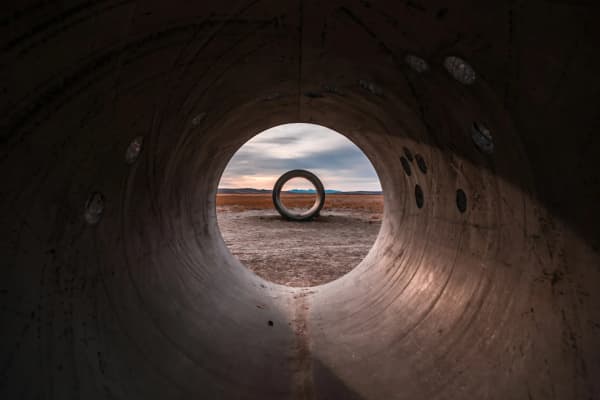
For more trips by distance, see day trips from Provo. For a West Desert day built around art instead of rocks, see the Sun Tunnels guide.
Frequently Asked Questions
Do you need a permit to dig at the Dugway Geode Beds?
How much can you take?
How do you get to the Dugway Geode Beds from Provo?
How long is the drive?
Do I need four-wheel drive?
Are there bathrooms or gas near the geode beds?
How do you open a geode?
Can you camp at the geode beds?
Sources
The facts in this guide were checked against these sources. Hours, fees and rules change, so confirm anything time-sensitive with the source before you go. How we make Provo.com.
- Dugway Geode Beds, Bureau of Land Management, Utah. Checked October 20, 2026.
- The Rockhounder: Dugway Geode Beds, Juab County, Utah Geological Survey. Checked October 20, 2026.
- Rock, Mineral, and Fossil Collecting Rules, Utah Geological Survey. Checked October 20, 2026.
- The Rockhounder: Wonderstone in the Vernon Hills, Utah Geological Survey. Checked October 20, 2026.
- Pony Express National Historic Trail and Backcountry Byway, Bureau of Land Management, Utah. Checked October 20, 2026.
- Simpson Springs Campground, Bureau of Land Management, Utah. Checked October 20, 2026.
- Fish Springs National Wildlife Refuge, U.S. Fish and Wildlife Service. Checked October 20, 2026.
- OSRM route service (OpenStreetMap data), driving estimates from Center St & University Ave, Provo, Project OSRM. Checked October 20, 2026.