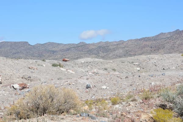

Tooele County starts just over the Oquirrh Mountains from Utah Valley and runs west across the Great Salt Lake Desert to Nevada. The populated end, around Tooele, Grantsville and Stansbury Park, has a pioneer gristmill, two small-town museums and the trail up Deseret Peak in the Stansbury Mountains. The empty end has the Pony Express road, the Bonneville Salt Flats and the World War II airfield at Wendover.
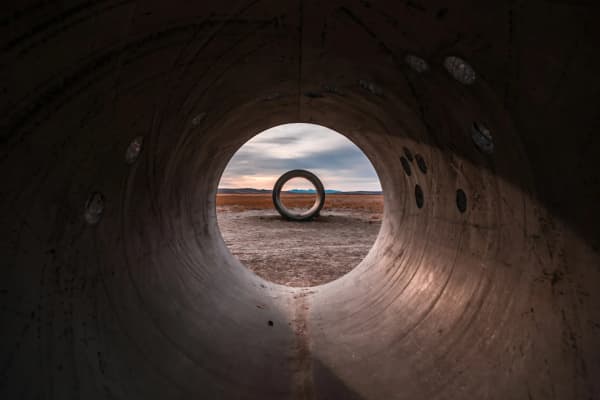
The Salt Flats and the racing calendar have their own guides, the Great Salt Lake and Bonneville Salt Flats from Provo and Bonneville Speed Week, and the Sun Tunnels, over the county line in Box Elder County, have an art-trip page. This page is everything else, with the flats included for planning.
From Provo
OpenStreetMap routing estimates, without traffic, from Center Street and University Avenue:
| Destination | Miles | Time |
|---|---|---|
| Benson Grist Mill, Stansbury Park | About 68 | About 1 hr 17 min |
| Tooele Valley Museum, Tooele | About 69 | About 1 hr 30 min |
| Bonneville Salt Flats parking | About 153 | About 2 hr 34 min |
| Historic Wendover Airfield | About 165 | About 2 hr 48 min |
The router sends the two Tooele stops different ways, which is why the times differ more than the miles. The Pony Express byway is the exception to all of this: it starts on SR-73 west of Lehi, so it is closer to Utah Valley than to Tooele.
Ten things to do in Tooele and the West Desert
1. Benson Grist Mill
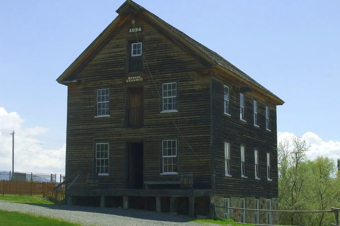
The mill was completed in 1854, built under apostle Ezra Taft Benson on orders from Brigham Young, with the Lee family overseeing construction. Powered by Twin Springs, it ground wheat and corn for Tooele Valley and some California-bound emigrants for more than 75 years, ran until the 1940s, then sat idle for four decades until volunteers acquired and restored it starting in 1983. The National Park Service calls it one of the oldest standing buildings in western Utah. Now a county historic site, it has the mill with its equipment, a country store and a bowery for picnics. The county calendar is the reason to time a visit: a farmers market from June 20 to October 17, a free Pioneer Fun day on July 24, a Renaissance faire in September, a free Fall Festival in mid-October and a Christmas lighting with a live nativity on November 30. Getting there: 325 Pole Canyon Road, Stansbury Park. Cost: The county lists no general admission fee; the Fall Festival and Pioneer Fun day are free. Season: Its Google listing in October 2026 showed Thursday through Saturday, 10 a.m. to 6 p.m. The county's event pages show two sets of dates for some events, so confirm before you go. Tooele County: Benson Grist Mill
2. Tooele Valley Museum and Historic Park
Tooele City's museum on Broadway covers the Tooele Valley Railway, mining in the Oquirrh Mountains and the area's military history, with picnic areas outside. The city's page does not state an admission price, so check before you go. Getting there: 35 North Broadway, Tooele; (435) 882-2836. Cost: Not stated on the city's page. Season: Wednesday through Saturday, 10 a.m. to 4 p.m., as listed by the city in October 2026. Tooele Valley Museum
3. Donner-Reed Museum
Grantsville's small museum holds artifacts recovered from the Donner-Reed Party's September 1846 crossing of the Great Salt Lake Desert, where the party began abandoning wagons, animals and supplies. The building dates to 1861 and has been a school, a meeting house, a church and city hall. It is on the National Historic Trails auto tour route, and Grantsville says it is one of only two places in Utah to get a National Parks passport stamp. Getting there: 90 South Cooley, Grantsville, at Cooley and Clark streets. Cost: Not listed. Season: Hours are not posted on the city or county pages; call Grantsville City at (435) 884-3411 before driving out. Grantsville City: Donner-Reed Museum
4. Deseret Peak
The big hike in the Stansbury Mountains, into the Deseret Peak Wilderness west of Grantsville. The Forest Service's Mill Fork Trail starts at Loop Campground at the top of South Willow Canyon Road, climbs gently, then switchbacks up a headwall to the ridge; there is no water along the way, leashed pets are allowed, and the agency suggests early starts in summer and calls the fall aspens especially beautiful. AllTrails lists the summit loop at 8.6 miles with 3,795 feet of gain and the Mill Fork out and back at 8 miles with 3,585 feet, both rated hard. Getting there: West on South Willow Canyon Road to the end. Cost: The Forest Service page does not mention a fee. Season: Summer and fall. Forest Service: Mill Fork Trail
5. South Willow Lake via the Stansbury Crest Trail
The shorter goal in the same wilderness: a small lake below the crest. AllTrails lists 7.5 miles out and back with 2,204 feet of gain, rated hard, with dogs on leash and wildflowers in season. It shares the drive up South Willow Canyon with Deseret Peak, so it is the fallback for a group that does not want the summit. Getting there: South Willow Canyon Road. Cost: None listed. Season: Summer and fall. AllTrails: South Willow Lake
6. Skyline Ridge Trail and Settlement Canyon
Tooele's in-town trail: a 4.5-mile non-motorized route for hiking, mountain biking and horseback riding that winds along the mountain north of Settlement Canyon Reservoir, exits near the RV camp in Settlement Canyon and connects to the Dark Trail. Getting there: The trailhead is at Wigwam Park, 673 South Main Street, Tooele. Cost: Free. Season: Spring through fall. Tooele City trails
7. West Desert motorsports park
The road course that opened 20 years ago as Miller Motorsports Park, later Utah Motorsports Campus, was taken over in 2026 by PV3 Enterprises, a Utah company, which renamed the 511-acre campus West Desert, spent more than $50 million on it and reopened it to the public on September 18, 2026. The reopening offered an all-access pass with hot laps on the main track with professional drivers, drifting, off-roading and karting. Getting there: In Tooele Valley; check the track's site for directions and events. Cost: Varies by event and activity. Season: Event calendar. RACER on the reopening
8. Pony Express Backcountry Byway and Simpson Springs
A maintained BLM gravel road that follows the Pony Express route across the West Desert, with station sites and interpretive displays along the way. From Utah Valley, the BLM's directions start at I-15 exit 279 in Lehi and run 25 miles west on SR-73 to the byway. The main stop is Simpson Springs, a Pony Express station site with a station replica and a Civilian Conservation Corps interpretive site, next to a BLM campground with 20 sites at $15 a night year-round, seasonal drinking water and vault toilets. The Dugway Geode Beds are farther down the same road, and our Eureka and Tintic guide covers another west desert day. Getting there: SR-73 west from Lehi to the byway. Cost: No fee to drive; $15 a night to camp. Season: Year-round; summer heat and wet spring roads both matter on gravel. BLM: Pony Express Byway, BLM: Simpson Springs
9. Bonneville Salt Flats
About 120 miles west of Salt Lake City, the flats are BLM land with free day use. Take I-80 exit 4 near Wendover, follow the signs toward the Speedway, then turn right on Leppy Pass Road to the parking area at its end. The BLM restricts driving on the salt when it is moist or under water, mostly in spring, and posts closures by sign; in 2026 the flats also closed to general access during event periods from late June through late September. Our Salt Flats guide explains the salt crisis and the photography rules. Getting there: I-80 exit 4, Leppy Pass Road. Cost: Free day use. Season: Fall is usually the easiest window. BLM: Bonneville Salt Flats
10. Historic Wendover Airfield
On the Utah side of Wendover, the airfield's museum tells how the base served in World War II and contributed to the Manhattan Project, and volunteers are restoring its buildings, including a B-29 hangar. The museum is in the old Brinkman Service Club. Pair it with the Salt Flats; the routing estimates put the two about 15 minutes apart. Getting there: 352 East Airport Way, Wendover. Cost: Not listed on the museum's site. Season: Monday through Friday, 10 a.m. to 5 p.m., and Saturday 9 a.m. to 5 p.m., closed Sunday, as listed in October 2026; the airfield is on Mountain Time. Historic Wendover Airfield
Two days that work
The Tooele Valley half day: Benson Grist Mill (on a Thursday, Friday or Saturday), the Tooele Valley Museum, and a short walk on the Skyline Ridge Trail. Home by mid-afternoon.
The long west desert day: leave early, drive I-80 to the Salt Flats while the light is low, spend an hour at the Wendover airfield museum, and come back with a stop at the Donner-Reed Museum if you called ahead. Carry water and fuel; the desert between Tooele and Wendover has long empty stretches.
For more Wasatch Front day trips, see Things to Do in Salt Lake City and the best day trips from Provo.
Related Guides
- The Great Salt Lake and the Bonneville Salt Flats From Provo
- Bonneville Speed Week From Provo
- Sun Tunnels: The West Desert Art Trip
- Dugway Geode Beds from Provo
- Cedar Fort and Fairfield
- Things to Do in Nephi and Juab County
Frequently Asked Questions
How far is Tooele from Provo?
Is Benson Grist Mill free?
How hard is the Deseret Peak hike?
Can you get to the Pony Express Trail from Utah Valley?
Can you drive on the Bonneville Salt Flats?
What happened to Utah Motorsports Campus?
Is there anything to do in Tooele County with kids?
When is the best time to visit the West Desert?
Sources
The facts in this guide were checked against these sources. Hours, fees and rules change, so confirm anything time-sensitive with the source before you go. How we make Provo.com.
- Benson Grist Mill, Tooele County Parks and Recreation. Checked October 19, 2026.
- Bensons Gristmill, National Park Service. Checked October 19, 2026.
- Tooele Valley Museum and Historic Park: Visit Us, Tooele City. Checked October 19, 2026.
- Donner-Reed Museum, Grantsville City. Checked October 19, 2026.
- Donner-Reed Museum, Tooele County. Checked October 19, 2026.
- Mill Fork Trail #752, USDA Forest Service, Uinta-Wasatch-Cache National Forest. Checked October 19, 2026.
- Tooele City: Trails, Tooele City. Checked October 19, 2026.
- Pony Express Back Country Byway, Bureau of Land Management. Checked October 19, 2026.
- Pony Express Station at Simpson Springs Campground, Bureau of Land Management. Checked October 19, 2026.
- Bonneville Salt Flats SRMA, Bureau of Land Management. Checked October 19, 2026.
- Historic Wendover Airfield, Historic Wendover Airfield Foundation. Checked October 19, 2026.
- Deseret Peak Wilderness Loop, AllTrails. Checked October 19, 2026.
- Deseret Peak via Mill Fork Canyon Trail, AllTrails. Checked October 19, 2026.
- South Willow Lake via Stansbury Crest Trail, AllTrails. Checked October 19, 2026.
- Utah Motorsports Campus to reopen as West Desert, RACER. Checked October 19, 2026.
- Benson Grist Mill and Tooele Valley Museum listings, Google Places. Checked October 19, 2026.
- OSRM routing (OpenStreetMap data), drive estimates from Center St & University Ave, Provo, Project OSRM. Checked October 19, 2026.