
Juab County begins where Utah County ends, at the south end of the Nebo range, and runs west across the desert toward Nevada. Nephi, its county seat, is 46 minutes down I-15 from Provo, close enough that Utah Valley families drive down for a rodeo on a weeknight. Past Nephi the county opens into sand dunes, a warm reservoir, gem fields and an old mining district.
Several pieces already have their own pages: the Ute Stampede, Yuba State Park, the Nebo Loop, Little Sahara and the lavender farm in Mona. This page puts the whole county on one list, with the current numbers, so you can pick the day.
How far each one is
OpenStreetMap routing estimates from Center Street and University Avenue, without traffic:
| Stop | Miles | Time |
|---|---|---|
| Mona | About 35 | About 41 min |
| Nephi (Main Street) | About 40 | About 46 min |
| Eureka | About 41 | About 54 min |
| Little Sahara visitor center | About 66 | About 1 hr 30 min |
| Yuba State Park | About 68 | About 1 hr 17 min |
Topaz Mountain and Fish Springs are a different scale of trip: the router's estimates run about three and a half hours to Topaz Mountain and around four to the refuge, much of it on gravel. Treat those as full days with spare water and fuel.
Ten things to do in Nephi and Juab County
1. Ute Stampede
Nephi's rodeo week fills the second week of July. In 2026 it ran July 8 to 11: PRCA Xtreme Bulls on Wednesday, then the Ute Stampede PRCA Rodeo at 8 p.m. on Thursday (family night), Friday (military and first responder night) and Saturday (championship night), with gates at 6:30 p.m. and a country act playing the west parking lot after each show. The carnival opened at the fairgrounds at 5 p.m. each night. The town side is free: the Heritage and Western Parade on Main Street Friday at 5 p.m., the Mammoth Parade Saturday at 4 p.m., a craft show at the courthouse, a car show and a 5K. The organizers warn against reseller tickets and sell their own. Our Ute Stampede guide has the history. Getting there: Juab County Fairgrounds, Nephi; the parades run on Main Street. Cost: Rodeo tickets; parades free. Season: Second week of July. Ute Stampede schedule
2. Devil's Kitchen
The Nephi end of the Nebo Loop's best short stop: an amphitheater of red rock that began as stream gravel, sand and mud 60 to 70 million years ago, was lifted with the Wasatch Range, and has weathered into fins and hoodoos. A paved, wheelchair-accessible path runs about 200 yards from a roadside lot to an overlook platform. Getting there: From Nephi, take SR-132 east 4.7 miles from exit 225 to the Nebo Loop turnoff, then about 8.7 miles north, roughly 14 road miles in all. Cost: Free. Season: Summer and fall; the byway closes to cars in winter and is groomed for snowmobiles, snowshoes and skis. Utah Geological Survey: Devils Kitchen
3. Ponderosa Campground and Salt Creek Canyon
The Forest Service campground on Salt Creek, about ten miles from Nephi and within a mile and a half of the Mount Nebo Wilderness, is the base for the south side of the range. It opens seasonally; Recreation.gov carries current fees and dates. Getting there: From Nephi, SR-132 (100 North), left on Forest Road 015 (the Nebo Loop Road), then left on Forest Road 048. Cost: Listed on Recreation.gov. Season: Seasonal. Our camping near Provo guide compares it with the closer campgrounds. Forest Service: Ponderosa Campground
4. Mount Nebo via the North Nebo Trail
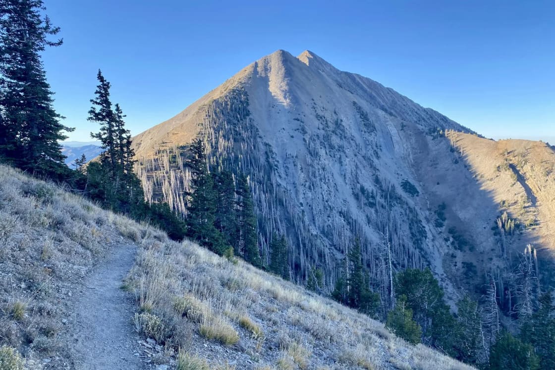
The highest peak in the Wasatch, at 11,928 feet. AllTrails lists the North Nebo route at 9.1 miles out and back with 3,608 feet of gain, rated hard: easy meadow walking for the first three and a half miles, then a steep scramble of about 1,300 feet in the last three-quarters of a mile over loose shale. AllTrails' note on the start matters: do not begin at the paved trailhead; drive or walk the dirt road north about a third to half a mile to a small lot past a cattle guard. Getting there: The Nebo Bench trailhead on the Nebo Loop, from Nephi's exit 225 or Payson's exit 252. Cost: No fee or registration, per AllTrails. Season: Summer and early fall for the summit. AllTrails: Mount Nebo via North Nebo
5. Mt. Nebo Botanical Farm and Distillery
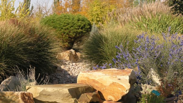
The Young Living farm in Mona grows lavender, clary sage, goldenrod, melissa, juniper and blue yarrow, and offers guided tours of the farm and distillery, wagon and paddle boat rides, a climbing wall and a petting zoo, with events through the year. Our Mona lavender farm guide covers bloom timing. Getting there: 3700 North Highway 91, Mona. Cost: Visit Utah's listing does not state admission; tours are booked online. Season: Visitor center open year-round, Monday through Saturday, 10 a.m. to 5 p.m. Visit Utah: Mt. Nebo Botanical Farm
6. Yuba State Park
The warm-water reservoir south of Nephi, known for beaches, paddleboarding and fishing for walleye, wipers, northern pike, tiger muskie, perch and catfish. The current catch: in October 2026 the park reported the reservoir at 18 percent, with the Oasis and Painted Rocks boat ramps closed because low water made them unreachable. Paddleboards rent for $30 for two hours. Our Yuba guide explains the water levels. Getting there: About 68 miles and 77 minutes from Provo by the routing estimate; the park uses self-pay at the entrance. Cost: $15 per vehicle Monday through Thursday, $20 Friday through Sunday and holidays, as listed in October 2026. Season: Year-round; summer for swimming. Yuba State Park
7. Little Sahara Recreation Area
BLM sand dunes reached by way of Nephi, about 115 miles from Salt Lake City by the BLM's count. Sand Mountain rises nearly 700 feet and is for experienced riders; families head for the two large sand play areas near White Sands Campground and Jericho Picnic Area, which are closed to motor vehicles. The BLM asks parents to supervise children and avoid tunneling in the sand. Four campgrounds, Oasis, Jericho, White Sands and Sand Mountain, are first-come, first-served with a 14-day limit. Our Little Sahara guide covers riding rules. Getting there: The entrance road is 4 miles west of Jericho Junction. Cost: $18 per vehicle per night, including campground access; annual passes $120, or $60 for seniors and people with disabilities. Season: Spring and fall; summer sand runs hot. BLM: Little Sahara
8. Tintic Mining Museum, Eureka
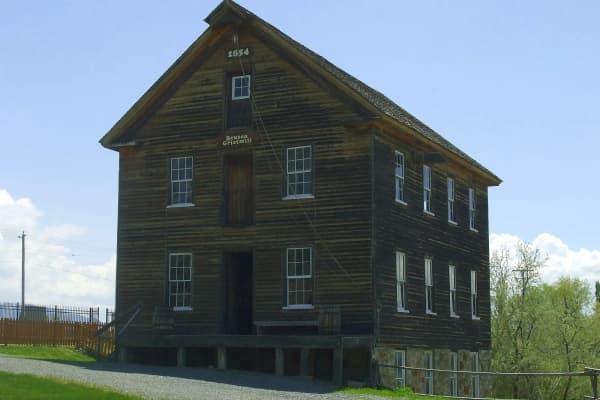
Eureka is the old Tintic Mining District town in northern Juab County, and its historical society keeps a mining museum. Visits are by appointment: the city's page lists society members to call, and because cell service is thin in town, it suggests asking the Gas Hole convenience store across the street to call for you. Our Eureka and Tintic ghost towns guide covers the rest of the district. Getting there: Eureka; arrange the visit by phone first. Cost: Not listed. Season: By appointment. Eureka City: Tintic Historical Society
9. Topaz Mountain
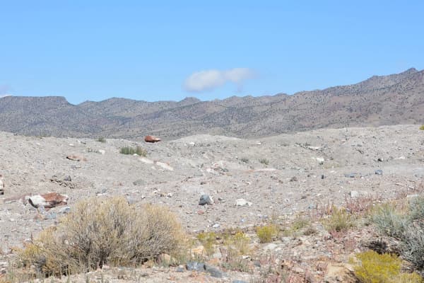
Collect Utah's state gem on public land in western Juab County. The Utah Geological Survey says single colorless topaz crystals, usually under an inch, wash out into the gullies around the mountain, and larger amber crystals and clusters sit in cavities in the white rhyolite; red beryl, garnet, amethyst, opal and other minerals turn up too. Part of the area is state trust land and part may be under gemstone leases, so do not collect on marked claims. Bring a rock hammer, chisels, eye protection, a hat and water, and watch for rattlesnakes. Getting there: From Nephi, SR-132 about 33 miles to Lynndyl, US-6 south about 5 miles, west 38 miles on the Brush Wellman road to the Topaz Mountain sign, then about 2 miles north on dirt; a four-wheel-drive vehicle is recommended but not required for the last few miles. Cost: Free. Season: Spring and fall. Utah Geological Survey: Topaz Mountain
10. Fish Springs National Wildlife Refuge
A desert oasis on the old Pony Express route: nearly 18,000 acres, with about 10,000 acres of wetlands fed by springs that hold near 75 degrees all year, so open water stays even in winter. The refuge hosts almost 300 bird species, and the Pony Express and the first transcontinental telegraph both passed through. An 11-mile self-guided auto tour route has interpretive signs; register at the entry kiosk, where the brochure and checklist are kept. Part of the refuge road closes April 15 to August 15. Pair it with the Pony Express byway in our Tooele list. Getting there: Remote, on the Pony Express route; the refuge's brochure map shows long approaches from State Highway 36, so carry water and fuel. Cost: The brochure lists no fee. Season: Open sunrise to sunset every day; spring and fall migrations are the reason to go. U.S. Fish and Wildlife Service brochure
Three Juab days from Provo
The July evening: leave Provo at 5 p.m. on a Ute Stampede Friday, catch the end of the parade on Main Street, eat at the carnival and watch the rodeo. Home before midnight.
The mountain day: Nebo Loop from Payson to Nephi, a stop at Devil's Kitchen, lunch in Nephi, then the farm in Mona on the way home. In fall this is the best of the list.
The desert day: Topaz Mountain or Fish Springs, not both. Leave early, carry more water than seems sensible, and fuel in Nephi or Delta.
The Sanpete valley is next door to the east; see Things to Do in Sanpete County. For the closer south-county towns, see Things to Do in Payson.
Related Guides
- The Ute Stampede
- Yuba State Park From Provo
- Driving the Nebo Loop
- Little Sahara Sand Dunes From Provo
- Eureka and the Tintic Ghost Towns
- Best Day Trips from Provo
Frequently Asked Questions
How far is Nephi from Provo?
When is the Ute Stampede?
Is Yuba State Park worth visiting at low water?
What is Devil's Kitchen?
How much does Little Sahara cost?
Can you collect topaz at Topaz Mountain?
Is the Mount Nebo summit hike from the Nephi side?
Can you visit the Tintic Mining Museum in Eureka?
Sources
The facts in this guide were checked against these sources. Hours, fees and rules change, so confirm anything time-sensitive with the source before you go. How we make Provo.com.
- GeoSights: Devils Kitchen, Juab County, Utah Geological Survey. Checked October 19, 2026.
- Ponderosa Campground, USDA Forest Service, Uinta-Wasatch-Cache National Forest. Checked October 19, 2026.
- Mt. Nebo Botanical Farm and Distillery, Visit Utah (Utah Office of Tourism). Checked October 19, 2026.
- Yuba State Park, Utah State Parks. Checked October 19, 2026.
- Yuba State Park fees, Utah State Parks. Checked October 19, 2026.
- Little Sahara Recreation Area, Bureau of Land Management. Checked October 19, 2026.
- Tintic Historical Society, Eureka City. Checked October 19, 2026.
- Topaz at Topaz Mountain, Utah Geological Survey. Checked October 19, 2026.
- Fish Springs National Wildlife Refuge general brochure (2025), U.S. Fish and Wildlife Service. Checked October 19, 2026.
- Fish Springs auto tour, U.S. Fish and Wildlife Service. Checked October 19, 2026.
- Ute Stampede schedule of activities, Ute Stampede Rodeo. Checked October 19, 2026.
- Mount Nebo via North Nebo Trail, AllTrails. Checked October 19, 2026.
- OSRM routing (OpenStreetMap data), drive estimates from Center St & University Ave, Provo, Project OSRM. Checked October 19, 2026.