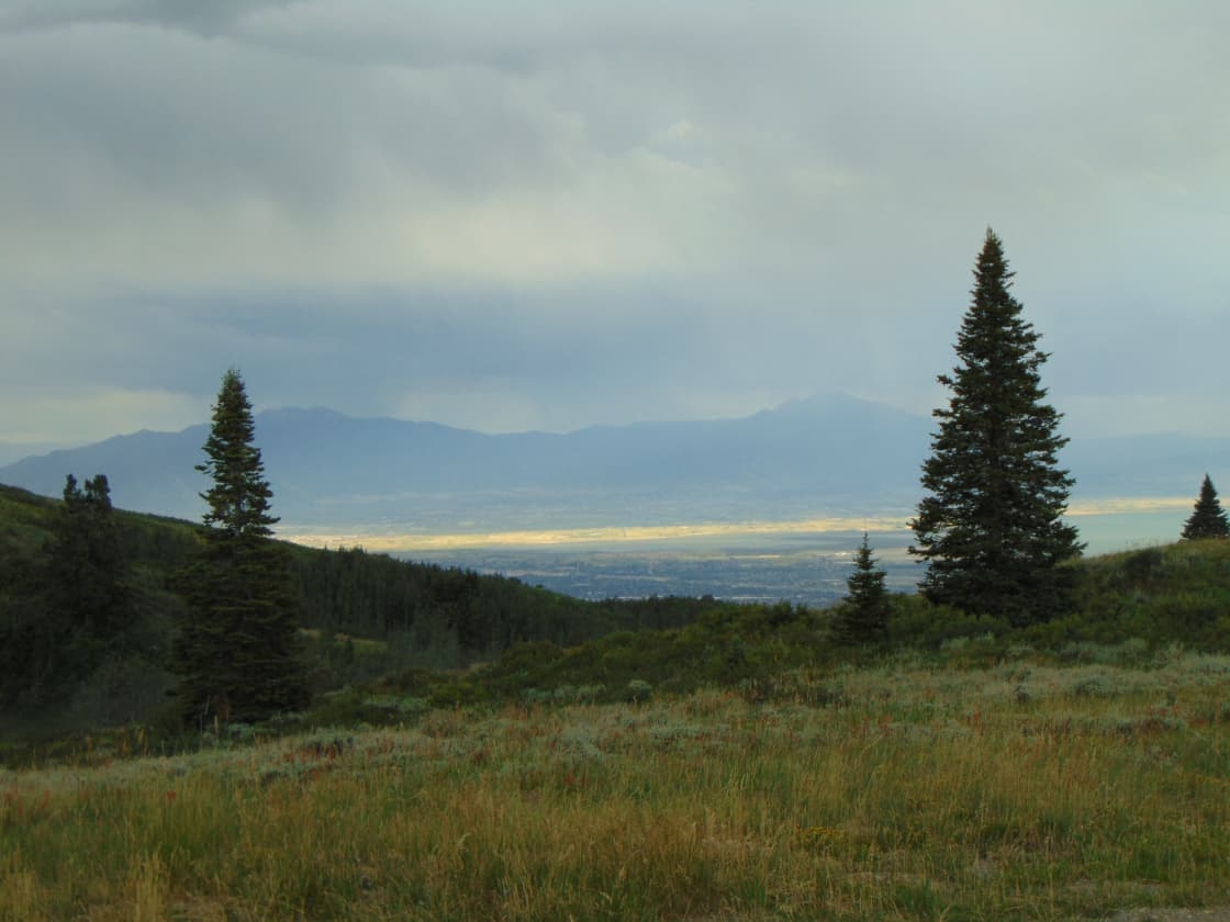

For about three weeks each summer, the high meadows above Utah Valley do something that does not photograph well and has to be seen. The snow has finally gone, the ground is still holding water, and everything blooms at once — dense, layered and at a scale that makes the alpine basins look upholstered.
Then it dries out, the color goes, and that is it until next July.
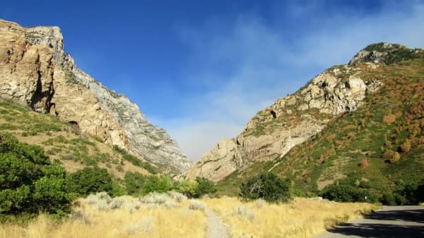
The trick is that the window moves. It is driven by the previous winter's snowpack rather than the calendar, so a fixed date is useless and a fixed approach is not. This guide covers when the bloom happens, which trails near Utah Valley hold it, how the access and fee rules work — including a rule the county's own tourism listing gets wrong — and how to plan around the weather that builds over these peaks most summer afternoons.
For the mountain itself, see our Mount Timpanogos hiking guide; for the drive, the Alpine Loop scenic drive guide; and for the canyon generally, American Fork Canyon.
The short version
- Peak is generally midsummer at high elevation, shifted by snowpack.
- Elevation staggers the bloom. Lower trails go early; high basins hold on longest.
- Driving the Alpine Loop without stopping is free. The pass is for developed sites.
- Albion Basin is not ours — it is Little Cottonwood, in Salt Lake County.
- Start early. Afternoon thunderstorms over these peaks are a genuine hazard, not a nuisance.
Why the timing moves, and how to read it
Alpine wildflowers are on a compressed schedule. At 8,000 to 10,000 feet the growing season is short, so plants bloom hard and fast in the narrow gap between snowmelt and drought.
That gap opens when the snow leaves, which is a function of how much fell and how warm the spring was. A heavy winter can push the bloom back by a couple of weeks. A light one pulls it forward. This is why advice pinned to a specific week is unreliable and why locals talk about conditions instead.
Two practical readings help. Elevation stages the show: the same species blooms at lower elevations first and works upward through the summer, so if you are late for one basin you may be exactly right for a higher one. And aspect matters: north-facing slopes hold snow longer and bloom later than south-facing ones at the same elevation, so a shaded gully can still be green when the sunny slope opposite has gone gold.
The useful move in any given year is to check recent trip reports and current trail conditions rather than committing months ahead. By mid-July most of the snow on the main Timpanogos routes has typically melted out and the trails are dry — that is the general pattern, and the specific year is what you verify.
The access rule most sources get wrong
This one is worth getting right because it changes what a casual afternoon costs.
The Forest Service is explicit: there is no fee for non-stop travel along the Alpine Scenic Loop Backway, and no fee for using gravel turnouts that are not associated with a developed recreation site. A recreation pass is required if you stop at a developed site, and it must be displayed in the vehicle while parked.
So the practical translation is: drive the loop, pull over at undeveloped turnouts, look at the mountain, drive home — free. Park at a trailhead, a campground or a developed picnic area — pass required.
Several widely read sources describe this differently. At least one official-looking regional tourism page states that a per-vehicle day-use fee is charged at the canyon entrance, which frames an optional pass as a mandatory toll. The same source's listing page quotes a fee schedule well below what the Forest Service currently publishes, and other travel pages repeat those older figures. The Forest Service's own fee schedule lists higher rates for the 3-day, 7-day and annual passes.
We are not printing specific numbers here, for a reason that this whole situation demonstrates: fee schedules change, stale figures propagate for years, and a page that hardens a price becomes another source of the same problem. Check the Forest Service's own page for the current schedule. America the Beautiful federal passes are honored at recreation sites in American Fork Canyon, so if you already hold one, you are covered.
Two more access facts worth knowing. The road is paved but has no centerline markings for most of its length, with steep grades and narrow blind curves — which is why pulling a trailer is prohibited and why long vehicles are discouraged. And the loop is seasonal: closed by snow for much of the year, closing in the fall, with opening dependent on conditions. It has also closed mid-season for heavy traffic and road hazards, particularly on peak fall weekends, so checking UDOT before you drive is not excessive caution.
Where the flowers are
The Timpanogos high meadows. The two main routes up Mount Timpanogos — Timpooneke from the American Fork Canyon side and Aspen Grove from the Provo Canyon side — both climb through terrain that produces heavily in season. Timpooneke is the gentler and more shaded of the two, which makes it the usual first choice (in July through October it needs a Recreation.gov timed-entry ticket to park on weekend and holiday mornings); Aspen Grove is steeper and more dramatic, passing waterfalls and the Emerald Lake basin. Both eventually join near the 11,749-foot summit.
The important point for flower-hunting is that you do not need to summit. The meadows partway up are where the color is, and turning around at a good basin makes a complete day at a fraction of the effort. Summiting Timpanogos is a long, serious outing; looking at flowers on its flanks is not.
The Silver Lake Flat area. Higher in American Fork Canyon, this reservoir area is a reliable spot for flowers through July and into early August, with trail connections leading further into the backcountry. It is a good option when you want meadow scenery without a major climb.
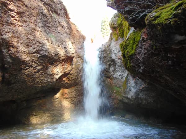
Cascade Springs. A short detour off the loop, and the most accessible option on this list by a wide margin. A large artesian spring system feeds a series of limestone terraces and pools, with a boardwalk and paved pathway loop over and around them. The boardwalk loops add up to roughly three-quarters of a mile, and it is a short, largely level walk suitable for almost anyone, and the wet, spring-fed environment supports lush vegetation that stays green well after the dry slopes have turned.
The aspen belt along the loop crest. Not a hike so much as a series of stops, but the aspen groves near the summit of the road hold understory flowers and frame the views of Timpanogos's glacier-carved face. This is the free, no-hiking, no-pass version if you stick to undeveloped turnouts.
A note on what is not here. Albion Basin, at the top of Little Cottonwood Canyon, is the Wasatch's most celebrated wildflower destination and it is spectacular. It is also in Salt Lake County, an hour-plus from Provo by a route that goes north and then back east up a different canyon, and in recent years it has operated under access restrictions during peak season. It is a great day out. It is not a Utah Valley hike, and this guide does not pretend otherwise.
Predicting the year from the snowpack
Because the bloom tracks snowmelt rather than the date, you can forecast it reasonably well months ahead if you know what to watch.
The Wasatch snowpack is measured through the winter and reported as a percentage of the long-term normal for the date. Those readings are public and updated continuously, and by late spring they tell you most of what you need.
A heavy snow year pushes everything later. More snow takes longer to melt, trails at elevation stay covered further into summer, and the bloom starts and finishes correspondingly late. In a big year the high basins may not be at their best until well into August, and lower trails will be the better bet in July.
A light year pulls everything forward and shortens it. The snow leaves early, the meadows get going sooner, and — this is the part people miss — they also dry out sooner. The bloom in a low-snow year is often not just earlier but briefer and less dense, because the soil moisture that sustains it runs out faster.
A warm, fast spring compresses the sequence. If the melt happens quickly, elevations that normally bloom weeks apart can go closer together, which is spectacular and short. A cool, slow spring stretches the same sequence out and gives you a longer usable window.
The practical routine is simple. Watch the snowpack percentage through late spring to set your rough expectation. Then, from late June, read recent trip reports for the specific trails — hikers post about snow on the trail and what is blooming, and that is the most accurate signal available. Adjust your target elevation to match: if the high basins are still under snow, go lower; if the low slopes have browned off, go higher.
Photographing meadows without being disappointed
Wildflower photographs are notoriously worse than the experience, and the reasons are fixable.
The wide shot rarely works. A meadow that overwhelms you in person flattens into a distant green smear, because the flowers are small and the frame is large. The standard fix is to anchor a strong foreground — a cluster close to the lens — and let the meadow and peak recede behind it. Getting low helps enormously.
Midday sun is the enemy. Hard overhead light blows out pale petals and kills the color you came for. Early morning is best on every count: softer light, fewer people, calmer air, and it aligns with the early start the weather demands anyway. Overcast is good for flower detail.
Wind is the reason your close-ups are soft. Alpine meadows are breezy and the plants are on thin stems. Faster shutter speeds fix it; waiting for a lull between gusts fixes it better.
Include the mountain. What distinguishes a Wasatch flower photograph from any other flower photograph is Timpanogos behind it. A composition that places the peak in the frame gives the image a location, and a location makes it worth keeping.
And the standing rule holds: compose from the trail. There is no photograph in an alpine basin worth the years it takes the ground to recover.
What you are looking at
You do not need to identify anything to enjoy a meadow, but knowing a few of the players makes the whole thing more legible.
The high Wasatch meadows in peak season typically layer several colors at once. Indian paintbrush supplies the reds and oranges, in bracts rather than true petals. Lupine carries the blues and purples in tall spikes, with distinctive palm-shaped leaves. Sticky geranium adds pink-purple at mid-height. Yarrow and various white umbels fill in pale layers. Mule's ears and arrowleaf balsamroot produce the big yellow sunflower-like blooms that dominate lower and mid-elevation slopes earlier in the season. Columbine favors shaded, moist pockets, and finding it usually means you have wandered somewhere damp and sheltered.
The layering is the thing worth watching for. A meadow at genuine peak is not one color with others mixed in; it is several species blooming simultaneously at different heights, which is what produces the dense upholstered effect and what disappears within a week or two as the sequence moves on.
One further thing worth noticing: the meadows are working, not decorative. The compressed bloom exists because pollinators at this elevation have the same narrow window the plants do, and an alpine basin at peak is loud with bees and hoverflies and busy with hummingbirds where the paintbrush is dense. Standing still for two minutes in a good meadow reveals considerably more activity than walking through it does.
Please stay on established trails. Alpine meadows recover slowly from trampling at this elevation because the growing season is so short, and a shortcut through a basin leaves a scar that persists for years. Photographs taken from the trail are just as good.
Weather, altitude and the early start
Two hazards define summer hiking at this elevation, and both are managed by starting early.
Afternoon thunderstorms build over the Wasatch with real speed in mid and late summer. A clear morning is not a forecast. Being on an exposed ridge or in an open meadow when one arrives is dangerous — lightning is the risk, not the rain — and the terrain that produces the best flower displays is exactly the open, exposed terrain you least want to be caught in. The standard mountain discipline applies: start at or before dawn, plan to be off exposed ground by early afternoon, and be willing to turn around.
Altitude and sun. These trailheads start around 7,000 feet and climb from there. The air is thin, the UV is intense, and there is very little shade in an open meadow. Carry more water than the distance suggests, use sun protection more aggressively than you would at valley elevation, and expect a given mileage to feel harder than the same mileage in Provo.
Add the practical items: layers, because meadow temperature swings sharply between sun and shade, and footwear that tolerates wet ground, because snowmelt keeps sections of these trails muddy and there are stream crossings well into the season. Afternoons on the loop also bring traffic — the road is narrow, popular and shared with cyclists, so an early start improves the drive as much as the hike.
Making a day of it
The efficient version, from Provo or Orem, is a loop rather than an out-and-back.
Drive up through American Fork Canyon early, hike a meadow section from Timpooneke or stop at Silver Lake Flat, come back down to the loop and continue over the crest, detour to Cascade Springs for the boardwalk, then descend into Provo Canyon past Sundance and home. That covers the range's flower terrain, a short accessible walk and the scenic drive in a single circuit, without retracing.
If you want the flowers with almost no walking, do the same drive and treat Cascade Springs as the destination. If you want a serious day, take Timpooneke or Aspen Grove properly and be honest with yourself about the summit — Timpanogos is a long mountain and the flowers are not at the top.
Either way, the window is short. When the reports say the meadows are going, that is the week — not the following month. For the rest of the valley's trail options across the year, our Rock Canyon guide covers the closest serious hiking to Provo itself.
A note on fees, dates and conditions. Recreation fees, road opening and closing dates, and access rules change, and this page deliberately avoids printing figures that circulate in stale form elsewhere. Confirm the current fee schedule and road status with the Forest Service and UDOT before you go, and check recent trail conditions rather than assuming a typical year.
Frequently Asked Questions
When do Wasatch wildflowers peak near Utah Valley?
Do I have to pay a fee to drive the Alpine Loop?
What does a recreation pass for American Fork Canyon cost?
Is Albion Basin a Utah Valley wildflower hike?
Which is better for wildflowers, the Timpooneke or Aspen Grove trail?
When does the Alpine Loop road open and close?
Do I need to hike far to see wildflowers?
What should I bring for a high-elevation wildflower hike?
Sources
The facts in this guide were checked against these sources. Hours, fees and rules change, so confirm anything time-sensitive with the source before you go. How we make Provo.com.
- Cascade Springs, USDA Forest Service, Uinta-Wasatch-Cache National Forest. Checked October 12, 2026.
- Silver Lake Flat Trailhead / Reservoir, USDA Forest Service, Uinta-Wasatch-Cache National Forest. Checked October 12, 2026.
- Timpooneke Trailhead, USDA Forest Service, Uinta-Wasatch-Cache National Forest. Checked October 12, 2026.
- Cascade Springs Interpretive Trail, AllTrails. Checked October 12, 2026.