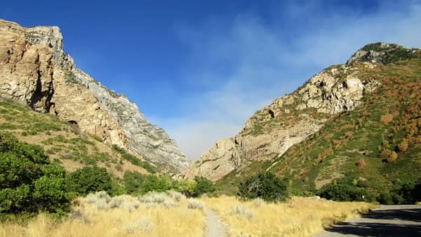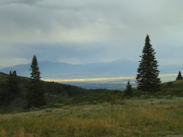

Utah Valley hiking has a crowding problem, and it is very concentrated. Five trails absorb most of the traffic — the Y Mountain trail, Rock Canyon, Mount Timpanogos, Stewart Falls and Bridal Veil Falls. On a July Saturday the parking at three of those is a competitive sport.
The trails below are the next tier. None of them is secret, exactly. They are simply the ones that do not make the lists, which in practice means you will see a fraction of the people.
There is one thing to sort out before you go, and it is the reason this page exists in the shape it does.
Four of these six names mean more than one place
This is the single most useful thing to know about the quieter half of Utah Valley's trail network. The famous trails have unambiguous names. These do not.
- Big Springs is a park, a hollow, a spring, and a 5.8-mile connector trail to Rock Canyon — all in the same drainage, all called some version of the same thing.
- Silver Lake is a drive-to reservoir, an alpine lake a couple of miles above it, and a third lake higher still. There is also an entirely unrelated Silver Lake in Big Cottonwood Canyon, an hour north, which is the one most search results are about.
- Dry Canyon is a canyon above Lindon and Orem, and also a Forest Service trail number that runs for miles past it into country most day hikers never see.
- Provo Peak is a three-mile round trip or a thirteen-mile round trip depending entirely on which trailhead you use.
We have run into this pattern repeatedly across Utah Valley's trails — Battle Creek Falls carries two legitimate difficulty ratings for the same reason, and the Bonneville Shoreline Trail publishes contradictory stats because it is a set of segments rather than one path. The fix is always the same: find out which segment a number describes before you plan around it.
Big Springs Hollow, South Fork Provo Canyon
The most family-friendly trail on this page, and the one most likely to make you wonder why you had not heard of it.
From the mouth of Provo Canyon you drive east to Vivian Park, turn onto South Fork Road, and follow it past South Fork Park to Big Springs Park at the top. The trail leaves from the far end of the parking area and heads up a broad side canyon along a small stream, crossing it repeatedly on wooden bridges.
The vegetation is the draw. The lower canyon is thick maple, chokecherry and elderberry, giving way to aspen and pine higher up, and it is shaded for most of its length — which matters here more than almost anywhere else in the valley, because the exposed foothill trails become unpleasant after about ten in the morning in July.
Published distances run from about 3.5 miles to about 4.3, with elevation gain quoted anywhere from roughly 450 to just over 1,000 feet. That spread is not sloppiness. The canyon carries several roughly parallel paths — a dirt road bed on one side, narrower singletrack near the creek — and the standard outing is a loop assembled from whichever combination you choose, extended or cut short at any of several junctions. You can also simply walk up as far as you feel like and turn around, which is what a lot of families do.
Provo City lists a longer option from the same trailhead: the Big Springs trail continues through the canyon to meet the Rock Canyon trail, about 5.8 miles, which the city estimates at two to four hours. That is a different trip from the family loop and should be planned as one.
The springs themselves sit near the top of the loop, with planking laid over the wet ground. Water at the source is generally regarded as clean, but the usual backcountry caution applies.
Grotto Falls, Payson Canyon
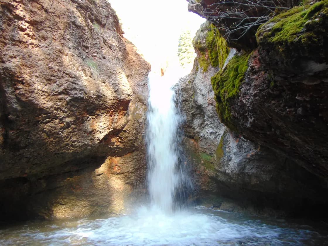
The shortest real payoff in Utah County. The trailhead sits about eight miles south of Payson on the Nebo Loop Scenic Byway, and it is about a quarter to a third of a mile from the car to the waterfall, which drops through a cobbled overhang into a shallow pool — the alcove is what gives the place its name.
The trail is wide, mostly level, and crosses the stream repeatedly on log and plank bridges. Reports differ on exactly how many; it is enough that small children treat the crossings as the point of the outing rather than an obstacle. Most groups are back at the car inside forty-five minutes.
Three things worth knowing:
There are two trails at that pullout and people start up the wrong one. The other is the Bennie Creek trail. Check the sign before you commit — this is the same failure mode as the Stewart Falls trailhead, where the neighboring path is the twelve-mile Aspen Grove route up Timpanogos.
The winter version is a completely different hike. When the Nebo Loop gate closes for the season, you park at the gate and walk the road to the trailhead — commonly reported at around 1.3 miles each way, which turns a half-mile stroll into something closer to a 3.5-mile outing with real elevation added. It is a pleasant walk and you will likely have the canyon to yourself, but it is not the hike the summer write-ups describe. The road closure is snow-dependent at both ends and the dates move year to year, so check status rather than the calendar.
Expect some burned forest. Wildfire has touched parts of this side of the loop in recent years, and standing dead timber is visible in places. It is recovering ground, not a ruined one.
Silver Lake and Silver Lake Flat, American Fork Canyon
Here the name problem is at its worst, so take it in order.
Silver Lake Flat Reservoir is the drive-to one. From American Fork Canyon you pass Tibble Fork, turn toward Granite Flat, and then take a dirt road roughly two and a half to three miles to the reservoir. The shoreline is flat, easy walking with essentially no climbing, though the Forest Service lists no formal loop trail around it, and it is a fine hour with a stroller-aged family, small children, or a paddleboard. Moose are common in the meadows around it.
Silver Lake is the alpine one, and it is a hike. The trail leaves from the north side of the reservoir and climbs 2.3 miles one way into the Lone Peak Wilderness, per the Forest Service, so roughly four and a half miles round trip with something in the range of 1,200 to 1,450 feet of gain, depending on whose track you believe. The first half is easy walking through aspen; the second half is rockier and steeper, with a stream crossing that runs high in early season. It is one of the most spectacular places in the range. The Forest Service keeps a year-round open-fire ban across the whole Silver Lake basin.
Silver Glance Lake is higher again, a few hundred feet of additional climbing above Silver Lake, and gets a fraction of the visitors.
And then there is the fourth one: Silver Lake in Big Cottonwood Canyon is a different lake in a different county. Several hiking guides open with that warning, which tells you how often it happens.
Two practical notes, both from the Forest Service's own page for the site. It lists 4x4 as recommended for the dirt road up — hikers routinely report low-clearance cars in the lot, but that is the agency's guidance and the road is washboarded. And the posted restrictions are specific: no fires within a quarter mile of the reservoir, no trailers on the road, no public access to the spillway, and dogs leashed in developed sites. The agency also posts current conditions for this site that change through the season, including the status of the river crossing, so it is worth a look the week you go.
This is a fee area. See the section on fees below, because the numbers you find online are frequently out of date.
Dry Canyon, above Lindon and Orem
The most convenient hard workout in the north valley, and the trailhead confuses people for a mundane reason: Orem's 2000 North and Lindon's 200 South are the same road. Drive east on it until it ends, turn onto Dry Canyon Drive, and the paved lot is there. Directions written by different people put the same trailhead in different cities, and both are right.
What you get is a steep, sustained climb up the west face below Timpanogos with the whole valley opening behind you. AllTrails puts a common out-and-back version at about 5.7 miles with roughly 2,900 feet of gain and rates it hard, which is fair — this is a grind, not a stroll, and it is largely exposed. Go early.
The name is only mostly accurate. In wet years there is water in the creek up the canyon, which is worth knowing if you are counting on there being none. Stinging nettle is common here, as it is in Battle Creek one canyon north, so long sleeves are not a bad idea on an overgrown stretch. There is a pit toilet at the trailhead and no drinking water. The canyon also holds a well-established set of limestone climbing routes, so expect to share the approach with people carrying rope.
The Forest Service trail here is Dry Canyon #049, and it is far longer than the day-hike version suggests — its own description runs the trail 0.6 miles to the Curly Springs junction, another 1.9 to Little Baldy, a quarter mile more to the Big Baldy saddle, then north 2.2 miles to the Battle Creek trail and a final 0.8 to the Timpooneke Road. That connector is the reason Dry Canyon shows up in trip reports that sound nothing like the hike most people do. It is also how the canyon links into the Bonneville Shoreline Trail network for loop options.
Slate Canyon, south Provo
Slate Canyon is the quiet one, and it is quiet mostly because it does not lead anywhere obvious. There is no waterfall, no lake and no summit at a reasonable distance — just a long, steady climb up an old road bed on the south end of Provo, working around the flank of Maple Mountain toward a junction with the Slide Canyon trail high above.
That is exactly why people who live on the south side use it. It starts from the valley floor, so it is reachable when the canyon roads are closed; it climbs consistently, so it is good conditioning; and it passes through a real sequence of zones — oak and scrub low down, then pine, then aspen and meadow up top. Trip reports describe the tread as somewhat overgrown in places but used enough to stay obvious.
It also carries water. Accounts of the through-route describe multiple reliable springs up Slate Canyon and more in Slide Canyon, which is unusual on this side of the valley and is the reason it works as an approach for longer trips.
Treat it as an out-and-back of whatever length suits you. The full linkups from here are serious undertakings. Our full Slate Canyon guide covers the trailhead, the four different distances quoted for it, and the conservation easement being negotiated at its mouth.
Provo Peak
At 11,068 feet, Provo Peak is the mountain filling the skyline directly east of the city, and it is the clearest illustration of the segment problem on this page.
From the high trailhead it is short. Kyhv Peak Road climbs from Provo Canyon and runs roughly 13.5 miles to the west ridge trailhead — allow around 45 minutes for the drive, because the last several miles are rough dirt and slow. From there the west ridge is about 1.5 miles up and roughly three miles round trip. Short, though very steep; this is a climber's path more than a graded trail, and there is real exposure near the top.
From the valley it is an expedition. The Slate Canyon approach is commonly logged at about 13 miles with something in the region of 6,800 feet of gain and ten to twelve hours of moving time. Hikers starting from the Y trailhead report similar numbers. Same summit, entirely different day, and it is worth being certain which one a trip report is describing before you use its timing.
The gate matters here more than anywhere else on this list: Kyhv Peak Road closes in winter. Once it does, the short route is gone and the mountain has to be climbed from the valley floor, which is a serious winter objective rather than an afternoon.
A note on names, since both come up in local usage: the peak, the road, and the overlook were all formerly named for "Squaw Peak," and since the US Board on Geographic Names renamed the peak Kyhv Peak in September 2022, current Forest Service directions and the major trail apps have adopted Kyhv Peak Road for the road as well. The old name still appears on some maps, apps, and older signage, which is worth knowing when you are matching a trail description to a map — our Kyhv Peak guide sorts out all four features that carried the old name.
Fees, gates and the things that stop you
Almost nothing on this page is stopped by trail conditions. It is stopped by roads and gates.
Fees are canyon-specific, not regional. American Fork Canyon is a Forest Service fee area, and Silver Lake and Silver Lake Flat sit inside it. Provo Canyon is free, so Big Springs Hollow costs nothing. The Nebo Loop charges at particular developed sites rather than operating a single canyon gate. Federal interagency passes are honored where fees apply, and the day pass is sold in multi-day and season tiers rather than as a single daily rate. Published amounts have changed and old figures circulate widely enough that we are not going to quote one as current — confirm with the Uinta-Wasatch-Cache National Forest or at the station. Payment on site has historically been cash or check, with a digital pass available online, which is worth arranging before you drive.
The three seasonal road closures that shape this list: the Nebo Loop closes for winter, which lengthens Grotto Falls dramatically; the Alpine Loop closes for winter, which removes the American Fork approach to the Silver Lake trailhead; and Kyhv Peak Road closes for winter, which removes the short route on Provo Peak. All three are snow-dependent at both ends and the dates move — our guide to winter driving in the canyons covers the wider picture, but the only reliable move is to check current status the day before.
What to carry. These are quieter trails, which is the appeal and also the risk: fewer people means less help if something goes wrong, and cell coverage in South Fork and up Slate Canyon is patchy at best. Carry more water than you expect to need, tell someone your plan, and start early in summer — the exposed foothill trails, Dry Canyon in particular, are unforgiving by mid-morning. If you are building up toward these, our complete guide to hiking around Provo covers the mainline trails and the seasonal timing that governs all of them.
Related Guides
- Provo Peak: The Mountain Behind the Y, and Why the Road Is the Hard Part
- Hard Hikes Near Provo — the climbs, sorted by gain
- Utah Valley Hike Finder — filter every trail by difficulty, length, season, dogs and fees
- Canyon & commute conditions — several of these trailheads sit behind a gate for half the year
- Hikes for Kids Under 8 Near Provo, and the Stroller Test
- Payson Lakes and Payson Canyon: The Complete Guide
- Big Springs Park and the South Fork: Provo Canyon's Quiet Side
Frequently Asked Questions
What are the best lesser-known hikes near Provo?
Which quiet hike near Provo is best with small children?
Do I need to pay a fee for these hikes?
Are these trails open in winter?
Why do trail apps give different distances for the same hike here?
Sources
The facts in this guide were checked against these sources. Hours, fees and rules change, so confirm anything time-sensitive with the source before you go. How we make Provo.com.
- Trails | Provo, UT, Provo City Parks and Recreation. Checked October 12, 2026.
- Grotto Trail #086, USDA Forest Service, Uinta-Wasatch-Cache National Forest. Checked October 12, 2026.
- Silver Lake Flat Trailhead / Reservoir, USDA Forest Service, Uinta-Wasatch-Cache National Forest. Checked October 12, 2026.
- Silver Lake Trail #036, USDA Forest Service, Uinta-Wasatch-Cache National Forest. Checked October 12, 2026.
- Dry Canyon Trail #049, USDA Forest Service, Uinta-Wasatch-Cache National Forest. Checked October 12, 2026.
- Big Springs Hollow Loop, AllTrails. Checked October 12, 2026.