
Every person who lives in Utah Valley eventually looks up at Timpanogos and thinks: I should climb that.
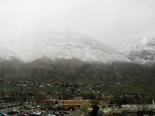
It's the right instinct. Timp is the most dominant thing in the valley — a wall of rock and snow rising about 7,000 feet above the Provo–Orem floor, visible from your driveway, your commute, the parking lot at the grocery store. Summiting it is a genuine local rite of passage, and thousands of people do it every summer.
It's also the hike people most consistently underestimate. Close to a city, well-marked, hugely popular — all of which reads as "easy," and none of which is the same as easy. This is a 14-plus mile day with somewhere north of 4,000 feet of climbing, finishing on an exposed ridge above 11,000 feet.
Here's everything you need to plan it properly.
The mountain, briefly
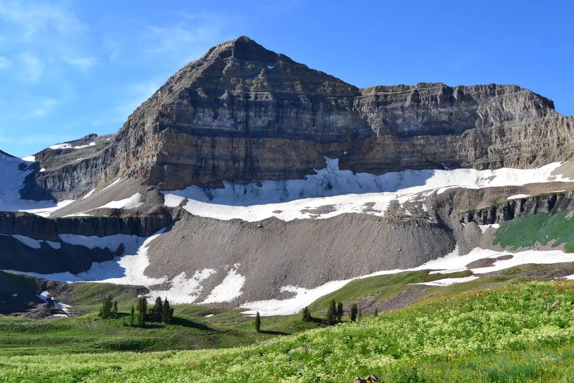
Mount Timpanogos tops out at roughly 11,750 feet — published figures range between about 11,749 and 11,753 depending on the source, which is ordinary variance for a peak like this. It's the second-highest summit in the Wasatch Range, behind Mount Nebo to the south, and it sits within the Uinta-Wasatch-Cache National Forest.
There are two standard routes, both starting off the Alpine Loop, Timpooneke from the American Fork Canyon side and Aspen Grove from the Provo Canyon side:
| Timpooneke | Aspen Grove | |
|---|---|---|
| Trailhead elevation | ~7,360 ft | ~6,900 ft |
| Round trip | ~14–15 miles | ~14–16.7 miles |
| Elevation gain | ~4,400–4,700 ft | ~4,800–5,600 ft |
| Parking | Day-use pass; timed-entry ticket on summer weekend and holiday mornings | Day-use pass |
| Character | Gradual, basin-to-basin | Steeper, waterfalls, lake |
| Crowds | Usually busier | Usually somewhat less |
A note on those numbers: published distances and gain figures for this mountain vary noticeably between sources — GPS tracks differ, people measure from different parking spots, and the summit spur gets counted inconsistently. Treat the ranges above as ranges, not gospel. What's consistent across every source is the shape of the thing: both routes are long, both climb hard, and both take most people the better part of a day.
Timpooneke: the gradual one
The Timpooneke Trail (#053) starts near Timpooneke Campground, up a short paved side road off the Alpine Loop.
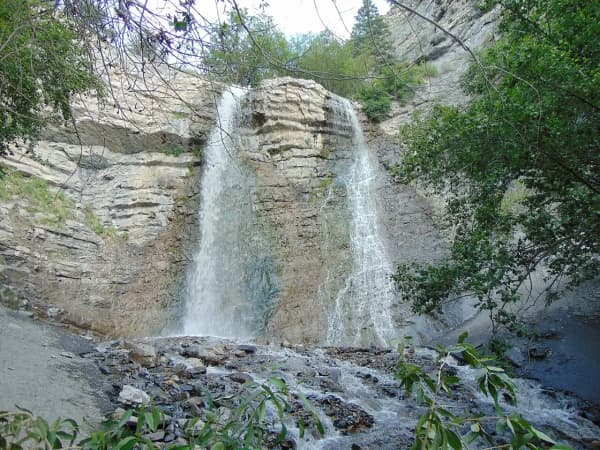
The route climbs what locals call the Grand Staircase — a canyon that gains elevation in a rhythm of flat benches and steep pitches rather than one relentless grind. That rhythm is why people call this trail the easier of the two: you get recovery stretches. Scout Falls comes early and makes a worthy turnaround on its own if the full summit isn't happening.
Higher up, the trail opens into Timpanogos Basin, a sheltered grassy bowl that in late July fills with wildflowers and, reliably, mountain goats. This is the part of the hike people photograph most.
From the basin, the trail splits. One branch climbs to the ridge and on to the summit; the other crosses toward Emerald Lake and the Aspen Grove side. Both eventually converge on the same final ridge.
Timpooneke is generally the more popular start, which means earlier parking pressure and more company on the trail.
Aspen Grove: the steeper, prettier one
The Mount Timpanogos Trail (#052) leaves from the Mount Timpanogos Trailhead at Aspen Grove, on UT-92 on the Provo Canyon side of the Alpine Loop, just past Sundance.
This one earns its elevation. After a gentle first mile, the trail steepens into long switchbacks climbing through Primrose Cirque, with waterfalls visible for much of the ascent. It's the more scenic climb by most accounts, and the harder one — meaningfully more vertical than Timpooneke.
Around 4.3 miles the terrain opens into the Hidden Lakes area and turns rocky and alpine. Shortly after comes Emerald Lake, a genuine alpine lake, the emotional midpoint of the hike, and where the trail meets Timpooneke arriving from the north.
Emerald Lake is also where the snowfield sits. More on that below, because it matters.
The Aspen Grove trailhead shares parking with the Stewart Falls trail, which makes the lot competitive even among people who have no summit ambitions.
The summit ridge: Timpanogos Summit Trail #054
However you get there, the finish is the same: the Timpanogos Summit Trail (#054), which the Forest Service lists at 2.2 miles from just west of Emerald Lake, climbing well over a thousand vertical feet along a broad but increasingly exposed ridge with steep drop-offs on both sides.
This is where the hike changes character. The footing is rock and talus, cairns matter, and the wind that was pleasant at Emerald Lake becomes the defining feature of the day. People routinely arrive at the ridge in shorts and a t-shirt and find themselves cold — the west side of the mountain funnels wind hard.
At the top sits the stone shelter hut, a small emergency structure that's marked the finish line for generations of Utah hikers. On a clear day you're looking down at Utah Lake, the whole valley, and a good portion of the state.
The ridge isn't technical. You don't need ropes or climbing skill. But it is not a place to be in a thunderstorm, in the dark, or beyond your energy reserve — and the honest truth is that most people who get in trouble on Timp get in trouble on the descent, tired, after a summit that took longer than planned.
The snowfield: read this part twice
Below the summit near Emerald Lake, a large snowfield persists well into summer. Locals call it "the glacier," though it isn't one.
Two things to understand:
Before mid-July, snowfields above the cirque are typically substantial and can be hazardous. Crossing steep, firm snow without an ice axe and traction is how competent hikers get hurt. Early-season attempts require actual snow skills, not optimism.
Do not glissade it because it looks fun. Sliding down the snowfield is a long-standing Timpanogos tradition and a long-standing source of serious injury. The snow firms up unpredictably, the runout has rocks, and people lose control at speed. Every year experienced locals watch someone try it and regret it. If you want the tradition, the safe version is walking down carefully with traction.
Even in August, patches linger. Microspikes and trekking poles are worth carrying on any summit attempt outside the peak of late summer.
Timing your day
Start early. Earlier than that.
A pre-dawn start is the standard on this mountain, and it solves four problems simultaneously:
- Parking. Both trailhead lots fill. At Timpooneke on summer weekends and holidays you also need a timed-entry ticket for a morning arrival; at Aspen Grove the Forest Service says to have a plan B once the lot is full.
- Afternoon thunderstorms. Summer storms build over the Wasatch in the afternoon with real speed. You do not want to be on an exposed ridge above 11,000 feet when one arrives.
- Heat. Long stretches of both trails are sun-exposed.
- Daylight margin. If the hike runs long — and it often does — you want that buffer on the front end, not spent.
Most people are on trail between 4 and 6 a.m. Bring a headlamp regardless; you'll likely start with it, and you may finish with it.
Weekdays are dramatically quieter than Saturdays. If your schedule allows it, take the weekday.
What to bring
The non-negotiables:
- Water — at least 3 liters per person. Sources on the upper mountain are unreliable. Altitude and dry air dehydrate you faster than you'll notice.
- More food than feels necessary. This is a 10-hour athletic effort.
- Layers, including a real jacket, hat, and gloves. Summit conditions bear no relationship to trailhead conditions.
- Sun protection. At 11,000 feet the UV is punishing, and much of the route has no shade.
- Headlamp, with working batteries.
- Trekking poles — valuable on the descent, which is where knees and ankles suffer.
- Microspikes outside peak late summer.
- A downloaded offline map. Cell coverage exists in patches but should never be your navigation plan.
Bathrooms are available at both trailheads. There is nothing above them.
Am I ready for this?
An honest self-assessment, because the mountain won't do it for you.
You're probably ready if you've comfortably completed a hike in the 8–10 mile range with 2,500-plus feet of gain, you can be on your feet for eight hours, and you've spent time above 9,000 feet without altitude symptoms.
Build up first if your longest hike is Y Mountain or Rock Canyon. Those are excellent trails and excellent training — but Timp is several times the effort. A reasonable progression is Y Mountain, then Stewart Falls, then a longer canyon hike, then Timp.
Altitude is the wildcard. It affects people unpredictably and doesn't correlate neatly with fitness. Headache, nausea, and dizziness above 10,000 feet are signals to descend, not to push through.
The turnaround rule: pick a time before you start — say 1 p.m. — and commit that wherever you are at that hour, you turn around. Summit fever is the single most reliable cause of bad decisions on this mountain. It will be there next year.
What the day looks like
For planning purposes, here's a realistic shape for a Timpooneke summit day. Adjust to your own pace — this is a moderate one.
- 4:00 a.m. — Leave Provo or Orem. Coffee and breakfast happen in the car.
- 4:45 a.m. — Park at the trailhead. Headlamps on. Layers on, because it's cold at 7,300 feet before dawn.
- 6:30 a.m. — Scout Falls area, sunrise light hitting the upper basin walls. First real break.
- 8:30 a.m. — Timpanogos Basin. Wildflowers, goats, and the first clear look at how much mountain is left.
- 10:30 a.m. — The saddle. Wind picks up hard here; add the jacket you've been carrying.
- 11:15 a.m. — Summit and the shelter hut. Twenty minutes, photos, food.
- 11:45 a.m. — Start down. This is the half people underestimate.
- 3:30–4:30 p.m. — Back at the car, knees complaining.
That's a ten- to eleven-hour day, car to car, at an unhurried pace with a fit group. Slower groups add two hours easily. If your plan has you starting at 8 a.m., look at that timeline again and move it.
The point-to-point option
Experienced groups sometimes hike it as a traverse — up one trail, down the other — which sees the whole mountain instead of half of it twice.
It requires two vehicles and a shuttle: leave one car at the finishing trailhead, drive everyone to the start. The trailheads are both on the Alpine Loop but not close to each other, so the shuttle is a real drive, not a five-minute repositioning.
Most people who do this go up Timpooneke and down Aspen Grove, which puts the gentler grade on tired legs at the end and the waterfalls in front of you on the descent. The reverse works too.
It's a longer day than an out-and-back on either trail. Only worth it if the logistics are easy for your group.
Rules, permits, and leaving it intact
You don't need a permit to hike Mount Timpanogos, but you may need one to park. From July through October, the Forest Service requires a Recreation.gov timed-entry ticket, plus a recreation pass, to park at the Timpooneke trailhead on Saturdays, Sundays and holidays (including July 24 and Labor Day) between midnight and noon. Aspen Grove has no ticket system, just the day-use pass, and its lot fills early. Heavy traffic is something the mountain pays for in wear.
A few things that matter:
Pack out everything, including fruit peels and pistachio shells. Above treeline, organic matter doesn't break down the way it does at valley elevations, and Timp is one of the most heavily trafficked peaks in Utah.
Stay on the trail through the basins. The alpine meadows here are fragile and slow to recover; shortcutting switchbacks cuts scars into terrain that takes decades to heal.
Don't feed or crowd the goats. They're habituated enough already, and habituated wildlife has a poor long-term outlook.
Human waste should be handled properly and well away from water sources — Emerald Lake and the streams below it drain into the valley's water system.
Camping. If you are thinking about an overnight, verify current regulations, fire restrictions, and any seasonal closures with the Uinta-Wasatch-Cache National Forest before planning to stay out.
Wildlife, wildflowers, and the reasons people come back
Mountain goats are effectively guaranteed in Timpanogos Basin and near Emerald Lake, often close enough to photograph without a long lens. Give them room and don't feed them.
Moose appear in the lower forested sections of both trails. Moose deserve genuine caution — give them enormous space, never get between a cow and a calf, and back away rather than pressing for a photo.
Wildflowers peak in late July in the alpine basins, and it's the best argument for timing your attempt to that window.
Getting there and what it costs
Both trailheads are on the Alpine Loop (UT-92): Timpooneke on the American Fork Canyon side and Aspen Grove on the Provo Canyon side. Both trailheads are developed recreation sites, so a recreation pass is required to park there and must be on display in the vehicle. At Timpooneke, from July through October, Saturday, Sunday and holiday mornings also require a timed-entry ticket from Recreation.gov. (Driving the loop without stopping is free — the fee attaches to stopping at a developed site, not to entering the canyon. Anyone hiking Timp is stopping.) Check the current rate and pass options with the Forest Service before you go, since fees and payment methods change. An America the Beautiful pass is honored.
The Alpine Loop is a seasonal road and closes in winter. Confirm it's open before planning an early- or late-season attempt.
If you're coming from Provo or Orem, the drive to either trailhead is roughly 30–45 minutes depending on which one and where you start.
If the summit isn't the goal
Not every trip up this mountain needs to reach the top, and some of the best days here don't.
Scout Falls from Timpooneke is a modest, family-friendly out-and-back. Stewart Falls from Aspen Grove is one of the valley's most rewarding short hikes — and it leaves from this same parking lot, which is how people end up on the wrong trail. Emerald Lake as a destination in itself is a spectacular day that skips the exposed ridge entirely.
All three are legitimate. The mountain isn't a test you pass or fail.
The story you will hear at the trailhead
Someone will tell you the mountain is a sleeping Indian princess, and that the heart-shaped formation in Timpanogos Cave is hers. It is a good story and it is not an old one: a BYU athletics coach wrote it in the 1920s to give his annual mass hike a ceremony, and it was mistaken for Ute tradition almost immediately. The real history of the name — and of the people it belonged to — is in our piece on the invented legend of Timpanogos, and it is worth ten minutes before you walk up there.
The wider picture
Timpanogos is the anchor of Utah Valley's outdoor identity — the peak in the photographs, the backdrop to Sundance, the mountain the new school district up north named itself after. Our complete Provo hiking guide covers the rest of the valley's trails from beginner to serious, and the American Fork Canyon guide has more on the canyon itself, including Timpanogos Cave.
Go early, carry more water than you want to, and turn around when the clock says so. The summit's been there a long time.
Related Guides
- Wildflower Hikes in the Wasatch: Where and When
- Provo Peak: The Mountain Behind the Y, and Why the Road Is the Hard Part
- Battle Creek Falls: The Complete Hike Guide (2026)
- Lesser-Known Hikes Near Provo: Six Trails Past the Famous Five (2026)
- Hiking Lone Peak: The Two Routes, the Closed Gate and the Scramble at the Top
- Utah Valley Hike Finder — filter every trail by difficulty, length, season, dogs and fees
- Canyon & commute conditions — the Timpooneke approach goes with the first wave of gate closures
Frequently Asked Questions
How long does it take to hike Mount Timpanogos?
Which is better, the Timpooneke or Aspen Grove trail?
How high is Mount Timpanogos?
When is the best time to hike Mount Timpanogos?
Is Mount Timpanogos dangerous?
Can you hike Mount Timpanogos with a dog?
Sources
The facts in this guide were checked against these sources. Hours, fees and rules change, so confirm anything time-sensitive with the source before you go. How we make Provo.com.
- Timpooneke Trailhead, USDA Forest Service, Uinta-Wasatch-Cache National Forest. Checked October 12, 2026.
- Mount Timpanogos Trailhead (Aspen Grove), USDA Forest Service, Uinta-Wasatch-Cache National Forest. Checked October 12, 2026.
- Timpooneke Trail #053, USDA Forest Service, Uinta-Wasatch-Cache National Forest. Checked October 12, 2026.
- Mount Timpanogos Trail #052, USDA Forest Service, Uinta-Wasatch-Cache National Forest. Checked October 12, 2026.
- Timpanogos Summit Trail #054, USDA Forest Service, Uinta-Wasatch-Cache National Forest. Checked October 12, 2026.
- Mount Timpanogos via Timpooneke Trail, AllTrails. Checked October 12, 2026.