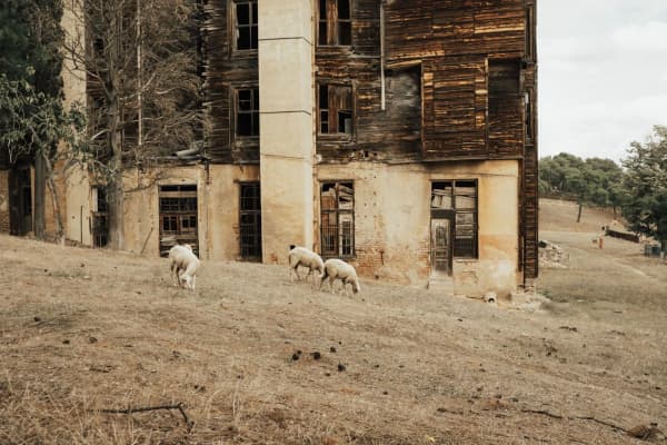
Salem is a town built around a reservoir. In 1851 two Payson men dammed a set of springs at the head of a marshy hollow to save the water for crops, and the settlement that grew up beside the dam was called, simply, Pond Town. The pond is still there, still the center of town, and still where Salem holds its celebrations. On the hill to the east sits the other thing Salem is known for: a mine dug for decades on the strength of a farmer's dreams, which never found ore.
Up the bench to the south, Elk Ridge has a much shorter story. It was a ranch until 1968, a subdivision called Salem Hills until 1976, and a town because Utah County required it to become one once enough people moved in.
Summer Spring and the first dam
The Utah History Encyclopedia says Native people knew the site as Summer Spring. It sat between Peteetneet Creek, where Payson was founded in 1850, and the Spanish Fork River, in the part of the valley the Timpanogos and other Ute bands used long before settlers arrived. Our page on the Timpanogos people of Utah Valley tells their history.
In 1851, David Fairbanks, who was also the bishop over the Peteetneet settlement, and David Crockett found the springs. With help from Payson families who needed farmland, they built a dam to hold back water that otherwise spread out into swamp, and they harvested some crops that year. In 1852 they built a second, stronger dam. A 1938 Daughters of Utah Pioneers marker in Salem says Fairbanks and Crockett "claimed land beside a small stream at the head of Salem Lake and built a dam."
It did not last. By 1853, the encyclopedia says, the families had gone back to Peteetneet and the site was abandoned. That was the year the Walker War began with a killing at the Payson fort, and small outlying places all over the valley were emptied.
Pond Town, 1856
The second settlement came from a town that was failing. In 1856, the encyclopedia says, settlers from Palmyra, a settlement struggling with drought and alkali soil, moved to the pond. George Wilson and his brothers bought the Fairbanks and Crockett interest and moved in with eight other families. The 1938 DUP marker names others who settled Pond Town that year, including Eli Ashcraft, Royal Durfrey, Silas Hillman, Aquilla Hopper, Jacob Killian and Truman Tryon, with Robert Davis and Thomas Killian arriving later in the year, and says they built a fort "for protection from the Indians" measuring 160 feet north to south and 150 feet east to west.
Lyman Curtis came the same year with four of his sons. Curtis, born in 1812, had been a member of Brigham Young's 1847 vanguard company, the first group of Latter-day Saint pioneers to enter the Salt Lake Valley, according to the church's pioneer database. He became the settlement's leading figure.
The houses were built as adjoining adobe "fort homes," and the encyclopedia says residents lived in them until about 1870, when the danger had passed. The town was laid out in five-acre blocks, with homes and barns inside and fields and grazing land outside, and boys herded the town's cattle on common ground.
Pond Town becomes Salem
Pond Town became Salem, and the reason depends on which source you read. The DUP marker says Lyman Curtis renamed the town Salem, meaning "City of Peace." The Utah History Encyclopedia says Salem was named for Curtis's birthplace, to honor what he had done for the community. The two are not incompatible, and neither source gives a year for the change.
Curtis's greatest work was water. The pond alone could not irrigate much, so in the 1860s Salem dug a canal to bring water from the Spanish Fork River. The encyclopedia says the Salem Canal, eight miles long, took about two and a half years to build and was finished in 1869 under Curtis's direction. Two more dams went in over the following years. In 1916 the Strawberry Valley Project brought more water still, part of the federal system that our Strawberry Valley Project history explains.
A farm town of barter and beets
With water, Salem grew wheat and other grains, tomatoes, garden produce and poultry. From 1891, the encyclopedia says, families grew sugar beets for factories around the valley, and schoolboys got a "beet vacation" to help with the harvest. Later, peas went to the Del Monte cannery between Salem and Spanish Fork. Ranchers ran cattle and sheep on grazing permits in the national forest, in Strawberry Valley and on private land in Loafer Canyon.
Cash was scarce for a long time. The church started a cooperative store in the late 1860s that ran on barter until 1897. The Salem Mercantile Company, the "Merc," opened in 1908 under the James Peter Christensen family, took produce in trade, issued its own scrip and stayed open until 1969.
The Salem Ward was organized in 1877, and a red brick meetinghouse was finished in 1898. Salem incorporated as a town in 1886; fourteen boards of trustees and their presidents ran it until 1920, when the first mayor took office.
The Dream Mine
The most famous thing in Salem's hills is a hole in the ground.
John Hyrum Koyle was born in Spanish Fork in 1864 and served a mission in the Southern States. According to the Utah History Encyclopedia entry by historian Jay M. Haymond, in August 1894 he had a dream, repeated three times, of a rich body of ore inside the mountain east of Salem, along with instructions to develop it, with a processing mill and grain storage bins. In 1909 the Koyle Mining Company was formed and sold 114,000 shares at a dollar each.
The church did not support it. Apostle James E. Talmage, a trained geologist, inspected the claims and found no evidence of precious metal, and church leaders spoke against the mine. Koyle, who had become bishop of the Leland Ward near Spanish Fork by 1910, was released. In 1947 he signed a repudiation of his claims and then took it back almost immediately, and he was excommunicated on April 18, 1948. He died in Payson the next year.
The digging went on anyway. Haymond writes that the mine continued intermittently for about 23 more years under Quayle Dixon, and in 1961 the Relief Mine Company replaced the Koyle company and kept up the annual assessment work on the claims. No ore was ever found. The encyclopedia notes that the mine became as closely associated with Salem as the pond. It is private property.
Salem grows
Salem stayed a farm town until the end of the twentieth century. The census counted 4,372 residents in 2000, 6,423 in 2010 and 9,298 in 2020. The pond, now ringed by park land, carries the town's identity as much as ever: Salem Days puts a cardboard boat race on it and fireworks over it each August, and the Water Lantern Festival has been held at Knoll Park on its shore. Our living in Salem guide covers the town today.
Elk Ridge: a ranch, a rule and a vote
Elk Ridge sits on the bench in the foothills between Salem and Payson, and nobody lived there in numbers until the 1970s.
The land was part of the Goosenest Ranch, 1,726.4 acres homesteaded by James Fayette Shuler, according to the city's history. Elk herds wintered on its hillsides. In 1968 a developer, James Winterton, bought part of the ranch from Shuler's heirs and submitted a subdivision plat to Utah County under the name Salem Hills, for the town below it. History To Go adds that Winterton's son helped him develop it.
The county attached a condition. Elk Ridge's history says Utah County approved Salem Hills on the understanding that it would incorporate if its population ever passed 100 permanent residents. It did, and Salem Hills incorporated on December 22, 1976, a date the city and a 1992 Deseret News profile agree on.
The name did not last long. Residents chose Elk Ridge, for the elk on the hillsides and, History To Go says, to stop being confused with Salem. When they chose it is unclear. The Deseret News profile says voters picked the name at incorporation from three options, Elk Ridge, Mount Loafer and Oak Ridge. The city says residents voted in a special election about a year and a half after incorporation. History To Go dates the change to 1978.
Growth was steady and then sudden. The city counts 99 homes and 381 residents in 1980 and 771 people in 167 homes in 1990, which made it the third-fastest-growing place in the county at the time. The city's history says that when Payson built the Gladstan Golf Course next to town in the early 1990s, the publicity ended Elk Ridge's days as the county's "best kept secret." The census counted 1,838 residents in 2000, 2,436 in 2010 and 4,687 in 2020. The city has no commercial businesses of its own, its history notes, though many residents run businesses from home.
See it today
Salem Pond, 259 West Salem Lake Drive. The descendant of the 1851 dam and the reason for the name Pond Town, now a city park with fishing, a playground and a walking path. Google's listing showed it open 5 a.m. to 11 p.m. daily in October 2026. Some of the shoreline across the bridge is private property, so stay on the public side.
The Pond Town Fort marker, 13 South 300 West, Salem. Erected by the Salem Camp of the Daughters of Utah Pioneers in 1938 (marker number 36), with the names of the 1856 settlers and the fort's dimensions.
Main Street and the old highway. The encyclopedia notes that a few of the businesses that grew up along U.S. Highway 91, Salem's old main road, still remain.
The Dream Mine. Visible on the hillside east of Salem, but on private land and not open to the public.
Elk Ridge. No historic buildings survive from the ranch era. The view across the valley from the bench is what drew people here; Payson's Gladstan Golf Course, at 1 Gladstan Drive, sits at the town's edge, and our Utah Valley golf guide covers it.
For the older town both grew out of, read a short history of Payson.
Frequently Asked Questions
Why was Salem called Pond Town?
Why is it called Salem?
When was Salem settled?
When was Salem incorporated?
What is the Dream Mine?
How did Elk Ridge start?
Why was Salem Hills renamed Elk Ridge?
Where can I see Salem's history today?
Sources
The facts in this guide were checked against these sources. Hours, fees and rules change, so confirm anything time-sensitive with the source before you go. How we make Provo.com.
- Dream Mine (Jay M. Haymond, Utah History Encyclopedia), Utah Division of State History, History To Go. Checked October 20, 2026.
- Elk Ridge History, Elk Ridge City. Checked October 20, 2026.
- Utah Division of State History, History To Go: Elk Ridge, Utah Division of State History, History To Go. Checked October 20, 2026.
- Church History Biographical Database: Lyman Curtis, Church History Biographical Database. Checked October 20, 2026.
- Pond Town Fort (DUP marker 36), Historical Marker Database. Checked October 20, 2026.
- Salem Pond listing, Google Places. Checked October 20, 2026.
- Gladstan Golf Course listing, Google Places. Checked October 20, 2026.
- Salem (Utah History Encyclopedia), University of Utah Press / Utah Education Network. Checked October 20, 2026.
- Community profile: Elk Ridge, Deseret News. Checked October 20, 2026.
- 2020, 2010 and 2000 Decennial Census redistricting data (P1), U.S. Census Bureau via USAFacts connector. Checked October 20, 2026.