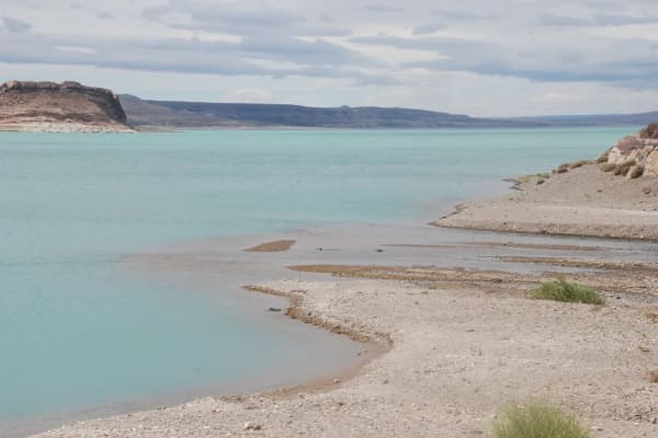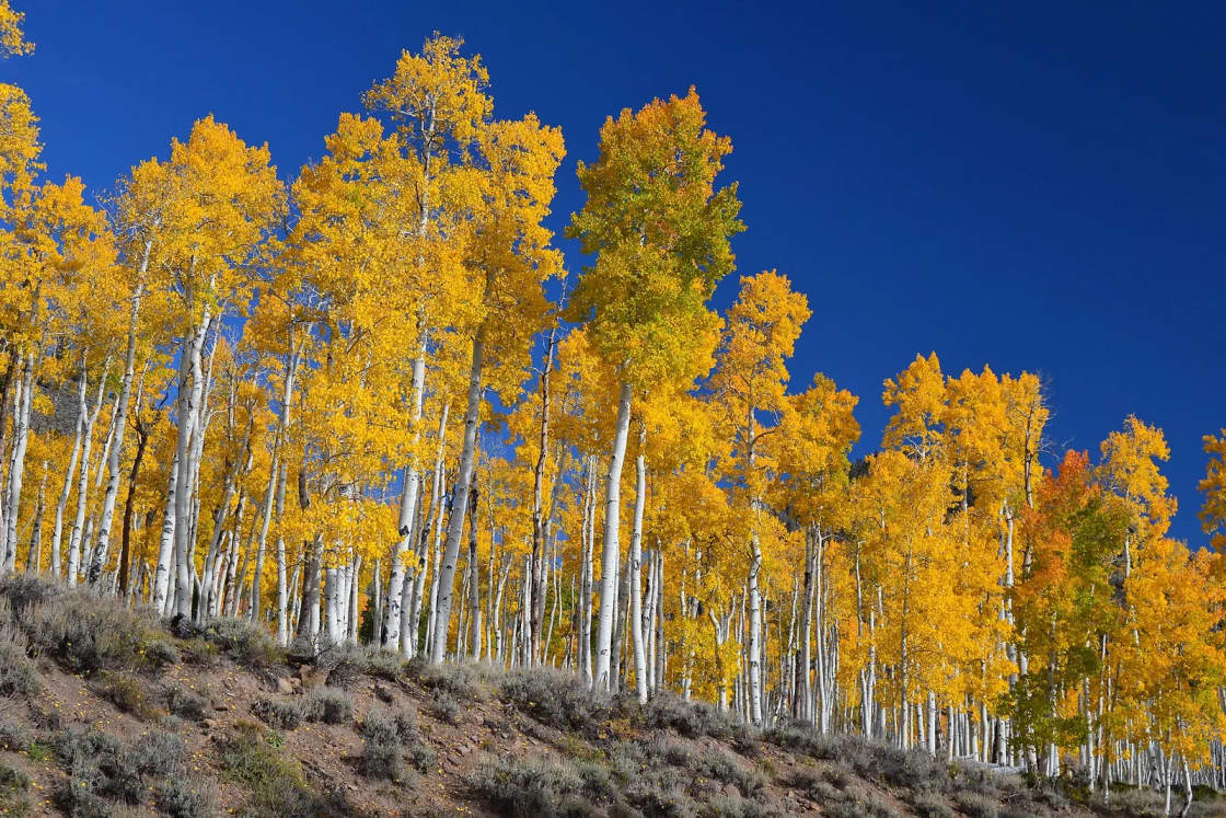

Fish Lake is about 149 miles and just under three hours from downtown Provo, by an OpenStreetMap routing estimate (OSRM, no traffic) from Center Street and University Avenue to Fish Lake Lodge. Pando, the aspen clone that the Forest Service believes is the largest organism ever found, is about one mile southwest of the lake on State Highway 25. You drive through it on the way in. There is no gate and no ticket, and in late October there are very few other people.
The route: I-15 south for about 74 miles, US-50 east toward Salina, State Route 24 south through Sevier County farm country, and then State Route 25 up into the Fish Lake basin for the last eight miles.
What Pando is, in numbers
Here is how the Fishlake National Forest describes it:
- One organism. Pando is a quaking aspen clone that started from a single seed and spreads by sending up new shoots from its expanding root system. Every trunk is genetically the same tree.
- Over 106 acres, with more than 40,000 individual trunks.
- Nearly 13 million pounds, which is why the Forest Service calls it "the largest organism ever found."
- Age: hard to calculate. The Forest Service says it is estimated to have started at the end of the last ice age. Individual trunks are much younger; some are over 130 years old.
- The name is Latin for "I spread." Its nickname, the Trembling Giant, comes from the flattened leaf stems that make aspen leaves flutter in the slightest breeze.
Researchers first recognized it in the 1970s, and geneticists later confirmed it. In 2006 the U.S. Postal Service put it on a stamp as one of the "40 Wonders of America."
Why there are fences in the grove
You will notice fencing around parts of Pando. The reason is the most interesting thing about the place: the clone is declining.
The Forest Service names two causes. The first is a lack of young trees, which it ties to over-browsing by deer and other hoofed animals eating the new shoots before they can grow. The second is insects and disease (bark beetles, root rot, cankers) killing the older trunks. Old trees dying with nothing replacing them means, in the Forest Service's words, "a smaller clone or complete die off" over time.
Foresters have tested ways to stimulate the roots to sprout and set up research plots in every treated area. The nonprofit Friends of Pando partners with the forest on monitoring and restoration and publishes maps and data, including the wildlife-control boundary, on its site. When you walk the grove, the difference between fenced and unfenced ground (young aspen inside, bare understory outside) is the experiment, in plain view.
How to visit without being part of the problem: stay on existing paths, do not carve the bark (aspen scars are permanent and open the tree to disease), and do not climb or prop open fencing.
Fish Lake itself
The Forest Service calls Fish Lake Utah's largest natural mountain lake, covering about 2,500 acres. The campgrounds on the hillside above it sit at about 9,000 feet. Things to know:
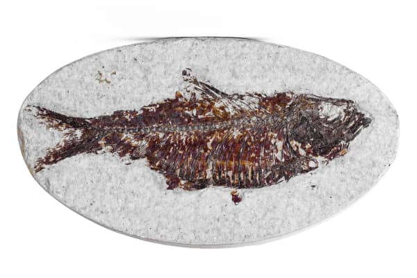
- Fishing: it is famous for Mackinaw (lake trout) in the 20 to 40 pound range, with rainbow trout, splake, perch and kokanee salmon too. Limits and special rules change by year, so read the current Utah fishing guidebook. Our fishing licenses guide explains which license you need and how the 365-day license works.
- The Lakeshore National Recreation Trail runs along the east side of the lake; the Forest Service says hikers get lake views after climbing about 900 feet.
- Pelican Canyon Trail, five miles one way from Bowery Creek Campground, climbs through meadows and spruce, pine and aspen to the 11,633-foot Fish Lake Hightop.
- Boating, canoeing and kayaking are popular in summer. The resorts on the lake, such as Fish Lake Lodge (435-638-1000), run on seasonal schedules, so call ahead before counting on a boat rental, a meal or a room in the off-season.
What is open in late October 2026
| Place | Status | Source |
|---|---|---|
| Pando and SR-25 | Open; no fee listed | Fishlake NF |
| Bowery Creek Campground | Closed for winter, reopens spring 2027 | Fishlake NF |
| Mackinaw Campground | Closed all of 2026 for construction | Fishlake NF |
| Forest fire restrictions | Stage 1 restrictions terminated | Fishlake NF alerts |
The forest's alerts page also listed, in October 2026, a caution about mud and rock slides and downed trees near the Widemouth 2 Fire burn area, and the termination of two fire closure orders. Check the alerts page before you go.
The practical upshot: late October is a day-trip season, not a camping season, at the lake. Bring layers. At this elevation the basin is much colder than Utah Valley, and the first snows come early.
Season by season
Late September to early October is the trip most people picture: the whole basin turns gold, and Pando is the center of it. It is also when the lake is busiest. Our Capitol Reef guide notes that Fish Lake is about 40 minutes off its route and "turns entirely gold in late September," which makes a two-stop fall weekend easy.
Summer is the camping and boating season. Bowery Creek's sites sit on a sagebrush hillside with lake views, flush toilets and drinking water. Half the sites are reservable on Recreation.gov and half are first-come, first-served, which means arriving on a Friday afternoon without a reservation is a gamble. The forest's 16-day stay limit applies. Our camping near Provo guide explains how Recreation.gov windows work.
Late fall (now): quiet, cold, leafless, and a good time to see the structure of the grove, the bark, and the fencing without crowds. Campgrounds are closed.
Winter: the campgrounds are closed and State Route 25 climbs to the lake from the valley floor, so check UDOT road conditions before driving up. If ice fishing is the goal, our ice fishing guide covers the lakes closer to home and the ice safety rules that apply anywhere.
How the day works from Utah Valley
The straightforward day trip:
- Leave Provo by 8 a.m. Fill up and grab food along I-15 or in the Richfield and Salina area; the basin has no full-service town. Mystic Hot Springs in Monroe is near this route; see our hot springs comparison.
- Reach Pando around 11. Park where there is room to pull completely off the highway and walk the grove.
- Lunch at the lake, then the Lakeshore Trail or a slow drive around the basin.
- Leave by 3 or 4 to be home by early evening. In fall, deer are active on rural highways at dusk, which is a real reason to drive the two-lane sections in daylight.
The fall weekend: Fish Lake and Pando on Saturday, then continue down State Route 24 to Torrey and Capitol Reef on Sunday. If the kids want something closer to home on the way back, Yuba State Park is just off I-15 on the drive north.
The color calendar: the aspens above Utah Valley turn earlier than most people expect. Our fall in Provo guide has the local timing; if you miss it at home, the Fish Lake basin is the next place to look.
For more trips at this distance, see day trips from Provo.
Frequently Asked Questions
How far is Fish Lake from Provo?
What is Pando?
Where exactly is Pando?
Does it cost anything to see Pando?
When is the best time to visit Pando?
Are the Fish Lake campgrounds open now?
What fish are in Fish Lake?
Is Fish Lake a day trip from Provo?
Sources
The facts in this guide were checked against these sources. Hours, fees and rules change, so confirm anything time-sensitive with the source before you go. How we make Provo.com.
- USDA Forest Service, Fishlake National Forest: Pando, USDA Forest Service, Fishlake National Forest. Checked October 20, 2026.
- Bowery Creek Campground, USDA Forest Service, Fishlake National Forest. Checked October 20, 2026.
- Mackinaw Campground, USDA Forest Service, Fishlake National Forest. Checked October 20, 2026.
- Alerts and notices, USDA Forest Service, Fishlake National Forest. Checked October 20, 2026.
- Friends of Pando. Checked October 20, 2026.
- OSRM route service (OpenStreetMap data), driving estimates from Center St & University Ave, Provo, Project OSRM. Checked October 20, 2026.
- Google Places listings (coordinates, addresses, hours), Google. Checked October 20, 2026.