
Yuba is the big reservoir most Utah Valley families drive past on the way to St. George. It sits beside I-15 south of Nephi, about 78 minutes from downtown Provo, at roughly 5,100 feet. That is low and southerly for a Utah lake, and the water reflects it: the fish are walleye, pike, catfish and wipers rather than the trout of Strawberry or Scofield, and Juab County's tourism office credits warm summer water for its crowds.
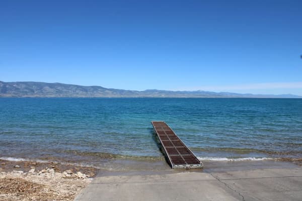
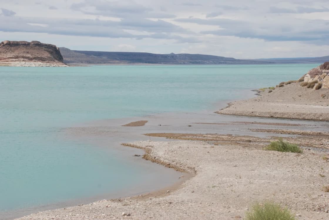
The catch in 2026 is water level. As of October, Utah State Parks reports the reservoir at 18 percent and both main boat ramps closed. Read that section before towing anything.
Getting there
From Provo, the route is almost entirely I-15 south: about 63 miles of interstate past Springville, Payson and Nephi, then a couple of miles of local road to the Oasis area, the park's developed entrance. OpenStreetMap routing (OSRM) puts the drive at about 68 miles and 78 minutes without traffic. Utah State Parks gives the park's address as Levan.
By the same routing, that is about the same time as Scofield (79 minutes) and a little more than the Strawberry visitor center (64 minutes), but with no canyon or mountain pass on the way. In winter, that matters: the road to Yuba is interstate the whole way.
What it costs
From Utah State Parks' Yuba fee page:
| Item | Price |
|---|---|
| Day use, Monday to Thursday | $15 per vehicle (up to 8 people) |
| Day use, Friday to Sunday and holidays | $20 per vehicle |
| Paddleboard rental | $30 for 2 hours, $40 for 4, $60 for longer |
| Dry storage | $5 a day |
The park's hours are 7 a.m. to 10 p.m. Fees apply even when the booth is empty; pay with the envelope at the entrance or the QR code. The page does not list senior or West Beach pricing and suggests calling the park at 435-758-2611.
The water level, and what it closes
Yuba is an irrigation reservoir, and it rises and falls with the farms downstream. In October 2026, the park's page showed:
- Water level: 18 percent.
- Oasis and Painted Rocks boat ramps: closed, "currently inaccessible due to low water levels."
- Water temperature: 65°F.
- Algae: "Looks good!"
So in fall 2026 Yuba is a lake for shore fishing, paddling, camping and walking the exposed shoreline, not for trailered boats. Carry-in kayaks and paddleboards still work. If you are reading this in spring or summer 2027, check the park's current conditions page; a good snow year changes everything about this reservoir.
Why "warm-water" matters
Most of the reservoirs Utah Valley uses are high, cold mountain water. Scofield, for comparison, sits at about 7,600 feet according to Utah State Parks. Yuba is roughly 2,500 feet lower and well south.
That shows up in the fish. Utah State Parks lists Yuba's species as walleye, wipers, northern pike, tiger muskie, perch, catfish and carp, and says fishing is popular year-round. If you have only fished the Provo River and the trout reservoirs, Yuba is where you try a different set of species. Our fishing near Provo guide covers the closer water, and our licenses guide covers what you need before you cast.
For swimmers, Juab County's tourism page and the park both point to sandy beaches and warm summer water.
The four areas
The reservoir is long, and the park is split into separate areas around its shore. Juab County's tourism page describes them this way:
- Oasis: the fully developed campground, with modern restrooms and showers. This is where most first-time visitors go.
- Painted Rocks: a more primitive camping area with restrooms and a boat ramp (closed for low water as of October 2026). Rock art can be seen by boat just north of the ramp.
- North Beach and West Beach: primitive camping areas with restrooms.
Camping and cabins
From the park's fee page:
| Site | Per night |
|---|---|
| Oasis electric sites (1 to 19) | $45 |
| Oasis non-electric sites (20 to 28) | $40 |
| Painted Rocks electric sites | $45 |
| North Beaches campground | $30 per vehicle |
| Eagle View campground | $35 per vehicle |
| Cabins (Walleye and Perch) | $100 |
The park says the two cabins were recently renovated and have heat and air conditioning, which makes them the shoulder-season option. Only one vehicle is allowed per campsite; a second vehicle at Oasis is $25. Group sites at Oasis and Painted Rocks run $200 to $250.
The U.B. Dam
Utah State Parks tells the reservoir's story on its Yuba history page. Local farmers and ranchers had to build the dam themselves, between 1902 and 1917, or risk losing their water rights. The workers called it the "U.B. Dam," and the sound of that name became Yuba. In 1907 heavy snowmelt filled the reservoir faster than the spillway could release it, and members of the Church of Jesus Christ of Latter-day Saints from Deseret, about 40 miles west, blasted a temporary spillway to relieve the pressure on the dam.
The park also notes that visitors may come across rock art, pottery, stone tools and remnants of mining and ranching. The rule is simple: look, photograph, leave it in place, and report finds to Utah State Parks.
Boats and paddleboards: the aquatic invasive species rules
Every launch in Utah, motorized or not, comes with homework. The Division of Wildlife Resources says:
- Anyone launching any watercraft, paddleboards and kayaks included, must complete the annual mussel-aware boater course.
- Motorized boats also pay an annual AIS fee: $20 for residents, $25 for nonresidents.
- Clean, drain and dry every time you leave a waterbody, and pull drain plugs for transport.
- Lake Powell is Utah's only water with confirmed quagga mussels. Boats coming from Powell need a professional decontamination or a dry time of 7 days in summer, 18 in spring and fall and 30 in winter.
Our reservoir roundup covers the inspection and decontamination stations at the busier lakes.
Making a day of it
Yuba is on the way to several things Utah Valley families already drive to:
- Nephi is the last town before the park, home of the Ute Stampede rodeo in the second week of July.
- Mount Nebo and the Nebo Loop Scenic Byway are the high country you pass on the way.
- Mona, on the way back north, has the Mt. Nebo lavender farm, a summer stop.
- The Sanpete County festival circuit is east of the reservoir.
Who Yuba is for
Yuba suits families who want sand and warmer water without a mountain drive, anglers who want walleye and pike, and campers looking for a lake within 90 minutes that is not full of Wasatch Front weekend traffic. It suits boaters less well right now; until the water comes back, the ramps are closed.
For a cold, clear mountain reservoir instead, see Deer Creek and Jordanelle or Strawberry. For every reservoir within two hours and what each is good for, see our full roundup.
Related Guides
- Every reservoir within two hours of Provo
- Scofield Reservoir and the Skyline Drive
- Fishing near Provo
- Boat, jet ski and paddleboard rentals in Utah Valley
- Where to swim in Utah Valley
- Hiking Mount Nebo
Frequently Asked Questions
How far is Yuba State Park from Provo?
How much does it cost to get into Yuba State Park?
Can you launch a boat at Yuba right now?
What fish are in Yuba Lake?
Why is it called Yuba?
Is Yuba good for swimming?
Can you camp at Yuba?
Are there petroglyphs at Yuba?
Sources
The facts in this guide were checked against these sources. Hours, fees and rules change, so confirm anything time-sensitive with the source before you go. How we make Provo.com.
- Yuba State Park, Utah State Parks. Checked October 20, 2026.
- Yuba State Park Fees, Utah State Parks. Checked October 20, 2026.
- Yuba State Park: Discover (history), Utah State Parks. Checked October 20, 2026.
- Boating in Utah in 2026: take the mandatory course, pay the fee, Utah Division of Wildlife Resources. Checked October 20, 2026.
- Scofield State Park (elevation comparison), Utah State Parks. Checked October 20, 2026.
- Yuba State Park, Juab County Travel. Checked October 20, 2026.
- OSRM routing API (OpenStreetMap data), drive times from Center St & University Ave, Provo, Project OSRM / OpenStreetMap contributors. Checked October 20, 2026.