
Two of Utah's most photographed landscapes are white, flat, otherworldly, and constantly confused with each other. Visitors ask for "the salt flats" and mean the lake. They ask about the lake and picture the racing surface from a car advert.
They are different places, roughly 120 miles apart, and they make different days. One is a shrinking inland sea an hour north of Provo, alive with brine shrimp and migrating birds and surrounded by a genuine environmental argument. The other is a hard salt crust in the far west desert that people drive to specifically because there is nothing on it.
Both reward a Utah Valley day trip. Neither rewards showing up without checking conditions first, because both change with the season and one of them closes for weeks at a time.
Lake levels, closure dates, racing schedules and access rules all move. Everything below describes how these places work and what has been published recently; verify current conditions before you drive.
The single fact that sorts the confusion
Both places are leftovers of the same vanished body of water.
Lake Bonneville was an enormous freshwater lake that covered something like a third of what is now Utah during the last ice age. When it drained and evaporated, it left two very different residues behind.
The lowest part of the old basin kept its water and became the Great Salt Lake — a terminal lake, meaning rivers flow in and nothing flows out. Everything that arrives leaves only by evaporation, which is why the salt concentrates.
A western lobe of the old lakebed dried out completely and left a dense salt crust behind. That is Bonneville.
So they are cousins, not the same thing. The lake is water. The flats are ground you can stand on.
The drive to each, honestly
The Great Salt Lake is the easy one. The two most useful access points from Utah Valley are Great Salt Lake State Park near Magna, on the lake's south shore, and the Antelope Island causeway at Syracuse further north. Both are roughly an hour from Provo in decent traffic, entirely on freeway until the last stretch.
The Bonneville Salt Flats are not an afternoon. They sit near Wendover on the Nevada line, about 165 miles from Provo — I-15 north, then I-80 west across the desert. Budget two and a half hours each way and treat five hours of driving as the baseline cost of the day.
The western leg of I-80 is empty. Fuel, water and a working phone charger matter more here than on most Utah drives, and mobile coverage is patchy in stretches.
What the lake is doing right now
This is the part most guides skip, and it is the thing that most changes what you will see.
The Great Salt Lake has been running near historic lows. It closed the 2025 water year at roughly 4,191 feet of elevation in its south arm, one of the lowest year-end readings on record. Readings through 2026 have hovered near that mark, peaking in spring and falling back through the summer as evaporation outruns inflow.
For scale: the level generally described as the minimum healthy elevation is about 4,198 feet. The lake was far higher and larger during the floods of the mid-1980s, and at recent lows it covers a fraction of that area.
State agencies and researchers describe conditions as having stabilized somewhat compared with the steep declines earlier in the decade, helped by water deliveries, changes in water management and causeway operations that control salinity between the lake's two arms. Stabilized is not the same as recovered. Bringing it back to a healthy elevation would take substantially more inflow every year for decades.
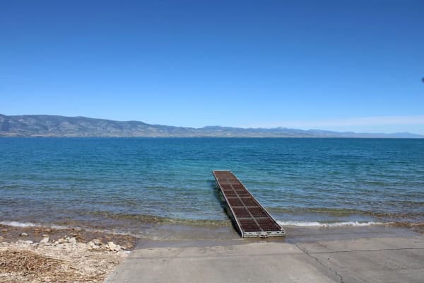
What that means for a visitor is simple and slightly bleak: the shoreline is further out than the map suggests, the exposed lakebed is wide, and places built as marinas sit well back from water.
Where you can reach the water
Great Salt Lake State Park, near Magna on the south shore, is the closest thing to a straightforward lake stop from Utah Valley. It has a marina, a visitor center, restrooms and interpretive material, and it is the standard place people go to look at the lake without committing to a full island day.
Antelope Island, reached by a causeway from Syracuse, is the better destination if you have the time — bison, hiking, a historic ranch and good birding. It carries its own entrance fee that annual passes to other systems generally do not cover, and it has its own seasonal quirks, including biting insects in spring. We have a dedicated guide to that trip.
Stansbury Island, on the lake's south-west side, is quieter, rougher and less developed, with mountain biking and hiking on a network that suits people who would rather not share a trail.
Do not expect a beach day. Swimming in the lake is possible at some access points and is a strange, buoyant, briny experience, but shoreline conditions vary enormously with the level and the mud is deep in places.
The smell, explained properly
The lake's reputation for odor is real but widely misattributed.
Salt does not smell. What produces the periodic sulfurous smell is bacterial activity in decaying organic material in shallow water and shoreline mud, which releases hydrogen sulfide. It is strongest in warm weather, in still or shallow water, and when the breeze is blowing onshore.
Practically: high ground smells less than low muddy shoreline, cooler days smell less than hot ones, and the phenomenon is intermittent rather than constant. Plenty of visitors notice nothing at all.
The brine shrimp and the birds, which are the real story
The lake looks empty and is not.
Its salinity is too high for fish, which is why the food web runs on brine shrimp and brine flies instead. Those support a bird population of global rather than local significance — the lake and its wetlands are a critical stopover on the migratory flyway, drawing millions of birds across the year.
There is also a commercial brine-shrimp harvest, with cysts collected in autumn and winter and sold largely as aquaculture feed. It is a genuine industry built on an animal most visitors never see.
Falling lake levels raise salinity, and rising salinity stresses the shrimp. That is the mechanism behind most of the ecological alarm: it is not the lake disappearing that worries scientists first, it is the food web tipping past what the shrimp can survive.
The dust question, which matters in Utah Valley
This is the part with a direct connection to where you live.
As the lake retreats it exposes lakebed, and exposed lakebed can generate windblown dust. Because that sediment has spent a long time accumulating whatever the watershed carried into it, the composition of the dust — and how much of it reaches populated areas along the Wasatch Front — has become an active area of research and public argument.
You do not need to take a position on it to find it interesting. But it does explain why a lake an hour north of Provo turns up in Utah County conversations about air quality, and why the level has become a political subject rather than a hydrological curiosity.
The Bonneville Salt Flats: what you are visiting
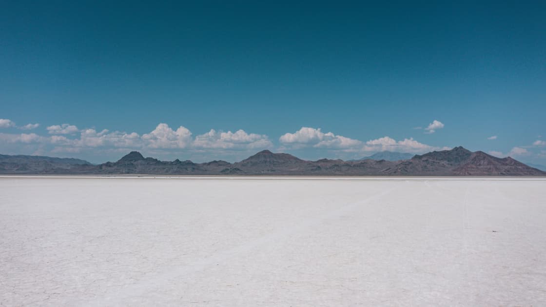
Roughly 30,000 acres of hard white salt crust on the western edge of the old Lake Bonneville basin, about 120 miles west of Salt Lake City in Tooele County. The commonly cited dimensions are around 12 miles long by 5 miles wide.
The BLM manages it as a Special Recreation Management Area and an Area of Critical Environmental Concern, and it is listed on the National Register of Historic Places. Those three designations together are the reason access is more regulated than an empty desert appears to warrant.
The crust is mostly sodium chloride — table salt — over a brine-saturated subsurface. It is bright, disorienting, and in the right light produces the mirror effect that fills photographers' portfolios when a thin film of water sits on top.
When you can drive on it, and when you cannot
This is the single most common trip-ruining mistake.
The salt flats are generally open to the public for recreation, but motor vehicle access is closed seasonally in spring when the salt is moist or standing water is on the surface, with dates varying by year and posted by sign. Driving on wet salt damages the crust and strands vehicles.
Separately, the BLM closes the flats to general access during permitted racing and private events, publishing dated closure windows each year. During those closures, vehicles typically still have access to the paved road and the parking area — so you can look, but you cannot drive out onto the surface.
The practical rule: check the BLM's current status page before you commit five hours of driving to it.
The racing calendar, and why it moves
Land-speed racing is why most people have heard of Bonneville, and the season is a series of separately organized events rather than one meeting.
Recent years have seen a recurring pattern of events across mid-summer into autumn — test-and-tune sessions, a mile event, Speed Week, motorcycle speed trials, a world-of-speed meeting and world finals — each administered under BLM permit with its own closure window. The organizations involved include the Southern California Timing Association, the Utah Salt Flats Racing Association and the East Coast Timing Association.
Dates shift annually. Events have also been canceled outright in past years when the salt was too thin, too rough or too wet to race safely. Do not book a trip around a racing date you have not confirmed with the organizer this season.
The salt crisis, in plain terms
The racing surface has been deteriorating since the 1960s, and the argument about why is long-running and unresolved.
Racers have historically blamed potash mining, which draws brine from the area as part of its extraction process. The mine operator replaces salt under the terms of its BLM permit — reported figures have run into hundreds of thousands of tons in a year — but racers point out that a previous operator voluntarily restored a substantially larger volume annually in the late 1990s, and they want the restoration requirement raised to that older benchmark.
Researchers have suggested the picture is more complicated than mining alone, involving groundwater, climate and the basin's overall water balance.
The cooperative response is the salt laydown program, in which brine is pumped onto the flats during winter and left to add to the crust as temperatures rise and it dries out in late spring. Save the Salt, a coalition of racing and industry groups, works with the BLM and state agencies on restoration, including physical repairs to dikes that were letting brine escape.
The upshot for a visitor: the crust is thinner and rougher than the mythology implies, and that is why access rules are tighter than they used to be.
Photography rules people get wrong
Casual personal photography is fine. Commercial and organized shoots are not automatically fine.
The BLM requires a special recreation or film permit for commercial filming and photography, and for organized events including races, archery competitions and running events. If a shoot involves crew, staging, props or payment, assume a permit is in the conversation rather than assuming it is not.
The other rule is unwritten and matters more: do not drive out onto wet salt for a mirror shot. That is exactly the condition under which the surface is closed, and it is how vehicles end up sunk to the axles far from help.
What to bring to the flats specifically
Sun protection beyond what you would normally pack. A white surface reflects light upward, which burns the underside of a chin, a nose and the backs of arms in ways ordinary shade does not prevent. Sunglasses are not optional in bright conditions.
Water, more than seems necessary. There is no shade and no water source.
Closed shoes you do not mind ruining, because salt is corrosive and unpleasant in sandals.
And a plan for washing the vehicle afterwards if you do drive on the surface. Salt gets into everything underneath a car and does not politely leave.
The other reason to drive to Wendover
If you are giving up five hours to the road, there is a second destination at the end of it that most salt-flats visitors drive straight past, and it is one of the more historically significant sites in the state.
Wendover's main World War II mission was training B-17, B-24 and B-29 bomber crews; the first group arrived in April 1942, and 21 bombardment groups trained there. The 509th Composite Group, under Colonel Paul Tibbets, was activated on December 17, 1944 as the first unit organized and trained expressly for atomic warfare, and it flew the atomic missions against Japan from Tinian in August 1945.
The isolation was the point. Crews practiced dropping a single weapon with precision and then executing a sharp turn away from the blast, using inert practice bombs nicknamed pumpkins.
What survives is unusual. The base is listed on the National Register of Historic Places, and some of the original buildings still stand, including the B-29 hangar associated with the Enola Gay.
After the war the base was deactivated and reactivated several times, renamed Decker Field and declared surplus; the General Services Administration deeded the runways, hangars and other buildings to the town of Wendover in 1977, and the Air Force relinquished what remained in 1992. Tooele County agreed in 1998 to back the airport's redevelopment, and a museum now runs tours of the restored structures.
For a Utah Valley family, this converts an exhausting drive into a genuine day: the salt in the morning light, the airfield in the afternoon. Confirm current hours and tour availability before you plan around it.
The state line, and what Wendover is
Wendover is two towns with one name and two sets of rules.
Wendover, Utah and West Wendover, Nevada sit against each other on the border. The Nevada side has the casinos, most of the hotel capacity and a different time zone observance in practice — West Wendover operates on Mountain time with the Utah side rather than Pacific time with the rest of Nevada, which trips up visitors who assume the state line moves the clock.
For trip planning this mostly means lodging is easier to find than the map suggests, and that an overnight rather than a round trip is a reasonable option if you want the flats at both ends of the day. It also means the drive home is a full two and a half hours from a town where it is easy to stay up later than you intended.
Two itineraries that work from Provo
The lake day. Leave Utah Valley mid-morning, drive an hour north, spend the day on Antelope Island or at the state park, and be home for dinner. This works nearly year-round and suits families, birders and anyone wanting a half-day rather than an expedition.
The salt flats day. Leave early — early. Drive I-15 to I-80 and west to the Wendover exit. Stop at the flats, allow time for the light, and either turn around or stay the night in Wendover and come back the next morning. The one-day version is a long day of driving for a short visit, and people routinely underestimate how tiring the western I-80 stretch is on the return leg.
Trying to fold both into a single outing produces a day in which you mostly see the inside of a car.
The short version
The Great Salt Lake is close, complicated and important, and it is at a moment in its history worth seeing and understanding rather than photographing and leaving. Go with the level in mind, expect the shoreline to be further out than you pictured, and give Antelope Island the time it deserves rather than treating the lake as a roadside stop.
The Bonneville Salt Flats are far, strange and heavily conditional. Check the closure status, respect the seasonal driving ban, and accept that the crust is a managed and contested surface rather than a limitless empty plain.
Neither is a spontaneous trip. Both are better for ten minutes of checking before you leave.
Related Guides
- Antelope Island from Provo: The Bison, the Causeway Fee Your Pass Does Not Cover, and When the Gnats Win
- Best Day Trips from Provo, Utah (2026)
- Utah Lake: The Complete Guide (2026)
- Logan and Cache Valley from Provo: The Other College Valley
- Ogden From Provo: 25th Street, the Dinosaur Park and the Mountain Behind It All
Frequently Asked Questions
How far are the Bonneville Salt Flats from Provo?
Can you drive on the Bonneville Salt Flats?
How far is the Great Salt Lake from Provo?
How low is the Great Salt Lake right now?
Does the Great Salt Lake really smell?
Are the salt flats and the Great Salt Lake the same thing?
When is Speed Week at Bonneville?
Can you combine both in one day from Provo?
Sources
The facts in this guide were checked against these sources. Hours, fees and rules change, so confirm anything time-sensitive with the source before you go. How we make Provo.com.
- Bonneville Salt Flats, Bureau of Land Management. Checked October 12, 2026.
- From the Atomic Age to War Games, Utah Division of State History (History to Go). Checked October 12, 2026.
- Wendover Air Force Base, National Park Service. Checked October 12, 2026.