
More on The South Valley: every guide we have published there, in one place.
Head west out of Santaquin on US-6 and the landscape changes fast. The orchards give way to open valley, then the road climbs into the East Tintic Mountains and the hillsides start showing yellow streaks where the cut exposes altered rock.
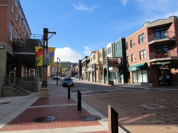
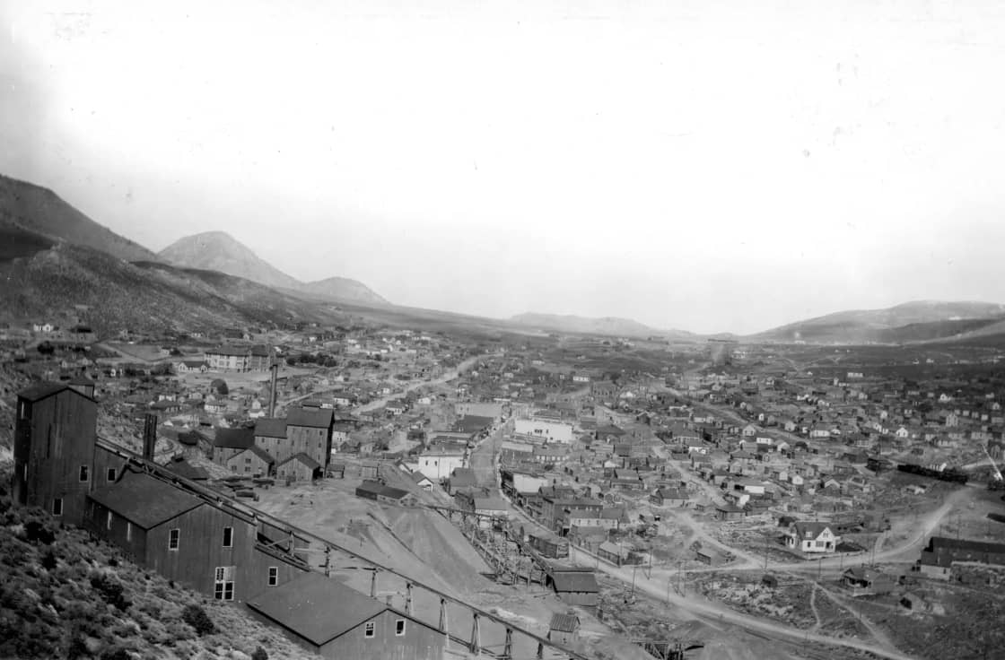
Twenty miles in, you arrive somewhere strange: a main street of two-story stone and masonry buildings, most of them empty, strung along a gulch, with houses climbing the slopes on either side. This is Eureka, and for a few decades around the turn of the twentieth century it was one of the largest cities in Utah.
It is a superb day trip from Utah Valley. It is also a place where the standard travel-blog framing gets two important things wrong.
Correction one: Eureka is not a ghost town
Nearly every listicle that mentions Eureka files it under ghost towns. It is not one.
Eureka is an incorporated Utah city with a functioning mayor's office and city council, a population of several hundred, schools, youth sports, several congregations, and civic organizations.
What Eureka is, is small — a fraction of a town that once counted itself among Utah's largest, in a district that once supported several thousand people. The empty storefronts are real. The abandonment is not.
This matters practically, not just pedantically. Visitors who arrive believing a place is abandoned behave differently in it. People live in these houses. Photograph the buildings, not through the windows.
Correction two: the lead
This is the fact that almost never appears alongside the photogenic headframes, and it is the one that should change how you visit.
In 2002, after finding high lead and arsenic in soil and elevated blood-lead levels in children, the Environmental Protection Agency placed Eureka on the Superfund National Priorities List. The cleanup ran from 2001 to 2010 and removed contamination from more than 700 residential and commercial properties, excavating and replacing yards, with crushed limestone rip-rap hauled in to cap tailings piles and stop wind and water carrying contaminated dust further.
That work was done, and Eureka today is a remediated town rather than an active hazard. But the contamination was a district-wide legacy, not a town-specific one, and tailings remain across the wider Tintic area outside the cleanup footprint. Exploratory work in the district has at times re-exposed tailings that had settled.
None of this makes the area off-limits. It makes it a place where you keep to roads and public areas, do not dig, do not collect soil or tailings as souvenirs, and wash hands and boots afterward — and where you supervise children rather than letting them play in loose ground.
What the district was
The Tintic Mining District dates to 1869, when a cowboy named George Rust found silver ore while returning from prospecting in the nearby mountains.
The name comes from Chief Tintic, a Ute leader who in the 1850s used the canyons here to evade a US posse and was never caught.
What followed was a classic western rush, and an unusually durable one. Tintic went on to rank among the most productive historic metal districts in Utah — second only to Bingham by most accounts — producing silver, gold, lead, copper and zinc across the better part of a century. Production shifted after 1879 from surface workings to deep mining, which required corporate capital and produced the large consolidated operations that dominated the district thereafter.
Circulating figures for total production vary wildly and some of them are plainly garbled — you will see aggregate claims quoted in tons that are almost certainly meant to be dollars. Treat any single headline number you find with suspicion; the district's significance does not depend on it.
The towns, and what survives of each
Eureka is the living one, described above, and the anchor of any visit.
Mammoth sits a couple of miles east off US-6 up an alluvial fan, and is the ambiguous case. A large mid-century fire station is the most substantial building left; there is a stone monument marking the site of the old Tintic hospital, on ground that is otherwise bare; and a scattering of cabins remain, some occupied and some not. The Mammoth mine was found just over the hill from Eureka as the early rush unfolded.
Silver City was one of the earliest camps of the district. Very little stands now.
Diamond, Knightsville, Homansville, Dividend and Ironton are gone as settlements, surviving mostly as names, foundations and locations on a map.
The Provo connection: Knightsville
If you have read about Provo's early industry, the name Knightsville should register.
Jesse Knight made his fortune in this district, and the settlement of Knightsville carried his name. That money went on to fund a great deal in Utah County — buildings at Brigham Young University among them.
So there is a direct financial line from these hillsides to downtown Provo, and it is one of the more satisfying threads in Utah County history. Our guide to the Provo Woolen Mills picks it up at the other end.
The mines closed, and then did not stay closed
The historic mining era wound down over the twentieth century, and the Superfund listing in 2002 was the accounting for it.
But the district has not been written off. Mining interests have worked in recent years toward restarting production in the Tintic, and the geology that made it rich has not gone anywhere. If you visit expecting a purely historical landscape, note that some activity in the district is contemporary rather than archival, and that access to particular ground can change.
Getting there and the fuel rule
From Utah Valley: I-15 to the Santaquin exit, then west on US-6 for about twenty miles, through Genola, Goshen and Elberta.
The advice repeated by Santaquin's own tourism material is worth taking literally: only limited services exist west of Santaquin. Fuel up, buy water and food, and use a restroom before you head out. Cell coverage is patchy in the canyons.
This is not remote country by Utah standards, but it is empty enough that a casual assumption about finding a shop will be wrong.
What to do when you arrive
A realistic half-day itinerary:
Drive the length of Eureka's main street first, slowly. It takes under ten minutes end to end and it orients you. The historic commercial buildings, the city hall dating from the 1890s, and the surrounding headframes are all visible from the road.
Visit the Tintic Mining Museum if it is open. Confirm hours in advance — small-town museums run limited and often seasonal schedules, frequently with volunteer staffing.
Look at the headframes. The surviving mine structures on the hillsides are the district's signature image and the reason photographers come.
Detour to Mammoth, a short drive east off the highway, for the most legible remains outside Eureka.
Note the geology. The yellow-streaked alterations in the road cuts are the surface expression of the hydrothermal activity that put metal in these hills. Once someone points them out you cannot stop seeing them.
Two things to skip
Do not enter mine workings. Abandoned mines are hazardous in ways that are not visible from the entrance — rotten timbering, concealed vertical shafts, and oxygen-depleted or contaminated air. Utah operates a long-running program to close hazardous openings statewide precisely because this kills people. Nothing underground here is worth it, and everything photogenic is above ground.
Do not collect. Rockhounding happens in the broader region, but casual souvenir-taking of soil, tailings or ore from a district with a lead contamination history is a bad idea to bring home in a car with children in it. Buy a specimen from a shop if you want one.
The Tintic Standard Reduction Mill
Worth knowing about because it is often confused with the district proper.
The Tintic Standard Reduction Mill ruins sit on the Utah County side, near Goshen, on the way out from Santaquin — a large terraced concrete structure built to process ore from the district. It is the most dramatic single ruin associated with Tintic and it is not in the Tintic Mountains at all.
Access status for the mill site has varied over the years and it sits on private ground, so check current rules before planning to walk it. Our guide to Utah County's small towns covers Goshen and the rest of the south-county route.
Why a reduction mill was thirty miles from the mines
This is the question the Goshen ruin raises, and answering it explains the whole industrial geography of the district.
Ore as it comes out of the ground is mostly worthless rock. Before it can be smelted it has to be concentrated — crushed, then separated so that the metal-bearing fraction is divided from the waste. That process needs three things the Tintic Mountains are short of: water in quantity, flat ground for large terraced structures, and a rail connection to move concentrate onward.
So the pattern across the West is mines in the hills and mills in the valley, connected by rail. The arrival of rail is what converted Tintic from a promising district into a producing one — because it made shipping ore economic.
It also explains the tailings. Milling concentrates metal and leaves behind enormous volumes of finely ground waste rock, which is precisely the material that later became a contamination problem. The piles are not mine spoil; they are mill residue, ground fine enough to blow.
The labor history is worth knowing
Tintic was a working district, and it behaved like one.
The district saw strikes and the mutual aid of a mining town, with congregations and neighbors pulling together in hard years, and local histories of Tintic are full of both. Those stories are the reason to think of Tintic as a community rather than a set of holes in the ground, and they are the part of its history that the empty storefronts do not convey.
What the empty buildings tell you
The thing that lingers after a visit to Eureka is the mismatch of scale.
The commercial buildings on the main street were built for a town many times the size of the one that lives there now — two-story masonry with the ambition of permanence, put up by people who assumed the ore would hold out. A city hall from the 1890s. Church buildings sized for full congregations.
Mining towns are built on a resource with a fixed quantity, and everybody involved knows it in the abstract while building as though they do not. That tension is legible in the architecture, and it is more interesting than any single artifact in the museum.
Utah Valley's current growth is happening on top of a different economic base, but the district an hour to the southwest is a useful reminder that the valley's history includes places that bet on one thing and were left holding the buildings.
What to pair it with
Little Sahara Recreation Area lies southwest and is the largest recreation draw in the region — sand dunes and off-highway vehicle terrain, managed by the Bureau of Land Management. It is a substantial destination in its own right rather than an add-on.
The orchard belt around Santaquin and Payson is directly on the route, and in late summer and autumn the fruit stands are open on the way home. Our guide to u-pick orchards around Santaquin and Payson covers the timing.
That pairing — mining ruins in the morning, peaches on the way back — is the trip most Utah Valley families would enjoy, and it turns a somewhat austere destination into a good day out.
When to go
Spring and autumn are best. Summer in the West Desert fringe is hot and exposed, with essentially no shade in the townsites, and midday light flattens the photographs everyone comes for.
Winter can be atmospheric but the side roads to Mammoth and the outlying sites are unmaintained in places, and a passenger car is a poor choice after snow.
Autumn has the additional advantage of the orchard timing on the return leg, which is the argument for a September or October trip over any other.
What to bring
Short list, shaped by the specific conditions rather than generic day-trip advice:
- Water and food from Santaquin. Repeating this because it is the mistake people make.
- Full tank. The nearest reliable fuel is behind you.
- Closed shoes, not sandals. Loose ground, broken glass, old metal.
- Hand wipes or water for washing, used before anyone eats. This is the lead precaution and it costs nothing.
- A paper map or downloaded offline map. Coverage is inconsistent in the canyons and the side roads are poorly signed.
- A real camera if you have one. The headframes and the empty street are the reason to come, and phone cameras struggle with the contrast on a bright day.
Leave the metal detector and the shovel at home. Beyond the contamination question, collecting on claims and private ground in an active mining district is a legal problem as well as a health one.
Roads, vehicles and seasons
US-6 is a paved, maintained state highway all the way through, and any car will manage the main route to Eureka in ordinary conditions.
The side roads are the variable. The spur to Mammoth is short and generally passable, but the tracks running out to the more remote townsites and workings are unmaintained, and a low-clearance car is the wrong tool after rain or snow. If you are not confident about a road, the honest answer is that the marginal payoff of reaching one more foundation is small.
Winter closes nothing officially but changes everything practically. Summer is hot and shadeless. The recommendation stands: go in spring or autumn.
The honest assessment
This is a rewarding day trip for people who like history, industrial landscapes and empty country. It is a poor one for people who want attractions.
There is no visitor center with an interpretive film, no restored streetscape, no reconstructed mine tour. There is a small museum with limited hours, a real town that is quietly getting on with itself, some dramatic remains on the hillsides, and a great deal of open ground.
Go for the landscape and the story, keep your hands out of the dirt, and stop for fruit on the way back. Our guides to day trips from Provo and haunted places in Utah Valley cover the wider set of options, the second of which deals with Thistle — a different and much closer Utah County ghost town with an entirely different cause of death.
Related Guides
Frequently Asked Questions
How far is Eureka from Provo?
Is Eureka, Utah a ghost town?
Which Tintic towns are ghost towns?
Is it safe to visit the Tintic mining district?
When was silver discovered in the Tintic district?
Can you go inside the old mines at Tintic?
Is there a museum in Eureka?
What else is nearby to combine with a Tintic trip?
Sources
The facts in this guide were checked against these sources. Hours, fees and rules change, so confirm anything time-sensitive with the source before you go. How we make Provo.com.
- Eureka Mills Superfund Site Profile, U.S. Environmental Protection Agency. Checked October 12, 2026.
- Superfund Sites in Reuse in Utah, U.S. Environmental Protection Agency. Checked October 12, 2026.
- Tintic Mining District - National Historic Area, Santaquin City. Checked October 12, 2026.
- Osisko Development Corp. Exhibit 99.2 (technical report), U.S. Securities and Exchange Commission (EDGAR). Checked October 12, 2026.