Corona Arch is the hike on Potash Road that people from Utah Valley tend to hear about after their first Moab trip. It sits on Bureau of Land Management land about 10 miles down State Route 279, outside Arches National Park, and it costs nothing to walk. The BLM calls it a moderately strenuous 3-mile round trip with "mild exposure to heights" in a few places, helped along by fixed cables and a short ladder. The route also crosses a working rail line within the first few minutes. Those three features, the railroad, the cables and the ladder, decide whether this is the right walk for your group, and this guide covers each one using what the BLM, the Moab Area Travel Council, Visit Utah and the National Park Service publish.
For the larger trip, including the drive and how Arches and Canyonlands fit together, start with our Moab from Provo guide. This page is the detail on one trail.
| Item | Detail | Source |
|---|---|---|
| Managing agency | BLM Moab Field Office | BLM |
| Round-trip distance | 3 miles | BLM |
| Time | About 2 hours | BLM visitor guide |
| Difficulty | Moderately strenuous | BLM |
| Elevation gain | 250 feet (Visit Utah); 459 feet (Discover Moab) | Visit Utah, Discover Moab |
| Trailhead | North side of SR-279, about 10 miles from US-191 | BLM |
| Fee | None to hike | BLM |
| Hazards | Railroad crossing, two cables, short ladder, drop-offs | BLM, Visit Utah |
| Arch opening | 140 feet by 105 feet | Visit Utah, Discover Moab |
| Trail use | More than 80,000 hikers a year | BLM |
| BLM Moab office | 435-259-2100 | BLM |
The drive from Provo
An OpenStreetMap routing estimate (OSRM) puts the Corona Arch trailhead about 196 miles from downtown Provo, a little over four hours of driving without stops or traffic. The route is the same one our Moab guide describes: US-6 southeast from Spanish Fork through Spanish Fork Canyon and Price, east on I-70 past Green River, then south on US-191 toward Moab.
The useful detail for anyone coming from the north is that Potash Road leaves US-191 before you reach town. Discover Moab places the SR-279 junction 4.1 miles north of Moab. The BLM's directions are written from Moab ("take US-191 north for 4 miles, then turn left onto UT-279"), so drivers arriving from Provo make the same turn in the opposite direction, to the right, before crossing the Colorado River into town. From the junction, Discover Moab lists the Corona and Bowtie arches trailhead at mile 9.9, and the BLM says parking and the trailhead are on the north side of the highway.
Moab is not a day trip from Utah Valley, and a two-hour hike does not change that math. Because the trailhead is on your way in and out, the hike fits best on the morning you arrive or the morning you leave. A morning hike on the way home, followed by the petroglyphs and dinosaur tracks described below, puts you back on US-191 northbound with daylight left for US-6.
Our Moab guide covers the US-6 drive and its reputation in detail. Check road conditions before leaving with UDOT's traffic site at udottraffic.utah.gov, which carries incidents, road weather forecasts and cameras. SR-279 itself is a paved state highway, and the Grand County scenic byway plan describes it as running 17 miles from US-191 to the Intrepid Potash plant.
Potash Road and the trailhead
State Route 279 carries the name Potash–Lower Colorado River Scenic Byway. Grand County's scenic byways corridor management plan describes the road squeezed between the Colorado River and sandstone cliffs, past climbing walls locally called Wall Street and the "impressive slickrock mound known as Amasa Back," with the trail to "Corona Arch and Bowtie Arch" and Gold Bar Campground just beyond.
The trailhead lot is on the north side of the road, according to the BLM. Gold Bar Recreation Site, a BLM campground and river takeout, is across the highway. The BLM's Gold Bar page lists 9 individual first-come sites and 4 reservable group sites, with vault toilets, fire grates and picnic tables, and states that there is no water. If you need a restroom, that is the closest one listed by the BLM; if you need water, bring it from town.
The BLM's directions say nothing about lot capacity, and the agency's general advice in its Moab visitor guide applies here: if trailhead parking is full, pick another trail or come back later. Grand County's byway plan describes this stretch of highway as squeezed between the river and the cliffs, so do not improvise parking on the shoulder.
The railroad crossing
The rail crossing comes almost immediately. The BLM's route description starts this way: register at the visitor register box near the railroad, then cross the railroad track. Visit Utah places the crossing about 0.1 mile from the trailhead and says the trains haul potash from the nearby mine. Grand County's byway plan identifies the line along SR-279 as the Union Pacific railroad, which runs between the river and the cliffs past Gold Bar toward the Intrepid Potash operation at the end of the road. The Grand Canyon Trust's trail description notes the tracks serve "a large potash mine a few miles down the Colorado River."
None of the official sources consulted for this guide publish a train schedule for this line, and a schedule would not make the crossing safe anyway. Treat the track as active every time you cross it, in both directions.
Operation Lifesaver, the national rail safety nonprofit, publishes track safety basics that apply here:
- Trains always have the right of way. The group says trains have the right of way "100% of the time over pedestrians and vehicles."
- Tracks are private property. Operation Lifesaver says all train tracks are private property and that walking on or beside them is illegal trespass. It advises crossing only at designated crossings. On this trail, that means crossing where the BLM route crosses and moving on, not walking the rails or stopping on the ties for photos.
- Trains are quieter and faster than you think. The group says the average freight train at 55 mph needs more than a mile to stop, and that trains do not run on schedules.
- Cut the distractions. Operation Lifesaver advises against texting, headphones or anything else that would keep you from hearing an approaching train.
For families, the practical version is simple: stop everyone short of the rails, look and listen both ways, cross together, and do not let children run ahead on this stretch. Make the same stop on the way back, when people are tired and the parking lot is in sight. Sign the BLM register on the way up.
The trail before the cables
Past the tracks, the BLM says the route follows an old roadbed up through a gap in the rim, then follows cairns up a wash, crosses a low sandy pass and runs along the base of the cliff to the first safety cable. Discover Moab's trail listing adds that cairns and painted dashes mark the route across the slickrock.
Stay on that marked line. The BLM asks hikers to stay precisely on the trail, and its visitor guide explains why the cairns matter: they are built by rangers to keep hikers on route, and the guide says visitors have "gotten lost, injured, and died due to following false rock cairns." Do not build new stacks or add to existing ones.
The Grand Canyon Trust's description points out rounded, multicolored river cobbles scattered across the slickrock, deposited when the Colorado River ran at a higher level. The arch itself sits in a bowl carved from Navajo Sandstone.
Pinto Arch, early on
Two smaller arches come before Corona, and they are easy to miss if you are watching your feet. Visit Utah describes Pinto Arch as a pothole arch visible high on the canyon rim to the left early in the hike. The Grand Canyon Trust says it sits in the wall of a large bowl on the left side and can be hard to pick out depending on the light, because the opening shows sandstone behind it rather than sky.
The BLM's own pages do not name Pinto Arch, and Discover Moab mentions a "Goldbar Arch" instead, so names vary depending on the source. Pinto is a view from the trail, not a destination; there is no official spur to it.
The first cable
The BLM's description is short: follow the cliff base "to the first safety cable and then the second." Visit Utah gives more detail, describing a long cable anchored to posts at about 0.7 mile, just before the first view of Corona Arch. The Grand Canyon Trust calls it a handrail across a steep section of slickrock.
This cable is where the decision belongs. Visit Utah suggests stopping after the first cable if you are uneasy about heights or unsure of your footing, and Discover Moab notes that hikers who skip the cables can still see the arch from a viewpoint. The first full view of Corona Arch comes after this cable, so a group that turns around here has still seen what most people came to see.
How to use the cable well:
- Keep one hand on it and your weight over your feet. The cable is there for balance, not to haul yourself along.
- Let one person at a time move along each span between posts, so a slip by one hiker does not pull on another.
- Wait at either end for oncoming hikers rather than trying to pass on the slope. With more than 80,000 hikers a year, according to the BLM, you will often meet people here on a weekend.
- Wear shoes with grippy soles, and brush loose sand off your soles before you start across.
The second cable, the cut steps and the ladder
After the first cable, the route climbs. The BLM says the second cable comes next and then a short ladder "climbs over a small ledge," after which it is "an easy walk on the slickrock bench to the arch." Visit Utah describes the second cable running beside steps chopped into a sandstone slab, followed by a five-step metal ladder. The Grand Canyon Trust adds that the ladder reaches a broad ledge that wraps around the bowl to Corona Arch.
The BLM's Moab visitor guide is blunt about this section: the two safety cables with steps cut into the rock "may be difficult for some hikers and be impassible for dogs."
This is the stretch that sorts people. A few things to plan for:
- Plan the descent too. You will come back down the same ladder, steps and cable. Face the rock on the ladder going down, and keep a hand on the cable.
- Free your hands. Put phones, water bottles and trekking poles away before the steps. A small pack is easier than carrying anything.
- Children need a spotter. An adult below a child on the steps and ladder is safer than one above.
- Wet, sandy or icy steps are a reason to stop. The cut steps and the ladder rungs are where frost, snowmelt or blown sand do the most harm.
Once you are above the ladder, the BLM describes the rest as easy walking on the slickrock bench. Visit Utah warns that the trail passes numerous drop-offs and to watch children, and that warning applies on the bench as much as on the cables. None of the sources describe railings at the edges.
Bowtie Arch and Corona Arch
Bowtie Arch is close to the end of the hike. Visit Utah describes it as a pothole arch towering above the trail on the left. The Grand Canyon Trust explains how it formed: water percolated down through the sandstone above an alcove, so the opening is in the roof and the front of the alcove forms the arch. The same source notes a small "hanging garden" fed by seeping water, and says the trail passes almost under it.
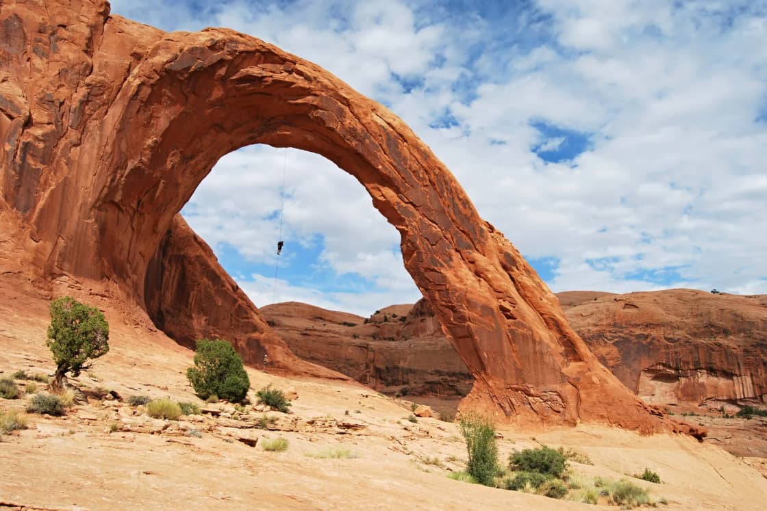
Corona Arch is the large one. Visit Utah and Discover Moab both list the opening at about 140 by 105 feet, and Visit Utah says the arch is also called Little Rainbow Bridge. Grand County's byway plan uses the same 140-by-105-foot figure.
Rope use at Corona Arch is restricted by federal rule. A BLM press release dated Nov. 5, 2015, says the BLM acquired the arch from the State of Utah in 2014 and that a temporary restriction on roped activities had been in place since early 2015. The BLM's current trail page says a rule restricting roped activities at Corona Arch was published in the Federal Register in July 2017, after several years of outreach and environmental review, to reduce resource damage and user conflicts and provide "a quieter, more family friendly experience." The 2015 proposal covered ziplining, highlining, slacklining, climbing, rappelling and rope swinging. The BLM also designated the trail a National Recreation Trail on May 30, 2018.
Under the arch, do not carve, chalk or scratch anything. The BLM's visitor guide says vandalizing natural and cultural features is a crime punishable by fines and jail time.
Distance and elevation, and why the numbers differ
The BLM is the land manager, so its figure is the one to plan around: a 3-mile round trip, rated moderately strenuous, with about 2 hours of hiking time in the visitor guide. The BLM's trail page does not list an elevation gain.
Other pages disagree. Visit Utah lists 3 miles and 250 feet of gain. A Discover Moab trail listing shows 2.3 miles and 459 feet, though its main Corona Arch page says 3 miles and "at least 2 hours." The Grand Canyon Trust gives 3 miles with a high point of 4,400 feet and a low of 4,000. None of the sources explain the difference. For planning, assume 3 miles and a few hundred feet of climbing, and budget more than 2 hours if your group is slow on the cables.
Dogs on the trail
Dogs are allowed. Visit Utah lists the trail as dog friendly, Discover Moab says leashed pets are allowed, and the BLM's visitor guide says pets must be leashed or under voice command at all times and that owners must pick up after them.
The harder question is the steps. The same BLM guide says the cables and cut steps on this trail "may be impassible for dogs." A ladder is not something most dogs can climb. If your dog is too big to lift safely up and down the steps and ladder, turn around at the first cable view or choose another trail. Our dog-friendly hikes near Provo guide has options closer to home.
The BLM's pet safety notes apply strongly here: desert heat is deadly for dogs, carry water for them, never leave them in a hot car, and test the rock with your hand. If you cannot comfortably keep your hand on the surface, the BLM says, it is too hot for a dog's paws.
Fees and rules
The BLM says there is no fee to hike the trail, and because Corona Arch is on BLM land rather than inside Arches National Park, no park pass or park entry rule applies. The rules on the BLM trail page are short: stay precisely on the trail, pick up litter, and no roped activities at the arch. The BLM's visitor guide adds that all human and pet waste should be packed out in an approved bag. Camping at Gold Bar across the road is separate, at $20 per site per night at a self-service fee station, with group sites reserved through Recreation.gov.
November and winter conditions
November is a reasonable month for this hike, with two cautions: ice and daylight.
The National Park Service's almanac for nearby Arches National Park lists an average November high of 56 degrees Fahrenheit and an average low of 30. December averages drop to 45 and 23. Those averages mean below-freezing mornings are normal, and shaded rock along the cliff base can hold frost or snowmelt long after the sun has warmed the open slickrock.
The Park Service warns that "even small amounts of snow or ice can make local trails and roads impassable." On Corona Arch, the places where that matters are the cable sections, the cut steps and the ladder. A thin glaze there is a reason to stop at the first view and turn around. None of the sources consulted describe winter conditions on those specific features. If there has been recent snow or rain, call the BLM Moab Field Office at 435-259-2100 before driving out.
Short days are the other limit. This late in the year, sunset comes early in Moab, and the trailhead is more than four hours from Provo. A group that leaves Provo in the morning, stops in Green River and reaches Potash Road at midafternoon may be coming down the ladder close to dusk. Check sunset time for your date before you go, start the hike with at least three hours of light to spare, and carry a headlamp in case the cables take longer than planned. Coming down slick steps in the dark is the scenario to avoid.
Heat and water the rest of the year
Summer is the opposite problem. The Park Service almanac lists an average July high of 100 degrees, with 16 days above 100 in an average July, and warns that summer temperatures often make strenuous exercise difficult. The BLM's trail page notes the lack of shade, and Visit Utah says there is little shade except under overhanging cliffs in late afternoon. Discover Moab and the BLM's visitor guide both recommend hiking early or late in the hot months.
The BLM visitor guide recommends drinking at least one gallon (four liters) of water per day in the desert and carrying salty snacks on local trails. There is no water at the trailhead, and the BLM says there is none at Gold Bar Campground either.
Late summer brings a different risk. The Park Service notes that the monsoon season brings "violent storm cells which often cause flash floods," and the BLM visitor guide warns that flash flooding and lightning can be deadly. The route follows a wash for part of its length and crosses open slickrock; if storms are building, wait them out or come back another day.
Who should skip it, or stop at the first cable
The BLM rates this trail moderately strenuous and calls the exposure mild. Still, it is not the right hike for everyone in a mixed group:
- People with a real fear of heights. The cables are there because of exposure. Visit Utah's suggestion is to stop after the first cable if you are uneasy.
- Hikers with balance or knee problems. The BLM says the cables and cut steps may be difficult for some hikers, and you descend the same way you came up.
- Toddlers and young children who cannot be held or kept within reach. Visit Utah warns of numerous drop-offs. An adult spotter on the steps matters for older children too. For younger kids, our hikes for kids under 8 guide is a better fit.
- Large dogs that cannot be lifted. The BLM says the steps may be impassible for dogs.
- Anyone hiking in icy, wet or very hot conditions. The same section becomes a different hike when the rock is slick or the slickrock is radiating summer heat.
Turning around after the first cable is a legitimate plan. Discover Moab says the arch can still be seen from a viewpoint without using the cables.
What to bring
- Water, more than you expect to drink, plus salty snacks, as the BLM recommends.
- Shoes with sticky rubber soles. Running shoes with worn tread are a poor choice on sandy slickrock.
- A small pack, so both hands are free on the cables and ladder.
- A hat and sun protection. Visit Utah says to carry plenty of water and wear a hat.
- Layers in November, since morning temperatures near freezing are normal.
- A headlamp in fall and winter.
- A waste bag for human and pet waste, which the BLM asks visitors to pack out.
- Water and a bowl for a dog, if you bring one.
Safety notes
Most of the safety advice is in the sections above. Two points do not fit elsewhere. Phone coverage on BLM land around Moab is patchy, as our Moab guide notes, so tell someone where you are going and when you expect to be back. And leave ropes, slacklines and climbing gear in the car: roped activities at the arch are restricted by federal rule.
What to check before you go
- BLM trail page and Moab Field Office. The BLM's Corona Arch Trail page is the authority for directions, rules and any closures. The Moab Field Office is at 82 E. Dogwood Ave. and its trail page lists 435-259-2100.
- Moab Information Center. The BLM visitor guide lists the interagency center at 25 E. Center St. in Moab, with hours of 8 a.m. to 5 p.m. daily and a phone number of 435-259-8825. Confirm hours before relying on them, especially in winter.
- Road conditions. UDOT's traffic site, udottraffic.utah.gov, covers US-6, I-70 and US-191, including road weather and cameras.
- Weather. Check the forecast for Moab, recent snow or rain, and the sunset time for your date.
- Parking. If the lot is full, the BLM's advice is to pick another trail or return later.
Other stops on Potash Road
Corona Arch pairs well with the shorter, free stops closer to town on the same road. Discover Moab's byway guide lists them by mileage from the US-191 junction:
- Petroglyph panels, mile 5.1. Discover Moab says the panels are on the cliffs to the right, with marked pull-offs on the left side of the road. Grand County's byway plan calls them "one of the finest collections in the region." The BLM asks visitors not to touch petroglyphs, because oils from hands damage them over time.
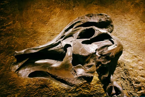
- Dinosaur tracks at the Poison Spider Mesa Trailhead, about mile 5.9. The BLM says a short side trail from the parking area leads to petroglyphs and a tracksite with footprints from at least 10 carnivorous dinosaurs, identified as Eubrontes and Grallator and dated to about 190 million years ago. The BLM says to look and, at most, gently touch the tracks, without walking on, scraping or marking them. There is no fee, the site is open year-round, and the lot holds standard vehicles only; the BLM sends trailers to pullouts along Potash Road or to overflow parking at Gold Bar.
- Longbow Arch, from the same Poison Spider lot. The BLM visitor guide lists a 2.4-mile route with dinosaur tracks, rock art and Longbow Arch, ascending 200 feet with a short slickrock climb on metal handles that may be impassible for dogs.
- Jug Handle Arch, mile 13.5. Discover Moab lists it beside the highway past Corona Arch, and Grand County's plan says most people stop to admire it.
The pavement ends at the Intrepid Potash mine. Discover Moab notes that high-clearance vehicles can continue on a dirt road toward Canyonlands, a route covered in our Island in the Sky guide from the paved side.
Related Guides
- Moab from Provo: Planning the Drive, Arches and Canyonlands
- Canyonlands Island in the Sky: Mesa Arch, Grand View Point and the Short Drive In
- Arches, Canyonlands and Capitol Reef: A Five-Day Loop From Provo
- Fiery Furnace in Arches: Permits, Ranger Hikes and Why You Cannot Wander In
- Arches Entry Reservations: What Happened, and How to Check Before You Drive
- Little Wild Horse and Bell Canyons
- Green River from Provo
- Dog-Friendly Hikes Near Provo
- Hikes for Kids Under 8 Near Provo
Frequently Asked Questions
How long is the Corona Arch hike?
Where is the Corona Arch trailhead?
Do you have to cross railroad tracks on the Corona Arch trail?
Are there ladders and cables on the Corona Arch trail?
Can I bring my dog on the Corona Arch trail?
Is there a fee to hike to Corona Arch?
Is Corona Arch a good hike in November?
Who should skip the Corona Arch hike?
Sources
The facts in this guide were checked against these sources. Hours, fees and rules change, so confirm anything time-sensitive with the source before you go. How we make Provo.com.
- Corona Arch Trail, Bureau of Land Management, Moab Field Office. Checked November 12, 2026.
- BLM Moab Visitor Guide, Bureau of Land Management, Moab Field Office. Checked November 12, 2026.
- Gold Bar Recreation Site, Bureau of Land Management. Checked November 12, 2026.
- Poison Spider Mesa Trailhead, Bureau of Land Management. Checked November 12, 2026.
- BLM Seeks Public Comment on Proposed Permanent Restriction of Roped Activities at Corona Arch and Gemini Bridges, Bureau of Land Management. Checked November 12, 2026.
- Visit Utah (Utah Office of Tourism): Corona Arch, Visit Utah (Utah Office of Tourism). Checked November 12, 2026.
- National Park Service, Arches National Park: Weather, National Park Service, Arches National Park. Checked November 12, 2026.
- Grand County Scenic Byways Corridor Management Plan, Grand County, Utah. Checked November 12, 2026.
- Utah Department of Transportation: UDOT Traffic, Utah Department of Transportation. Checked November 12, 2026.
- Corona Arch Trail, Grand Canyon Trust. Checked November 12, 2026.
- Track Safety Basics, Operation Lifesaver, Inc.. Checked November 12, 2026.
- Walking Safely Near Tracks, Operation Lifesaver, Inc.. Checked November 12, 2026.
- Corona Arch Hiking Trail, Moab Area Travel Council (Discover Moab). Checked November 12, 2026.
- Corona Arch Trail listing, Moab Area Travel Council (Discover Moab). Checked November 12, 2026.
- Potash-Lower Colorado River Scenic Byway (U-279), Moab Area Travel Council (Discover Moab). Checked November 12, 2026.