Arches National Park holds more than 2,000 documented stone arches, according to the National Park Service, and the agency calls it the densest concentration of natural stone arches in the world. That is a lot of holes in one 16-by-8-mile patch of desert north of Moab. The short answer to why is that the park sits on top of a buried salt layer that cracked the rock above it into long parallel slabs, and the rock in those slabs is a sandstone that is strong enough to hold up a span but soft enough for water to hollow out. The longer answer involves an ancient desert, a lot of rain and frost, and a counting rule that decides which holes get on the list in the first place.
This explainer is for a family or a student group from Utah Valley who wants to understand what they are looking at before the drive. It walks through the ingredients, the steps from a crack to a fallen arch, the difference between an arch and a natural bridge, how scientists listen to arches vibrate, and what the "most arches in the world" line does and does not mean. For the trip itself, start with our Utah national parks from Provo, ranked guide.
Quick facts
| Fact | Figure | Source |
|---|---|---|
| Documented arches in Arches National Park | Over 2,000 | National Park Service |
| Minimum opening to count | 3 feet in any one direction | National Park Service |
| Arches counted in park literature, 1970 | Nearly 90 | National Park Service |
| Average yearly precipitation in the park | 8 to 10 inches | National Park Service |
| Main arch-forming rock | Slick Rock Member of the Entrada Sandstone | NPS Geodiversity Atlas |
| Age of the Entrada at the visitor center | About 150 million years | NPS Geodiversity Atlas |
| Landscape Arch light opening | 306 feet, about 6 feet thick at its narrowest | National Park Service |
| Delicate Arch opening | 46 feet high, 32 feet wide | National Park Service |
| Wall Arch collapse | Aug. 4, 2008, a 71-foot span | National Park Service |
| Significant arches elsewhere in Utah | At least 800 photographed and identified | Utah Geological Survey |
| Utah arches on a 2012 list of 14 spans over 200 feet | 6 | Utah Geological Survey |
| Provo to the Arches entrance | About 187 miles, roughly 3 hours 45 minutes | OSRM routing estimate |
The short version
The Utah Geological Survey's Lance Weaver, writing in the survey's Survey Notes in January 2016, lists several reasons Utah's Colorado Plateau ended up with what he calls "the densest concentrations of natural arches found anywhere in the world." Boiled down, they are:
- The right rock. Arches can form in limestone, shale, granite and basalt, the survey says, but sandstone is the most common host in Utah. Several of the state's sandstone layers are strong enough to support large arches yet soft enough to erode.
- The right climate. Weaver writes that semiarid conditions help keep sandstone exposed. A wetter climate can leach out the natural cement holding sand grains together, while "a climate that is too dry will not sustain the perennial streams" that cut the cliffs and canyons where arches start.
- Lots of parallel cracks. Broad uplifts and folds fractured the rock in regular sets of joints, which erode into canyons and narrow rock walls called fins. At Arches, the survey says, the movement of salt underground played a role.
- The right shape. "Arches form because the shape is nature's most effective geometry for holding up overlying strata," the survey says. A curved opening spreads the load as compression and removes the pulling stress that would otherwise crack the rock above.
A U.S. Geological Survey bulletin on the park, Bulletin 1393, makes the same point more bluntly: "Arches form the strongest shapes for supporting overlying rock loads." Holes of other shapes tend to fail. Holes that settle into an arch shape tend to last.
Ingredient one: salt deep underground
The story starts long before the sandstone. The NPS Geodiversity Atlas for Arches places the park in the Paradox Basin, a fault and fold belt the Park Service dates to the Pennsylvanian period, about 318 to 299 million years ago. Thick salt deposits accumulated in that basin. The atlas says the park's salt story runs from about 300 to 228 million years ago, and the Park Service's biophysical description of the park calls the Paradox Formation a salt and gypsum layer that is "highly plastic."
Plastic is the key word. Salt under enough pressure flows like very slow putty. The park's geology page explains that the thick layer of salt, squeezed by the rock above and below, bulged upward into long domes. The rock layers draped over those domes had to stretch and bend, and they cracked into roughly parallel lines.
The biggest of those structures runs right through the park. The Park Service describes Salt Valley as a collapsed salt anticline, an upward fold whose salt core later dissolved and let the top sag in. The geodiversity atlas also calls it the Salt Valley-Cache Valley salt wall, and says normal faults along the edges of Salt Valley and Cache Valley dropped the valley side down. If you drive the main park road toward Devils Garden, you are driving along that structure.
Ingredient two: an old desert turned to stone
The rock that does most of the arch work is the Entrada Sandstone. The Park Service says it formed from an ancient desert of shifting dunes. Its grains are nearly spherical, which leaves a lot of open space between them and makes the rock very porous, so rain soaks in easily. The geodiversity atlas puts the Entrada at about 150 million years old at the park visitor center and names its Slick Rock Member as the main arch-forming unit, made of quartz grains cemented by calcium carbonate.
What lies above and below the Entrada matters too:
- Below: The Park Service describes the Carmel layer under the Entrada as sand and clay, denser and less porous. Water that soaks down through the Entrada stops at the Carmel and pools at the contact. The atlas names the Dewey Bridge Member of the Carmel Formation and says the Windows formed along its contact with the Slick Rock.
- Above: The atlas lists the Moab Member of the Curtis Formation sitting on the Slick Rock and says Delicate Arch formed at that contact.
All of this was buried. The Park Service says over a mile of rock once covered the layers now exposed in the park, and it all had to wear away before the Entrada saw daylight again. The geodiversity atlas credits compression during the Laramide Orogeny, the mountain-building episode that also raised the Rockies, as a cause of the fractures that became the fins.
Ingredient three: water, ice and gravity
Arches is a dry place. The Park Service lists average precipitation of 8 to 10 inches a year. But in the park's telling, water is still the main sculptor. The process the Park Service and USGS Bulletin 1393 describe goes like this:
- Rainwater picks up a little carbon dioxide from the air and soil, which makes it weakly acidic. The bulletin says that water dissolves the calcite cement in the Entrada, starting where the cement is thinnest.
- Once the cement is gone, loose sand falls away with gravity, wind or running water. The Park Service notes that wind helps clear the debris, but water does the loosening.
- Water trapped between the porous Entrada and the denser Carmel freezes in winter. Ice expands and pries the layers apart. The park calls this freeze-thaw action, and the bulletin calls it frost wedging.
- Water also dissolves small honeycomb pockets called tafoni, the Park Service says, and potholes on flat rock near cliff edges can wear down until they break through the wall below.
Stability helps, too. The Park Service says earthquakes are rare in the area, which has been geologically stable for at least 50,000 years. Frequent shaking would splinter these thin spans long before they grew large.
How a fin becomes an arch, step by step
Put the ingredients together and you get a sequence you can see at different stages across the park:
- Cracks. Salt movement and folding break the Entrada into slabs. USGS Bulletin 1393 describes "thin slabs mostly 10 to 20 feet thick between nearly parallel joints." The NPS atlas says the joints are closely spaced on the flanks of the anticlines.
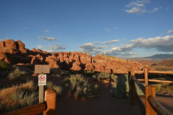
- Fins. Water runs down the cracks and widens them. Weaker slabs wear away, leaving tall, narrow walls of rock standing in rows. The bulletin says some of these walls are only 1 or 2 feet thick while others are 50 feet thick or more, and it points to the Fiery Furnace and Devils Garden as places where fins and pinnacles crowd together. Our Fiery Furnace permit guide covers how to walk through one of those mazes.
- A weak spot. Somewhere along a fin, the rock is a little softer or the cement a little thinner. Water pooling on the Carmel layer at the base, or soaking into a bedding plane higher up, starts an alcove or a small cave.
- Breakthrough. Frost and dissolving water keep working until the alcove punches through to the other side. The bulletin says that once a wall breaks through, weakened rock in the ceiling falls away and an arch shape begins to emerge.
- Growth. Rock keeps falling from the underside and sides of the opening. Pieces that are poorly supported drop first, which is why the survivors trend toward a curve that carries its load in compression.
- Collapse. Eventually the span gets too thin to hold itself up and falls. The Park Service's broader timeline is sobering: about a million years ago the area was a flat plain, and in about 100,000 years the Entrada and Carmel layers here may be fully eroded.
That last step is not a failure of the system. It is the system. The same forces that open an arch keep thinning it until it is gone, and the rows of fins behind it are already lined up to become the next ones.
Not every arch forms the same way
The Park Service sorts the openings in Arches into a few types:
- Cliff wall arches form on the side of, or right next to, a rock wall. The park says they are easy to miss, and that streaks of desert varnish that seem to disappear behind a slab can give one away. Examples include Park Avenue Arch, Biceps Arch in the Windows Section and Visitor Center Arch.
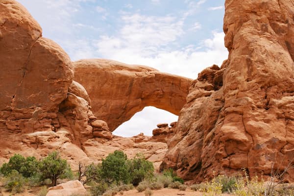
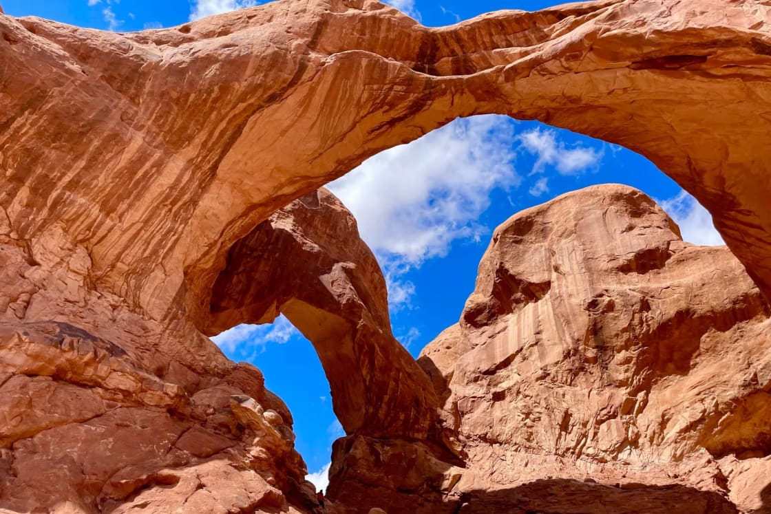
- Free-standing arches stand apart from other walls and fins. Delicate Arch, Landscape Arch, North and South Windows and Double Arch are on the park's list. Some are called windows for the views they frame.
- Pothole arches form where a small depression on top of a rock mass joins an alcove on a rock face below. The park names Pothole Arch Upper and Lower near the Garden of Eden and Bean Pot Arch in the Great Wall, and notes that measuring one takes an experienced climber. Bulletin 1393 describes Pothole Arch as the union of a vertical pothole and a horizontal cave as a nearby cliff receded.
- Natural bridges sit over a stream or stream channel. The water does not have to flow year-round. The park says only a handful are known there, including Walk Through Bridge in the Fiery Furnace.
The Utah Geological Survey adds a few processes that build arches elsewhere in the state. Where streams cut deep canyons, the rock relaxes and cracks parallel to the canyon walls, and ice in those cracks peels off sheets of rock to form alcoves. Kolob Arch in Zion formed along parallel joints in Navajo Sandstone, the survey says. And where sandstone is cemented unevenly, softer patches wear out first, producing what the survey describes as hundreds of small arches and windows in places like Goblin Valley and Snow Canyon state parks.
Arch, natural bridge or alcove?
The three words get mixed up at trailheads, so here is how the agencies use them.
An arch is an opening with no stream running through it. Rainbow Bridge National Monument says arches form within the apex of a rock alcove, with no active water flowing beneath. The Natural Arch and Bridge Society, as quoted by the Utah Geological Survey, defines a natural arch as "a rock exposure that has a hole completely through it," formed by natural, selective erosion that leaves a mostly intact frame.
A natural bridge spans a watercourse. Natural Bridges National Monument sums up the difference in one line: running water carves natural bridges, while seeping moisture and frost shape arches. In White Canyon, the monument explains, streams once looped back and forth in tight bends separated by thin canyon walls. The water wore through those walls, the stream took the shortcut and the rock left standing above became a bridge. The Utah Geological Survey describes the same process across the plateau: as the land rose, rivers dug in while keeping their winding paths, and undercutting eventually let them break through the necks of the bends. Technically, the society and the survey count a natural bridge as a type of natural arch, so a bridge is an arch with a stream under it.
An alcove is a recess or overhang in a cliff that has not broken through. Many arches start as alcoves, and the survey describes the "sheeting" of rock in alcoves as part of how canyon-wall arches form. An alcove becomes an arch only when light shows through the other side.
Natural Bridges is the best place in the state to see the bridge side of the family. The monument's geodiversity atlas lists its three spans:
| Bridge | Height and span | Thickness of span |
|---|---|---|
| Sipapu | 220 feet high, 268-foot span | 53 feet |
| Kachina | 210 feet high, 204-foot span | 93 feet |
| Owachomo | 106 feet high, 180-foot span | 9 feet |
The atlas describes Kachina as the youngest, with a thick, stout span, and Owachomo as the oldest and thinnest, which fits the monument's description of a bridge's life: thick and massive at first, thinner and more delicate with time, then gone. It also says the bridges are very young in geologic terms, perhaps tens of thousands of years old, cut into rock deposited between about 310 and 205 million years ago. In Utah, only Rainbow Bridge and Morning Glory Natural Bridge have longer spans than Sipapu, according to the atlas. Our Natural Bridges guide covers the loop drive and trails.
Rainbow Bridge, near Lake Powell, is a different rock recipe. The Park Service says its base is Kayenta Formation and its span is Navajo Sandstone, both once buried under about 5,000 feet of other rock. Uplift about 5.5 million years ago raised the landscape roughly 3,000 feet, the park says, which steepened Bridge Creek as it ran off Navajo Mountain, a 10,388-foot laccolith. The faster water cut through a sandstone fin and kept widening the gap. The park says natural bridges are rarer than the many sandstone arches on the Colorado Plateau.
Why arches fall: Wall Arch and others
Every arch in Utah is temporary. Wall Arch made that plain. The Park Service says that on the night of Aug. 4, 2008, campers at Devils Garden Campground heard a loud noise. The next morning, the remains of Wall Arch, which had spanned a 71-foot gap, lay across the Devils Garden trail. The park's explanation is erosion and gravity: rain, ice and groundwater gradually dissolved the calcium cement holding the grains together until the structure could no longer support its own weight. There was no single trigger the park points to.
Landscape Arch, a short walk up the same trail, is the park's best-known example of an arch in its late stages. The Park Service lists its light opening at 306 feet and says it is only about 6 feet thick at its narrowest. The park says large segments of the arch came down in the 1990s, and its article on monitoring notes a piece fell in 1991. Even the length is debated: the Utah Geological Survey's 2012 list, based on Natural Arch and Bridge Society measurements, gives Landscape a 290-foot span. Different measuring conventions, same arch.
Collapses happen outside Arches too. On Aug. 8, 2024, the arch known as Double Arch, also called the Toilet Bowl, Crescent Pool and Hole in the Roof, fell in Rock Creek Bay in Glen Canyon National Recreation Area. The Park Service said it formed in Navajo sandstone about 190 million years old and that changing water levels and wave action were suspected of contributing, along with weathering, wind and rain. "While we don't know what caused this collapse," Superintendent Michelle Kerns said in the release, she added that "these features have a life span that can be influenced or damaged by manmade interventions."
How scientists monitor arches
You cannot see an arch weakening from the inside, but you can sometimes hear it. A University of Utah group led by geologist Jeff Moore places seismometers on arches to record the tiny vibrations caused by wind, distant earthquakes and other sources. The group's research page explains why that matters: an arch's resonance depends on its mass and stiffness, so a change in how it vibrates over time can be indirect evidence of internal change, such as a crack growing.
Here is what the published work and the Park Service say the team has done:
- Long-term sites. The Park Service says the team has monitored seven sites in Arches since 2013, plus 18 other arches in the region, including three sites in Canyonlands and Owachomo Bridge at Natural Bridges.
- North Window crackmeter. Installed in November 2015, it records the width of a crack every 30 minutes. The Park Service says the crack opens and closes by more than 2 centimeters a year, with daily movement averaging more than half a millimeter, but stays within the same range from year to year. "This crack is really dynamic," Moore told the park, while noting there is "no opening trend."
- A detailed test case. A June 2020 University of Utah news story describes how the team placed 30 seismometers on Musselman Arch in Canyonlands, with Park Service permission, to check simpler measurements taken at 17 other arches with one or two instruments each. The arches showed low damping, meaning they keep vibrating long after a gust or a far-off quake.
- Shape and strength. The same research compared beam-like arches with arches shaped like an upside-down hanging chain, which the team calls inverted catenary arches. The story says Delicate Arch rests on a thin, easily eroded clay layer and Rainbow Bridge is slightly connected to a neighboring knoll, and that both remain vulnerable to eventual collapse despite their strong shapes.
The work is noninvasive. The 2020 story says seismometers sit on the rock surface for a few hours to a few days without damaging it. The researchers describe it as a first step toward detecting damage, not a countdown clock. No one can tell you which arch will fall next.
What "most arches in the world" rests on
You will hear that Utah has more arches than anywhere on Earth. The official claims are narrower than that, and they deserve a close read.
The claim is about density. The Park Service says Arches has the densest concentration of natural stone arches in the world. The Utah Geological Survey says Utah's Colorado Plateau holds the densest concentrations found anywhere. Neither says anyone has tallied every arch on the planet. No public worldwide census exists in the sources we reviewed, so a raw "most arches" ranking cannot be checked.
The count depends on the rule. The park's list includes any opening at least three feet in one direction, with no width requirement. Its guide to arch types says rockfall gaps and vertical cracks do not count, and that the park has many more non-arch openings than named arches. Change the threshold and the number changes. A park biophysical description gives more than 1,800 cataloged arches with a span greater than one meter, about three feet, while the current pages say over 2,000.
The count depends on who looked, and how hard. The Park Service's history of the "arch hunters" says park literature in 1970 described "nearly 90 arches." USGS Bulletin 1393 credits Dale J. Stevens, a professor of geography at Brigham Young University, with the most complete count of southeastern Utah's arches at the time. Working February through April 1973, the bulletin says, he considered openings of 3 feet or larger, measured them with a range finder or steel tape, and found more than 300 in southeastern Utah, 124 of them in the park. The bulletin notes several areas of the park were not intensively searched. The Park Service says Stevens and his team developed a standardized method for measuring and recording arches, and that ranger Ed McCarrick, Chris Moore and other searchers spent about three decades finding the rest. The arches did not multiply. The searching did.
Size is a different contest. The Utah Geological Survey's January 2012 update by Grant Willis, using Natural Arch and Bridge Society measurements, listed 14 known arches with spans over 200 feet. Six were in Utah: Landscape Arch, Kolob Arch, Morning Glory Natural Bridge, Rainbow Bridge, Sipapu Natural Bridge and Stevens Arch. The top of the list was not in Utah. Fairy Bridge on the Buliu River in Guangxi, China, led at 400 feet, followed by the Jiangzhou Immortal Bridge, also in Guangxi, at 280 to 340 feet. Landscape Arch was at 290 feet and Kolob Arch at 287, with Aloba Arch in Chad's Ennedi range at 250 feet and Rainbow Bridge at 234. Willis wrote that Landscape holds the record for sandstone arches and for "arc-type" arches, not for natural arches overall, and warned, "Expect this list to change again as searches continue." The Weaver piece four years later said six of the world's 15 largest known natural arches are in Utah. The Natural Bridges atlas adds that the world's largest known natural bridges are in China and are karstic, formed in soluble rock like limestone rather than sandstone.
Utah has plenty outside the park. The survey says at least 800 significant arches have been photographed and identified elsewhere in Utah, with thousands more estimated. So the fair way to say it is this: Arches has the densest known cluster of arches anywhere, under a three-foot rule, and Utah holds a large share of the world's biggest sandstone spans, though not the single biggest arch.
Where to see good examples from Provo
Driving times below are OpenStreetMap routing estimates (OSRM) from downtown Provo, without stops or traffic. Add time for fuel, entrance lines and the walk.
- Arches National Park, about 187 miles, roughly 3 hours 45 minutes. For the full fin-to-arch story, walk the Devils Garden trail past Landscape Arch and the Wall Arch site; the Park Service lists Landscape at 1.8 miles round trip and the full Devils Garden trail at 7.9 miles. Delicate Arch, which the park calls its largest free-standing arch, is a 3-mile round-trip hike with 480 feet of climbing, or a 100-yard walk to the lower viewpoint about a mile away. See our Delicate Arch trail guide and the two-day Arches and Canyonlands itinerary.
- Corona and Bowtie arches, about 196 miles, a little over 4 hours. These sit on Bureau of Land Management land outside Moab. Our Corona Arch and Bowtie Arch hike guide covers the trail.
- Canyonlands' Island in the Sky. Mesa Arch, which the Utah Geological Survey uses as an example of an arch in Jurassic sedimentary rock, is on our Island in the Sky guide.
- Natural Bridges National Monument, about 282 miles, close to 6 hours. The best place to compare a bridge with an arch. The monument was established in 1908, and the Park Service says it became the world's first International Dark Sky Park in 2007.
- Goblin Valley State Park, about 179 miles, roughly 3 hours 45 minutes. The survey's example of small windows formed by uneven cementing. See our Goblin Valley guide.
- Capitol Reef, about 182 miles to the Hickman Bridge trailhead. See our Hickman Bridge and Cassidy Arch guide.
- Zion's Kolob Canyons, about 226 miles to the visitor center. Kolob Arch is on the survey's list of the world's largest. Our Kolob Canyons guide covers the area.
If you want the bigger regional picture, our explainer on the Great Basin, Colorado Plateau and Rocky Mountains shows where the arch country begins, and our Moab from Provo guide covers the weekend logistics.
Look, don't climb: the rules and why
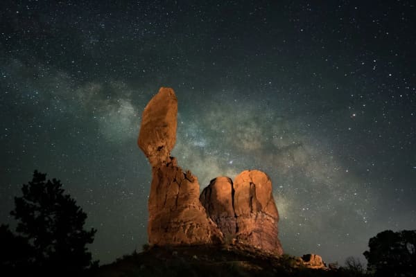
Arches National Park prohibits climbing, scrambling or walking on, wrapping webbing or rope around, or rappelling off "any named or unnamed arch with an opening greater than three feet," according to its rock climbing page. The same three-foot line that defines an arch defines the closure. Balanced Rock is also closed to climbing, and slacklining, highlining and BASE jumping are prohibited.
The rule comes from a 2014 determination covering both Arches and Canyonlands. Before then, technical climbing was already banned on named arches, but other activities on arches, and technical climbing on unnamed ones, were not. The memo gave three reasons:
- The rock. Arches weather and collapse on their own, and the memo says the weight and vibration from people, especially over time, may speed that up and cause permanent damage.
- Safety. Narrow, elevated spans carry a high degree of risk.
- Everyone else's view. Rising visitation and more people posing on arches for photos were cutting into other visitors' enjoyment of the scenery.
The memo names one exception, Washer Woman Arch in Canyonlands' Island in the Sky District. It also says setting aside special areas for these activities would not work, because the harm could happen wherever they occurred.
A few other rules connect directly to the geology. The park's regulations page says off-trail travel crushes biological soil crust, the living surface that "prevents erosion and sustains plant growth." Graffiti is illegal, and the park says rangers and volunteers spend hundreds of hours a year removing scratches and drawings from the rock. Drones are not allowed. The park's message is simple: "leave no visible trace of your visit." For a family, that translates to staying on the trail, keeping kids off the spans, and taking the photo from the ground.
Reading the landscape on your visit
Once you know the sequence, the park reads like a timeline. Rows of fins in Devils Garden are the raw material. An alcove partway up a wall is an arch that has not broken through. A small window is a young arch. Landscape Arch, thin and long, is an old one. A pile of sandstone blocks on the Devils Garden trail is what Wall Arch looks like now. And the flat floor of Salt Valley, below it all, is where the buried salt started the whole thing by flowing, doming and cracking the rock above it.
The Park Service's own estimate is that the layers that make these arches may be fully eroded here in about 100,000 years. That is long by family standards and short by geologic ones. The arches you see on this trip are one frame in a slow movie, and some of the ones your kids will show their own kids have not opened yet.
Frequently Asked Questions
How many arches are in Arches National Park?
What makes a hole in a rock count as an arch?
Does Utah have the most arches in the world?
What is the difference between an arch and a natural bridge?
Why did Wall Arch fall?
Can you climb on the arches in Arches National Park?
How do scientists tell if an arch is close to collapsing?
How far is Arches National Park from Provo?
Sources
The facts in this guide were checked against these sources. Hours, fees and rules change, so confirm anything time-sensitive with the source before you go. How we make Provo.com.
- Geologic Formations - Arches National Park, National Park Service. Checked November 15, 2026.
- Arches - Arches National Park, National Park Service. Checked November 15, 2026.
- Types of Arches, National Park Service. Checked November 15, 2026.
- National Park Service: Arch Hunters, National Park Service. Checked November 15, 2026.
- Fallen Arches: Wall Arch, National Park Service. Checked November 15, 2026.
- NPS Geodiversity Atlas: Arches National Park, Utah, National Park Service. Checked November 15, 2026.
- Biophysical Description of Arches National Park, National Park Service. Checked November 15, 2026.
- Landscape Arch Trail, National Park Service. Checked November 15, 2026.
- National Park Service: Delicate Arch, National Park Service. Checked November 15, 2026.
- Studying the Fate of Arches, National Park Service. Checked November 15, 2026.
- Rock Climbing - Arches National Park, National Park Service. Checked November 15, 2026.
- Activities on Arches Determination, National Park Service. Checked November 15, 2026.
- Regulations - Arches National Park, National Park Service. Checked November 15, 2026.
- Geology - Natural Bridges National Monument, National Park Service. Checked November 15, 2026.
- Natural Bridges National Monument, National Park Service. Checked November 15, 2026.
- NPS Geodiversity Atlas: Natural Bridges National Monument, Utah, National Park Service. Checked November 15, 2026.
- Geologic Formations - Rainbow Bridge National Monument, National Park Service. Checked November 15, 2026.
- Double Arch collapse news release, Aug. 9, 2024, National Park Service, Glen Canyon National Recreation Area. Checked November 15, 2026.
- Glad You Asked: Why Are There So Many Natural Arches in Utah?, Utah Geological Survey. Checked November 15, 2026.
- Every Record Must Fall: An Update on the Largest Arches in the World, Utah Geological Survey. Checked November 15, 2026.
- Geological Survey Bulletin 1393: Origin and Development of the Arches (archived copy), U.S. Geological Survey via NPS History. Checked November 15, 2026.
- Utah's arches continue to whisper their secrets, University of Utah. Checked November 15, 2026.
- Utah Geohazards Research - Projects, University of Utah Geohazards Research Group. Checked November 15, 2026.
- OSRM routing service (driving estimates from downtown Provo), Project OSRM / OpenStreetMap. Checked November 15, 2026.