The Great Salt Lake is salty because it has no outlet. Rivers carry water and dissolved minerals in, evaporation takes only the water out, and the minerals stay behind. That one-way plumbing explains the salt. It does not explain why the lake's two halves are so different, and that second question has a more recent and more human answer: a railroad causeway, a hole cut through it in 2016, and a berm built in 2022.
| Type of lake | Terminal (water flows in, none flows out) |
| Rivers that feed it | Bear, Weber and Jordan |
| South arm (Gilbert Bay) | About 12 percent salinity on average, per the Utah Geological Survey |
| North arm (Gunnison Bay) | About 25 percent on average, per the Utah Geological Survey |
| Ocean water, for comparison | About 3.5 percent, per the Utah Geological Survey |
| Evaporation | About 2 million acre-feet a year, per the state's Great Salt Lake website |
| North arm salt crust | At least 414 square miles in late summer 2014, per the Utah Geological Survey |
| Drive from Provo | About an hour to the state park near Magna; about two hours budgeted for Antelope Island |
A lake with no outlet
The state's Great Salt Lake website calls it a shallow, salty remnant of ancient Lake Bonneville, and says it is terminal because three rivers, the Bear, Weber and Jordan, flow in while no water flows out. The same page says the lake loses about 2 million acre-feet of water through evaporation each year, with the highest rates in summer. It also gives a date for Bonneville's formation, about 11,000 years ago, in a single sentence. We read that figure on one page and did not cross-check it against a second source, so treat it as the state's wording and look at the Utah Geological Survey's Lake Bonneville material if the date matters to you.
Evaporation removes water and leaves dissolved minerals, which is why a lake without an outlet gets saltier. The state's page does not spell that last step out; it is the standard explanation for any terminal lake. What the state does say is where the water comes from. Its current conditions page says runoff from the Uinta, Wasatch and Bear River ranges supplies most of the lake's water, and that the Bear, Jordan and Weber rivers together provide nearly 70 percent. Utah Valley readers should note the Jordan River is the outlet of Utah Lake according to our Antelope Island guide, so Utah Valley's water is part of this system.
The same page notes that lower inflows over time shrink the lake, and that drought and warmer temperatures may speed the decline. For how that shows up on the gauge, see our water level explainer.
Three ways to say how salty
Salinity numbers are easy to misread because there is more than one way to state them. The state's current conditions page describes a converter that switches between three measures. Concentration is grams of salt per liter of brine. Percent salinity is the weight of salt as a share of the combined weight of salt and water. Density is how heavy the brine is. The converter takes brine temperature as an input, and the page notes that it cannot derive a concentration from a refractometer percentage.
That matters because the figures in news stories mix units. The Utah Geological Survey's 12 percent and 25 percent are percent salinity. A report that gives a number in grams per liter is describing the same thing on a different scale, and you cannot compare the two without converting. The page also points to a research article on an equation of state for hypersaline water in the lake, which is the technical basis for the conversions. We did not read that article, so we do not describe its method.
How salty, by arm
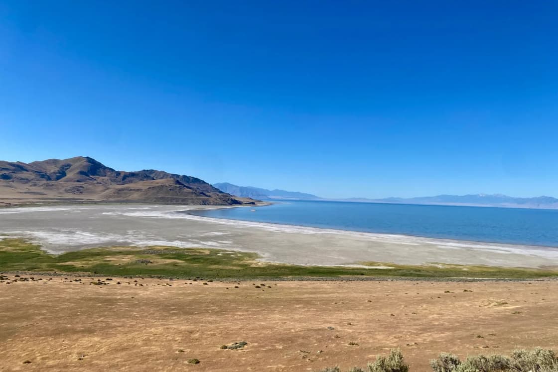
The lake is not one uniform pool. A railroad causeway finished in 1959 divides it, and the Utah Geological Survey says the two arms have had clearly different salinity levels since. Based on nearly 50 years of data, it reports that Gilbert Bay, the south arm, averages about 12 percent and Gunnison Bay, the north arm, averages about 25 percent, roughly double. The Survey puts ocean water at about 3.5 percent. By those averages, the south arm is a little over three times as salty as the sea and the north arm about seven times.
Those are long-term averages. A single reading on a single day can sit well above or below them, which is why the state site hosts live data rather than a fixed number.
Why the north arm is saltier
Most of the freshwater inflow enters the south arm, the Survey explains. That dilutes it. Brine passes through the causeway only in limited amounts, so the north arm's salt stays concentrated.
The causeway's history is a little more tangled than the one date suggests. The Utah Division of Forestry, Fire and State Lands says the Southern Pacific built a causeway in 1902 as an alternate route to the original rail line through the Promontory Mountains. In 1959 the 12-mile wooden bridge was replaced with a rock-filled causeway that included two culverts. The culverts sank as the fill slowly settled, were abandoned and were filled in, which slowed the flow between the arms further. The USGS calls the structure the Union Pacific causeway and gives the same 1959 completion date. The two agencies use different railroad names in the pages we read, so if you need the corporate history, check a railroad source rather than relying on either.
The 2016 breach and the 2022 berm
In 2016 the causeway was breached to restore flow between the arms and improve rescue boat access to the north arm, according to the Division. The Division describes the breach as a 180-foot section of the causeway, removed to create an open channel.
The channel solved one problem and created another. Brine is denser than fresh water, so the saltier, denser north arm water flowed south along the bottom of the channel, raising south arm salinity. The Division said reduced freshwater inflows had already raised salinity, and that this threatened the brine shrimp in the south arm and the migratory birds that feed on them. In response, state contractors built a berm raising the bottom of the breach by four feet at the end of July 2022. The Division's September 22, 2022 announcement said the berm was meant to cut north-to-south flow while still letting south arm water flow north. Its engineers said early readings showed the work was significantly reducing the flow of higher-salinity water through the bottom of the channel. The announcement gave no salinity figures, so we have none to report.
KSL reported in February 2024 that Gov. Spencer Cox ordered a second raise in winter 2023, that the south arm then sat more than 3 feet higher than the north arm, and that the state was still reviewing how to manage the two arms. One option mentioned was an aqueduct under the causeway, with the Division requesting state funds to study it. We did not find a later decision, so check with the Division for the current status.
The salt crust on the north arm
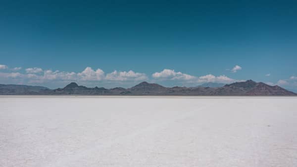
Where the water is saltiest, it stops being only water. The Utah Geological Survey describes a crust on the Gunnison Bay lakebed that is a solid mass of coarse salt crystals, up to about half an inch long. In late summer 2014 its mapping found at least 414 square miles of crust, 349 of them inside the one-foot thickness contour. The crust is about 1.9 feet thick near shore and typically about one foot near the water's edge. Core drilling in 1970 and 1972 found up to 4.6 feet in central Gunnison Bay, and boreholes in 1974 found up to 8 feet locally.
The Survey estimates at least 456 million short tons of salt in the crust, including about 20 million tons outside the one-foot contour. It calls that a minimum, since the crust is likely thicker toward the center. That is at least 10 percent of the lake's estimated 4.5 billion tons of salt, and at times the crust has held about 20 percent. Halite, which is sodium chloride, makes up about 99 percent of it, with small amounts of calcium, magnesium, potassium and sulfur. The Survey said that if enough lower-salinity water entered the north arm, the crust could begin to dissolve. That article was written when the breach was still new, and we did not find an update on the crust, so we do not claim what it looks like now.
Why salinity matters to life in the lake
The Utah Division of Wildlife Resources describes a lake with archaea, bacteria and more than 400 species of phytoplankton, and says its most visible residents are brine shrimp in tons, brine flies in billions and birds in millions. Its page says the food the lake produces helps keep migratory birds alive and supports their reproduction in North and South America, "from Alaska to Argentina." It also says the lake has a short, efficient link between water, nutrients and sunlight and the higher animals, and that small changes in physical or biological components can shift the balance. The state's main page says the lake supports as many as 12 million migratory waterfowl and waterbirds a year and adds more than $2 billion annually to Utah's economy.
Brine shrimp are where salinity hits hardest. KSL reported in February 2024, citing the Division, that about 29 million pounds of brine shrimp cysts were harvested in the most recent season, up more than 50 percent from 19 million the year before and inside a historical range of 25 to 35 million. It said shrimp lost the ability to reproduce as levels fell and salinity rose, that hatch rates climbed from about 60 percent in 2022 to above 90 percent in 2023, and that the Division credited the berm changes. The same story quoted Tim Hawkes of the Great Salt Lake Brine Shrimp Cooperative saying the lake supplies roughly 40 to 45 percent of the world's brine shrimp cysts and eggs. KSL also noted that Utah lawmakers named brine shrimp the state's official crustacean in 2023. Those are one news outlet's account of agency and industry statements, not a Division publication we read directly.
Salt, lakebed and dust
Salinity and level are linked, and low levels expose lakebed. The state's main page gives the November 2022 record low area as about 800 square miles and lists dust, worse air quality, less snow, limited lake access and habitat loss among the risks of a drying lake. KSL, in July 2026 coverage of a dust storm, quoted University of Utah atmospheric scientist Kevin Perry saying dust events occur about three to eight times a year and that the particles are largely PM10. It named arsenic as one of 13 substances identified as potential concerns in sediment around the lake. The article gave no exposed-area figure and no specific public health instruction, so for air quality advice on a given day, use the Utah Division of Air Quality's own forecasts, which we did not read for this guide.
Can you float in it?
Utah State Parks says swimming or floating in the highly saline water is allowed at Antelope Island State Park, and names Bridger Bay Beach as the best place. The page lists restrooms and showers at the beach. We did not find a state source on how buoyant the water feels, so we do not describe it. Great Salt Lake State Park lists swimming among its activities but gives no conditions, and its showers are listed for campers and slip renters only.
Seeing the lake from Provo
Our Great Salt Lake and Bonneville Salt Flats day trip guide puts the nearest easy access points about 50 to 60 miles north, roughly an hour, at Great Salt Lake State Park near Magna and the Antelope Island causeway at Syracuse. The Antelope Island guide gives the route: I-15 north to Exit 332, then west on Antelope Drive, and says to budget two hours. The Bonneville Salt Flats are a different trip entirely, about 165 miles each way. For a wider Salt Lake outing, see the Salt Lake City day trip from Provo and the overview of day trips from Provo. Closer to home, Utah Lake is a freshwater lake with an outlet, which is part of why the two differ so much; see also Utah Lake's history. The Spiral Jetty trip guide covers the north arm side of the lake.
Hours, per Utah State Parks: Antelope Island State Park is open year-round from 6 a.m. to 10 p.m. and closed Thanksgiving and Christmas, with its visitor center open 9 a.m. to 5 p.m. Great Salt Lake State Park, at 1498 W 1075 S in Layton by the state's listing, is open sunrise to 5 p.m. with a 9 a.m. to 5 p.m. visitor center. It lists a marina, boat tours, paddleboard and tandem kayak rentals and swimming, but does not list a day-use fee on its main page, so check the park's fee page. The Antelope Island page, when we read it, said the main boat ramp was closed because of low water, a reminder that level affects what you can do; conditions change, so look again before you go.
What a family or student needs to know
Go for the strangeness and the birds, not for a beach day in the usual sense. Bring water and sun protection, and check the parks for current conditions, since the state pages we read give few practical details. Teachers and students can use the Survey's percentages and the state's three salinity measures as a short lesson in why units matter. For the history of the freshwater lake next door, our Utah Lake history is the companion read.
Who should skip this
Skip this guide if you want a current salinity or lake level; it does not have one, and the state's conditions page and the USGS are the places to look. Skip the lake itself if you want clear water for swimming laps, if you have an open cut, or if a dusty, windy day would trigger asthma. If you only want the numbers on the gauge, the water level explainer is the shorter path.
What we could not confirm
The sources we read did not give a current salinity reading or an account of where the lake's salt originally came from, so this guide does not either. We could not open the Survey's own "Glad You Asked" salinity column, so the arm averages come from its salt crust article. We did not confirm the Union Pacific breach date from an official page, a second Bonneville date, or the present state of the north arm crust. Salinity changes with the lake's level and inflows.
Frequently Asked Questions
Why is the Great Salt Lake salty?
How salty is the Great Salt Lake?
Why is the north arm saltier than the south arm?
Is the Great Salt Lake saltier than the ocean?
What is the salt crust on the north arm?
Where did the salt come from?
Can you float in the Great Salt Lake?
Does the lake's salinity change?
Why does salinity matter for brine shrimp and birds?
How far is the Great Salt Lake from Provo?
Sources
The facts in this guide were checked against these sources. Hours, fees and rules change, so confirm anything time-sensitive with the source before you go. How we make Provo.com.
- Salt Crust on Great Salt Lake's North Arm, Utah Geological Survey. Checked November 4, 2026.
- Great Salt Lake causeway berm raised 4 feet to protect salinity levels, Utah Division of Forestry, Fire and State Lands. Checked November 4, 2026.
- Great Salt Lake ecosystem wildlife, Utah Division of Wildlife Resources. Checked November 4, 2026.
- Antelope Island State Park, Utah State Parks. Checked November 4, 2026.
- Great Salt Lake State Park, Utah State Parks. Checked November 4, 2026.
- Great Salt Lake, State of Utah. Checked November 4, 2026.
- Great Salt Lake Current Conditions, State of Utah. Checked November 4, 2026.
- Brine shrimp cyst collection at Great Salt Lake up over 50%, KSL. Checked November 4, 2026.