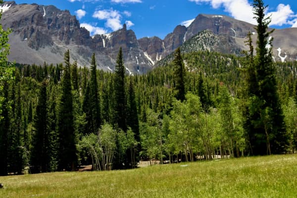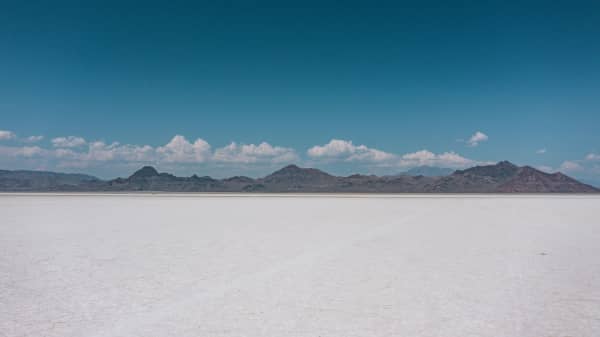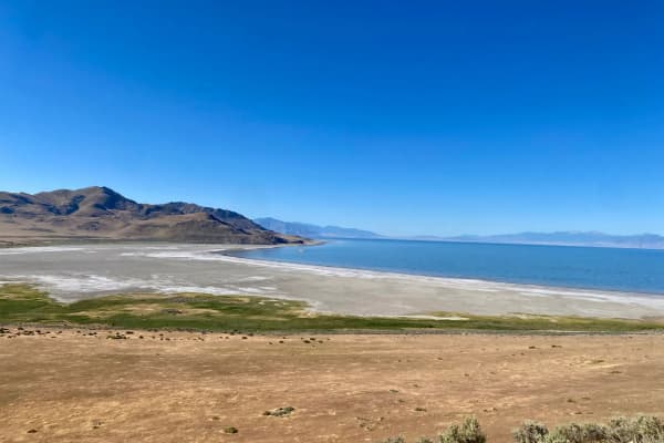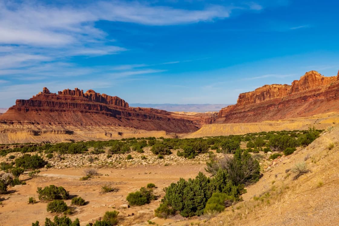
Utah is usually described by its parks or its ski resorts, but the state is easier to understand as three landscapes that meet in a rough Y shape. In the west is the Great Basin, with long, narrow mountain ranges separated by flat valleys. In the south and east is the Colorado Plateau, a stack of nearly flat rock layers cut by canyons. In the north are the Rocky Mountains, which in Utah means the Wasatch Range and the Uinta Mountains. Provo sits right on one of the seams between them.
This guide explains why each region looks the way it does, using the Utah Geological Survey, the National Park Service and the state's own history pages, and then says where you can see each one from Provo. It is the map-reading companion to our Utah national parks ranking from Provo, which covers drive times and seasons for the parks themselves.
A caution about method. Geologists argue about where exactly to draw the lines, and the Utah Geological Survey says so itself. The boundaries below are the simple three-province version, plus the transition zone the Survey describes. Where we give a drive time, it comes from our own ranking page and is an OpenStreetMap routing estimate with no traffic. Where we have no confirmed figure, we say to check a map.
The three regions at a glance
| Region | What it looks like | Why it looks that way |
|---|---|---|
| Great Basin (Basin and Range) | Parallel mountain ranges separated by broad, flat basins | Crust stretched and broke into fault blocks; sediment filled the valleys |
| Colorado Plateau | Flat-lying layered rock, deep canyons, colorful bands | One intact block that rose and was cut by erosion |
| Middle Rocky Mountains | High ranges: the north-south Wasatch and the east-west Uintas | Ancient cores pushed up; glaciers carved the upper valleys |
Utah's history pages call the Colorado Plateau the largest of the three provinces in the state and the Rocky Mountains the smallest. Both facts surprise people who think of Utah as mostly mountains.
The Great Basin: ranges and basins
The Great Basin is the northern part of the larger Basin and Range province, which the Park Service says extends into Mexico. The name is about water, not shape. The Park Service describes the Great Basin as stretching from the Sierra Nevada in California to the Wasatch Range in Utah, and says none of its precipitation reaches an ocean. Utah's state history pages add that most of Utah's portion is the Bonneville Basin, once beneath ancient Lake Bonneville, and that many of its basins drain internally.
Why it looks like corrugated cardboard
The Utah Geological Survey describes the Basin and Range as steep, narrow, north-trending mountain ranges separated by wide, flat valleys. The mountains are made of old rock, Precambrian (more than 570 million years old) and Paleozoic (570 to 240 million years old), that extension broke into fault blocks.
The Park Service explains the mechanism on its Great Basin National Park geology page. Starting about 30 million years ago, the crust began stretching east to west. Bedrock broke into blocks several miles wide, tens of miles long and thousands of feet thick. Some blocks tilted and formed the north-south ranges. Others sank to form basins. Another Park Service page, on Parashant National Monument, adds that most of the faults are normal faults, with mountains on the upthrown blocks and valleys on the downthrown blocks, and that fault planes usually dip steeply, around 60 degrees.
The valleys then fill. Rivers, landslides and wind carry sediment off the mountains, and the Park Service says those basins can hold hundreds to thousands of meters of material. The Park Service's geology page says the crust is still stretching today.
Lake Bonneville
The Great Basin's wet past is part of the picture. The Park Service says Lake Bonneville grew to about the size of Lake Michigan at its largest, and the Utah Geological Survey says it reached its deepest level about 15,000 years ago. The Great Salt Lake is what remains: Utah's state history pages say it covers the lowest part of the Bonneville Basin, with a surface at about 4,200 feet above sea level. If you walk the old shorelines on the mountainsides above Utah Valley, you are reading that lake's record. Our Bonneville Shoreline Trail guide for Utah County covers where.
What to look for
- Long, straight mountain fronts rising abruptly from flat valley floors, which is what fault blocks produce.
- Wide, nearly flat basins with salt flats, dry lakebeds or terraces that mark old lake levels.
- Ranges that run roughly north-south, and are far longer than they are wide. Utah's history pages say the fault-block mountains of the Utah Great Basin typically run 25 to 50 miles long and 15 to 20 miles wide.
The Colorado Plateau: stable ground, deep cuts
The Colorado Plateau is the opposite case. The Park Service describes it as a relatively flat surface that has experienced little deformation, covering northern Arizona, southern and eastern Utah, western Colorado and northwest New Mexico. Utah's history pages say it holds five national parks, six national monuments and a national recreation area, and is drained by the Colorado and Green rivers.
Why it looks like layers
The Utah Geological Survey describes the plateau as mostly flat-lying, largely undeformed sedimentary rock layers. The Park Service's Parashant page calls it remarkably stable, with little folding or faulting in roughly the last 600 million years. It says the plateau rose along with the Basin and Range by as much as 3 kilometers in the last 20 million years but stayed a single tectonic block, while the neighboring Basin and Range crust cracked and stretched. The Survey's version: the plateau began rising about 10 million years ago and reached more than 10,000 feet in places.
Because the plateau stayed intact, erosion became its main sculptor. The Park Service says that as the land rose over the past 10 million years, streams cut deeper into it, and that the Colorado River began carving the Grand Canyon less than 6 million years ago. Steep canyons drain water off nearly flat layers and expose the colorful rock bands that photographs of southern Utah are known for.
The plateau is not perfectly flat. The Survey notes that igneous cores form the Henry, La Sal and Abajo mountains, and that folds such as the San Rafael Swell and the Waterpocket Fold are exceptions to the flat layering. The Waterpocket Fold runs through Capitol Reef. The Survey also divides Utah's plateau into three subprovinces: the Uinta Basin, Canyonlands and the High Plateaus.
What to look for
- Horizontal bands of rock in different colors, stacked like a layer cake.
- Canyons with steep walls and flat tops (mesas, buttes and plateaus).
- Mountains that sit alone as islands, like the La Sals above Moab, rather than in long parallel chains.
The Middle Rocky Mountains: Wasatch and Uintas
The Survey's third province is the Middle Rocky Mountains, which in Utah includes two very different ranges. The Wasatch runs north-south. The Uintas run east-west. Utah's history pages say the Wasatch is a fault-block range that runs from the Idaho border to Mount Nebo, and that the Uintas are an east-west folded anticline, one of the few such ranges in the Rocky Mountains.
Why it looks like a wall
The Survey says both ranges have Precambrian cores that include some rocks more than 2.6 billion years old. Cretaceous compression (138 to 66 million years ago) thrust rock sheets upward, and granitic intrusions 38 to 24 million years ago helped form the modern Wasatch Range. The Survey dates the Wasatch uplift to within the past 12 to 17 million years. The last 1.6 million years added glaciers, which left moraines and U-shaped valleys.
The Uintas have their own story. The Survey says they were first uplifted about 60 to 65 million years ago, eroded down, then rose again about 15 million years ago to more than 13,000 feet. Utah's history pages list Kings Peak in the Uintas at 13,528 feet, the highest point in Utah, and say the Uintas have 24 peaks above 13,000 feet. The highest Wasatch peak, Mount Nebo, is listed at 11,877 feet.
What to look for
- High, rugged peaks with bowls and U-shaped valleys at the top, which are the marks of glaciers.
- Steep, straight mountain fronts along the Wasatch, where the range meets the valley floor.
- Alpine terrain that stays snow-covered long after the valleys have turned green.
Where the three meet: the transition zone
The Utah Geological Survey describes a broad region in central Utah that has characteristics of both the Basin and Range to the west and the Colorado Plateau to the east, about 100 kilometers (62 miles) wide. Some geologists treat it as a separate fourth province, and the Survey says that where to draw the line is debated.
That matters on a road trip. If you head south from Provo toward Capitol Reef, you do not cross a crisp border. You cross a zone where fault-block ranges give way to plateau country over a long stretch of driving. The three-province map is a simplification, and the zone in the middle is why a drive south from Utah Valley changes so gradually.
How Utah Valley sits at the edge of the Wasatch Front
The Wasatch Front is the urban strip along the western foot of the Wasatch Range, and Utah's history pages call it Utah's core area, home to the Salt Lake City metropolitan area. Those pages say that in 1990 about 77 percent of the state's population lived there on 4.3 percent of the land. Utah Valley, with Provo and Orem, lies on that same mountain front.
The geography explains why. The Wasatch Range, a fault-block range in the Rocky Mountains province, forms the eastern wall. The valley floor to the west is part of the Great Basin, where basin sediments and old lake deposits give flat, buildable ground. The Park Service describes the Great Basin as running to the Wasatch Range. So when you stand in Provo, you have a Rocky Mountain wall behind you and a Great Basin valley in front of you. The history pages say the Wasatch runs from the Idaho border to Mount Nebo, which they list as its highest peak. Our Mount Nebo hike guide and Mount Timpanogos guide cover the peaks.
There is a safety side to this. The same history pages call the Wasatch Fault the most dangerous earthquake threat in Utah because it lies near where most people live and work. That fault is the mountain front you see from Provo. We cover the practical steps in earthquake preparedness in Utah Valley.
Where to see each from Provo
Use this as a starting point, and check a live map for current routes and closures. Drive times below are the estimates from our national parks ranking, made with OpenStreetMap routing and no traffic, so treat them as rough.
| Region | Where to see it | From Provo |
|---|---|---|
| Rocky Mountains | The Wasatch Range directly east of Provo | In view from the valley; check a map for trailhead drives |
| Great Basin (edge) | Utah Valley, Utah Lake and the Bonneville shorelines on the mountainsides | In Utah Valley |
| Great Basin (core) | Great Basin National Park, Nevada | About 4 hours (OSRM estimate, Lehman Caves Visitor Center) |
| Colorado Plateau | Capitol Reef National Park | About 3 hours 35 minutes (OSRM estimate) |
| Colorado Plateau | Arches National Park | About 3 hours 43 minutes (OSRM estimate) |
Rocky Mountains: close to home
The range is the backdrop of the city. The Wasatch peaks are the easiest of the three landscapes to reach, and our hiking guides to Timpanogos and Nebo are the starting point. We do not give a trailhead drive time here because it depends on the trail; check the individual guides or a map.
Great Basin: valley floor and park
The valley itself is Great Basin ground. For a fuller sense of the region, there are two paths. The Great Salt Lake and the Bonneville Salt Flats show the lake-basin side; our Great Salt Lake and Bonneville Salt Flats guide covers that. We have no confirmed drive time for those destinations in the sources we checked for this guide, so check a map.
For the mountain-and-valley pattern in its full form, go to Great Basin National Park, covered in Great Basin National Park from Provo. The Park Service says the park is about five miles west of Baker, NV, and advises routing to the Lehman Caves Visitor Center, the Great Basin Visitor Center or Baker rather than trusting a navigation app, which may send drivers to remote spots in the park. From southern Utah it directs drivers north on Utah Highway 21 through Milford and Garrison. The route becomes Nevada Highway 487 at the border, and you enter the Pacific time zone there. The Park Service lists Salt Lake City as 234 miles from the park. Our parks ranking gives about 193 miles and about 4 hours from Provo to Lehman Caves, by estimate.
What the park shows: the Park Service says the South Snake Range has a glacial cirque beneath Wheeler Peak, and caves including Lehman Caves. The park page is the place to check current tour and road information.
Colorado Plateau: the longer drive
Capitol Reef is the closest of Utah's five national parks by our estimate, about 181 miles and 3 hours 35 minutes, and it shows the plateau's exceptions: the Waterpocket Fold is one of the folds the Survey names. See Capitol Reef from Provo. For canyon country around Moab and the La Sal Mountains, see Moab from Provo. For the high plateau edge, Bryce Canyon is covered in Bryce Canyon from Provo. Our ranking estimates about 4 hours 4 minutes to Bryce.
Reading a road map across Utah
You can read the geology from a highway map if you know the patterns.
- Parallel ranges with long straight valleys between them means Great Basin. The ranges run north-south because the faults do.
- Rivers that end in a lake or flat instead of reaching the sea is the internal drainage the Park Service describes for the Great Basin.
- Big canyons, mesas and rivers (the Green and Colorado) means Colorado Plateau, where erosion rather than faulting does the shaping.
- High, glaciated peaks means Rockies, in Utah the Wasatch and the Uintas.
- Gradual change on a long drive means you are crossing the transition zone, not a border.
Planning notes
- Best for a short outing: the Wasatch and the Utah Valley shorelines, since both are at the edge of town.
- Best for seeing all three in one trip: a multi-day loop. Start with the Wasatch, drive into the transition zone, and finish on the plateau. Our parks ranking lists pairings and seasons.
- Who should skip the park drives: anyone who wants a day trip. Each park estimate in our ranking is more than 3 hours one way, so these work better as overnights.
- What to check before going: current road conditions and closures, park hours and fees on the official Park Service page, and weather. The parks ranking page covers seasonal conditions in detail.
- Maps help. The Utah Geological Survey publishes geologic maps and its Popular Geology pages; the Survey is the place to go for a deeper look at any one region.
Sources and limits
This guide draws on the Utah Geological Survey's "How was Utah's topography formed?" article, the Utah State Historical Society's physical geography page, and three Park Service pages (Great Basin National Park geology, Parashant National Monument's geologic boundary page, and Great Basin National Park directions). Drive times come from our own ranking page and are estimates. We could not confirm a drive time to the Great Salt Lake or to any Wasatch trailhead from the sources we read, so none is given. Park conditions, fees and road status change; confirm them with the Park Service before you go.
Related Guides
- Utah National Parks from Provo, Ranked
- 100 Things to Do in Utah from Provo
- Utah Scenic Byways from Provo, Ranked
Frequently Asked Questions
What are Utah's three main landscape regions?
Which of the three regions is Provo in?
Why do the Great Basin and the Colorado Plateau look so different?
What does 'Great Basin' mean?
Is the Wasatch Range part of the Great Basin or the Rockies?
Is Great Basin National Park in Utah?
How far is the Colorado Plateau from Provo?
Are the Wasatch and the Great Basin still changing?
Sources
The facts in this guide were checked against these sources. Hours, fees and rules change, so confirm anything time-sensitive with the source before you go. How we make Provo.com.
- How was Utah's topography formed?, Utah Geological Survey. Checked November 7, 2026.
- Physical Geography of Utah, Utah Division of State History (utah.gov). Checked November 7, 2026.
- South Snake Range Geology, National Park Service, Great Basin National Park. Checked November 7, 2026.
- Parashant: A Boundary Between Geologic Provinces, National Park Service. Checked November 7, 2026.
- Directions to Great Basin National Park, National Park Service. Checked November 7, 2026.