Utah Lake's history is mostly an argument about one number: how high the water should stand. Too high, and it floods the farms and towns around the shore. Too low, and Salt Lake County's canals run dry and the fish die in the mud. For 175 years, that number has been set by fish laws, a dam on the Jordan River, an arbitration panel, a drought, a lawsuit and a federal water project. The bridge everyone has proposed and nobody has built is the latest chapter.
This page tells that story in order. It is a companion to our Steamboats, Carp and the June Sucker page, which covers the carp, the excursion boats, the resorts and the fish in detail, so those topics appear here only where the larger story needs them.
The short timeline
| Year | What happened |
|---|---|
| 1776 | Spanish explorers reach the lake and map it as the Laguna de los Timpanogos |
| 1849 | Fort Utah is built on the Provo River, beside the Timpanogos fishery |
| 1855 to 1856 | Grasshoppers and drought; Utah Lake fish feed much of the territory |
| 1872 | Salt Lake County dams the Jordan River, turning the lake into a reservoir |
| 1885 | An arbitration committee sets the first compromise elevation |
| 1931 to 1935 | Drought drains the lake to under 3 percent of its 1931 storage |
| 1967 | Cities stop dumping raw sewage directly into the lake |
| 1983 to 1985 | Record floods, a landowner lawsuit and a new operating plan |
| 1987 | The U.S. Supreme Court confirms Utah owns the lakebed |
| 1992 | Congress drops the plan to dike Provo and Goshen bays |
| 2009 | A private toll bridge is proposed; it is never built |
| 2021 | The June sucker is downlisted from endangered to threatened |
| 2022 | The state cancels the islands proposal; the Utah Lake Authority is created |
The lake of the Timpanogos
Long before anyone measured its level, Utah Lake was a food system. The June Sucker Recovery Implementation Program's history of the lake, Utah Lake: Legacy, written by the Provo historian D. Robert Carter, describes how Ute fishermen attached traps to weirs, fished with nets weighted by stone sinkers, built log rafts to fish from and probably used basket traps. A 2024 Utah Valley University report on the lake's legislative history adds that the Timpanogos people held an annual spring fish festival here, attended by Shoshone groups from around the region who came to trade.
The Domínguez and Escalante expedition reached the valley in September 1776. Its mapmaker, Bernardo de Miera y Pacheco, finished a map in 1777 labeling the lake the Laguna de los Timpanogos. Working from what Ute guides told him about the country north of the Provo River, he drew Utah Lake and the Great Salt Lake as one connected body of water, a mistake that misled later explorers.
The people the lake was named for, and what happened to them, are the subject of our page on the Timpanogos of Utah Valley. The short version for this story is that the fishery was the reason both peoples wanted this valley, and the lake could not feed both.
1849: a fort beside a fishery
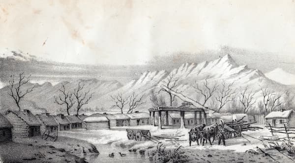
Mormon settlers built Fort Utah on the Provo River in the spring of 1849, on ground the Timpanogos used. According to Legacy, the newcomers learned from their Ute neighbors when and where to fish. The fishing that followed is one of the threads running through the violence of 1849 and 1850, which our short history of Provo tells in full.
What the settlers found was abundance on a scale that is hard to picture now. George Washington Bean wrote in 1854 that suckers and mullets ran up the Provo River so thickly that "the river would be full from bank to bank as thick as they could swim for hours and sometimes days together." Legacy estimates the June sucker population in the millions and notes that the valley's 1851 census counted 1,505 people.
Famine fish, and the first fish laws
Fish carried the settlements through their worst years. In 1848, after frost and crickets destroyed crops, fishing companies were organized to supply settlers who had nothing else. Then came 1855: grasshoppers stripped fields from Cache Valley to Parowan, drought followed, and, in Legacy's words, "eating fish was the only way many people survived."
The numbers from 1856 give a sense of the harvest. Joseph W. Bates, fishing for Salt Lake City's First Ward, reported that his company "caught some 8 tons of fish" in six weeks near the lake. At least six such companies worked the lake that summer. Provo's incomplete tithing records show at least 6,975 pounds of fish donated as tithing, which implies a catch of at least ten times that. Legacy says tithing fish from Utah Lake helped pay public workers on the Salt Lake Temple, the fence around Temple Square and the Fillmore statehouse.
The pressure produced Utah's first conservation laws:
- 1853: the territorial legislature gave county courts authority over fisheries to prevent the "needless destruction of fish." Provo and Utah County then split the job: the city took the Provo River under its charter, the county took the lake.
- 1856 to 1862: a trap that Robert Wimmer built across the Jordan River caught up to 500 pounds a day and starved the streams upstream of it. After angry Salt Lake Valley residents threatened violence, legislators ordered it removed. An 1862 act let county courts license fish traps but barred them from the Jordan.
- 1872: a game law set seasons, banned some catches, set seine mesh sizes, prohibited fishing with chemicals and required fishways in diversion dams.
- 1896: after years of fishermen blasting trout runs with dynamite, then called "giant powder," it became a felony.
Commercial fishing became a family business. Peter Madsen began fishing the lake in 1854 according to one passage of Legacy, and a caption in the same book says his family dominated commercial fishing "from 1855 well into the 1940s." The book also notes that the Loy family has fished the lake commercially for four generations.
The great native trout did not survive the century. A 2017 summary by the engineer LaVere Merritt, posted with the Legislature's 2017 interim committee materials, says Bonneville cutthroat trout, many over ten pounds, were fairly common until about 1900. Legacy says a few remained in the lake until the mid-1930s. Carp arrived in the 1880s as a replacement food fish, and the year is disputed; our carp and steamboats page sets out the four competing dates.
1872: the dam that made the lake a reservoir
The decision that shaped everything after it was made in Salt Lake County. In 1872, Salt Lake County farmers built a dam near the Jordan Narrows, by the Point of the Mountain, so they could store water in Utah Lake and release it into their canals. A June Sucker Recovery program timeline calls the result "Utah's first water storage reservoir."
The trouble was immediate. Salt Lake City's public utilities department, in a 2011 history of the dispute, describes the sequence:
- In spring 1873 the Utah County court said the lake had risen and blamed the dam for flooding farmland around the shore.
- No settlement came, and the dam was washed out. Salt Lake County's court records say "the head gates washed out, being helped by persons unknown."
- The dam was rebuilt in spring 1874. Salt Lake County's own court investigated the complaints and found the dam had no effect on the lake's level.
- In 1880 the dam was raised, and the outcry from Utah County landowners grew.
In 1885, after several years of dispute, an arbitration committee of prominent citizens led by President John Taylor of The Church of Jesus Christ of Latter-day Saints set a compromise elevation: the level above which the outlet gates had to be opened. Salt Lake City's history records it as 4,515.799 feet in "City datum," the city's own survey system at the time. (The UVU report gives the same number as "4,515 feet above sea level"; the 1985 figure below is measured on the federal survey datum, so the two numbers should not be compared directly.) A five-member commission, two from each county plus a referee, ran the gates.
The dam had a cost no one at the arbitration table was counting. Legacy notes that fish swimming out of the lake were carried into the canals and onto Salt Lake Valley fields, where they died.
Pumps, and the lake that nearly vanished
Salt Lake County's claim on the lake grew. After the drought of 1900 and 1901 shrank the Jordan River, a large pumping plant was approved at the outlet in 1902. The Lehi Free Press, quoting the town history Lehi: Portraits of a Utah Town, says that with all eight units running it delivered 700 million gallons a day and was considered the largest pumping station in the world, and that a $185,000 project in 1920 doubled its capacity. Salt Lake City's 2011 account places the Utah Lake Pumping Plant at the lake's outlet in Lehi.
Then came the 1930s. The U.S. Bureau of Reclamation's project history says storage in Utah Lake fell from about 850,000 acre-feet in 1931 to about 20,000 acre-feet in 1935. A Salt Lake City water history quoted by the Free Press puts the low at 4,477 feet in September 1935, twelve feet below the compromise level: "at this level the lake is essentially drained."
The local papers recorded what that looked like. On November 22, 1934, the Lehi Free Press reported that three men walked from Pelican Point straight across the lake to the old Murdock resort site south of Lehi on a lakebed "crusted and cracked into large cakes." A deputy state game warden told the Lehi Sun that October that stranded fish had burrowed into the mud and that he was catching live fish with sunburned sides. Legacy says the average depth fell to about a foot. A Lehi Sun writer blamed Salt Lake's pumps and urged readers to take up the slogan "SAVE UTAH LAKE."
The drought's lasting answer was upstream storage. The emergency produced the Provo River Project and Deer Creek Dam, which our guide to where Provo's water comes from explains, and it set up the larger fights of the next half century, told in our page on Utah Valley's water wars.
The plan to wall off the bays
The most radical plan for the lake was never built, and almost nobody remembers it. When the federal government designed the Bonneville Unit of the Central Utah Project, it included diking off Provo Bay and Goshen Bay, the two large shallow arms of the lake, to reduce evaporation. Evaporation is the lake's biggest loss: Salt Lake City's 2011 summary puts it at about 380,000 acre-feet a year, more than flows out the Jordan.
The state history office's account of the Central Utah Project says the diking was never constructed and that Jordanelle Dam was built as the alternative. The Bureau of Reclamation's Bonneville Unit summary records the formal end: the 1992 Central Utah Project Completion Act eliminated "the draining of Benjamin Slough, and diking of Goshen Bay and Provo Bay in Utah Lake."
Merritt's 2017 notes for legislators explain why the idea keeps failing on paper. Only Provo Bay has bottom soils somewhat suited to farming, and it is also one of the lake's most important wildlife areas. Current wetland law would require replacement marshes, so "the net outcome would likely be little, if any, additional lands for farming or development, as well as little, if any, water savings from reduced evaporation."
The water that came back: 1983 to 1985
Fifty years after the lake nearly disappeared, it overflowed. Salt Lake City's utilities history calls 1983 to 1985 the wettest period on record. On September 15, 1983, the Utah Lake Landowner's Association filed a class action against Salt Lake County, the canal companies and everyone else claiming Utah Lake water, alleging they had broken the 1885 agreement. In 1984 the lake rose about five feet above the compromise level and flooded farmland around the shore.
The 1984 Legislature put $1.5 million into the Disaster Relief Board, $500,000 of it for engineering studies. The resulting Utah Lake Jordan River Flood Management Program cost more than $10 million and included a new outlet structure, dredging in the lake and the river, and changes to five diversion structures.
The parties settled on March 8, 1985. Under the agreement:
- The lake is run under a written flood management plan instead of the 1885 agreement.
- The new compromise elevation is 4,489.045 feet above sea level. At that level the lake holds about 870,000 acre-feet.
- Jordan River flow is capped at 3,400 cubic feet per second at 2100 South in Salt Lake City.
- The first 125,000 acre-feet of active storage is reserved for holders of primary storage rights, a list that includes Salt Lake City, several canal and irrigation companies, two conservancy districts and Kennecott.
The engineering study also settled a century-old suspicion. It found that a natural restriction in the river at "Indian Ford," south of Camp Williams, was what backed water into the lake, not the Turner Dam at the Narrows.
High water had remade the shoreline before. Legacy says the Provo Lake Resort, west of today's Provo airport, closed in 1918 when the rising lake flooded it for the last time, and that in early 1922 a winter storm drove ice onto the shore and destroyed the new Provona Beach bathhouses.
Who owns the bottom
A question that sounds academic turned out to decide the lake's future. In 1987, in Utah Division of State Lands v. United States, the U.S. Supreme Court ruled that the bed of Utah Lake passed to the state at statehood under the equal footing doctrine. According to the UVU report, the case began when the federal government tried to lease lakebed land for drilling.
State ownership comes with a duty: the bed is sovereign land held in trust for the public. That principle is what stopped the largest development plan the lake has seen.
The bridge that was never built
The lake sits between the fastest-growing towns in Utah County, and for decades people have asked why there is no road across it.
Around 1990: Utah County engineer Clyde Naylor proposed a causeway. BYU's Daily Universe reported in 2000 that he pictured it spanning about five miles between the Provo-Orem border and Pelican Point, and that the idea "was lauded by some and laughed at by the rest." Provo's city manager called it "just theoretical."
2007: Rep. Ken Sumsion of American Fork said he would seek $5 million for an engineering and environmental study of a seven-mile commuter bridge. The Utah Lake Commission said any bridge should sit on pilings, not a causeway, to avoid altering the lake's chemistry.
2009: a private company, Utah Crossing Inc., led by Leon Harward, proposed a $600 million toll bridge, privately financed and privately owned. KSL and the Deseret News reported the plan: a six-mile span from Vineyard Lake Road near Orem's 800 North exit to Saratoga Springs just north of Pelican Point, four lanes, about 35 feet above the water, with a hump rising to 50 feet for sailboats, and a toll of $2 to $3. Because the state owns the lakebed, the company would have leased it. The Sierra Club's regional representative called it "Utah's version of a bridge to nowhere." The Utah Lake Commission held a public hearing that October. The bridge was not built.
2017: Merritt's notes for legislators described the engineering problem. The lakebed is "a very poor foundation." A fill causeway would need a base several hundred feet wide or driven piles, would settle for years, and would need bridges or culverts so water could circulate. In some springs, wind-driven ice sheets stack 10 to 20 feet high along the shore.
2026: in May, FOX 13 reported that the Mountainland Association of Governments had put an east-west lake crossing on its project list for a regional plan running through 2055, and that UDOT wanted to study whether it could be built and paid for. The Utah Lake Authority said it had drilled 500 feet without finding bedrock and that multiple fault lines run through the lake.
The islands, briefly
The best-known recent proposal combined a crossing with something much larger. Lake Restoration Solutions applied in 2017 to dredge the lake and build islands under a 2018 law that let the state trade lakebed for restoration. Its application, as the Deseret News described it, called for 34 islands of about 18,000 acres, 190 miles of new shoreline, at least four roads, a price above $6.5 billion, and an average lowering of the lake by seven feet.
On October 27, 2022, the Division of Forestry, Fire and State Lands canceled the application. It said the plan "contemplates a disposition that would impede navigation and permanently dispose of sovereign lands to private parties," contrary to the public trust. The lawsuits and the company's 2023 dissolution are covered in our Utah Lake guide, and the Legislature's 2024 repeal of the 2018 law is on our carp and steamboats page.
Cleaning it up
For most of its settled history the lake was also a sewer. The UVU report says a 1948 BYU study by Dean Anderson found "the waters in multiple areas of Utah Lake were being seriously polluted," that cities around the lake built treatment plants over the next two decades, and that by 1967 raw sewage was no longer being discharged directly into the lake. The same report cites an Environmental Working Group study finding that Geneva Steel released 266,468 pounds of ammonia and phenol into the lake between 1990 and 1994.
The recovery work of the last 25 years has three main parts:
- The fish. Nine agencies and groups joined the June Sucker Recovery Implementation Program in 1999. By 2010, carp made up about 90 percent of the lake's fish biomass, according to the UVU report; mass removal followed. On February 3, 2021, the U.S. Fish and Wildlife Service moved the June sucker from endangered to threatened.
- The shoreline. The report says as much as 70 percent of the invasive phragmites reed that walled off the 75-mile shoreline has been removed.
- The river mouth. The Provo River Delta Restoration Project, run by the federal Utah Reclamation Mitigation and Conservation Commission, removed a dike and rebuilt a braided delta. Interior Department accounts describe it as 260 acres in 2022 and as "nearly 300 acres" in the 2026 budget. Our birdwatching guide and 2026 delta update cover what is open.
Governance changed too. The Legislature created the Utah Lake Commission in 2007 as a planning body with limited authority, and in 2022 replaced it with the Utah Lake Authority, which can raise money and carry out its own plans.
Where to see it
- Utah Lake State Park, at the mouth of the Provo River, is where Arthur N. Taylor opened the Provona Beach resort in 1921, according to Legacy.
- The Provo River Delta, beside it, is the newest landscape on the lake.
- The outlet at Lehi, where the pumping plant and gates sit, is where the 1885 and 1985 agreements are carried out every spring.
- Pelican Point on the west shore is the spot every bridge proposal has aimed at.
- Lincoln Beach on the south shore has the warm spring Albert Carrington noted in 1849; our Lincoln Beach page has the road conditions.
Before swimming anywhere on the lake in summer, check the state's bloom advisories; our algal bloom explainer shows where to look.
Frequently Asked Questions
Who controls how high Utah Lake gets?
Did Utah Lake ever dry up?
Why was there a fight over a dam on the Jordan River?
Was a bridge across Utah Lake ever proposed?
Who owns the bottom of Utah Lake?
What was the plan to dike Utah Lake?
When did the 1980s Utah Lake flood happen?
Where can I see Utah Lake's history in person?
Sources
The facts in this guide were checked against these sources. Hours, fees and rules change, so confirm anything time-sensitive with the source before you go. How we make Provo.com.
- Utah Lake and the Jordan River Flood Control (2011), Salt Lake City Public Utilities. Checked October 20, 2026.
- Provo River Project, U.S. Bureau of Reclamation. Checked October 20, 2026.
- Central Utah Project, Utah Division of State History, History To Go. Checked October 20, 2026.
- Central Utah Project, Bonneville Unit, U.S. Bureau of Reclamation. Checked October 20, 2026.
- Delta restoration project to improve Utah Lake water quality, U.S. Department of the Interior, CUPCA Office. Checked October 20, 2026.
- Central Utah Project Completion Act, FY2026 Budget in Brief, U.S. Department of the Interior. Checked October 20, 2026.
- Historical Overview of Territorial, State, and Federal Legislation Impacting Utah Lake (Oct. 2024), Utah Valley University, Herbert Institute. Checked October 20, 2026.
- Conserve water or save land? A brief history of Utah Lake property rights, Utah Lake Commission/Authority. Checked October 20, 2026.
- The Scene: Utah Lake in the 1880s-1920s, June Sucker Recovery Implementation Program. Checked October 20, 2026.
- Utah Lake: Legacy (D. Robert Carter), June Sucker Recovery Implementation Program, via Utah Lake Authority. Checked October 20, 2026.
- Utah Lake: A Few Considerations (Nov. 2017, LaVere B. Merritt), Utah Legislature interim materials. Checked October 20, 2026.
- Utah Lake all but disappeared in the 1930s, Lehi Free Press. Checked October 20, 2026.
- Utah Lake causeway idea just a futuristic fantasy (2000), The Daily Universe (BYU). Checked October 20, 2026.
- Lawmaker pushes for bridge across Utah Lake (2007, AP), KSL. Checked October 20, 2026.
- Group proposes bridge over Utah Lake (2009), Deseret News. Checked October 20, 2026.
- Private company wants to build toll bridge across Utah Lake (2009), KSL. Checked October 20, 2026.
- Group seeks public input on bridge across Utah Lake (2009), KSL. Checked October 20, 2026.
- Is a bridge over Utah Lake simply a bridge too far? (May 2026), FOX 13. Checked October 20, 2026.
- Utah Lake islands project rejected (Oct. 27, 2022), Deseret News. Checked October 20, 2026.