
The Mirror Lake Highway is the road. This page is the walking. From Kamas the highway climbs east and north over Bald Mountain Pass, and nearly every trail worth doing in the western High Uintas starts from a pull-off or a trailhead along it, all within about two hours of Provo. Below are the trailheads in the order you reach them, what each trail asks of you, and the rules for the wilderness beyond. For the town at the trailheads' doorstep, see things to do in Kamas.
Our Mirror Lake Highway guide covers the drive, the seasonal closure, camping, mosquitoes and how the range compares with the Alpine Loop. Read it first if this is your first trip. Trail figures here are from AllTrails unless noted, and mileages from Kamas come from the trailheads' AllTrails directions.
Getting there, and the pass you need
Drive: up Provo Canyon to Heber, north to Kamas, then east on Highway 150. By an OpenStreetMap routing estimate from downtown Provo, Kamas is about 44 miles and an hour; the Trial Lake turnoff about 70 miles and 1 hour 40 minutes; the Mirror Lake area about 76 miles and 1 hour 50 minutes. Those are no-traffic numbers.
The pass: the Forest Service lists Mirror Lake Scenic Corridor Recreation Area standard amenity fees of $10 for three days, $20 for seven days and $60 for a year, and it honors America the Beautiful interagency passes. Several AllTrails trail pages still show older rates of $6, $12 and $45; the Forest Service page is current. Buy before you lose cell service.
Altitude: most of these trailheads sit above 10,000 feet, more than a mile higher than Provo. Our guide to Provo's elevation covers what that does to a body that lives at 4,500 feet. Start slower than you think you need to.
The trailheads, in order from Kamas
| Trailhead | About this far from Kamas | Trail | Round trip and gain |
|---|---|---|---|
| Crystal Lake (via Trial Lake road) | 27 miles | Clyde Lake Loop | 5.5 mi loop, 567 ft |
| Bald Mountain | about 30 miles | Bald Mountain summit | 2.8 mi, 1,171 ft |
| Fehr Lake pull-off | 31 miles | Fehr Lake | 3.7 mi, 629 ft |
| Pass Lake | 32 miles | Lofty Lake Loop | 4.6 mi loop, 984 ft |
| Highline | 34 miles | Naturalist Basin | 14.7 mi, 1,991 ft |
| Ruth Lake pull-off | 35 miles | Ruth Lake | 2.2 mi loop, 213 ft |
| Christmas Meadows | 46 miles plus 7 miles of gravel | Amethyst Lake | 13 mi, 2,188 ft |
Crystal Lake trailhead: the lake-hopping hub
From Kamas, 27 miles to the Trial Lake Campground, then west on a paved road about a mile to a fork and right about another mile to the trailhead. AllTrails describes parking for 57 vehicles and toilets, with water at Trial Lake Campground.
This is the best trailhead on the highway for people who want many lakes for little climbing. The trails here sit in national forest outside the wilderness boundary, according to AllTrails' park labels.
- Clyde Lake Loop: 5.5 miles, 567 feet of gain, high point about 10,492 feet. AllTrails lists the lakes it passes: Lily, Wall, Hope, North and South Twin, John, Clyde, Booker, Watson, Linear, Petite, Cliff and Crystal, with boardwalks over the meadows. Dogs on leash. The most-reviewed hike on the highway, with nearly 2,900 AllTrails reviews.
- Wall Lake: 2.6 miles round trip, 160 feet of gain, rated easy. The best short walk from this trailhead.
- Cliff Lake via Clyde Lake trail: 1.9-mile loop, 213 feet, easy.
- Crystal and Watson lakes: 2.6 miles, 377 feet.
- Island Lake via the Lakes Country Trail: 8.6 miles round trip, 1,020 feet, a longer day past the lake cluster.
- Ibantik Lake: 8.2 miles round trip, 1,141 feet.
- Twenty Lakes Loop: 7.1 miles, 915 feet.
Reviewers on AllTrails consistently mention muddy sections and rocky footing, and recommend weekdays and early starts.
Bald Mountain: the summit everyone does
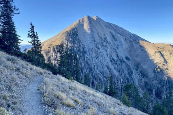
About 30 miles from Kamas; the turn is about half a mile north of the Bald Mountain overlook. 2.8 miles round trip, 1,171 feet of gain, to about 11,938 feet. AllTrails' average is two to two and a half hours.
Short, steep and rocky, Bald Mountain gives a first-time Uinta hiker a near-12,000-foot summit and a view over the lake country without an overnight. AllTrails reviewers recommend an early start, water and trekking poles. Two cautions: the altitude is real, and the summit ridge is a poor place to be when afternoon thunderstorms build. Turn around when the sky does.
The Notch Mountain traverse links this trailhead to Crystal Lake: AllTrails lists Bald Mountain trailhead to Crystal Lake trailhead via Notch Mountain at 10.5 miles point to point, 1,184 feet of gain, rated hard, which needs a car shuttle. AllTrails also lists a shorter out-and-back on the Notch Mountain Trail to Clegg and Notch lakes, about 4.7 miles with 521 feet of gain.
Fehr Lake: the quiet one with an extension
31 miles from Kamas, a signed turn-out about a quarter mile south of Moosehorn Campground. 3.7 miles round trip, 629 feet of gain.
AllTrails describes a natural-surface trail that runs gently downhill through meadow and woods to Fehr Lake, which means the climb comes on the way back. Past Fehr, the trail continues into Murdock Basin past Shepard Lake to Hoover Lake for anyone who wants more. Its reviewers suggest staying left at the lakes. A good first hike for kids who can handle the uphill return.
Pass Lake trailhead: the Lofty Lake Loop
About 32 miles from Kamas, just past the turnoff to Mirror Lake. 4.6-mile loop, 984 feet of gain, high point about 10,908 feet.
AllTrails' description: start on the Weber River trail, turn right onto the Lofty Lake Trail, pass the Cuberant Lake junction, continue past Kamas Lake to Lofty Lake, then cross the pass and drop past Scout Lake back to the Weber River trail. Reviewers recommend going counterclockwise for an easier climb. Dogs on leash. A shorter out-and-back to Kamas Lake alone is about 4.2 miles, 715 feet.
Next door, the Mirror Lake loop circles the most famous lake on the highway in about 1.5 miles with almost no climbing, the easiest walk on this page.
Highline trailhead: the door to the wilderness
About 34 miles from Kamas, at a large signed trailhead on the east side of the road. AllTrails lists a capacity of 24 vehicles, "often considerably more" on busy weekends, with toilets, water, a stock ramp and nearby campsites.
The Highline Trail heads east into the High Uintas Wilderness, and this is where day hikers become backpackers.
- Naturalist Basin: 14.7 miles round trip, 1,991 feet of gain, rated hard. AllTrails' route: follow the Highline about 4 miles to the Naturalist Basin Trail junction, then about 1.75 miles to Jordan Lake. The Highline first descends about 400 feet in the first 1.25 miles, then climbs about 650 feet to the lake, so the return starts with a climb. Three more lakes, Shaler, Faxon and LeConte, sit on a bench above Jordan Lake. AllTrails lists July through September as the best months.
- Jordan Lake alone, via the same route, is listed at 13 miles round trip, 1,545 feet.
- The Highline loop through Naturalist, Four Lakes and Grandaddy basins is a 35.4-mile backpacking trip with 4,294 feet of climbing.
Ruth Lake: the easy roadside lake
About 35 miles from Kamas, a signed roadside pull-off with restrooms. 2.2-mile loop, 213 feet of gain, rated easy, average under an hour.
The best family walk past the pass. AllTrails notes that at the west end of the lake the trail forks right and continues southwest to meet the Lofty Lake Loop, for anyone who wants a longer day. Reviewers mention crowds and some mud; go early.
Christmas Meadows: the north slope
About 46 miles from Kamas, just north of Stillwater Campground, turn onto an improved gravel road and follow it about 7 miles along the Stillwater Fork to Christmas Meadows Campground; the trailhead is at its upper end. AllTrails lists 15 parking places and a stock ramp, with toilets and water at the nearby campgrounds. AllTrails lists the Forest Service's Evanston-Mountain View Ranger District as the contact for this trailhead.
- Amethyst Lake: 13 miles round trip, 2,188 feet of gain, rated hard, average six and a half to seven hours. The route starts on the Stillwater Trail; about 2 miles in, the Amethyst Lake Trail forks left. AllTrails warns the first 2 miles of the side trail are steep and rocky, and notes that most backpackers camp at the end of a long meadow about 1.5 miles below the lake, where there is more shelter from wind. The lake sits in a cirque at timberline inside the wilderness.
- Ostler Lake via the same trails is about 11.4 miles round trip, 1,955 feet.
From Provo, Christmas Meadows is the longest drive on this page. It is the right choice for a two- or three-day trip, not a day hike.
The High Uintas Wilderness rules
Naturalist Basin, Amethyst and Ostler lakes and much of the country beyond the road lie inside the High Uintas Wilderness, which the Forest Service describes as 456,705 acres stretching nearly 60 miles east to west, designated in 1984. The Forest Service lists these rules for it:
- Group size: no more than 14 people and 15 head of stock. Larger groups must split into groups of 14 or fewer and stay at least one mile apart on trails and in camp.
- Campsites more than 200 feet from water sources, from trails and from other occupied campsites.
- Carry out all litter. Bury nothing except human waste, buried 6 inches deep.
- Horses: tethered no more than an hour within 200 feet of water, never tied to a tree for more than an hour, and all feed must be certified weed free.
Wilderness on the National Forest is closed to motor vehicles, mechanized equipment and bicycles. The Forest Service also asks visitors to keep fires small or use a stove and to camp out of sight of lakes and trails. Our Mirror Lake Highway guide notes that the Forest has occupancy and campfire orders in force for the High Uintas; check them before an overnight.
Picking your trail
- A first visit with kids: Mirror Lake loop, Ruth Lake or Wall Lake.
- One big view in a morning: Bald Mountain, early.
- Many lakes, modest climbing: the Clyde Lake Loop.
- A loop with a pass: Lofty Lake, counterclockwise.
- Your first wilderness overnight: Naturalist Basin.
- A quieter, wilder overnight: Amethyst Lake from Christmas Meadows.
For fishing the river that runs beside the highway, see our Upper Provo River guide. For an alpine day closer to home, our guide to the Timpanogos traverse covers the big hike above Utah Valley, and our camping guide covers the Mirror Lake campgrounds and their booking windows.
Frequently Asked Questions
How far are the Uintas from Provo?
Do I need a pass to hike off the Mirror Lake Highway?
What is the easiest hike in the Uintas near Mirror Lake?
How hard is the Bald Mountain hike?
What is the best Uinta backpacking trip from the Mirror Lake Highway?
What are the High Uintas Wilderness rules?
Can I bring my dog on Uinta trails?
When are the Uinta trails open?
Sources
The facts in this guide were checked against these sources. Hours, fees and rules change, so confirm anything time-sensitive with the source before you go. How we make Provo.com.
- Mirror Lake Scenic Byway (fees), USDA Forest Service. Checked October 19, 2026.
- Wilderness (High Uintas regulations), USDA Forest Service. Checked October 19, 2026.
- Bald Mountain Trail, AllTrails. Checked October 19, 2026.
- Clyde Lake Loop, AllTrails. Checked October 19, 2026.
- Lofty Lake Loop Trail, AllTrails. Checked October 19, 2026.
- Fehr Lake Trail, AllTrails. Checked October 19, 2026.
- Ruth Lake Trail, AllTrails. Checked October 19, 2026.
- Naturalist Basin, AllTrails. Checked October 19, 2026.
- AllTrails: Amethyst Lake, AllTrails. Checked October 19, 2026.
- Bald Mountain TH to Crystal Lake TH via Notch Mountain, AllTrails. Checked October 19, 2026.
- OSRM routing (OpenStreetMap data), Project OSRM. Checked October 19, 2026.