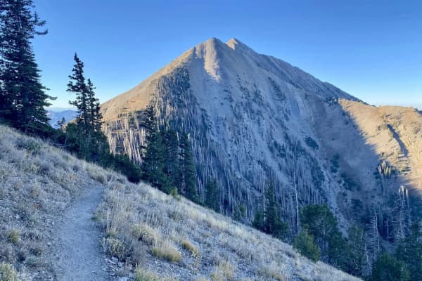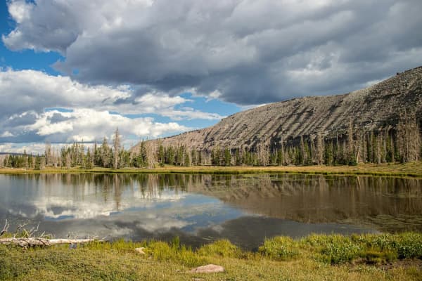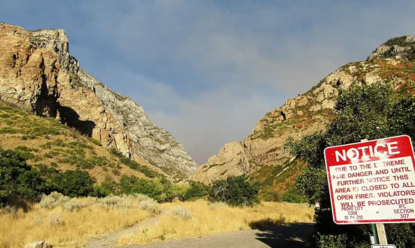
This page covers the trail system above Springville, Mapleton and lower Spanish Fork Canyon: nineteen numbered trails in the Spanish Fork Ranger District of the Uinta-Wasatch-Cache National Forest. It gives each trail the length the Forest Service publishes, where it starts, who is allowed on it and what to watch for. It is the reference to open after you have picked a canyon. For the canyons themselves (campgrounds, the golf course, the hot springs, the Thistle slide) read our Hobble Creek Canyon guide and our Spanish Fork Canyon and Diamond Fork guide.
Read these numbers the way the agency means them
Every distance below is the Forest Service's published trail length, one way, from the trailhead to the junction or road where the trail ends. It is not a round trip. A 3.33-mile trail is a 6.66-mile day if you walk back the way you came.
Three more things the numbers do not tell you:
- The agency publishes no elevation gain for these trails and no difficulty rating. Where a page below says steep, easy or rough, those are the Forest Service's own words.
- Most of these trails end at another trail. The system is a web, with the Great Western Trail running north and south along the top. That is why locals talk about Wardsworth and the Dry Canyon Cutoff together, or Monks Hollow and Long Hollow as one trip.
- Several are shared with motorized users. The Forest Service lists each trail's allowed uses, and they are given under each heading.
Fees, dogs and seasons in one place
Fees. Hobble Creek is not a designated Forest Service fee area, as our canyon guide explains: parking at a Right Fork trailhead costs nothing. In Diamond Fork, the Forest Service lists the Three Forks Trailhead and Sawmill Hollow Campground as day-use fee sites, so display a pass. For the Maple Canyon trailheads at Whiting Campground and the roadside trailheads along US-6, the agency's pages state no fee either way, and this guide does not guess.
Dogs. These canyons are not Salt Lake City watershed, and no Spanish Fork Ranger District trail page bans dogs. Our dog-friendly hikes guide explains how Forest Service leash rules work in Utah County: required in developed sites, and the sensible default everywhere else, especially on trails shared with stock and motorcycles.
Seasons. The Forest Service publishes no season for most of these trails. Our Hobble Creek guide notes that roads above the campgrounds are not maintained for winter travel, and the Diamond Fork road is gated seasonally, with the closure moving with conditions rather than sitting on a fixed date. In practice these are late-spring-to-fall trails. Fall also brings hunters; our hunting guide explains when the seasons fall, and bright clothing is cheap insurance from September on.
Hobble Creek Canyon: the Right Fork trails
Drive east on 400 South from Springville into the canyon. About six miles up, past the golf course, the road forks; every trail in this section starts off the Right Fork.
Left Fork Days Canyon Trail #011
3.69 miles one way · starts in Cherry Campground · hikers, horses, bikes
The Forest Service calls this one perfect for a day hike or a picnic, and it has done something unusual at the start: interpretive signs identify the local plants, so the first stretch doubles as a nature walk. The trail runs through cottonwood and maple and passes a freshwater spring pouring out of the side of the mountain.
The catch is water. The trail crosses the stream several times, and the agency says those crossings may be challenging for children. To find it, take the Right Fork, enter Cherry Campground, turn left and drive to the large parking lot; the trail leaves from the lot. It connects at its upper end with Kirkman Hollow.
Kirkman Hollow Trail #012
2.71 miles one way · Right Fork · hikers, horses, bikes, OHV
A drainage trail for about half its length, after which it climbs out and steepens toward the end, where it meets Days Canyon and the Great Western Trail. The Forest Service's directions put the trailhead about eight miles past the fork, on the right-hand side of the road. Our Hobble Creek guide lists Kirkman Hollow among the trails reached from Cherry Campground, which is true of the trail system through its Days Canyon connection; for the trailhead itself, follow the agency's directions.
Wardsworth Canyon Trail #010
3.33 miles one way · just past Balsam Campground · hikers, horses, bikes
The easy walk of the Right Fork, and in the Forest Service's words excellent mountain biking. It runs beside Wardsworth Creek, a year-round stream with pools that hold mostly cutthroat and brown trout, and the agency suggests watching for beaver dams after the first couple of miles. A few short, steep detours climb away from the creek where floods washed out the original tread.
Two things to know. The trailhead is on the left side of the road about half a mile past Balsam Campground, just after the pavement turns to gravel. And past its junction with the Dry Canyon Cutoff #128, the Forest Service says Wardsworth is no longer maintained, so that junction is the natural turnaround.
Packard Canyon Trail #091
4.21 miles one way · Right Fork · hikers, horses, bikes, OHV
The trail crosses the stream at the start, climbs onto the ridge opposite, and then runs a gentle incline along the top until it joins the Great Western Access Trail. The trailhead is on the right about a quarter mile after the pavement ends. It is the quickest way from the canyon road onto the ridge system, which is why it sees riders as well as hikers.
Dry Canyon Cutoff Trails #128 and #128A
#128: 5.54 miles · #128A: 2.16 miles · corrals about four miles past Cherry Campground · hikers, horses, bikes
The trailhead is on the left side of the road about four miles past Cherry Campground, next to some corrals; the trail starts through the gate. It follows a creek bed for about half a mile to a signed fork: right for the Cutoff, left for Dry Canyon. The Cutoff then follows the stream for about a mile and splits again at a carsonite marker.
#128A veers right through a meadow, climbs through aspen and scrub oak onto a ridge, crosses a dirt road, and runs mostly downhill past a small pond and a stream with several small waterfalls before joining Wardsworth. The Forest Service calls it a popular mountain biking trail. #128 continues straight along the streambed for another 1.5 miles, turns through a meadow and an aspen stand, crosses the same dirt road and drops down a tributary to meet Wardsworth Canyon lower down. Ridden with Wardsworth, the two make the Right Fork's best loops.
Dry Canyon Trail #003
5.92 miles one way · Dry Creek Picnic Area · hikers, horses, bikes
Not the Dry Canyon above Lindon, which is a different trail with a different number (see the FAQ below). This one shares its first half mile with the Cutoff, then takes the left fork and slopes gently up through scrub oak, aspen, cottonwood and Douglas fir. The Forest Service lists wild rose, chokecherry, scarlet gilia, penstemon, bluebells and mule ears along it, which makes it a June wildflower walk; our wildflower guide covers how the bloom moves up the mountain.
The agency's directions: drive the Hobble Creek road about 10.6 miles beyond the end of 400 South, taking the Right Fork, and park at the Dry Creek Picnic Area. The trailhead is a little beyond the fenced corral.
Maple Canyon, above Mapleton
Maple Canyon is Mapleton's canyon. From Springville, take US-89 south to Maple Street in Mapleton, turn east, and follow 400 North where it bends into Maple Canyon Road. It ends at Whiting Campground, and two trails leave from there.
Left Fork Maple Canyon Trail #006
5.89 miles one way · Whiting Campground lower parking · hikers, horses, bikes, OHV
A moderate trail, in the agency's word, that follows an old dirt road and then a riverbed gently upward from the campground, shaded by trees for much of the way. It connects at the top with the Little Diamond Trail, which drops into Diamond Fork. The trailhead is the parking lot at the end of the campground.
Right Fork Maple Canyon Trail #007
5.19 miles one way · about half a mile up from Whiting Campground · hikers, horses, bikes · no motorized vehicles
The scenic one, and the harder one. It begins at the far end of the campground and picnic area; about a quarter mile past the gate, a side road crosses the stream to the south, and that is the trail. Some sections are very steep. Box elder, Douglas fir and aspen shade the lower half, and higher up it opens into wild meadows around Maple Canyon Lake, with subalpine fir and the steep walls of Spanish Fork Peak above.
It continues around the lake and switchbacks to the ridgeline, where the Forest Service describes panoramic views north and west over Utah Valley and east beyond Strawberry Ridge, then swings around the mountain to Spanish Fork Peak and the top of Sterling Hollow. Watch the footing: the agency warns of numerous loose rocks.
Sterling Hollow Trail #008
4.51 miles one way · US-6, about six miles up Spanish Fork Canyon · hikers, horses, bikes
The hardest trail on this page. The Forest Service calls it extremely rough and steep and physically demanding: it follows Wind Rock Ridge through thick scrub oak straight to the summit of Spanish Fork Peak, 10,193 feet, the mountain behind Mapleton. The reward, in the agency's words, is a panoramic view that makes the effort worthwhile.
The trailhead is on the left (north) side of US-6 about six miles up Spanish Fork Canyon. A strong party can walk up Sterling Hollow and down the Right Fork to Whiting Campground with a car left at each end; that is our suggestion from how the two trails connect, not an agency route.
Diamond Fork and the Spanish Fork Canyon side trails
The Diamond Fork road leaves US-6 about six miles up Spanish Fork Canyon and runs north past Diamond Campground to the Three Forks Trailhead. Our hot springs guide covers the soak at the end of the most popular trail here; this section covers the rest of the system.
Fifth Water Trail #015
9.62 miles one way · Three Forks Trailhead · hikers, horses, bikes, OHV · fee site
The hot springs trail, and much more trail than most people use. From Three Forks you cross a footbridge and follow Sixth Water Creek for a shaded 1.1 miles, cross another bridge, and take the right fork up Fifth Water Creek (Sixth Water continues left). Pools, small rapids and odd conglomerate rock formations line the creek, and the sulfur smell arrives before the springs do. The largest springs are 1.5 miles up Fifth Water, where a cold waterfall meets the hot pools.
Above the springs the Forest Service describes another mile to a jeep road, Rays Valley Road half a mile after that, and then 4.5 little-used miles to Strawberry Ridge, past old beaver dams, across the Center Trail and up an old dirt road to the ridge. Our hot springs guide covers the soak, the etiquette and the winter gate.
Cottonwood-Second Water Trail #018
7.61 miles one way · Three Forks Trailhead · hikers, horses, bikes · fee site at Three Forks
The other trail from Three Forks: cross the footbridge to the right (the left one is Sixth Water). The Forest Service calls it easy yet long and excellent for mountain biking. It follows the stream and crosses it a number of times, with ups and downs and a gentle overall climb through maple, oak and small conifers. Because the path runs so close to the streambed, erosion is a recurring problem, and the agency asks for careful travel. Its far end meets the Center Trail near Indian Springs Road, which can also be reached from the Sheep Creek and Rays Valley roads.
Fourth Water Trail #017
2.26 miles one way · Rays Valley Road · hikers, horses, bikes, OHV
A short trail the Forest Service describes as easy and relatively level, following Fourth Water Creek almost the whole way from Rays Valley Road to the Center Trail, the Great Western Trail's section through this basin. Getting there is the expedition: up Spanish Fork Canyon to the Sheep Creek road, then the Rays Valley road to the trailhead on the right. Our Spanish Fork Canyon guide describes that high-country loop.
Little Diamond Trail #016
2.68 miles one way · Little Diamond Road #025 · hikers, horses, bikes, OHV
Much of this trail is a mine road that may still be used for mining, and it follows a dry riverbed most of the way to its junction with Left Fork Maple Canyon. Two cautions. The Forest Service describes it as relatively flat while also saying it gains 1,800 feet, which does not square with a 2.68-mile length; this guide reports both statements rather than picking one. And the access road, which leaves the Diamond Fork road just above Palmyra Campground, runs about six miles to the trailhead, rougher after the halfway point, where the Diamond Battle Historic Monument stands; the agency recommends four-wheel drive beyond the monument.
Mapleton-Sawmill Hollow Trail #013
12.78 miles one way · near Sawmill Hollow Campground · hikers, horses, bikes, OHV
The long one. It starts as an old road and easy walking, makes a quick jump up a small hill and steepens from there, providing access to the Great Western Access Trail along the ridge. Take the Diamond Fork road; Sawmill Hollow is about a mile before Springville Crossing, with a brown sign pointing the way. The Forest Service lists the neighboring campground as a day-use fee site.
Monks Hollow Trail #126
4.33 miles one way (agency length) · corrals about five miles past Diamond Campground · hikers, horses, bikes, OHV
An ATV route as well as a hiking trail. It begins in a grassy meadow, makes a steep climb through scattered maple and scrub oak, then levels into a gentle climb with a panoramic view of Diamond Fork and the ranges around it. The trailhead is a flat open area with corrals, a bridge, large trees and a large ATV sign, with room for a truck and trailer across the bridge.
One discrepancy: the Forest Service's own description calls it a six-mile trek, while the same page publishes 4.33 miles as the trail length. At its far end Monks Hollow becomes Long Hollow.
Long Hollow Trail #125
7 miles one way · US-6, six miles past the Thistle turnoff · hikers, horses, bikes, OHV
The trailhead is on the left side of US-6, six miles up the canyon past the Thistle turnoff. The first section is an unimproved road for about three miles; then the trail proper follows a shady, well-groomed drainage, climbs out to its high point at 7,356 feet, and drops to join Monks Hollow into Diamond Fork. With a shuttle, Long Hollow and Monks Hollow make a point-to-point between US-6 and the Diamond Fork road.
Jocks Canyon Trail #019
2.5 miles one way · Teat Mountain Road #070 · hikers, horses, bikes, OHV
A short, moderately steep trail up a drainage with steep slopes on either side, ending at the Cottonwood-Second Water Trail. The access is the hard part: up Spanish Fork Canyon to the Sheep Creek turnoff, about seven miles on that road, then left on Teat Mountain Road for about three miles of unimproved surface. The Forest Service recommends a high-clearance four-wheel-drive vehicle.
Teat Mountain Trail #202
3.28 miles one way · directly off US-89 at the end of the Red Narrows · hikers, horses, bikes, OHV
A relatively steep trail heading straight north from the highway to the top of Teat Mountain, where the Forest Service keeps a radio repeater. Scrub oak and sagebrush most of the way, and a view at the top that takes in Jocks Canyon to the east and Long Hollow to the west. It starts on the left side of the highway at the end of the Red Narrows, about fourteen miles past the Thistle turnoff. Parking is limited.
Tie Fork Trail #023
2.43 miles one way · Strawberry Ridge Road · hikers, horses, bikes
The gentle one of the high country, in the Forest Service's description relatively easy and scenic. It follows a deep, narrow stream with fish in it, winds through small grassy meadows among aspen and gives way to conifers near its end, with a moss-laden cascade along the river. From the Strawberry Ridge Road end, another trail continues to Second Water and the Center Trail.
The agency gives two approaches. The simpler is from US-6 at the Sheep Creek and Rays Valley road: about five miles up, turn right on the Strawberry Ridge Road, and the trail starts about a mile and a half up on the right. Its other approach climbs the Tie Fork Road from US-6, which it says definitely needs four-wheel drive, from a highway cafe we could not confirm is still operating.
Trails in this district that are not listed above
The Spanish Fork Ranger District inventory has more trails in these drainages than this page gives headings to, and the reasons are worth saying:
- Center Trail #009 is the Great Western Trail's 21.47-mile section through the upper Diamond Fork basin. It is a through-route rather than an outing, and its access road, Dip Vat, needs a high-clearance four-wheel-drive vehicle.
- Sixth Water Divide Trail #014 is described by the agency only as a 1.56-mile link between Rays Valley Road and the Center Trail.
- The White River trails (#070, #104 and #155) start south of Soldier Summit, a long way from Utah Valley, and #155 is described as an ATV route.
Planning a day here
- For a family walk: Left Fork Days Canyon from Cherry Campground, turning around before the stream crossings get deep, or the first mile of Wardsworth beside the creek. Our Jolleys Ranch guide covers the county campground in the same canyon if you want to make a day of it.
- For a ride: Wardsworth with the Dry Canyon Cutoff in Hobble Creek, or Cottonwood-Second Water from Three Forks. Our mountain biking guide covers the valley's other trail systems.
- For a summit: Sterling Hollow to Spanish Fork Peak, early, with more water than you think you need.
- For the fall color: any of the Right Fork trails in the last week of September and the first half of October, which our fall guide puts among the best maple color in the county.
- For the bench below all of this: our Bonneville Shoreline Trail guide explains which pieces of the foothill trail exist in Springville and why the stretch south of Hobble Creek is still mostly unbuilt.
Every trail on this page is in our Utah Valley hike finder, where it can be filtered by length, dogs, bikes and fees alongside the rest of the county.
Frequently Asked Questions
How long are the hiking trails in Hobble Creek Canyon?
Is there a fee to hike in Hobble Creek Canyon?
Which trail goes to Fifth Water Hot Springs?
Can I bring my dog on these trails?
Which of these trails allow ATVs or motorcycles?
What is the hardest trail above Mapleton?
Do I need four-wheel drive to reach these trailheads?
Is Dry Canyon in Hobble Creek the same hike as Dry Canyon above Lindon?
Sources
The facts in this guide were checked against these sources. Hours, fees and rules change, so confirm anything time-sensitive with the source before you go. How we make Provo.com.
- Left Fork Days Canyon Trail #011, USDA Forest Service, Uinta-Wasatch-Cache National Forest. Checked October 20, 2026.
- Kirkman Hollow Trail #012, USDA Forest Service, Uinta-Wasatch-Cache National Forest. Checked October 20, 2026.
- Wardsworth Canyon Trail #010, USDA Forest Service, Uinta-Wasatch-Cache National Forest. Checked October 20, 2026.
- Packard Canyon Trail #091, USDA Forest Service, Uinta-Wasatch-Cache National Forest. Checked October 20, 2026.
- Dry Canyon Cutoff Trail #128 and #128A, USDA Forest Service, Uinta-Wasatch-Cache National Forest. Checked October 20, 2026.
- Dry Canyon Trail #003, USDA Forest Service, Uinta-Wasatch-Cache National Forest. Checked October 20, 2026.
- Left Fork Maple Canyon Trail #006, USDA Forest Service, Uinta-Wasatch-Cache National Forest. Checked October 20, 2026.
- Right Fork Maple Canyon Trail #007, USDA Forest Service, Uinta-Wasatch-Cache National Forest. Checked October 20, 2026.
- Sterling Hollow Trail #008, USDA Forest Service, Uinta-Wasatch-Cache National Forest. Checked October 20, 2026.
- Fifth Water Trail #015, USDA Forest Service, Uinta-Wasatch-Cache National Forest. Checked October 20, 2026.
- Cottonwood-Second Water Trail #018, USDA Forest Service, Uinta-Wasatch-Cache National Forest. Checked October 20, 2026.
- Fourth Water Trail #017, USDA Forest Service, Uinta-Wasatch-Cache National Forest. Checked October 20, 2026.
- Little Diamond Trail #016, USDA Forest Service, Uinta-Wasatch-Cache National Forest. Checked October 20, 2026.
- Mapleton-Sawmill Hollow Trail #013, USDA Forest Service, Uinta-Wasatch-Cache National Forest. Checked October 20, 2026.
- Monks Hollow Trail #126, USDA Forest Service, Uinta-Wasatch-Cache National Forest. Checked October 20, 2026.
- Long Hollow Trail #125, USDA Forest Service, Uinta-Wasatch-Cache National Forest. Checked October 20, 2026.
- Jocks Canyon Trail #019, USDA Forest Service, Uinta-Wasatch-Cache National Forest. Checked October 20, 2026.
- Teat Mountain Trail #202, USDA Forest Service, Uinta-Wasatch-Cache National Forest. Checked October 20, 2026.
- Tie Fork Trail #023, USDA Forest Service, Uinta-Wasatch-Cache National Forest. Checked October 20, 2026.
- Center Trail #009, USDA Forest Service, Uinta-Wasatch-Cache National Forest. Checked October 20, 2026.
- Sixth Water Divide Trail #014, USDA Forest Service, Uinta-Wasatch-Cache National Forest. Checked October 20, 2026.
- Right Fork White River Trail #070, USDA Forest Service, Uinta-Wasatch-Cache National Forest. Checked October 20, 2026.
- Trail Canyon Trail #104, USDA Forest Service, Uinta-Wasatch-Cache National Forest. Checked October 20, 2026.
- Left to Right Fork White River Trail #155, USDA Forest Service, Uinta-Wasatch-Cache National Forest. Checked October 20, 2026.
- Three Forks Trailhead, USDA Forest Service, Uinta-Wasatch-Cache National Forest. Checked October 20, 2026.
- Sawmill Hollow Campground, USDA Forest Service, Uinta-Wasatch-Cache National Forest. Checked October 20, 2026.
- Cherry Campground, USDA Forest Service, Uinta-Wasatch-Cache National Forest. Checked October 20, 2026.
- Whiting Campground, USDA Forest Service, Uinta-Wasatch-Cache National Forest. Checked October 20, 2026.