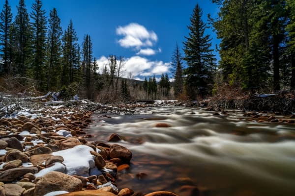

The Upper Provo is the part of the river nobody flies to Utah for, and that is its appeal. Above Jordanelle Reservoir the Provo is a freestone river, rising in the Uinta Mountains and running down past the Kamas Valley towns of Woodland and Francis. It is smaller, wilder and colder in spirit than the famous tailwaters below, and it has the strictest rule on the river: only brown trout may be kept. Hikers heading up from the river should see the Uintas from Provo, trail by trail.
This page is one of three. The overview of the Provo River explains the three-river idea, the Middle Provo covers the restored public corridor in the Heber Valley, and the Lower Provo covers Provo Canyon.
The rule that protects the natives
The 2026 Utah Fishing Guidebook gives the Upper Provo its own entry. From Jordanelle Reservoir upstream to the confluence of the North and South forks of the Provo River:
- Limit 2 brown trout under 15 inches.
- Closed to the possession of cutthroat trout, rainbow trout and their hybrids. All of them must be released immediately.
- Artificial flies and lures only.
The logic is visible in the list: brown trout are the fish you may harvest, and cutthroat, Utah's native trout, are the fish you may not. Above the forks (both join the main river in the forested country east of Woodland, according to OpenStreetMap's mapping of the streams) the guidebook lists no special rule, so the statewide limit of 4 trout applies.
The guidebook also asks anglers to learn to tell trout apart. On this water that skill is the regulation. If you cannot identify a fish as a brown trout, release it.
Two rivers above the reservoir
The valley stretch: Francis, Woodland and Kamas
Below the national forest boundary, the Upper Provo runs through the Kamas Valley in Summit County to the head of Jordanelle. This is where most visiting anglers get the law wrong.
The Utah Division of Wildlife Resources' stream access page explains the rule in plain terms. Under the state's 2010 law, H.B. 141, you may not walk on the private bed of a river where it crosses private property closed to trespass, unless the owner gives permission. You may float over that property and fish while floating, provided the water has enough width, depth and flow to float your vessel and you launch at a lawful access point, such as public land, a highway right of way or private land with written permission. Incidental touching of the bottom for safe passage is allowed.
The Forest Service describes the country east of Kamas as farm and ranch land before the road reaches the forest. The safe rule for the valley stretch: unless you know you are on public ground or have permission, treat the water as float-only. The DWR also notes that it stocks very few rivers, and only those with guaranteed public access, so do not expect hatchery fish here. When in doubt, the DWR suggests calling its regional office for the area you want to fish.
The forest stretch: the Mirror Lake Highway
East of Kamas, SR-150 climbs into the Uinta-Wasatch-Cache National Forest beside the river, and the land question goes away: this is public forest. The Forest Service's campground pages give the easiest landmarks, measured from the junction of SR-32 and SR-150 in Kamas:
| Site | Miles east of Kamas | What the Forest Service says |
|---|---|---|
| Soapstone Campground | 16 | Seasonal campground; winter gate location |
| Shady Dell Campground | 17 | "Popular for its fishing and stream" |
| Cobblerest Campground | 19.3 | Paved, no hookups; river fishing and hiking |
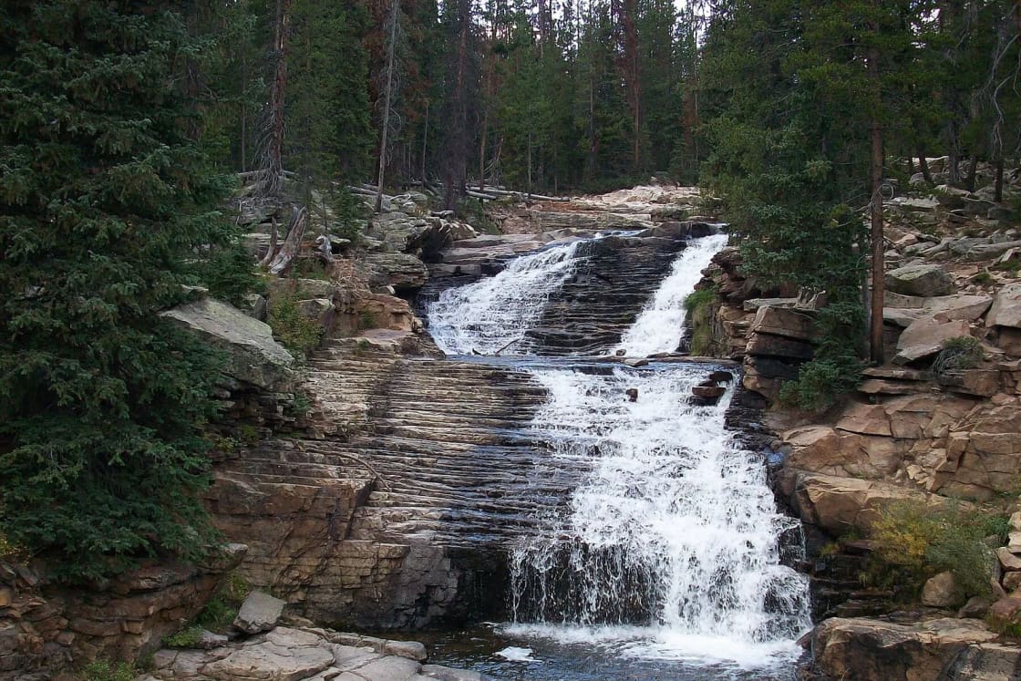
Above Cobblerest the highway keeps climbing past the Provo River Falls overlook toward Bald Mountain Pass and the lake country that our Mirror Lake Highway guide covers.
The fee. The highway runs through the Mirror Lake Scenic Corridor Recreation Area. The Forest Service lists standard amenity fees of $10 for 3 days, $20 for 7 days and $60 for a year, and honors America the Beautiful interagency passes. Your fishing license is a separate thing.
The camping season is over for 2026. The Forest Service listed Soapstone and Cobblerest as open May 15 to September 13 and Shady Dell to October 18. Day fishing continues until the snow and the gate end it.
The gate at Soapstone
UDOT closes the Mirror Lake Highway every winter for snow and avalanche danger. TownLift reported that the closure usually comes in late November or early December, when crews close and lock the gates at Soapstone. In 2025 the road stayed open unusually long and did not close until just before Christmas.
For anglers that means the forest stretch above Soapstone is a late-spring-to-early-winter fishery, and the late-October window you are in now is the last of it. Below the gate, the valley stretch remains reachable by road all winter.
Where the water comes from, and why it changes at Francis
The Upper Provo carries more than its own snowmelt, and you can see it on the gauges.
On the evening of October 19, 2026, the U.S. Geological Survey gauge near Woodland read about 91 cubic feet per second, and the gauge near Hailstone, just above Jordanelle, read about 194 cfs. Some of that difference is tributaries. A large part of the system's water, though, is imported:
- The Weber-Provo Canal. The Provo River Water Users Association diverts water from the Weber River about a mile east of Oakley into a canal roughly nine miles long that runs south to the Provo. Enlarged in the 1940s, it can deliver up to 1,000 cfs. The association measures the delivery at the Francis Gauge, where the canal meets SR-32 in Francis, about three miles southwest of Kamas.
- The Duchesne Tunnel. A ten-foot-wide tunnel runs six miles through the Uintas from a diversion dam on the North Fork of the Duchesne River, about 21 miles east of Kamas, to the Provo. Work began in 1948, stopped for the Korean War and was finished in 1954. The association says the tunnel is straight enough that you can see daylight at the far end. Its highest flows come during spring runoff.
The practical point: the river below Francis can rise or fall with canal deliveries that have nothing to do with the weather. Check the Woodland and Hailstone gauges before wading.
Who this river suits
The Upper Provo makes sense for three kinds of trips:
- A summer escape from the tailwater crowds. Pair it with a drive up the Mirror Lake Highway and a lake or two.
- A camping trip. Shady Dell and Cobblerest are on the river, and our camping guide covers how Forest Service sites book.
- A float through the valley, for anglers with a raft, a legal put-in and take-out, and enough water to float.
It suits anglers who want to keep fish less well: the harvest rule is brown trout only, and two of them.
Getting there from Utah Valley
Most people take US-189 up Provo Canyon to Heber, then SR-32 north through Francis to Kamas. By OpenStreetMap routing without traffic, from Center Street and University Avenue:
| Destination | Distance | Time |
|---|---|---|
| Woodland | 46 miles | 62 minutes |
| Soapstone Campground (SR-150) | 60 miles | 86 minutes |
The Forest Service's Kamas office, at 50 East Center Street in Kamas, (435) 783-4338, is open weekdays and is the place to ask about road and campground conditions. If you want a town stop on the way back, Park City is a short detour.
Before you go
- A Utah fishing license, valid for 365 days from purchase; see our license guide.
- Flies and lures only below the forks, and the ability to tell a brown trout from a cutthroat.
- A recreation pass if you will park at developed sites on SR-150.
- A clear idea of who owns the bank you are about to stand on.
For the reservoir at the bottom of this stretch, see Deer Creek and Jordanelle. For lakes within two hours, see every reservoir near Provo.
Regulations are from the 2026 Utah Fishing Guidebook. Campground seasons and fees are from Forest Service pages checked in October 2026.
Frequently Asked Questions
What counts as the Upper Provo River?
What are the 2026 fishing rules on the Upper Provo?
Can I wade the Upper Provo through Kamas and Woodland?
How far is the Upper Provo from Provo?
Do I need a pass to fish along the Mirror Lake Highway?
Can you get to the Upper Provo in winter?
Are there campgrounds on the river?
Why does the river carry more water below Francis?
Sources
The facts in this guide were checked against these sources. Hours, fees and rules change, so confirm anything time-sensitive with the source before you go. How we make Provo.com.
- 2026 Utah Fishing Guidebook, Utah Division of Wildlife Resources. Checked October 20, 2026.
- Stream access to Utah's public waters, Utah Division of Wildlife Resources. Checked October 20, 2026.
- Mirror Lake Scenic Byway, USDA Forest Service, Uinta-Wasatch-Cache NF. Checked October 20, 2026.
- Soapstone Campground, USDA Forest Service, Uinta-Wasatch-Cache NF. Checked October 20, 2026.
- Shady Dell Campground, USDA Forest Service, Uinta-Wasatch-Cache NF. Checked October 20, 2026.
- Cobblerest Campground, USDA Forest Service, Uinta-Wasatch-Cache NF. Checked October 20, 2026.
- Weber-Provo Canal System, Provo River Water Users Association. Checked October 20, 2026.
- Duchesne Tunnel System, Provo River Water Users Association. Checked October 20, 2026.
- Mirror Lake Highway closes for season just ahead of the holidays, TownLift. Checked October 20, 2026.
- North Fork / South Fork Provo River (stream geometry), OpenStreetMap / Nominatim. Checked October 20, 2026.
- USGS current water data for Utah (Provo River gauges), U.S. Geological Survey. Checked October 20, 2026.
- OSRM routing (OpenStreetMap data), Project OSRM. Checked October 20, 2026.