
The Uinta Mountains hold Utah's highest peaks, they run east to west rather than north to south like most ranges in the American West, and from Provo most people have never driven into them.
The Mirror Lake Highway is the way in. It climbs from Kamas over a pass above 10,000 feet and past a string of alpine lakes, many of them within a short walk of the pavement. It is one of the best scenic drives in the state and it is shut for a substantial part of the year, which is the single most important planning fact about it.
Road status, fees and forest orders all change. Confirm current conditions with the Uinta-Wasatch-Cache National Forest and UDOT before committing to the drive.
The route from Utah Valley
From Provo the approach runs up Provo Canyon on US-189 toward Heber, then north through Heber Valley to Kamas, where the highway proper begins. Reaching Kamas takes roughly an hour and a quarter.
From Kamas the road climbs steadily east and then north into the range. If you drive it without stopping you could be over the pass in well under an hour, but nobody drives it without stopping, and the realistic figure is a full day once you account for lakes, walks and lunch.
Note that the Provo Canyon segment of the approach has been under construction, with US-189 being widened, so allow for shifting traffic patterns on the way out. Our road construction guide covers the current picture.
The seasonal closure, which decides everything
This is a road that closes for winter. It reopens when conditions allow, generally in late spring or early summer, and stays open into autumn until snow closes it again.
There is no fixed date in either direction. Opening depends on snowpack, avalanche conditions and how quickly crews can clear a road at that elevation, and it varies by weeks between years. A warm spring in Provo tells you very little about whether the pass is clear.
The practical consequences are worth stating directly. Planning a trip for a specific weekend months ahead is a gamble. Early-season visitors frequently find the road open but the side roads, trailheads and campgrounds still snowbound. And late-season visitors can be caught by an early storm that closes it with no notice.
Check before you drive. This is the number-one reason Utah Valley residents waste a Saturday on this particular trip.
The fee area
The Mirror Lake corridor is managed as a Forest Service recreation fee area, and the requirement has been in place for a long time — there is a standing forest order covering it.
A recreation pass is required for recreating along the corridor, and an America the Beautiful interagency pass is generally honored. This is another argument for that pass being better value to a Utah Valley household than the national-park math suggests, since it also covers American Fork Canyon.
Rates, pass types and where you buy them change. Confirm with the Forest Service before you go rather than assuming, and buy in advance if you can, since services along the corridor are limited.
The altitude, which is not a footnote
The pass sits above 10,000 feet. Provo sits around 4,500. That difference is more than a number.
Weather at the top bears little resemblance to the valley forecast. Snow can fall at that elevation in any month of the year, and has. Temperatures routinely run far below what people packed for. Afternoon thunderstorms build fast in summer and an exposed alpine basin is a poor place to be during one.
Altitude also affects people directly. Visitors arriving from the valley sometimes feel it as headache or breathlessness, and exertion is harder than the same effort at home. Children and older visitors feel it more.
Pack layers well beyond what the day appears to require. This is the single most common preparation failure on this drive.
The lakes, which are the point
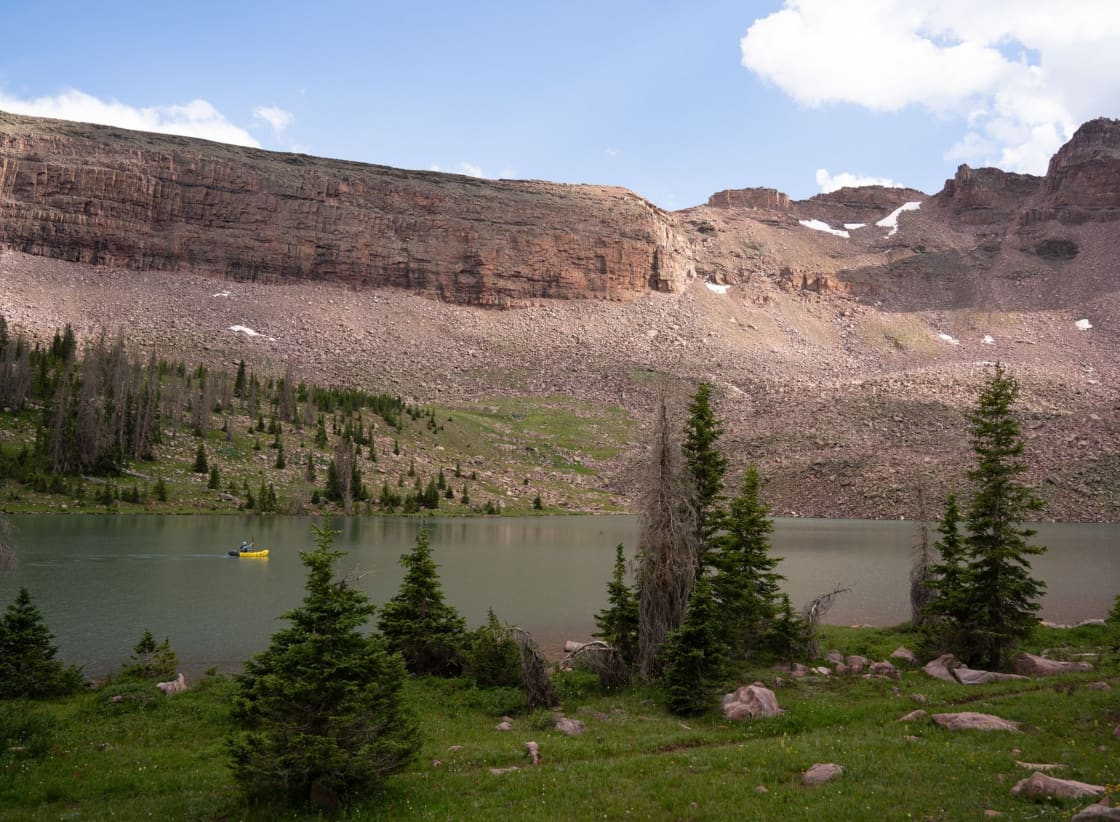
The corridor's defining feature is how many alpine lakes sit within easy reach of the road.
Some are directly roadside. Others are a five- or ten-minute walk. Beyond those, the country north and south of the highway holds hundreds more, reachable on foot, which is why this is one of the great backpacking regions in the interior West.
For a first visit the roadside and short-walk lakes are the right target. They deliver the alpine experience — clear cold water, granite, conifers, a peak reflected in still morning water — without requiring a route plan. Mirror Lake itself is the best known and correspondingly the busiest.
The water is cold. Genuinely cold, at that elevation, all summer. Swimming is a brief and character-building activity rather than a leisurely one.
Fishing
This is one of the most accessible concentrations of mountain-lake fishing in Utah, and a substantial share of the traffic on the highway is anglers.
Many lakes are stocked and hold trout, and the density of options means you can move between waters in a day rather than committing to one. Utah's fishing regulations apply, they vary by water, and the current guidebook from the Division of Wildlife Resources is the authority.
Compared with a big-water fishery like Strawberry Reservoir, this is a different activity — smaller fish, more walking, more scenery, and far more choice about where to stand.
Camping
Developed Forest Service campgrounds sit along the corridor and are the straightforward option. Dispersed camping is possible in places, subject to Forest Service rules and to whatever orders are currently in force.
Two things to plan for. High-elevation campgrounds open later and close earlier than valley intuition suggests, sometimes by a wide margin. And the popular ones book ahead, so a summer weekend is not something to improvise.
There are standing forest orders covering camping and vehicle use along the corridor, aimed at protecting wetlands, riparian areas and stream banks, which prohibit camping in closed sites or where physical barriers have been established. Our camping guide covers regional booking windows and stay limits.
The High Uintas Wilderness
Beyond the road, much of the range is designated wilderness, and that changes the rules.
Wilderness designation closes the area to motor vehicles, mechanized equipment and bicycles. There are limits on group size, requirements about camping distance from lakes and streams, and restrictions on campfires — the Forest Service has current occupancy and use orders and campfire restrictions in place for the High Uintas.
If your plan involves walking beyond the immediate roadside area, read the current orders rather than assuming general backcountry norms apply. They are more specific here than most people expect, and they exist because this is a heavily used wilderness with fragile alpine ground.
Mosquitoes, honestly
Nobody mentions this in the scenic descriptions and everybody remembers it afterward.
The Uintas in early season, roughly from when the road opens through midsummer, can be difficult for mosquitoes. Wet meadows, standing water from snowmelt and a short intense season combine into conditions that will end a picnic.
It improves markedly later in the season. If you are sensitive, aim for late summer or autumn, and bring repellent regardless. Long sleeves are worth the warmth trade in early season.
Why this range is unusual
The Uintas run east to west. Most major ranges in the American West run north to south, which makes the Uintas' east-west trend unusual.
That is not a trivia point — it changes the mountains. An east-west range has a long sunny south-facing flank and a long shaded north-facing one, which produces different vegetation, different snow retention and different drainage patterns than a north-south range of the same size.
The range is also high and broad rather than sharp, with a large plateau-like crest holding Utah's highest peaks and an enormous number of lakes scooped out by past glaciation. That glacial history is why there are so many lakes here, and why they sit in the particular rocky basins they do.
For anyone whose mental image of Utah is red rock, this is the corrective. It is granite, conifer, meadow and cold water, and it looks more like the northern Rockies than like anything in southern Utah.
Where the road goes
The highway climbs east from Kamas and then bends north, running along the western edge of the range before descending toward the Wyoming side.
Most Utah Valley visitors treat it as an out-and-back, driving to the pass and the lakes near it before returning. That is a reasonable day. Continuing over and down opens up a longer loop that eventually returns via a very different route, which turns the trip into a full-day circuit through country most Utahns never see.
Deciding which of those two trips you are doing before you leave matters, because the second is considerably longer than the map's mileage suggests once the elevation and the stops are accounted for.
Trailheads and the backpacking country
The corridor is the primary access point for a large share of Utah's alpine backpacking, and trailheads along it lead into basins holding hundreds of lakes.
This is serious country once you leave the road. Distances are long, weather is volatile, much of the terrain is above treeline, and route-finding matters. It is also some of the best backpacking in the interior West, which is why the trailhead parking fills on summer weekends.
For a day visitor the relevant point is simply that the people in the parking area with large packs are going somewhere quite different from where you are going, and that the trail signs reflect their trip rather than yours. Pick a lake, walk to it, and be honest about turning around.
What happens when the road closes
The highway does not stop being used in winter; it stops being driveable.
Once it closes, the corridor becomes a snow-country destination reached from the plowed end, used for cross-country skiing, snowshoeing and snowmobiling depending on the area and the rules in force. There is a long-standing Forest Service order governing dog access on one of the ski trails on certain days, which gives a sense of how specifically this is managed.
For Utah Valley residents this is mostly academic — closer winter options exist. It is worth knowing that the closure means "no cars," not "nothing there."
How it compares to the Alpine Loop
Utah Valley's default mountain drive is the Alpine Loop, and it is fair to ask why you would drive further for another seasonal mountain road.
The Alpine Loop is shorter, closer, and dramatic in a tight, steep, canyon way, with Timpanogos above it. The Mirror Lake Highway is longer, higher, and opens out into broad alpine country with a density of lakes the Alpine Loop has nothing comparable to.
They are different experiences rather than better and worse. The Loop is an afternoon. The Uintas are a day. If you have done the Loop several times and want the next thing, this is the next thing.
Autumn, which is the best time to go
If you get one trip, take it in early autumn.
The mosquitoes are gone, the crowds thin after Labor Day, the light is better, and the aspen turn against the conifers and granite. Temperatures are cold in the morning and pleasant by midday, which is close to ideal for walking.
The risk is the closure. Autumn is when an early storm can shut the road with little warning, so the same check applies with more urgency. The window is real but it is not guaranteed, and gambling on late October is how people find a gate.
What else is up there
The corridor is not only lakes. The drive crosses varied country — meadow, forest, exposed alpine terrain above treeline near the pass — and the views open dramatically at the top.
Day hiking options range from short lake loops to serious ascents, including routes toward the highest terrain in the state. Trailheads along the highway are the entry points for a large share of Utah's alpine backpacking.
For a casual visit, the honest framing is that this is a scenic drive with excellent short walks attached, and that is a perfectly good day. Treating it as a hiking destination requires more planning and better conditioning than the drive itself suggests.
Practical notes
Fuel in Kamas. Services along the corridor are minimal and the distances are longer than the map suggests.
Cell coverage is unreliable to nonexistent for much of the drive, so download maps and any regulations you need. Bring more water than seems necessary, because altitude dehydrates people who are not noticeably sweating.
Sun protection matters more here than in the valley — thin air, high sun and reflective water burn people on cool days. And keep an eye on afternoon cloud build-up in summer, because the safe move is to be off exposed ground before a storm arrives rather than during it.
A realistic first-visit plan
If you have never been and want a day that works, the shape is simple.
Leave Utah Valley early, because the drive is long enough that a late start eats the good part of the day. Fuel in Kamas. Drive up the corridor with the intention of stopping often rather than reaching a specific point.
Pick two or three lakes to walk to rather than trying to see everything. Eat somewhere with a view rather than pushing through to a destination. Turn around at the pass unless you have committed to the longer loop, and be heading down by mid-afternoon so that any thunderstorm activity is behind you rather than overhead.
That plan uses the corridor for what it is best at — accessible alpine country in short doses — and it leaves you knowing which lakes you want to go back to.
Who should skip it
An honest guide should also say who will not enjoy this.
If altitude affects you badly, this is a poor first choice; the whole point of the drive is elevation and there is no low-altitude version of it. If you are short on time, the drive alone consumes most of a day. And if you are hoping for the red rock Utah of photographs, this is emphatically not that, and people occasionally arrive disappointed for exactly that reason.
If any of those apply, the Alpine Loop or Heber Valley deliver a mountain day at a fraction of the commitment.
The short version
An hour and a quarter from Provo, a road climbs from Kamas to above 10,000 feet past a string of alpine lakes, and it is shut for a large part of the year. Check that it is open before you leave, buy or bring a recreation pass, pack far warmer clothes than the valley justifies, expect mosquitoes before midsummer, and go in early autumn if you get to choose.
Related Guides
- Camping Near Provo
- Strawberry Reservoir from Provo
- Heber Valley and Midway from Provo
- Alpine Loop Scenic Drive
- Best Day Trips from Provo
- Where to See Moose, Elk and Deer Around Utah Valley
Frequently Asked Questions
When is the Mirror Lake Highway open?
Do I need to pay a fee?
How far is it from Provo?
How high does the road go?
Is it good for fishing?
Can I camp along the highway?
What about the High Uintas Wilderness?
Is it suitable for a casual day trip?
Sources
The facts in this guide were checked against these sources. Hours, fees and rules change, so confirm anything time-sensitive with the source before you go. How we make Provo.com.
- Mirror Lake Scenic Byway, USDA Forest Service, Uinta-Wasatch-Cache National Forest. Checked October 12, 2026.
- Lilly Lake Campground, Uinta-Wasatch-Cache National Forest, Recreation.gov (USDA Forest Service). Checked October 12, 2026.
- High Uintas Wilderness, USDA Forest Service, Ashley National Forest. Checked October 12, 2026.
- Glad You Asked: Where Does Utah's Kings Peak Rank on the List of U.S. State Highpoints?, Utah Geological Survey. Checked October 12, 2026.