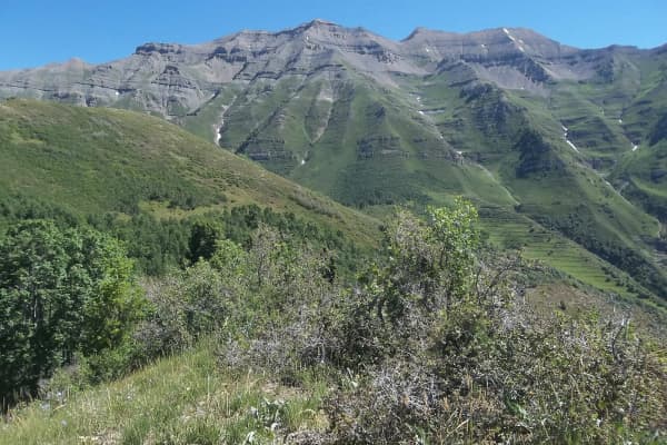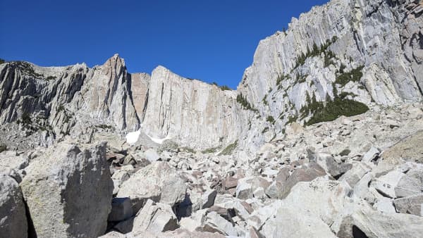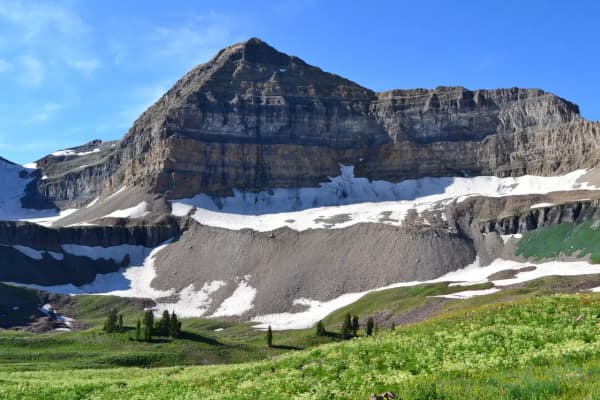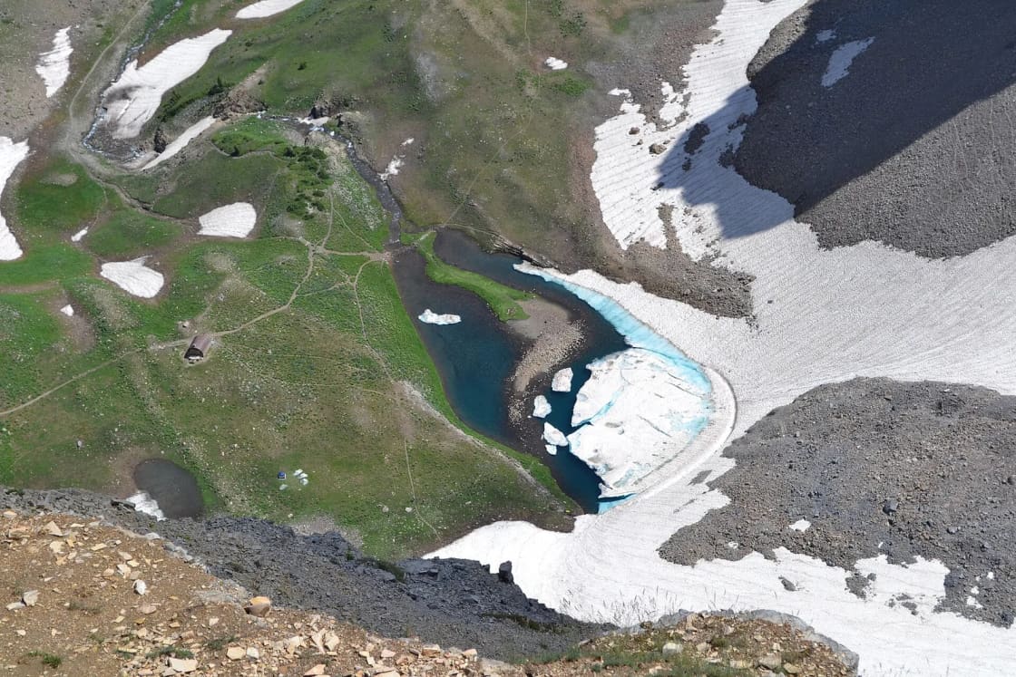

The Timpanogos traverse is the version of Utah Valley's signature hike that sees the whole mountain: climb from Timpooneke on the American Fork Canyon side, cross the high basins, and descend past the waterfalls to Aspen Grove on the Provo Canyon side. It takes two cars, an early start and some planning around a parking ticket. This page is about that planning. For the mountain itself, each trail section by section, the snowfield and what to pack, read our complete Mount Timpanogos guide first.
The numbers
| Version | Distance | Climbing | Source |
|---|---|---|---|
| Over the summit | 14.3 mi | about 4,370 ft | AllTrails, point to point |
| Via Emerald Lake, no summit | about 11 mi | less | Forest Service (5.8 mi) + AllTrails (about 5.35 mi) |
| Timpooneke out-and-back to summit | 14.3 mi | about 4,380 ft | AllTrails |
| Aspen Grove out-and-back to summit | 14.4 mi | about 4,840 ft | AllTrails |
Notice the last two rows. The out-and-backs are the same length as the traverse. What the traverse buys you is not a shorter day; it is new ground the whole way and the gentler start. AllTrails' track tops out at about 11,740 feet.
What "Wilderness Loop" means here
Most of this route lies inside the Mount Timpanogos Wilderness, and the trails form a rough horseshoe:
- Timpooneke Trail #053 climbs 5.8 miles from Timpooneke Campground through the stair-stepped canyon the Forest Service calls the Giant Staircase. Scout Falls is about 1.5 miles in. Higher up, the trail enters a large open basin below the final ridge and joins the Aspen Grove and summit trails near Emerald Lake.
- Timpanogos Summit Trail #054 begins about 300 yards west of Emerald Lake, where the Aspen Grove and Timpooneke trails meet, and runs 2.2 miles to the summit and its small summit house. Grades reach 35 percent.
- Mount Timpanogos Trail #052, the Aspen Grove trail, climbs from the Mount Timpanogos Trailhead through Primrose Cirque to the Emerald Lake basin, past several waterfalls. The trailhead is 4.9 miles up the Alpine Loop from US-189 in Provo Canyon.
So there are two ways to make the crossing. Over the top, you add the summit trail, and the full day is the 14.3-mile route most people mean by "the traverse." Without the summit, you walk from the Timpooneke basin to the Emerald Lake junction and down the Aspen Grove side, about 11 miles, crossing the mountain's two great basins without the final 2.2 miles of steep, rocky ridge. That version is the better choice for a group that wants the goats, the wildflower meadows and the waterfalls without the summit's exposure, and it is the natural fallback when the ridge is in cloud.
Recreation.gov's listing for the Timpooneke ticket names the Emerald Lake Shelter and the "Aspen Grove trail loop" as destinations from that trailhead, which is the same crossing.
Running the shuttle
The two trailheads are both on the Alpine Loop (SR-92) but on opposite sides of its summit.
- Meet at Aspen Grove with both cars. Leave one there. Display a pass in it.
- Drive everyone to Timpooneke in the second car: about 6.8 miles over the summit by OpenStreetMap routing (OSRM), estimated at 18 minutes without traffic. The road is narrow, steep and slow; treat that time as a minimum. At the stop sign on SR-92, the Forest Service says to turn into Timpooneke Campground and drive about half a mile to the trailhead.
- Hike Timpooneke to Aspen Grove.
- Drive back over the loop together to collect the Timpooneke car.
From downtown Provo, the same routing puts Aspen Grove about 28 minutes away (17 miles, via Provo Canyon) and Timpooneke about 45 minutes. If your group lives in Lehi or American Fork, the logic flips: meet at Timpooneke via American Fork Canyon (I-15 exit 284, east on SR-92, about 12 miles to the North Fork junction, then 2.5 miles up the South Fork, per the Forest Service) and shuttle to Aspen Grove first.
Without a second car, the options are a friend's drop-off and pickup, or turning the day into an out-and-back. There is no public shuttle on the Alpine Loop.
The parking ticket, and which car needs it
From July into October, the Forest Service requires a Recreation.gov timed-entry ticket to park at Timpooneke on Saturdays, Sundays and holidays (it names July 24 and Labor Day) from midnight to noon. Recreation.gov's rules:
- 76 tickets release 30 days in advance at 10 a.m. Eastern (8 a.m. in Utah), and 24 more release two days in advance at the same hour.
- One reservation per vehicle per day, and the reservation holder must be present.
- On ticket days the printed ticket and a valid pass must both be on the dashboard. America the Beautiful and Uinta-Wasatch-Cache annual passholders enter the pass number at checkout.
- Cancel at least five days ahead; no-shows are not refunded.
The ticket is for Timpooneke. The Forest Service's timed-entry system and the Recreation.gov listing cover that trailhead only; at Aspen Grove you need the recreation pass. That makes the standard direction easier: only the car you park at Timpooneke in the morning needs a ticket. If you reverse the route and finish at Timpooneke, the car you leave there at dawn still needs one, because it arrives before noon.
The Forest Service's Timpooneke page says the 2026 ticket season ended October 12 and will begin again in July 2027. Weekend traverses between now and the road's closure need only a pass.
Passes and fees for two cars
The Forest Service lists these per-vehicle passes at Timpooneke: $10 for three days, $20 for seven days, $60 for a season, with digital passes sold on Recreation.gov (site pass 74405). America the Beautiful and Uinta-Wasatch-Cache annual passes are honored. Both trailheads are developed fee sites, so a two-car traverse is two passes unless one or both cars already carry an annual pass.
Parking rules that cost money
The Forest Service is blunt about Timpooneke: park only in designated stalls or numbered turnouts along SR-92; no-parking zones are "strongly enforced" with tickets and towing; do not block gates or traffic. On busy days you may have to park as far down as Pine Hollow or Salamander Flat, which adds 1.5 to 2 miles each way. That walk is on top of a 14-mile day, which is the strongest argument for a weekday. The Forest Service's trail pages say Saturdays and holidays are very busy and recommend Sunday through Friday.
Timing the day
AllTrails lists June through September as the best months for the traverse, and the Forest Service warns that snow covers the Timpooneke and summit trails until mid-summer, making spring and early summer conditions "extremely hazardous." It also warns specifically against sliding down the snowfield above Emerald Lake.
A 14-mile day with 4,000-plus feet of climbing above 10,000 feet is long for most people. Starting at first light leaves room for the summit before afternoon storms build, and keeps the descent past the Aspen Grove waterfalls in daylight. If the group is slow by the time it reaches the basin, the Emerald Lake crossing without the summit is the obvious way to shorten the day without retracing your steps.
Late October and winter
As this is written in late October, the window is closing. The Alpine Loop closes for winter when snow arrives; UDOT closed it on November 3 in 2025, and local reporting describes a typical closure around November 1 with reopening near Memorial Day, later after big winters. Once the gates close, the shuttle is gone and both trailheads are effectively winter destinations reached only from the ends of the closed road.
Above the trailheads, fall storms bring snow and ice to the high basins and the summit ridge long before the road closes. By this point in the season the summit traverse is a snow climb, and Timpanogos's avalanche paths are a real winter hazard; our avalanche safety guide covers what that means for hikers. Next year's traverse window begins when the snowfields clear, typically in July.
Rules inside the Wilderness
- No fires in the Mount Timpanogos Wilderness.
- Group size: the Forest Service's Timpooneke Trailhead page says 15; its trail pages say groups should be fewer than 15. Keep groups at 14 or under and you satisfy both.
- Dogs on leash at all times, waste packed out (Timpooneke Trailhead page).
- Horses are allowed on Timpooneke; weed-free hay is required.
- The Forest Service calls Timpooneke "possibly the most-used trail in the forest," and its summit trail page describes a high alpine environment with little maintenance in places. Carry a map, be self-sufficient, and use extreme caution near steep snowfields, moving water under snow, waterfalls and cliffs.
Water. The Forest Service lists vault toilets and picnic tables at Timpooneke but no drinking water. Carry what you need for the whole crossing, or a filter and the knowledge of where the snowmelt runs in your month.
Wildlife. The Forest Service lists moose, mule deer, elk and mountain goats around Timpooneke. Goats are a near-certainty in the upper basins; give them room and never feed them.
Who should, and who should not
The traverse suits a group that has done one of the out-and-backs, or a comparable day such as Big Baldy or Box Elder Peak, and wants the other half of the mountain. It is a poor first Timpanogos for anyone unsure of their pace, because a traverse commits you: once you are past the basin, turning back is as long as going on.
If you want the scenery without the mileage, the Aspen Grove side to Stewart Falls or the first waterfalls, or the Timpooneke side to Scout Falls, are short outings from the same lots. Our Alpine Loop guide covers the drive between them, and the legend of Timpanogos explains the story you will hear at the trailhead.
Related Guides
- Hiking Mount Timpanogos: the complete summit guide
- The Alpine Loop scenic drive
- American Fork Canyon
- Provo Canyon
- Stewart Falls
- Wildflower hikes in the Wasatch
- Timpanogos Cave
Frequently Asked Questions
How long is the Timpooneke to Aspen Grove traverse?
Which direction should you hike it?
How far apart are the two trailheads by car?
Do I need a permit to hike Timpanogos?
How much does parking cost at Timpooneke and Aspen Grove?
When is the traverse in condition?
Can you camp on the way?
Can dogs do the traverse?
Sources
The facts in this guide were checked against these sources. Hours, fees and rules change, so confirm anything time-sensitive with the source before you go. How we make Provo.com.
- Timpooneke Trailhead, USDA Forest Service, Uinta-Wasatch-Cache NF. Checked October 20, 2026.
- Timpooneke Trail #053, USDA Forest Service. Checked October 20, 2026.
- Mount Timpanogos Trail #052, USDA Forest Service. Checked October 20, 2026.
- Timpanogos Summit Trail #054, USDA Forest Service. Checked October 20, 2026.
- Timpooneke Trailhead Timed Tickets, Recreation.gov. Checked October 20, 2026.
- Seasonal Roads, Utah Department of Transportation. Checked October 20, 2026.
- Mount Timpanogos via Timpooneke Trailhead to Aspen Grove, AllTrails. Checked October 20, 2026.
- Mount Timpanogos via Timpooneke Trail, AllTrails. Checked October 20, 2026.
- Mount Timpanogos Trail (from Aspen Grove), AllTrails. Checked October 20, 2026.
- Emerald Lake via Mount Timpanogos Trail, AllTrails. Checked October 20, 2026.
- Guardsman Pass, Alpine Loop close for 2025 winter season, KUTV. Checked October 20, 2026.
- Department of Transportation closes Alpine Loop for the winter, Daily Herald. Checked October 20, 2026.
- OSRM routing API (OpenStreetMap data), drive times from Center St & University Ave, Provo, Project OSRM / OpenStreetMap contributors. Checked October 20, 2026.