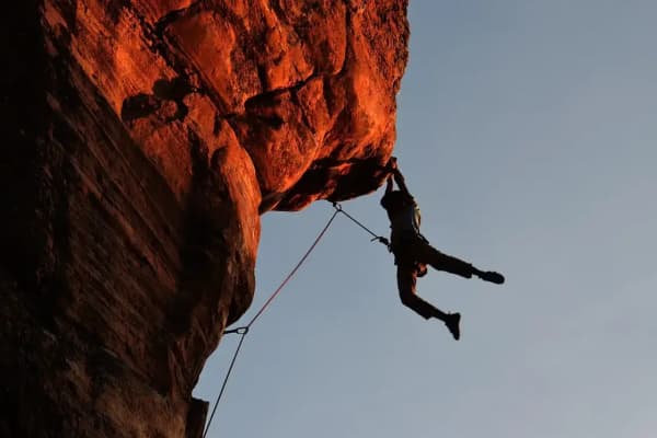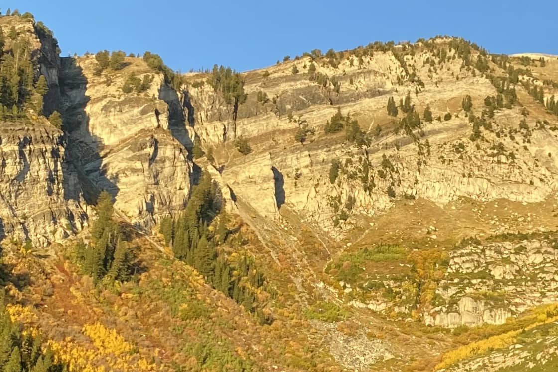

American Fork Canyon is Utah County's sport-climbing canyon: steep gray limestone, bolted routes, and crags you can reach in minutes from a roadside pullout. Mountain Project counts 762 climbs in its American Fork Canyon area and describes the draw in one line: "great sport climbing on steep, pocket-filled limestone." The busiest walls sit in a short stretch of SR-92 within about two miles above the Timpanogos Cave National Monument visitor center, about 33 minutes from downtown Provo by OpenStreetMap routing.
Our Provo climbing guide tells the history (American Fork is one of the places where hard American limestone sport climbing began) and covers Rock Canyon and the gyms. This page is the practical crag list for American Fork: where to park, what grades each wall offers, and the fee and parking rules that catch climbers.
Before you go: fee, parking and the cave
The fee. The Forest Service's Alpine Scenic Loop page says there is no fee for non-stop travel through the canyon or for using gravel turnouts not associated with a developed recreation site. If you stop at a developed site, such as a campground or picnic area, a recreation pass is required and must be displayed. The posted schedule is $10 for 3 days, $20 for 7 days, $60 a year, and America the Beautiful passes are honored. Mountain Project flags every crag here as "Located in a National Forest Fee Area." Since Division Wall, Hard Rock and Escape Buttress all start from campground or picnic-area parking, plan on a pass. Passes are sold at the information stations on the Alpine Loop road, the cave visitor center, the Pleasant Grove Ranger District office and online.
Parking. The 2026 visitor guide published jointly by the Forest Service and the Park Service is specific: vehicles may park in marked stalls in designated lots, and between mileposts 8 and 28, only at roadside pullouts, with all four tires off the pavement. Anything outside a lot or pullout "may be ticketed or towed." The crags below are all in that stretch.
The cave is separate. Timpanogos Cave is a national monument with its own timed tickets, which the 2026 guide lists at $12 for ages 12 and up, $7 for ages 2 to 11 and $2 for babies, with an Intro to Caving tour at $22. The Park Service says tour seasons typically run from May or June through September or October. In season, the visitor center lot fills in waves with cave visitors; it is not climber parking. Our Timpanogos Cave guide covers tickets.
The crags, in driving order
All descriptions, grades and route counts are from Mountain Project's area pages. Distances are as Mountain Project gives them from the cave visitor center.
Black Magic (about 0.5 mile past the visitor center)
24 routes, mostly 5.12 and harder. Park on the right about half a mile past the visitor center and cross the stream. The crag's signature is Helix, a hard 5.12b that spirals up into the top of a big cave, and there is middle-5.13 above that. Mountain Project notes there is little to warm up on.
The Hell Area (about 0.65 mile past the visitor center, mile marker 11)
74 routes. Mountain Project calls Hell "a one time sport climbing mecca" with "historical value as the beginning of limestone sport climbing in America," crediting Boone Speed, Tim Wagner, Jeff Pedersen, Mike Call, Bill Boyle, Mike Beck and others. The main page says Hell Cave has multiple quality routes from 5.12a to 5.14a, bouldery and steep. Classics named: Hell, Malvado, El Diablo and Body Count. Park at the large pullout on the right marked by the green mile marker 11 sign, about 0.65 mile past the visitor center and past the Hideaway parking, then walk back and cross the road to the trail.
The Membrane (about 1 mile past the visitor center)
33 routes, about 5.9 to 5.12c. The canyon's most popular crag, north-facing and zero approach: park at the pullout about a mile past the visitor center on the right, and the wall is directly across the stream, reached over a wide log with a fixed rope. Mountain Project gives the parking coordinates as 40.446923, -111.686530. Its route list runs from Bad Faith (5.9) and Kitchen Sink (5.10b) to Route 66 and Mandela (5.12a) and Flight Fright (5.12c). One warning in the page: the routes "are not grid bolted, so be prepared to run for the clips."
Division Wall (Little Mill Campground, about 1.3 miles)
31 routes, warm-ups through 5.13. Mountain Project's description: convenient, crowded on weekends, zero approach, with "a slew of 5.11, 5.12, and a bit of 5.13." The wall is behind campsite 27 in Little Mill Campground. Classics named include Liquid Oxygen, Isotoner Moaner, Division and Teenagers in Heat. The campground hosts have asked climbers to obey the 10 mph speed limit after close calls with children.
The Forest Service listed Little Mill's 2026 season as May 8 to October 11, so the campground is now closed for the year; check the Forest Service page for winter access before planning on Division Wall.
The Billboard (near Saw Mill Picnic Area)
32 routes, nothing easier than 5.11. One of the hardest crags in the canyon, Mountain Project says, "both for the difficulty of the routes and for the heinous approach." It is south-facing and high, so bring water. Park in the small pullout on the right about 0.2 mile from the Saw Mill Picnic Area, about 100 yards below the first Little Mill entrance; the trail starts faintly across the road. Many routes share anchors, so you can lead a moderate line and hang draws on a harder neighbor. A dozen draws and a 50-meter rope handle nearly everything.
Hard Rock (mile marker 12)
36 routes, 5.6 to 5.12, mostly 5.11 and 5.12. The canyon's learning crag. Mountain Project says it has "possibly the largest variety of grades," the canyon's easiest routes at 5.6 and 5.7, and calls it "a terrific and fun crag to learn how to lead climb/belay." It faces west and southwest: shade in the morning, sun from afternoon on, and good "almost all year." Park at the picnic-area lot on the north side at mile marker 12 (parking coordinates 40.4494743, -111.6740341) and follow the trail east up through the picnic area. A stick clip helps on the harder routes.
The Forest Service picnic area at this spot (its sign uses the British spelling of gray in the name) has a lot with room for about eight cars, a bulletin board and a bathroom, according to Mountain Project, and its own 18 routes.
Escape Buttress (past Hard Rock)
15 routes, sunny moderates. Park at the same picnic-area lot (Mountain Project says 1.7 miles up from the visitor center), follow the paved path east to the Hard Rock trail, then continue past the White Wave Wall to the gray buttress. Mountain Project calls it "some of the best moderate routes in AF," but adds that they are "not super closely bolted, so be solid at the grade."
Picking a crag
| If you want | Go to | Why |
|---|---|---|
| Your first outdoor leads | Hard Rock | 5.6 and 5.7, good trail, mixed grades |
| Moderates with no approach | The Membrane | 5.9 to 5.11 classics across the stream |
| Moderates in the sun | Escape Buttress | South-facing, but spaced bolts |
| A crowd and a campsite | Division Wall | Zero approach, behind site 27 |
| Hard 5.12 and 5.13 | Hell, Billboard, Black Magic | Steep, technical, history |
Seasons
Summer. Mountain Project notes the canyon is narrow and deep with trees to shade belayers, and the north-facing Membrane stays cool. It is also when the cave, the campgrounds and the pullouts are busiest. Our American Fork Canyon guide covers the summer parking crush. If you would rather boulder, see bouldering in Utah Valley.
Fall (now). Little Mill has closed for 2026, and the Forest Service says the Alpine Loop over the summit typically closes around November 1. UDOT aims to reopen it near Memorial Day. The lower canyon crags are reached from the American Fork side, not over the loop.
Winter. Mountain Project says Hard Rock is good almost all year. The Swinging Bridge picnic area across from the cave visitor center stays open year-round as snow allows, the Park Service says.
Spring. The 2026 canyon guide says some American Fork Canyon trails are hikers only each spring until they dry out, marked with bright green signs. Approach trails are trails too; do not cut switchbacks in the mud.
Taking care of it
The Salt Lake Climbers Alliance maintains anchors across the Wasatch. TownLift reported that in 2025 its anchor-maintenance staff maintained 1,232 bolts on 208 routes at 27 crags, American Fork Canyon among them, and that climbers report aging hardware through an online form. In 2024 the Daily Herald covered an SLCA cleanup at Little Mill and quoted its coordinator saying the group works under a volunteer agreement with the Pleasant Grove Ranger District. The Herald also cited a Forest Service estimate of more than 1 million visitors to the canyon each year.
If you see a spinning bolt or a worn anchor, report it to the SLCA rather than fixing it yourself.
Getting there from Provo
Mountain Project's directions from Provo: I-15 north to exit 276 (Pleasant Grove), east toward the mountains, north on State Street, then right on SR-146 (100 East), which runs to the canyon mouth and joins SR-92. From Lehi or Highland, use exit 284 and SR-92 east. By OpenStreetMap routing without traffic, the Membrane pullout is about 21 miles and 33 minutes from Center Street and University Avenue.
Bring a pass, a stick clip, a 50- to 60-meter rope, a dozen or more draws and a car that can sit fully off the pavement. For Provo Canyon ice, Rock Canyon and the indoor gyms, go back to our Provo climbing guide. If you have never climbed outside, start in a gym, and see our summer activities guide for the rest of the season's options.
Crag details are from Mountain Project area pages as published in October 2026. Fees and parking rules are from the Uinta-Wasatch-Cache National Forest and the 2026 Forest Service and Park Service canyon guide.
Frequently Asked Questions
How much climbing is in American Fork Canyon?
Where should a beginner climb in American Fork Canyon?
Do I have to pay to climb in American Fork Canyon?
Where do I park for the crags?
How far is American Fork Canyon from Provo?
Can I climb in American Fork Canyon in winter?
When is Timpanogos Cave open?
Who maintains the bolts?
Sources
The facts in this guide were checked against these sources. Hours, fees and rules change, so confirm anything time-sensitive with the source before you go. How we make Provo.com.
- Alpine Scenic Loop Backway (fees, seasonal closure), USDA Forest Service, Uinta-Wasatch-Cache NF. Checked October 20, 2026.
- Little Mill Campground, USDA Forest Service, Uinta-Wasatch-Cache NF. Checked October 20, 2026.
- American Fork Canyon / Timpanogos Cave 2026 visitor guide (newspaper), National Park Service and USDA Forest Service (via NPS History). Checked October 20, 2026.
- Operating Hours & Seasons, National Park Service, Timpanogos Cave NM. Checked October 20, 2026.
- American Fork Canyon, Mountain Project. Checked October 20, 2026.
- Mountain Project: The Membrane, Mountain Project. Checked October 20, 2026.
- Mountain Project: Hell Area, Mountain Project. Checked October 20, 2026.
- Mountain Project: Division Wall, Mountain Project. Checked October 20, 2026.
- Mountain Project: The Billboard, Mountain Project. Checked October 20, 2026.
- Mountain Project: Hard Rock, Mountain Project. Checked October 20, 2026.
- Escape Buttress, Mountain Project. Checked October 20, 2026.
- Mountain Project: Black Magic, Mountain Project. Checked October 20, 2026.
- Salt Lake climbing community wraps up year with 1,232 bolts maintained, TownLift. Checked October 20, 2026.
- Utah climbing group invites volunteers to American Fork Canyon cleanup event, Daily Herald. Checked October 20, 2026.
- Department of Transportation closes Alpine Loop for the winter, Daily Herald. Checked October 20, 2026.
- OSRM routing (OpenStreetMap data), Project OSRM. Checked October 20, 2026.