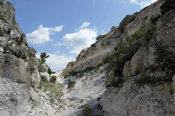
Most people who drive up Provo Canyon on a summer Saturday meet the same crowd: full parking lots at Bridal Veil Falls, a line of cars at Vivian Park, tubers and trains and picnickers everywhere. Turn south at Vivian Park, and within a minute the highway noise fades. The South Fork road climbs into a narrower, quieter, more wooded side canyon with its own parks, its own trails and a completely different feel from the corridor you just left.
This is Provo Canyon's quiet side. This guide covers the drive up the South Fork, the two city parks along it and who runs them, how to reserve a pavilion, the gentle Big Springs Hollow trail that makes this one of the easiest good walks near Provo, biking and horse access, winter snowshoeing, fall color, and the practical things that make a South Fork day go smoothly.
Getting There
Drive up Provo Canyon on US-189 to Vivian Park, where the South Fork of the Provo River comes down from the south to join the main river. Turn south onto the South Fork road and follow it up the fork. The road passes summer homes as it climbs into a quieter valley, with water running beside it the whole way, and it reaches South Fork Park and, farther up, Big Springs Park near its upper end.
What changes when you turn off. The South Fork is narrower and more wooded than the main canyon, and it climbs away from the highway within a minute. It is also a cold-air drainage, which means it runs noticeably cooler than the highway. That is delightful in August and unpleasant in October if you packed for the valley.
Cell service. Coverage drops off up the South Fork. Tell someone where you are going, download maps before you turn off, and do not count on calling for directions once you are up the road.
Drive slowly. The road is narrow in places and shared with cyclists, residents, walkers and families. Watch for children near the parks and for wildlife at dawn and dusk.
Who Runs What in Provo Canyon
Provo Canyon's parks are run by three different governments, and knowing which one owns a park saves confusion when you want to reserve a pavilion or check the rules.
- Provo City parks include Big Springs Park, Canyon Glen Park and South Fork Park.
- Utah County manages Vivian Park, Bridal Veil Park, Nunns Park and Canyon View Park.
- Orem City manages Mt. Timpanogos Park.
So the South Fork's parks are Provo City parks, reserved and managed through Provo City Parks and Recreation, while Vivian Park at the mouth of the fork is a county park with its own system. Our guide to Vivian Park and Nunns Park covers the county side.
South Fork Park
The first of the two South Fork parks is the gathering place. A stream runs through it, and Provo's Park Finder lists picnic tables, barbecue grills, restrooms, a drinking fountain, power and a fire pit, plus reservable pavilions. That combination of big pavilions and a short drive from the valley is why a lot of Utah Valley's family reunions and group picnics happen here.
It is a good choice when you are bringing a crowd, when you want shade and a creek for the children, and when you want the canyon's atmosphere without committing to a long drive. Our Provo Canyon guide calls the South Fork the canyon inside the canyon, and South Fork Park is where most people first experience it.
Big Springs Park
Farther up the road, Big Springs Park is quieter still. It is a Provo City park with a spring-fed creek, picnic grounds and a trailhead for the Big Springs Hollow trail, and like South Fork Park it has picnic tables, grills, restrooms and power, according to Provo's Park Finder. The stream running through the park is the reason it exists, and on a hot day it is the reason to go.
Big Springs is the better choice for a smaller group, a family picnic before a walk, or anyone who wants the trail right at the edge of the picnic area. It is also the natural base for winter visits, since the road is plowed to the park.
Reserving a Pavilion
Pavilions at Big Springs and South Fork parks are reserved through Provo City Parks and Recreation; the city's website has the current reservation contacts.
Book early for summer. Reunion season and summer weekends book first, and the large pavilions at South Fork Park are especially popular. If your date matters, reserve early.
Know the rules. City reservations come with their own terms, which differ from the county's system at Vivian Park. Read them before you plan anything elaborate.
Plan for the cold. Because the South Fork runs cool, an evening reunion can turn chilly quickly, even in midsummer. Bring layers for everyone.
For a broader look at where large families gather, including how the valley's four separate reservation systems work, see our guide to family reunion venues.
The Big Springs Hollow Trail
The South Fork's great gift is a trail that does not go straight up. Big Springs Hollow starts as a wide creek walk and climbs through aspens and meadows toward a ridge with a view back to Mount Timpanogos. AllTrails measures the full loop at about 4 miles with roughly 850 feet of gain and rates it moderate. It is shaded for much of the way, it has parallel paths that let you make the loop longer or shorter at will, and you can turn around at any point without feeling you have missed the point.
The lower creekside stretch is one of the gentler forest walks near Provo, which matters in a valley where most trails climb hard from the first step. That stretch is a natural choice for young children, grandparents, beginners and anyone recovering from a harder hike, and our guides to hikes for kids under 8 and six lesser-known hikes near Provo both recommend it. Provo Canyon is free, so the trail costs nothing to use.
Tips for the trail. Start from Big Springs Park, follow the creek, and decide on the way how far to go. Wear shoes with some grip, since the path can be muddy in spring and after rain. Bring water and a layer; the hollow is shaded and cool. In fall, time your walk for the aspens.
The Forest Service Trails Above the Park
The loop most families walk is the friendly lower end of a steeper trail system. Above the park, three numbered Forest Service trails climb out of the South Fork to the ridge between Provo Canyon and Rock Canyon, where they meet the Rock Canyon-Dry Fork Trail that our best hikes guide covers. The figures below are the Forest Service's published trail lengths, measured one way, and its published grades. These are not stroller trails, and the agency asks every user to respect the private property in and around the South Fork.
Big Springs Hollow Trail #059
5.4 miles one way · Big Springs Hollow Trailhead · hikers, horses, bikes, OHV
The Forest Service describes the full trail as very steep and scenic: 1.5 miles of climbing from the trailhead to the Big Springs-Shingle Mill link, then 3.9 miles more to the ridgetop junction with the Shingle Mill and Rock Canyon-Dry Fork trails. Published grades run 10 to 40 percent. That is a different outing from the 4-mile family loop above, which turns back long before the ridge. The agency's directions: South Fork Road 3.3 miles, right on Spring Hollow Road for 0.3 miles, and the large parking lot on the right.
South Fork of Packard Canyon Trail #058
About 13.5 miles one way, in published segments · dirt lot 4.2 miles up South Fork Road · hikers, horses, bikes, OHV
The Forest Service publishes this one in pieces: a quarter mile of dirt road to the Big Springs-Shingle Mill link, 2.5 miles of climbing to the Shingle Mill junction, 2.2 miles south and up to Windy Pass, and then 8.6 miles, mostly southward, to the Little Valley road. Those pieces add to about 13.5 miles. Grades run 10 to 40 percent. Most people who use it are heading for Shingle Mill or Windy Pass rather than the far end. The trailhead is a dirt parking area on the right, 4.2 miles up South Fork Road where it becomes Shingle Mill Canyon Road.
Shingle Mill Trail #057
2.0 miles one way · from 2.5 miles up South Fork of Packard Canyon · hikers, horses, bikes
The steepest finish of the three. From its junction with the Packard Canyon trail, the Forest Service says, Shingle Mill becomes steeper and harder to follow, marked only now and then with carsonite posts or rock cairns, and after 2.0 miles it reaches the ridgeline at the junction with Big Springs Hollow and Rock Canyon-Dry Fork. Grades reach 40 percent. Walked up Packard Canyon and Shingle Mill and down Big Springs Hollow, it closes a loop on the ridge; carry a map, because the junctions are not all signed.
Biking and Horses
Mountain biking. The South Fork Trail is an easy, scenic singletrack ride in the South Fork of Provo Canyon, which makes it a good introduction to trail riding for beginners and a relaxed spin for experienced riders. Our mountain biking guide covers it along with the valley's harder rides. Yield to hikers and horses, and slow down around blind corners.
Horseback riding. The South Fork area is one of Provo Canyon's recognized equestrian access points, alongside Nunns Park, with parking that accommodates a trailer, and there is an equestrian trailhead on the fork. Riders bringing their own animals can reach the surrounding forest trail system from here. Our horseback riding guide covers trail rides for people who do not own a horse.
Camping in the South Fork
There are campgrounds up the South Fork, and on a July weekend when the main canyon is a queue, the fork frequently is not. Our guide to camping near Provo covers the options up that side of the canyon and how reservations work, along with the valley's other campgrounds.
Camp Big Springs
Generations of Provo children know the South Fork because of Camp Big Springs, the Provo School District's outdoor camp, which has run outdoor-education sessions for decades and has become a rite of passage for the city's students. It is a district program rather than a public park, so it is not a place to visit on your own; the district publishes its sessions on its own calendar. Our guide to the Provo City School District covers the district more broadly.
Winter in the South Fork
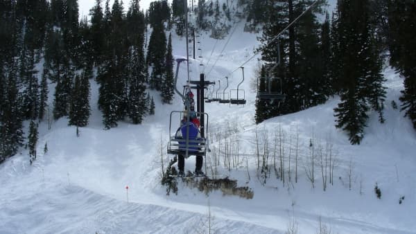
The South Fork stays open for winter recreation in a way many canyon areas do not. The road is plowed to Big Springs Park in winter, and the Big Springs Hollow trail becomes a popular snowshoe outing, and the lower section is the easy part. For beginners, it is one of the best first snowshoe walks near Provo; our guide to snowshoeing near Provo covers gear and other routes.
Remember that the fork runs colder than the valley and the main canyon, and that storms can change road conditions quickly. Check our canyon conditions page before you go, carry traction for your car, and bring warmer layers than you think you need.
Fall Color
The South Fork is one of the best fall-color drives near Provo, and it has two advantages over the famous routes. It turns before the main canyon does, because it sits higher and colder, and the color here rivals the Alpine Loop with a small fraction of the traffic. A late-September walk up Big Springs Hollow, through gold aspens, followed by a picnic at the park, is one of the best autumn afternoons in the valley.
Why the South Fork Stays Quiet
On a summer weekend, Vivian Park is often full and the main canyon can feel like a traffic jam. The South Fork is frequently not, for a few simple reasons. Many visitors do not know it is there. The road does not lead anywhere else, so there is no through traffic. And the attractions are quiet ones: picnics, gentle walks, a creek and shade. For families with young children, groups planning a reunion, or anyone who wants the canyon without the crowd, that is exactly the point.
Protecting the South Fork
Local conservation groups have taken an interest in keeping the South Fork's natural character as open space with public access. The fork mixes public parks with private summer homes and land, so the best way to help is simple: stay on trails and in the parks, respect private property and posted signs, and leave the creek and meadows as you found them.
Which Provo Canyon Park Should You Pick?
Provo Canyon has more parks than most visitors realize, and they suit different days.
For the river, the train and the classic canyon scene, choose Vivian Park, the county park at the mouth of the South Fork. It is busier, and on a summer weekend it can fill, but it puts you on the main river with the most going on.
For a waterfall, Bridal Veil Park, also run by the county, puts you at the foot of the canyon's best-known falls.
For a big group with a pavilion and some quiet, choose South Fork Park, the Provo City park with several large pavilions a short drive up the fork.
For a gentle walk and a picnic by a spring-fed creek, choose Big Springs Park, farther up the fork, where the Big Springs Hollow trail starts at the edge of the picnic grounds.
For a winter outing, choose Big Springs, where the road is plowed to the park and the trail becomes a snowshoe route.
Whichever you pick, check who runs it before you reserve: Provo City for the South Fork parks and Canyon Glen, Utah County for Vivian, Bridal Veil, Nunns and Canyon View, and Orem for Mt. Timpanogos Park.
Bringing a Dog
Big Springs Park and South Fork Park are Provo City parks, and Provo's parks rules allow dogs in city parks as long as they are on a leash. The city's only off-leash area is the dog park in Bicentennial Park, down in the valley, so keep dogs leashed in the South Fork parks and on the trail, pick up after them, and keep them out of other groups' picnic areas. Our guide to things to do with your dog covers the valley's dog rules, and our guide to dog-friendly hikes covers where to go next.
Spring and Summer
Spring. Snowmelt swells the South Fork and the springs, the meadows green up, and the aspens leaf out later than in the valley because of the cooler air. It is a lovely time for the Big Springs Hollow walk, but expect mud on the trail and fast, cold water in the creek.
Summer. This is the South Fork's busiest season, but busy here is a different thing from busy at Vivian Park. The shade and the cooler air make the fork a refuge on the hottest days, and a creekside picnic followed by a slow walk up the hollow is the classic plan. Arrive early on weekends if you want a table without a reservation.
Accessibility
The picnic areas at both parks sit close to parking, and the restrooms make a long visit practical for older relatives and families with small children. The Big Springs Hollow trail is wide and gently graded rather than steep, which suits many walkers who find other canyon trails too hard, but it is a natural-surface trail rather than a paved one, so it can be muddy or uneven, especially in spring. Visitors using wheelchairs or strollers will find the picnic grounds easier than the trail.
What to Bring
- Layers, because the South Fork runs cooler than the valley in every season.
- Water and snacks, since there are no stores up the fork.
- Shoes with grip for the trail, and water shoes if the children plan to play in the creek.
- A downloaded map and a plan for limited cell coverage.
- Trash bags to pack out what you bring.
- Traction for your tires and warm boots in winter.
Planning a South Fork Day
Morning. Drive up Provo Canyon early, turn at Vivian Park, and head up the fork before the day warms up.
Midmorning. Walk Big Springs Hollow as far as you like, then loop back along the creek.
Lunch. Picnic at Big Springs Park or, with a big group and a reservation, at a South Fork Park pavilion.
Afternoon. Let the children play in the stream, take a short bike ride on the South Fork Trail, or add a stop at Vivian Park on the way back down to the highway.
Safety Notes
The creek. The stream is shallow and inviting in summer but runs fast and cold during spring runoff. Watch young children closely near the water, especially early in the season.
The cold. Evenings are cool, and the fork can be much colder than the valley. Pack layers year-round.
Wildlife. Deer and other wildlife live in the South Fork. Give animals space, keep dogs leashed, and store food properly.
Getting help. With limited cell coverage, tell someone your plans, and know that help may take longer to reach you than in the main canyon.
The Short Version
Turn south at Vivian Park in Provo Canyon and follow the South Fork road into Provo Canyon's quiet side. Provo City owns the two parks up the fork, South Fork Park, with several large pavilions, and Big Springs Park, with a spring-fed creek and the trailhead for Big Springs Hollow; both have picnic tables, grills, restrooms, water and power, and pavilions are reserved through Provo City Parks and Recreation. The lower stretch of Big Springs Hollow is a gentle forest walk, the full loop is moderate, and it becomes a popular snowshoe in winter, when the road is plowed to the park. The fork runs cool, cell coverage fades, and the fall color rivals the Alpine Loop with far less traffic.
Related Guides
Frequently Asked Questions
Where is Big Springs Park?
Who owns Big Springs Park?
Can you reserve a pavilion at Big Springs or South Fork Park?
What facilities do the South Fork parks have?
How hard is the Big Springs Hollow trail?
Is the South Fork road open in winter?
Is there cell service up the South Fork?
What is Camp Big Springs?
Sources
The facts in this guide were checked against these sources. Hours, fees and rules change, so confirm anything time-sensitive with the source before you go. How we make Provo.com.
- Trails | Provo, UT, Provo City Parks and Recreation. Checked October 12, 2026.
- Park Finder (ParkFinderNew GIS layer 0), Provo City Parks and Recreation. Checked October 12, 2026.
- Park Rules | Provo, UT, Provo City Parks and Recreation. Checked October 12, 2026.
- Big Springs Hollow Trail #059, USDA Forest Service, Uinta-Wasatch-Cache National Forest. Checked October 20, 2026.
- South Fork of Packard Canyon Trail #058, USDA Forest Service, Uinta-Wasatch-Cache National Forest. Checked October 20, 2026.
- Shingle Mill Trail #057, USDA Forest Service, Uinta-Wasatch-Cache National Forest. Checked October 20, 2026.
- Big Springs-Shingle Mill Trail #211, USDA Forest Service, Uinta-Wasatch-Cache National Forest. Checked October 20, 2026.
- Big Springs Hollow Loop, AllTrails. Checked October 12, 2026.