
The Uinta Basin loop is about 342 miles and seven hours of driving from Provo and back, by an OpenStreetMap routing estimate (OSRM, no traffic). It goes south and east first, through Spanish Fork Canyon to Price, north over Indian Canyon to Duchesne, east across the basin past Starvation and Roosevelt to Vernal, and home on US-40 over Daniels Summit and down Provo Canyon. It is a two-day trip: too much road for one day once you add stops, and just right with a night in Vernal.
Our Vernal and Dinosaurland guide covers Dinosaur National Monument's quarry wall, the Field House and Red Fleet in depth. This page is the loop that gets you there by a different road and brings you home by the usual one.
The loop, leg by leg
OSRM's estimates for each leg:
| Leg | Route | Miles | Drive time |
|---|---|---|---|
| Provo to Price | US-6, Spanish Fork Canyon | 76 | About 1 hr 40 min |
| Price to Duchesne | US-191, Indian Canyon | 55 | About 1 hr 15 min |
| Duchesne to Vernal | US-40 | 58 | About 1 hr 10 min |
| Vernal to Provo | US-40, US-189 | 154 | About 3 hr |
Leg 1: Provo to Price and Helper
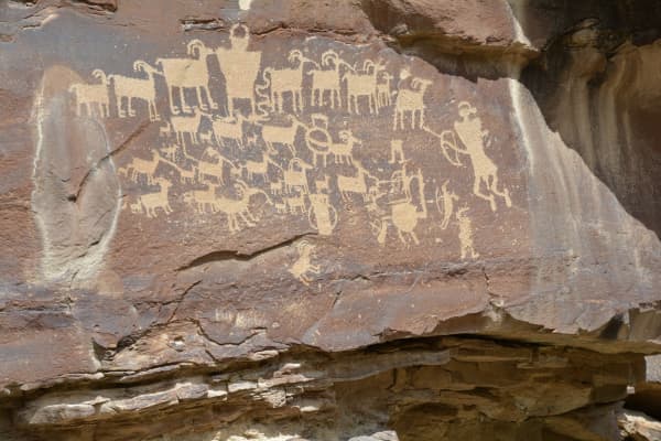
Spanish Fork Canyon, Soldier Summit and the drop into Helper. Our Nine Mile Canyon, Helper and Price guide covers the towns, the Prehistoric Museum in Price and the rock art in Nine Mile Canyon, which deserves its own day.
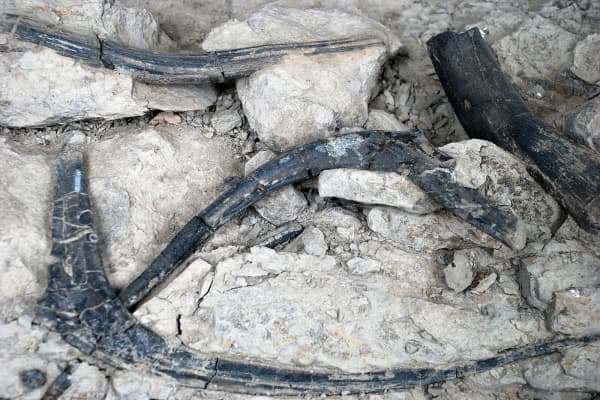
If you have a dinosaur fan along: Jurassic National Monument and the Cleveland-Lloyd quarry are about 30 miles south of Price. It closes for the season on November 1, 2026, and its quarry building is closed for construction; our Jurassic National Monument guide has the details. Adding it makes day one very full.
Fill up in Price or Helper. The next services are in Duchesne.
Leg 2: Indian Canyon to Duchesne
US-191 leaves Helper and climbs. The Federal Highway Administration's byway description: up Willow Creek past the start of the Roan and Book Cliff formations, to Indian Creek Pass at 9,100 feet in the Ashley National Forest, then down Indian Canyon along Indian Creek to Duchesne, a town settled in 1904. It passes from pinyon and juniper to aspen and Douglas fir, and the byway description says elk and deer are often seen and autumn color is especially good. Utah.com puts it at about 43 miles, with grades steep enough that it takes at least an hour.
Late October: the aspens are mostly done, but the pass is still the high point of the trip at 9,100 feet. Check UDOT for snow before you start, and drive it in daylight; deer are active at dusk.
Duchesne and Starvation
Just northwest of Duchesne, Fred Hayes State Park at Starvation (the reservoir is still Starvation to most people) is the basin's big lake. Utah State Parks describes:
- 3,500 acres of parkland around a large reservoir with remote beaches and coves.
- Walleye. The park's annual walleye tournament produces trophy fish over 10 pounds nearly every year.
- Four primitive and two developed campgrounds, cabins, a 3D archery course, slacklines, disc golf and nearby OHV trails.
Status in October 2026 (Utah State Parks):
- Winter hours: 8 a.m. to 5 p.m. (summer is 6 a.m. to 10 p.m.)
- Boat ramp open; water level 54 percent and receding.
- From October 1 to May 15, all sites are walk-in only, except the cabins, which are reservable year-round up to 120 days ahead.
- Drinking water is available in the main park area.
Duchesne has a grocery store, restaurants, hotels and convenience stores, the park notes, and "most places close earlier than what you may be used to." For a fishing-focused trip, read our fishing near Provo guide and check the current Utah fishing guidebook for walleye limits.
Leg 3: Across the basin to Vernal
US-40 runs east through Myton, Roosevelt and Fort Duchesne to Vernal. This is oil and gas country and the home of the Ute Indian Tribe of the Uintah and Ouray Reservation, headquartered at Fort Duchesne; our Vernal guide explains the history, and our guide to the Timpanogos and the Utes connects it to Utah Valley.
Sleep in Vernal. It has the lodging, and OSRM puts the Quarry Visitor Center about 19 miles and 26 minutes away for the morning.
Vernal and Dinosaur National Monument
Utah Field House of Natural History State Park Museum, 496 E Main St., Vernal. Utah State Parks lists Monday to Saturday, 9 a.m. to 5 p.m. Hands-on exhibits, a dinosaur garden and a free visitor center inside for local information. It is a state park: a Utah State Parks pass works, a federal pass does not.
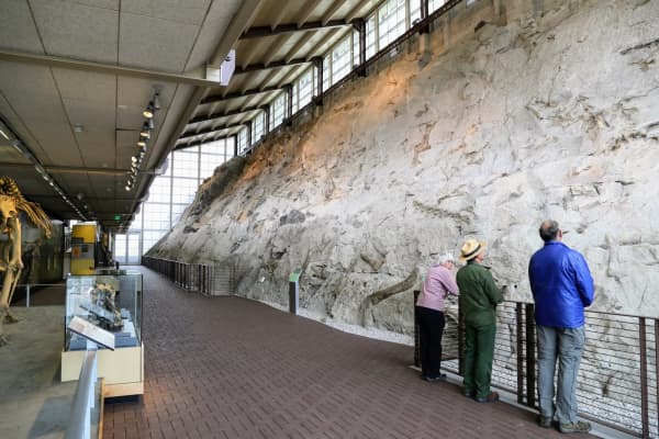
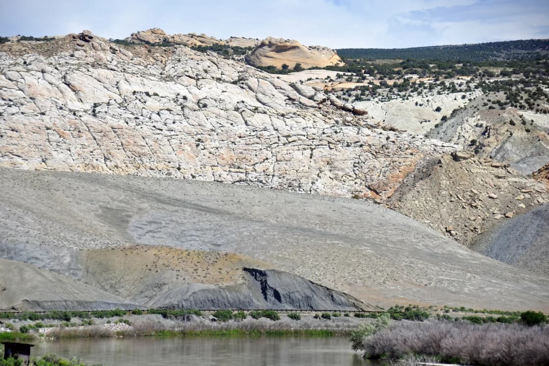
Dinosaur National Monument, near Jensen. The National Park Service lists standard entrance passes from $15 to $25 and America the Beautiful passes from free to $250. The Quarry Visitor Center and the Wall of Bones are the reason most people come; our Vernal guide explains how access to the quarry hall changes by season, and why people go to the wrong place first.
A third day? Flaming Gorge is north of Vernal on US-191.
Leg 4: Home on US-40
The long leg, about three hours by OSRM: west back across the basin, over Daniels Summit, through Heber and down Provo Canyon on US-189. Strawberry Reservoir is on the way and makes a good leg-stretch. The lodge at the top is covered in our Daniels Summit guide.
Our Vernal guide's warning applies: Daniels Summit is a real mountain pass, and it demands respect in winter. Fuel up in Roosevelt or Duchesne; the gaps between services are longer than Wasatch Front drivers expect.
The two-day plan
Day 1 (Saturday): leave Provo at 8. Helper by about 10 for coffee and a walk down Main Street. Indian Canyon late morning. Lunch in Duchesne, then an hour or two at Starvation. Vernal by late afternoon; the Field House closes at 5, so if it matters, go now (it is closed Sunday per Google's listing).
Day 2 (Sunday): Dinosaur National Monument in the morning. Leave Vernal by early afternoon, Strawberry for a stop, home by evening.
Doing it in the other order: if you would rather see the Field House on a Saturday morning, run the loop clockwise: US-40 to Vernal on day one, Indian Canyon and Price on day two.
Shorter version: our Nine Mile Canyon guide describes a loop through Gate Canyon to Myton, which skips Indian Canyon; it is rougher, and the BLM recommends checking conditions first.
In winter: with two high passes, the loop is a May-to-October trip for most families. From November through April, Vernal as an out-and-back on US-40 is the safer plan; check UDOT, and see our winter driving guide.
For more trips by distance, see day trips from Provo.
Frequently Asked Questions
How long is the Uinta Basin loop from Provo?
Which direction should I drive the loop?
What is the Indian Canyon Scenic Byway?
Is Starvation State Park still called Starvation?
Is Starvation open in late October?
What does Dinosaur National Monument cost?
What are the Utah Field House museum's hours?
Is the loop safe in winter?
Sources
The facts in this guide were checked against these sources. Hours, fees and rules change, so confirm anything time-sensitive with the source before you go. How we make Provo.com.
- Indian Canyon Scenic Byway, Federal Highway Administration, America's Byways. Checked October 20, 2026.
- Fred Hayes State Park at Starvation, Utah State Parks. Checked October 20, 2026.
- Utah Field House of Natural History State Park Museum, Utah State Parks. Checked October 20, 2026.
- Fees and passes, National Park Service, Dinosaur National Monument. Checked October 20, 2026.
- Jurassic National Monument (season closing date), Bureau of Land Management, Utah. Checked October 20, 2026.
- Indian Canyon Scenic Drive, Utah.com. Checked October 20, 2026.
- OSRM route service (OpenStreetMap data), driving estimates from Center St & University Ave, Provo, Project OSRM. Checked October 20, 2026.
- Google Places listings (coordinates, addresses, hours), Google. Checked October 20, 2026.