Utah has three mountain biking destinations that Provo riders talk about more than any others: Moab in the southeast, St. George in the southwest, and Park City in the Wasatch Back. They are not interchangeable. One is a 75-to-90-minute drive that works for an afternoon, and the other two are weekend trips that reward planning. This guide sorts the trail systems each place is known for by skill level, so a family with a ten-year-old, a BYU student on a hardtail and a rider who wants the hardest thing on the map can each find the right trailhead.
A note on sourcing. The trail names, skill ratings and seasons below come from Visit Utah, Discover Moab (the Moab tourism office), Greater Zion (the St. George-area tourism office), Visit Park City, the Mountain Trails Foundation and the Bureau of Land Management's Moab Field Office, all read on November 6, 2026. Drive times come from our existing Provo guides. Those pages are mostly tourism sites, and tourism sites rarely give exact trail lengths or current conditions, so where a number is missing we say so and point you to the source that keeps it current.
The three destinations at a glance
| Destination | Drive from Provo | Season, per official pages |
|---|---|---|
| Park City | Roughly 75 to 90 minutes | Primarily summer and fall; Deer Valley's summer operation runs mid-June to early September |
| Moab | About 3.5 to 4 hours each way | Visit Utah: late spring (March through May) offers the best weather, highs in the 60s and 70s |
| St. George | About 3.5 hours | Year-round; go-to for early spring, late fall and winter |
Drive times are from our guides: Park City from Provo, Moab from Provo and Zion and St. George from Provo. Traffic, weather and construction change them, so check UDOT's road conditions before a long drive.
Why these three, and why the order matters
Provo has its own riding, covered in our mountain biking near Provo guide, and it is better than people give it credit for. The reason to drive farther is usually one of three things: you want a different kind of terrain (red sandstone instead of Wasatch dirt), you want a different season (St. George when the high country is under snow), or you want a bigger network than any one trailhead near home.
That last point is the one people underestimate. A system is not a trail. At Moab and St. George, the draw is that several trail systems sit near one another, so a three-day trip can include different terrain each day. Park City is the opposite: it is one connected network that you reach from a town, with lifts and buses to move you around.
Below, each destination is divided into beginner, intermediate and advanced options. One caution applies to all of them. The official tourism pages rate difficulty loosely, and a trail called "intermediate" in one place can feel harder than an "advanced" trail somewhere else. Treat the ratings as a starting point and ask a local shop what the trails are like this week.
Moab: sandstone, shuttles and a spring-and-fall crowd
Moab is the most famous mountain biking town in Utah, and the BLM's Moab Field Office says spring and fall are its busiest seasons. Visit Utah says late spring, March through May, offers the best riding weather, with highs in the 60s and 70s. Anyone planning a summer trip should treat heat as the main hazard and read the safety section below.
From Provo, the usual route runs southeast on US-6 through Spanish Fork Canyon to Price and Green River, then east on I-70 and south on US-191, which our Moab guide puts at about three and a half to four hours each way. That makes Moab a weekend. It is possible to cram it into a long day, but you would spend more time in the car than on the bike.
Moab for beginners
- Bar M (Moab Brands). Discover Moab says Bar M has "over 30 miles of trails" in the entire system and terrain "suitable for riders of all skill levels." The BLM Moab Field Office says the Bar M Trail System, just north of Moab, has riding options "for beginners to experts all right out of the same trailhead." That makes it the strongest choice for a mixed-ability group. Discover Moab adds that Bar M has little shade, so bring plenty of water and snacks. From town, it says, the paved Moab Canyon Pathway leads about 10 miles to the Bar M system.
- Klondike Bluff and Baby Steps. Visit Utah calls these good introductions to Moab riding.
Moab for intermediate riders
- Navajo Rocks. Discover Moab lists four trails with lengths: Ramblin' at 3.3 miles, Big Mesa at 3.4 miles, Rocky Tops at 4.6 miles and Big Lonely at 3.2 miles. It recommends riding them clockwise and says riders often need to shuttle back to the parking lot along the road. The page does not assign difficulty ratings to individual trails, so look at a current map or ask a shop before choosing a loop.
- Raptor Route. Four connected trails (Eagle Eye, Hawks Glide, Falcon Flow and Kestrel Run), each rideable on its own. Discover Moab says they are best ridden downhill, and you can park at the bottom and pedal up the road or hire a shuttle to the top of Eagle Eye. Lengths are not listed.
- Amasa Back. Visit Utah says its six trails "test your fitness and bike skills."
- Newer singletrack. Visit Utah also names Sovereign Trail, Mag 7 and HyMasa/Captain Ahab among Moab's newer trails, without ratings.
Moab for advanced riders
- Slickrock. Visit Utah describes it as one for experienced riders.
- Porcupine Rim. Same description: experienced riders. Discover Moab names it but gives no distance.
We have not confirmed the length, fee or current rules for the Slickrock Trail from an official page, because the BLM and tourism pages we tried for it were not available when we checked. Before you go, read the managing agency's page or ask a Moab shop. The BLM Moab Field Office says Sand Flats is a 9,000-acre recreation area managed by Grand County and the BLM with 140 first-come, first-served campsites and six group sites reservable through Recreation.gov, but it does not list fees. Check the site's official page for current fees.
Moab logistics
Moab has shuttle services and guides, and Discover Moab notes that guides and shops often provide water, snacks and route knowledge. If you are new to the area, a guided first day is a reasonable way to learn which trails match your fitness. Our Moab guide also covers the national parks and the park entry situation, which is a separate trip-planning decision from the bike.
St. George: the winter answer
If Moab is the spring-and-fall town, St. George is the place Utah riders go when the Wasatch is snowed in. Visit Utah describes it as year-round riding and the go-to for early spring, late fall and winter. Greater Zion describes more than 300 days of clear skies and year-round trail access, and more than 300 miles of trails across the region. The drive from Provo is about three and a half hours, nearly all of it I-15 south, per our Zion and St. George guide.
St. George for beginners and mixed groups
- Cliffrose Trail System. Greater Zion says it is suitable for all skill levels and that its higher elevation extends the riding season beyond the valley floor. It also lists Rooster and PJ Party as downhill lines within Cliffrose.
- Snake Hollow Bike Park. Greater Zion says it has features for beginners through experts and is open year-round. If your group includes a kid who wants to learn jumps and a parent who wants to watch, this is the practical stop.
- Revenant Trail System. Greater Zion describes green, black and double-black descents off a shared trailhead where riders of all levels can start. That shared start is useful for families who split up by ability and meet back at the car.
- Paved options. For riders who would rather not use singletrack, Greater Zion's biking page lists the Pa'rus Trail (6.4 miles out and back, paved, following the Virgin River) as suitable for all levels, and the Sand Hollow loop (21.9 miles, counterclockwise, mostly flat). These are road or path rides, not mountain trails.
St. George for intermediate riders
- Sidewinder and Barrel Roll. Visit Utah describes them as more technically moderate and suited to intermediate riders. Greater Zion also names Barrel Roll.
- Goosebumps. Greater Zion says it has side options offering an easier path around steeper, more technical sections, which makes it a good place to test your limits without committing to them.
- Bear Claw Poppy. Greater Zion calls it a classic flow trail.
St. George for advanced riders
- Gooseberry Mesa. Visit Utah calls it a "technically challenging trail system" with slickrock and singletrack, and says it is for advanced riders. Greater Zion describes the North Rim of Gooseberry Mesa as technical and challenging.
- Zen Trail. Greater Zion describes it as technical.
- Snow Canyon State Park. Greater Zion lists a 4.5-mile one-way route, part of an 18-mile loop, as challenging. A Utah State Parks annual pass covers the entrance there, per our Snow Canyon winter guide; a federal America the Beautiful pass does not.
St. George logistics
Greater Zion lists about 30 local bike shops and outfitters offering rentals and guided tours, and links to maps from the Southern Utah Bicycle Alliance. It links to MTB Project and Trailforks for trail details. The pages we read gave no individual trail distances and no heat guidance, so confirm both with a local shop. Visit Utah describes St. George as the go-to for winter, which is also a signal to be careful about midsummer: we did not find an official page that gives a heat cutoff, so check the forecast and carry more water than you think you need.
Park City: the day trip with a lift option
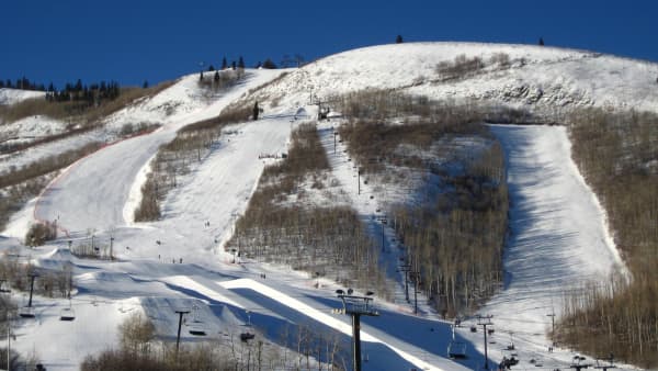
Park City is the one destination here that does not require a hotel. Our Park City guide puts the drive at 75 to 90 minutes, by either I-15 and I-80 (the all-weather route) or through Provo Canyon on US-189 and US-40 past Heber. Visit Park City describes a network of more than 400 miles of paved and natural-surface trails, and says it is reachable by bike path or bus from nearly anywhere in town. Riding styles it lists are cross-country, marathon, downhill, enduro and BMX.
Park City for beginners
- Round Valley. Visit Utah says it has wider singletrack and suits casual riders. Visit Park City says it is reached from the Quinn's Junction trailhead.
- Trailside bike park. Visit Park City says the pedal-up flow and pump tracks at Trailside offer progressive features for newer riders.
Park City for intermediate riders
- Armstrong and Bob's Basin. Visit Park City describes these as stacked loop areas with descending-only trails. It also lists Silver Queen, Three Candles, Mojave, Snow Top, Deer Crest, Jenni's and Seldom Seen among named trails, without ratings.
- Wasatch Crest and Mid Mountain. Visit Utah names Armstrong, Mid Mountain and Wasatch Crest as cross-country options but does not give difficulty. Ask a local shop about current conditions before you commit.
Park City for advanced riders and lift riders
- The Mid Mountain Epic. Visit Park City says the IMBA-certified Epic ride follows the Mid Mountain trail for 26 miles across Deer Valley and Park City Mountain, starting and staying around 8,000 feet. A 26-mile ride at that elevation is a serious day, particularly for a rider coming from Utah Valley's lower trailheads.
- Lift-served downhill. Visit Utah says Park City Mountain and Deer Valley run lift-served downhill trails. Visit Park City says Deer Valley Snow Park provides access to the Deer Valley Bike Park, Snow Top and Deer Crest via the Silver Lake Express lift, that Woodward and Deer Valley have machine-built flow and technical trails, and that Deer Valley's summer operation runs from mid-June to early September. Ticket prices and lift hours are not listed on the pages we read, so check the resort sites.
Park City logistics
Visit Park City says free buses serve the area; the orange route goes to Silver Lake Village and Deer Valley and the purple route goes to Empire Lodge daily, with the purple route also reaching Bonanza Flat and Bloods Lake trailheads Friday through Sunday. Guided-ride providers it lists are White Pine Touring, All Seasons Adventures, Deer Valley Resort and Inspired Summit Adventures. For trail maps and conditions, it points to parkcitytrails.org and the Trailforks app. The Mountain Trails Foundation, a nonprofit that builds and maintains non-motorized trails in the Park City area, publishes trail reports with current conditions and trail guides, and its site covers direction rules, skill levels and muddy-trail conditions.
Matching your group to a destination
If you want a quick sorting rule, use this.
- A family with young riders, one weekend, no plan. Park City for the day, with Round Valley or the Trailside bike park. Add Cliffrose or Snake Hollow if you are already in St. George.
- A group with mixed abilities that wants one trailhead. Bar M in Moab, where the BLM says beginners to experts can start from the same trailhead, or Revenant in St. George, where Greater Zion says all levels start from a shared trailhead.
- Winter or early spring, snow in the Wasatch. St. George.
- Spring or fall, a long weekend. Moab, with a guide on day one if you have not ridden slickrock.
- Summer, one day, you want elevation and cooler air. Park City, where trails and bike parks are primarily summer and fall riding.
- Experienced riders after something technical. Gooseberry Mesa in St. George, or Slickrock and Porcupine Rim in Moab.
What to bring
The tourism pages are consistent on one thing: shade and services are limited at the desert trailheads, and Discover Moab says so about Bar M directly. A reasonable kit for any of these trips:
- More water than you expect to drink, and snacks. Discover Moab recommends both at Bar M.
- A helmet, gloves, spare tube and pump or CO2, and a multitool. Utah's rocky trails punish underbuilt gear, and a flat in a place without cell service is a long walk.
- A paper or downloaded map. The sources above point to Trailforks, MTB Project and parkcitytrails.org, and phone service varies by trailhead.
- Sun protection for desert trips.
- A bike that matches the trail. Several of the trails above are rated for experienced riders; a rental shop can tell you whether a hardtail or full-suspension bike is better for the loop you picked.
Cost
We did not find prices on the tourism pages for bike rentals, guided rides, shuttles, lift tickets or Sand Flats fees. Confirm each directly before you budget. What the pages do give you is a sense of the structure: Park City has free buses and resort-run lift access, Moab has shuttles and guides, and St. George has about 30 shops and outfitters that rent and guide. The largest cost for a Provo family is usually the drive and a hotel night for the two southern destinations. Our camping near Provo guide covers cheaper overnight options closer to home, and the BLM Moab Field Office says Sand Flats has 140 first-come, first-served campsites.
Safety and conditions
- Heat. Neither Greater Zion nor Discover Moab gives heat guidance in the pages we read, and Visit Utah places the best Moab weather in March through May. Plan summer desert rides for early morning and carry extra water. Check the National Weather Service forecast for the exact town.
- Mud. The Mountain Trails Foundation says its site covers direction rules and muddy-trail conditions. Our Provo mountain biking guide explains why riding wet clay is a good way to damage a trail that volunteers maintain: ruts harden and last a season, and repeated damage is what leads to access restrictions. If mud sticks to your tires, turn around.
- Trail direction. Discover Moab recommends riding Navajo Rocks clockwise and the Raptor Route downhill. Visit Park City describes Armstrong and Bob's Basin as descending-only. Follow posted direction signs.
- Shuttles and returns. Discover Moab says Navajo Rocks riders often need to shuttle back along the road. Plan the return before you start, not when you are tired.
- Bike-park risk. Lift-served downhill is a different sport from cross-country. Wear a full-face helmet and pads if the park requires or recommends them, and check the resort's rules.
- Weather and roads. Check UDOT's road conditions for US-6, I-15, US-191 and the Provo Canyon route before long drives, particularly in shoulder seasons.
Who should skip it
- If you are just learning to ride singletrack, skip Slickrock, Porcupine Rim and Gooseberry Mesa for now. Visit Utah labels them for experienced and advanced riders.
- If you only have one afternoon, skip Moab and St. George. You would spend about seven hours in the car.
- If your group includes someone who dislikes heat, skip a midsummer desert trip.
- If you want lifts and a restaurant scene without singletrack, Park City works, but that is a different trip from the one this guide describes.
Before you go: a checklist
- Check the trail conditions source: Trailforks and parkcitytrails.org for Park City, Trailforks or MTB Project for St. George, and a Moab shop or the BLM Moab Field Office (435-259-2100) for Moab.
- Confirm rental, shuttle and lift availability directly with the shop or resort.
- Check the forecast and UDOT road conditions for your route.
- Check Sand Flats, Deer Valley and any state-park fees on their official pages.
- Reserve lodging early for spring and fall weekends in Moab, which the BLM calls the busiest seasons.
If you are not sure which destination suits you, start with Park City. It is the shortest drive, has the widest range of beginner options, and has a bus system that handles the parking problem. If you enjoy it, plan a spring weekend in Moab or a winter weekend in St. George next. For a full list of Utah state parks within two hours of Provo, including several with their own trails and camping, see our Utah state parks guide, and for more weekend ideas see 100 things to do in Utah from Provo. If you want a nearer ride first, our Corner Canyon mountain biking guide covers Draper's network, about 37 minutes from downtown Provo.
Frequently Asked Questions
Which Utah mountain biking destination is closest to Provo?
Where should a beginner ride in Moab, St. George or Park City?
Is Moab only for expert riders?
When is the best time of year to ride in St. George?
When does Park City mountain biking season run?
How many miles of trail does Park City have?
Should I bring my own bike or rent one?
Can I do Moab, St. George or Park City in one day from Provo?
Sources
The facts in this guide were checked against these sources. Hours, fees and rules change, so confirm anything time-sensitive with the source before you go. How we make Provo.com.
- Mountain Biking in Utah, Visit Utah. Checked November 6, 2026.
- Moab Field Office, Bureau of Land Management. Checked November 6, 2026.
- Mountain Trails Foundation. Checked November 6, 2026.
- Mountain Biking in Greater Zion, Greater Zion. Checked November 6, 2026.
- Biking in Greater Zion, Greater Zion. Checked November 6, 2026.
- Mountain Biking in Moab, Discover Moab. Checked November 6, 2026.
- Mountain Biking in Park City, Visit Park City. Checked November 6, 2026.