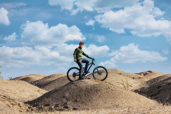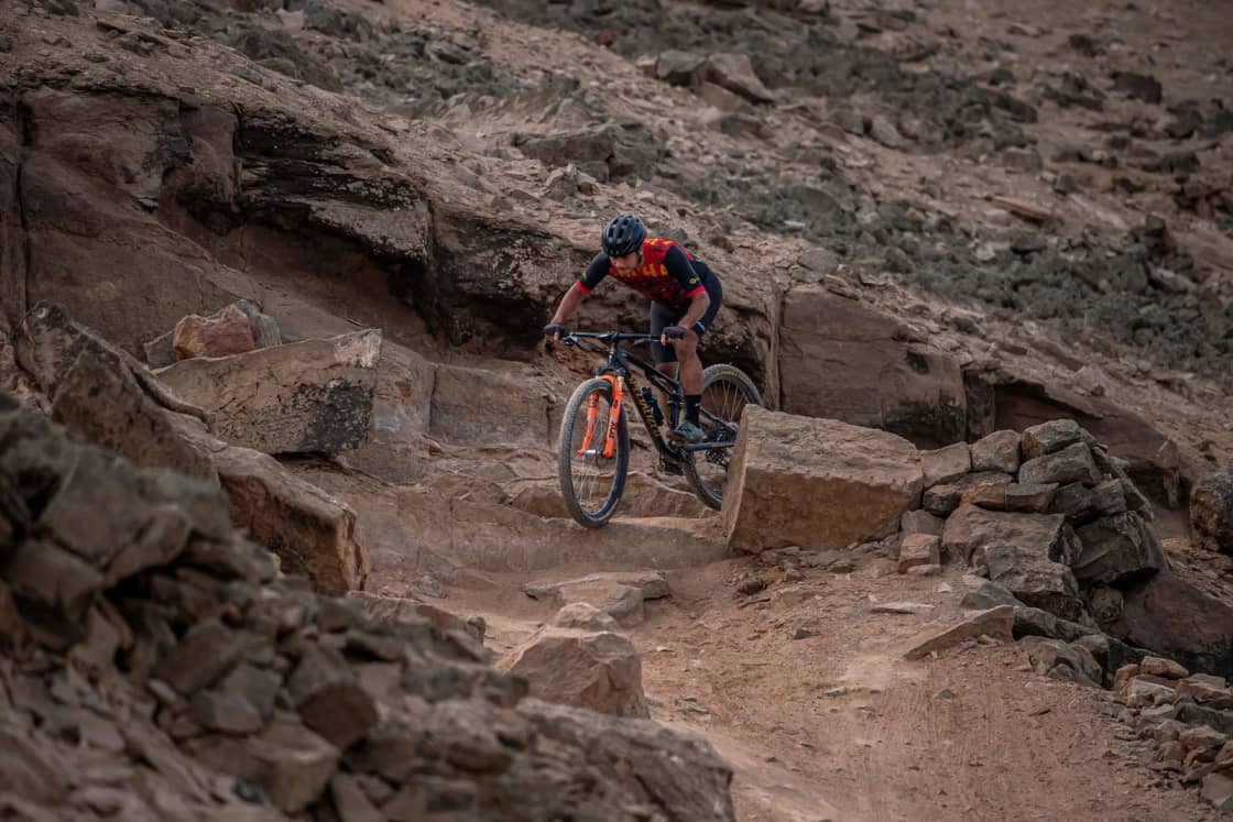
Gooseberry Mesa is the trail that put St. George-area mountain biking on the map, and it is not where most riders should start. The Bureau of Land Management, which manages it, says the Gooseberry Mesa National Recreation Trail is "designed for technical mountain biking," with singletrack and slickrock on a mesa at about 5,200 feet, and one of its trails is rated Extreme. The good news for a Provo rider heading south this winter is that the same BLM field office manages several systems built for people still learning, with smooth trails rated Easiest, a short Practice Trail to test yourself on, and a family-friendly loop on the edge of St. George.
This guide goes through the main trail systems with the ratings the land managers publish, the trail lengths from BLM pages and brochures, the access roads, and when the weather works. It is the trail-level follow-up to our broader Utah mountain biking destinations guide, which compares St. George with Moab and Park City. For the non-biking side of the trip, see our Zion and St. George guide and our Snow Canyon winter guide.
A note on sources. Ratings and lengths below come from the BLM St. George Field Office's trail pages and printed brochures, Utah State Parks, Visit Utah, Greater Zion (the Washington County tourism office) and the Utah Division of Outdoor Recreation, all read on Nov. 18, 2026. Where sources disagree, we say so. Some BLM brochures appear older than the web pages, and trail networks here grow and change, so check with the field office or a local shop before you commit to a route.
The trails at a glance
| Trail | Official rating | Length and source |
|---|---|---|
| White Trail (Gooseberry Mesa) | Easiest (BLM) | 3.1 miles (BLM) |
| Practice Trail (Gooseberry Mesa) | More Difficult (BLM) | 1.3 miles; 2.35-mile loop from the White Trailhead (BLM) |
| North Rim (Gooseberry Mesa) | More Difficult (BLM) | 2.1 miles (BLM) |
| South Rim (Gooseberry Mesa) | Extreme (BLM) | 5.9 miles (BLM) |
| Jem Trail (Hurricane Cliffs) | Moderate/Easiest (BLM) | 6.7 miles (BLM) |
| More Cowbell (Hurricane Cliffs) | Moderate/Easiest (BLM) | 2.5-mile loop (BLM) |
| Goosebumps (Hurricane Cliffs) | Moderate/More Difficult (BLM) | 3.5 miles (BLM) |
| Guacamole (near Virgin) | Moderate/Most Difficult (BLM) | 5.5 miles round trip with loop variations (BLM) |
| Barrel Roll (Santa Clara River Reserve) | Moderate/More (BLM) | 5.79-mile loop (BLM) |
| Bearclaw Poppy (St. George) | Novice (Visit Utah) | 4.2 miles (BLM brochure) |
| Little Creek (near Hurricane) | Advanced (Visit Utah) | Not listed by the BLM; ask a local shop |
How the BLM ratings work
The BLM brochures for Gooseberry Mesa and Bearclaw Poppy say their ratings follow the International Mountain Bicycling Association (IMBA) Trail Difficulty Rating System and "categorize the technical challenge of the trail, not the physical exertion." That distinction matters. A trail rated Easiest can still be a long, hot ride, and a short trail can be rated hard because of one ledge.
The brochures define the levels this way:
- Easiest: a firm, stable surface, grades averaging 5 percent or less with a maximum of 15 percent, and unavoidable obstacles no taller than two inches (Gooseberry brochure) or three inches (Bearclaw Poppy brochure).
- More Difficult: mostly stable surface with some variability, grades averaging 10 percent or less, unavoidable obstacles up to eight inches.
- Most Difficult: widely variable surface, unavoidable obstacles up to 15 inches, and possible steep drop-offs, tight turns and low overhangs.
- Extreme: unpredictable surface, grades averaging 20 percent or more, and unavoidable obstacles 15 inches or taller.
Some BLM web pages use blended ratings, such as "Moderate/Easiest" for Jem or "Moderate/More Difficult" for Goosebumps. Read those as sitting between two levels. Visit Utah and Greater Zion use looser labels like "novice" and "advanced," which are useful for a sense of the trail but are not the BLM's rating.
Gooseberry Mesa
The BLM says the Gooseberry Mesa trail system was developed in the late 1990s through cooperative efforts and became a National Recreation Trail in 2006. Its brochure describes "a series of interconnected trails bisected by a dirt road," recommends the system for mountain bikers and hikers, and says it is not suitable for equestrians. Slickrock sections are marked with white dots, all intersections are marked, and there are reassurance markers in places that are hard to follow.
Getting there
The BLM's directions: from I-15 Exit 16, head east on State Route 9 into Hurricane. Turn right on Main Street and take the first left onto State Route 59. Turn left on the Smithsonian Butte National Backcountry Byway, go 2.8 miles, then turn left and travel northwest 3.3 miles to the Gooseberry Trailhead. From there, turn left and go west 1.3 miles to the White Trailhead, or continue northwest 1.2 miles to the Windmill Trailhead.
The road is the first test. The BLM's White Trail page says the Smithsonian Butte byway and the access road may be impassable during or after bad weather. Visit Utah's Gooseberry page says the unpaved approach is tricky to follow, that "4x4 is better than 2WD," and that you should not attempt the drive when it is muddy. If it has rained or snowed in the last day or two, plan a day on the paved-access trails closer to town instead.
The trails, by rating
The BLM brochure lists these trail lengths: Windmill 1.8 miles, Bowls and Ledges 1.1 miles, Practice 1.3 miles, White 3.1 miles, North Rim 2.1 miles, Hidden Canyon 1.9 miles, South Rim 5.9 miles and Yellow 0.5 miles.
- White Trail (Easiest, 3.1 miles). The BLM describes it as "an old 4x4 road that bisects the Gooseberry Mesa," with a few sandy patches and nothing very deep. It rises gently to the west, which makes the ride back to the trailhead easier. Around 2.4 miles it becomes sandy and narrow, and off-highway vehicles are not permitted past that point. The brochure says the White Trail and other designated roads are the only routes on the mesa open to motorized users, so expect to share it.
- Practice Trail (More Difficult, 1.3 miles). The BLM page says riders can do it "for the sheer fun of it or to test your bike handling skills," and describes a 2.35-mile loop that starts and ends at the White Trailhead. The brochure's advice is direct: "If you are unsure of your technical riding ability, ride the Practice Trail first. Use this trail to gauge your riding ability and fitness before venturing further." If the Practice Trail feels like a struggle, the rest of the mesa will be harder.
- North Rim (More Difficult, 2.1 miles). The BLM calls it "a classic single track with a mix of dirt, rock, trees, and exposure." Visit Utah describes it as more suitable for intermediate riders, with short, steep climbs. Greater Zion warns riders to "be prepared for a challenge on this rising and falling slickrock trail."
- South Rim (Extreme, 5.9 miles). The BLM says "the South Rim Trail is demanding," with steep drop-offs, difficult climbs, sharp turns and narrow ledges, and that the Extreme rating reflects its rim exposure. Visit Utah calls the South Rim and Hidden Canyon loop advanced technical and notes that walking the cliffside sections is an option.
Visit Utah describes a counterclockwise big loop linking the North and South Rims at just over 13 miles of intermediate and advanced terrain. That is a full day for most riders, especially once you count the drive in.
Services on the mesa
There are none to speak of. Visit Utah says there are pit toilets at the trailheads but no water or toilets on the trail, and no cell coverage, so bring a detailed map. The BLM brochure says there is no trash collection; pack it in and pack it out. Dispersed camping is allowed on the public land where previous camping use is evident, and campfires are permitted but discouraged, with fire restrictions possible at any time of year. The area mixes public, state and private land, and the brochure says no recreational uses are authorized on the private parcels.
Hurricane Cliffs: the beginner and intermediate system below the mesa
The BLM says the Hurricane Cliffs Trail System was planned mainly with mountain biking in mind and now has nearly 40 miles of beginner and intermediate trails. It sits between La Verkin and Hurricane on the west, State Route 9 on the north and Gooseberry Mesa on the east. Its older brochure counts ten trails and 31 miles at about 4,000 feet, and a separate BLM mountain biking page gives "31+ miles" for Gooseberry Mesa and Hurricane Cliffs combined. The newest figure is the one on the system's own page, but the gap is a reminder to use a current map.
The named trails on the BLM page are Jem, the Hurricane Rim, Dead Ringer, Goosebumps, Cryptobiotic, More Cowbell, Gould's, Gould's Rim, Canal, Chinatown Flume and Chinatown Wash. Visit Utah describes the Hurricane Rim, Gould's Rim and Jem combination as roughly 20 miles of roller-coaster singletrack, primarily intermediate with some advanced technical sections.
The trails to start on
- Jem Trail (Moderate/Easiest, 6.7 miles). The BLM calls it a classic that inspired the area's current trail system, mostly smooth singletrack with some rocky sections, known for fast downhill riding and views of the Virgin River and Zion's sandstone towers. Two cautions from the same page. First, a section is one-way: from the Jem Trailhead to the Goosebumps intersection (1.41 miles) riders go north, downhill, and riders returning to the trailhead use Dead Ringer instead. Second, about 0.75 miles in, a steep drop from the mesa top to the wash bottom should be ridden "with care (good riders only)." A newer rider should walk it.
- More Cowbell (Moderate/Easiest, 2.5-mile loop). The BLM describes "a short loop that circles the rim of a small mesa," reached from the Jem Trailhead by taking Dead Ringer for about a third of a mile. It has views of Gooseberry Mesa and Zion on the skyline. For a first desert ride, this is a sensible length.
- Goosebumps (Moderate/More Difficult, 3.5 miles). Built in 2013, the BLM says it "hugs the toe of the slope at the base of Gooseberry Mesa," rolling through the drainages that come off the mesa. Greater Zion says its steeper, more technical sections have easier side options, which makes it a good next step after Jem.
Trailheads, directions and camping
The BLM lists the Jem and Sheep Bridge trailheads with a vault toilet, a bike repair stand and an information kiosk, and the Virgin Dam Trailhead with a vault toilet and kiosk. The Hurricane Hill Trailhead is not a BLM site. From State Route 59, the brochure puts Hurricane Hill at 0.75 miles (turn left into the lot), Virgin Dam at 3.1 miles (left on the gravel road, then 3.4 miles), and Jem at about 5 miles (left on the gravel road, then 0.25 miles).
The brochure also says the trails are moisture sensitive and asks riders not to ride or hike when the ground is wet, and that roads off SR 59 may not be passable when wet. The Canal Trail is hikers only; it follows a historic water canal completed in 1904, is managed by the Hurricane City Historical Preservation Association, and has exposed cliffs and tunnels.
For riders who want to sleep near the trails, the BLM says the system has 56 designated dispersed campsites, each with a numbered placard and a metal fire ring. Camping outside designated sites is prohibited, most sites are reachable in a medium-clearance vehicle, and stays are limited to 14 days in any 28 consecutive days.
Little Creek and Guacamole: the advanced mesas
Little Creek. Visit Utah rates it advanced: "This area can be difficult and is best for more technically advanced riders," though less experienced riders "can always hop off their bikes and walk the challenging sections." It says the Magic Carpet Ride on the Main Loop is the easiest option and is well marked, but also that "it's very easy to get lost on these trails." A 2019 feature reprinted by Greater Zion said Little Creek's trails began as unofficial routes built by local riders and that their legal status was then pending a BLM travel management plan. We did not find a current BLM page for Little Creek, so call the St. George Field Office about its status and access before going.
Guacamole. The BLM lists the Guacamole Trail as singletrack for hikers and mountain bikers, 5.5 miles round trip "with all possible loop variations," rated Moderate/Most Difficult. From the trailhead it crosses slickrock toward the mesa rim, where cairns may help with navigation. A rim loop adds about 0.85 miles, and a Y about 1.9 miles in starts a technical loop through slickrock formations. Visit Utah rates the area intermediate and describes a 2.2-mile Guacamole loop and an 11-mile "Whole Guacamole," with Holy Guacamole adding more technical sections; those figures do not match the BLM's, likely because they count different combinations.
Getting there is the hard part. The BLM's directions: from I-15 Exit 16, take SR 9 east about 19.6 miles, past Virgin, turn left on Dalton Wash Road and go 1.7 miles to a fork, take the left fork and follow the main dirt road about 2.4 miles around the base of the mesa, then climb a steeper section to the top and follow the road southeast to parking on the right. The BLM recommends a high-clearance, 4WD vehicle for the final climb, and Visit Utah says you need a 4x4.
Santa Clara River Reserve and Barrel Roll
On the west side of St. George, the Santa Clara River Reserve is 6,500 acres of BLM land that the agency manages together with the cities of Ivins and Santa Clara, according to its brochure. It includes a 1,645-acre Area of Critical Environmental Concern with prehistoric sites and riparian habitat. The brochure says the mountain bike trails "require intermediate riding skills (most trails are rated More Difficult)," all trails are non-motorized, and riders must park at one of three designated trailheads: Tukupetsi, Anasazi Valley and Cove Wash. Taking artifacts is illegal.
The brochure's trail list includes Barrel Roll at 5.9 miles, Sidewinder at 1.7, Rim Rock at 3.1, Black Brush at 3.4, Cove Wash West at 4 and Suicidal Tendencies at 4.5.
Barrel Roll. The BLM's trail page gives it 5.79 miles and a Moderate/More rating, and calls it "a loop ride that can be ridden in either a clockwise or counter-clockwise direction," with clockwise easier for the obstacles. Greater Zion also recommends clockwise and mentions views of the mouth of Snow Canyon and the Pine Valley Mountains.
The BLM's directions to Cove Wash: from I-15 Exit 6, go north on Bluff Street and turn left on State Route 8 (Sunset Boulevard), which becomes Santa Clara Drive. Just before the Jacob Hamblin Home, turn left on Gates Lane. At 0.4 miles turn left, at 0.7 miles turn right, pass the water tank and turn right at 1.3 miles, then follow the road left to the trailhead at 1.5 miles.
Bearclaw Poppy, Zen and the Green Valley area
Bearclaw Poppy is the closest thing to a St. George town trail, and the one most often recommended for new riders. Visit Utah rates it novice, "fun for riders of all fitness and ability levels" and "not very technical," and says it can be ridden year-round, with trailheads at Green Valley and Bloomington about 4 miles apart. The BLM brochure lists the Bearclaw Poppy Trail at 4.2 miles and Stucki Springs at 7.0 miles. Visit Utah says more ambitious riders can link it with Stucki Springs or Zen.
It also comes with the strictest rules in this guide. The dwarf bearclaw poppy is a federally listed endangered species, and the BLM says Washington County "is the only place on earth where it grows." The area is an Area of Critical Environmental Concern, closed to motorized use and equestrians, and open to hikers and mountain bikers on designated trails only. The brochure warns that "a single bike track across the cryptobiotic crust can damage poppy habitat for decades" and that failing to stay on trail could close the area to mountain bikes permanently. It also says bicyclists yield to hikers. Visit Utah adds that downhill riders have the right-of-way among cyclists.
The BLM's directions to the Bloomington Trailhead: from I-15 Exit 5, go west on Dixie Drive, left on 600 West, right on Tonaquint Drive, right on Bloomington Drive and right on Navajo Drive until it turns to gravel; park in the open area on the right just past the cattle guard. The brochure lists a second, Gap Trailhead off Canyon View Drive, where high-clearance vehicles are recommended.
Zen. This is not a beginner trail. Greater Zion describes it as having "technical challenges," and the 2019 feature it reprinted called Zen ledgy and technical, with a demanding descent. We did not find a BLM page with an official rating or length, so treat it as advanced and check a current map.
Green Valley. The same 2019 feature describes the "mellow Green Valley Loop" as the trail early local riders mostly stuck to. We did not find a current official page for it; ask a shop how it connects to the Bearclaw Poppy trailheads.
Church Rocks and the Red Cliffs area
Church Rocks is a common recommendation for riders moving past beginner trails. We did not find a BLM page for it. Utah.com, a Deseret Digital Media travel site, described Church Rocks and Dino Cliffs in 2023 as "intermediate with a few expert level spots that can be walked," rideable as a roughly 4-mile loop with about 250 feet of climbing. Confirm the current route with a shop.
North of I-15, the Red Cliffs National Conservation Area has more than 130 miles of designated hiking, mountain biking and equestrian trails across 45,600 acres, according to the BLM, and is habitat for the threatened Mojave desert tortoise. The BLM's Prospector Trail page lists that trail at 6.85 miles, rated Moderate/More Difficult, starting from the Grapevine, Cottonwood or White Reef trailheads; horses have the right-of-way.
Snow Canyon State Park: where bikes can go
Snow Canyon is a state park, not BLM land, and its rules are narrower. Utah State Parks says bikes are allowed in the main canyon on Snow Canyon Drive, the paved Whiptail trail and West Canyon. In Paradise Canyon, all trails are open to bikes except the interior portion of the Gila trail, which the park says is impassable to bikes. Bikes are not allowed on the Johnson Canyon trail. Visitors must stay on designated, mapped trails.
The park says e-bikes are allowed and that "all posted speed limits apply." It does not rent bikes; it says several rental companies operate in St. George and Ivins. The park is open 6 a.m. to 10 p.m. daily and sits at 3,100 to 4,100 feet. Whiptail is a good choice for a rider who wants red rock without singletrack. For entrance fees, the campground and the winter-only Johnson Canyon hike, see our Snow Canyon winter guide.
When to go: October through April
St. George has a reputation as a winter riding town, and the sources back that up. Visit Utah says summer daytime temperatures in the Hurricane area average above 100 degrees, to the point that it mentions night riding as a summer option, and that winter biking is an option too. The 2019 feature reprinted by Greater Zion described "60-degree temps in the belly of winter" and quoted a local rider's advice to start at daylight and finish before it gets too hot. Utah State Parks describes winter afternoons at Snow Canyon in the mid-50s, with temperatures dropping quickly after sunset.
Put that together and the practical window for a Provo rider is roughly October through April, with these caveats:
- Elevation changes the math. Gooseberry Mesa is at about 5,200 feet and the Hurricane Cliffs system at about 4,000, per the BLM, so the mesa runs cooler than St. George. That is welcome in October and April and less so after a January storm.
- Wet ground is the winter problem. The BLM says the Hurricane Cliffs trails are moisture sensitive and should not be ridden wet, and that the dirt roads off SR 59 and to Gooseberry may be impassable after bad weather. After rain, pick a trail with paved access, such as Bearclaw Poppy's Bloomington trailhead or Snow Canyon's Whiptail, and give the clay a day or two.
- Short days. In December and January, the drive from Provo eats much of the daylight. Plan a Gooseberry day for a morning when you are already in Hurricane.
- The drive north can be the hazard. Our Zion page notes that I-15 crosses high stretches near Scipio and Beaver that get snow and wind. Check UDOT before leaving and see our winter driving guide.
Water, crust and other desert rules
- Water. None on the trails we cover. Visit Utah's advice for Gooseberry is "water (more than you think you'll need)," plus snacks and a map, since there is no cell coverage.
- Biological soil crust. The dark, bumpy surface off-trail is alive. The National Park Service describes it as "a living community of tiny organisms" including cyanobacteria, microfungi, lichen and mosses, and says damaged crust can "take many years to restore itself, sometimes even multiple decades." The BLM's Bearclaw Poppy brochure makes the same point about bike tracks. Stay on the trail, and on slickrock, follow the painted dots.
- Gates and livestock. The BLM brochures say grazing occurs on these lands and to leave gates as you find them.
- Etiquette. On BLM trails here, bicyclists yield to hikers and equestrians, and on the Gooseberry Mesa roads, vehicles yield to all users.
- Emergencies. Call 911 for life-threatening emergencies. For search and rescue and other law enforcement, the BLM lists the Washington County Sheriff at 435-634-5730.
E-bikes on BLM land
This is the rule most likely to catch a visitor. The BLM says its 2020 e-bike rule "does not, by itself, open any non-motorized trails to e-bike use"; field offices have to make a planning decision first. The Utah Division of Outdoor Recreation's e-bike page says that in the St. George area, "BLM and USFS land in this area limit e-bikes to motorized trails or those specifically designated for e-bikes." By contrast, it says the Moab Field Office opened a number of areas to Class 1 e-bikes starting in March 2026, and the Cedar City Field Office allows Class 1 e-bikes on listed trail systems.
We did not find a St. George Field Office decision opening its mountain bike trails to e-bikes. Snow Canyon State Park does allow them. If you plan to ride an e-bike on BLM land, call the St. George Field Office at 435-688-3200 first. Our e-bikes in Utah Valley guide explains the three e-bike classes.
Shops, rentals and guides
Greater Zion's mountain biking page lists more than 30 shops, rental outfits and guide services across St. George, Hurricane, Ivins, Springdale and Washington, including Red Rock Bicycle Co., which it lists with locations at 268 W State St. in Hurricane and 446 W 100 S in St. George. The BLM says all commercial guides and outfitters must hold a current Special Recreation Permit to operate on BLM land, and the Santa Clara River Reserve brochure says the field office can provide a list of current permittees. That is a reasonable way to check a guide before booking. A guided first day on Gooseberry Mesa makes sense for anyone who has not ridden slickrock, since the hardest part for a first-timer is often finding the route.
The St. George Field Office's Public Lands Information Center is at 345 East Riverside Drive (some BLM pages list 353 East Riverside Drive), 435-688-3200, utsgmail@blm.gov. If you are buying or tuning a bike before the trip, see our Provo bike shops guide.
The drive from Provo
St. George is about 260 miles from downtown Provo, nearly all of it on I-15 south. Our Zion and St. George guide puts the drive at about three and a half to three and three-quarter hours. An OpenStreetMap routing estimate (OSRM, no traffic) we ran on Nov. 18 came out longer, at about 4 hours 20 minutes to St. George and about 4 hours 10 minutes and 247 miles to Hurricane. Hurricane is the stop for Gooseberry Mesa, Hurricane Cliffs and Guacamole, so a Hurricane base saves the back-and-forth; Bearclaw Poppy and the Santa Clara River Reserve are on the St. George side. Our lodging guide compares the two towns.
A weekend for a mixed group
- Day one, Hurricane Cliffs. Start at the Jem Trailhead. Newer riders do the More Cowbell loop; stronger riders take Jem's one-way downhill and come back on Dead Ringer, or add Goosebumps.
- Day two, Gooseberry Mesa, if the road is dry. Everyone rides the Practice Trail first. Newer riders stay on the White Trail; experienced riders take the North Rim, and only confident technical riders try the South Rim.
- If it rains. Wait out the mud, then try Bearclaw Poppy from the Bloomington trailhead or ride Snow Canyon's Whiptail.
If your crew is choosing between this trip and a Moab weekend, our Moab Slickrock and beginner mountain biking guide covers the other side of the state. For closer riding, see mountain biking near Provo.
Related on Provo.com
- Utah Mountain Biking Destinations From Provo: Moab, St. George and Park City
- Snow Canyon and the St. George Winter Weekend From Provo
- Zion and St. George From Provo
- Utah State Parks Within Two Hours of Provo
- Moab Mountain Biking: The Slickrock Trail and Where Beginners Should Start Instead
- Where to Stay for Zion: Springdale, Hurricane, St. George or Kanab
- E-Bikes in Utah Valley: Classes, Rules and Where You Can Ride
- Mountain Biking Near Provo
Frequently Asked Questions
Is Gooseberry Mesa OK for beginners?
How do you get to Gooseberry Mesa?
What are the easiest mountain bike trails near St. George?
When is the best time to mountain bike in St. George?
Are e-bikes allowed on BLM mountain bike trails near St. George?
Can you mountain bike in Snow Canyon State Park?
Is there water at Gooseberry Mesa?
How far is St. George from Provo for a bike trip?
Sources
The facts in this guide were checked against these sources. Hours, fees and rules change, so confirm anything time-sensitive with the source before you go. How we make Provo.com.
- Gooseberry Mesa National Recreation Trail, Bureau of Land Management. Checked November 18, 2026.
- Gooseberry Mesa National Recreation Trail brochure, Bureau of Land Management. Checked November 18, 2026.
- Bureau of Land Management: White Trail, Bureau of Land Management. Checked November 18, 2026.
- Practice Trail, Bureau of Land Management. Checked November 18, 2026.
- North Rim Trail, Bureau of Land Management. Checked November 18, 2026.
- South Rim Trail, Bureau of Land Management. Checked November 18, 2026.
- Utah Mountain Biking Opportunities: Gooseberry Mesa and Hurricane Cliffs, Bureau of Land Management. Checked November 18, 2026.
- Hurricane Cliffs Trail System, Bureau of Land Management. Checked November 18, 2026.
- Hurricane Cliffs Trail System brochure, Bureau of Land Management. Checked November 18, 2026.
- Bureau of Land Management: Jem Trail, Bureau of Land Management. Checked November 18, 2026.
- More Cowbell Trail, Bureau of Land Management. Checked November 18, 2026.
- Goosebumps Trail, Bureau of Land Management. Checked November 18, 2026.
- Guacamole Trail, Bureau of Land Management. Checked November 18, 2026.
- Santa Clara River Reserve, Bureau of Land Management. Checked November 18, 2026.
- Santa Clara River Reserve brochure, Bureau of Land Management. Checked November 18, 2026.
- Barrel Roll Trail, Bureau of Land Management. Checked November 18, 2026.
- Bearclaw Poppy Trail System brochure, Bureau of Land Management. Checked November 18, 2026.
- Red Cliffs National Conservation Area, Bureau of Land Management. Checked November 18, 2026.
- Prospector Trail, Bureau of Land Management. Checked November 18, 2026.
- E-Bikes on BLM-Managed Public Lands, Bureau of Land Management. Checked November 18, 2026.
- Electric Mountain Bikes in Utah, Utah Division of Outdoor Recreation. Checked November 18, 2026.
- Snow Canyon State Park, Utah State Parks. Checked November 18, 2026.
- Biological Soil Crusts, National Park Service, Dinosaur National Monument. Checked November 18, 2026.
- Ridin' Greater Zion, Visit Utah. Checked November 18, 2026.
- Gooseberry Mesa, Visit Utah. Checked November 18, 2026.
- Mountain Biking, Greater Zion. Checked November 18, 2026.
- Greater Zion mountain biking feature (Bike Mag reprint), Greater Zion. Checked November 18, 2026.
- 10 Accessible Mountain Biking Trails in St. George and Beyond, Utah.com (Deseret Digital Media). Checked November 18, 2026.