Long before Utah Valley's cities existed, farming communities in the Four Corners built stone villages, towers and cliff dwellings across what is now southeast Utah. The Park Service calls the people who built them the ancestors of today's Pueblo people, and their descendants, among the Hopi, Zuni and Rio Grande Pueblos, are living communities today.
For a Utah Valley family, southeast Utah is a long drive, about five hours to Blanding, but it is one of the best places in the country to see these sites in person, from a museum with a kiva you can climb into to towers standing on canyon rims. This guide covers who the Ancestral Puebloans were, where to see their work and how to visit respectfully.
| Who | Ancestors of today's Pueblo peoples (Hopi, Zuni, Rio Grande Pueblos) |
| When, in southeast Utah | Edge of the Cedars village: about A.D. 825 to 1225; Hovenweep towers: mostly 1230s to late 1270s |
| Left the region | By about 1300, for Arizona and the Rio Grande valley |
| Start here | Edge of the Cedars State Park Museum, Blanding |
| From Provo | About 5 hours 20 minutes to Blanding |
Dates from Utah State Parks and the National Park Service, read Nov. 1, 2026. Drive time from OpenStreetMap routing, without stops.
Who they were
"Ancestral Puebloan" is the term the Park Service uses for the farming peoples of the Four Corners. Older books and signs often say "Anasazi."
They grew corn, beans and squash, built stone and adobe villages, and dug kivas, the round, partly underground rooms used for ceremony and community. Over the centuries their villages ranged from scattered farmsteads to large planned communities.
In southeast Utah:
- Edge of the Cedars, in Blanding, was lived in from about A.D. 825 to 1225, Utah State Parks says, by ancestors of contemporary Pueblo peoples.
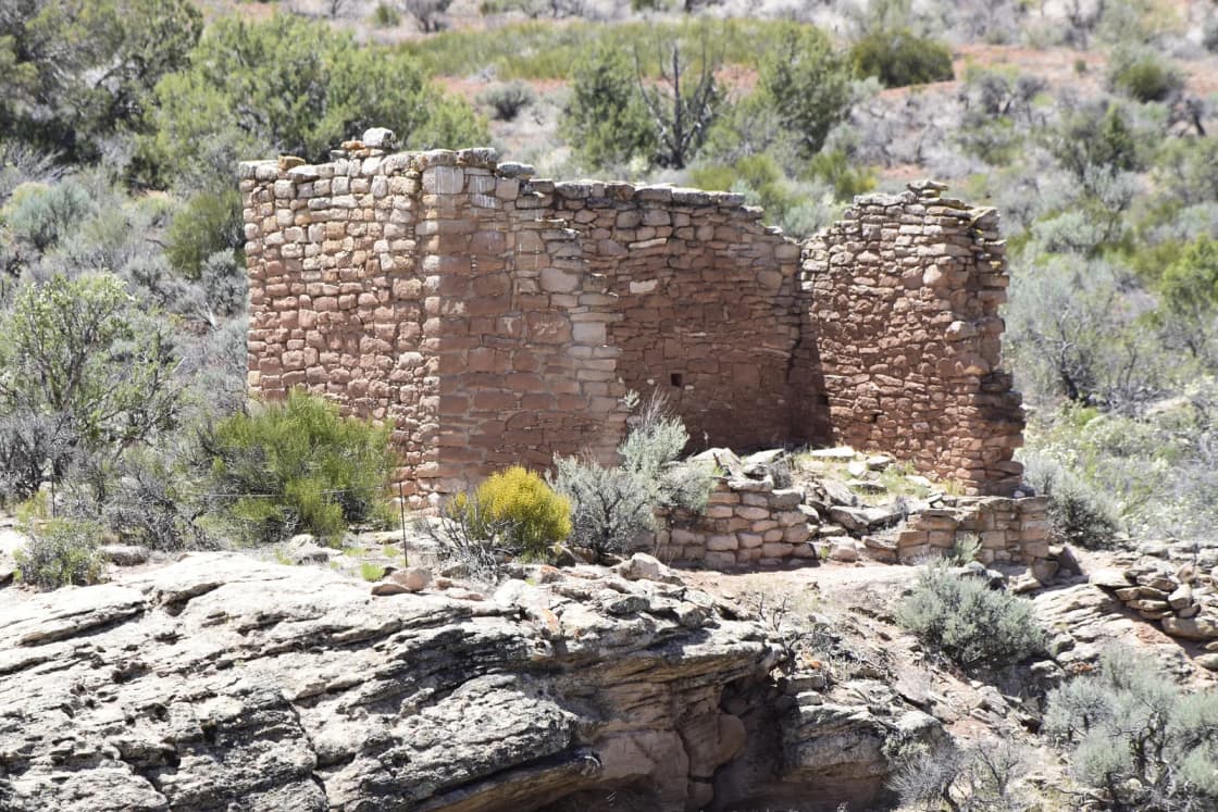
- Hovenweep, on the Utah-Colorado line, was built mostly between the 1230s and the late 1270s, according to tree-ring dating cited by the Park Service.
By 1300, the Park Service says, Puebloan people had left the Four Corners region, moving mainly to central Arizona and the Rio Grande valley in New Mexico. The Hopi, Zuni and Rio Grande Pueblo tribes are their modern descendants. The story isn't a disappearance. It's a migration, and the people are still here.
For the people who lived around Utah Lake, and why their story is still debated, see our history of the Timpanogos of Utah Valley.
Where to see their work
Edge of the Cedars State Park Museum, Blanding
Start here. The museum sits beside an excavated village, Edge of the Cedars Pueblo, with a short paved trail around the ruin and a 1,000-year-old kiva you can enter by climbing down a ladder. Inside, Utah State Parks says, is one of the largest collections of Ancestral Pueblo pottery on exhibit in the Four Corners area.
- Hours: Monday to Saturday 9 a.m. to 5 p.m., Sunday 9 a.m. to 4 p.m.; December through February, 9 a.m. to 3 p.m. daily.
- Closed: Thanksgiving, Christmas Eve, Christmas Day, New Year's Eve and New Year's Day.
- Fees: listed on the park's fees page.
Hovenweep National Monument
On the Utah-Colorado border, Hovenweep protects towers and pueblos more than 700 years old. The Square Tower Group is the main site, with a self-guiding 2-mile loop trail around the rim of the canyon. A 31-site campground sits at the Square Tower Unit.
The outlying units (Holly, Horseshoe and Hackberry, Cutthroat Castle and Cajon) are 4 to 9 miles away. The Park Service says much of that road is unmaintained dirt and gravel and recommends a high-clearance vehicle. Pets are allowed on trails on a leash of six feet or less.
Cedar Mesa and Bears Ears National Monument
West of Blanding, Cedar Mesa's canyons hold cliff dwellings and granaries in their alcoves. The BLM manages them, and a few are short walks:
| Site | Distance | Notes |
|---|---|---|
| Butler Wash Interpretive Trail | 1 mile round trip | Overlook of a cliff dwelling |
| House on Fire (South Fork of Mule Canyon) | 2 miles round trip | Granaries; minimal elevation change |
| Mule Canyon Interpretive Site | 0.5 mile | Wheelchair accessible; restored kiva |
From the BLM's Cedar Mesa trip planner.
Day-use permits are required for Cedar Mesa's canyons: $5 per person per day, $10 per person for a week, or a $40 annual vehicle hangtag, sold at trailhead fee tubes, at the Kane Gulch Ranger Station on State Route 261 or on Recreation.gov. Kane Gulch is open Thursday to Sunday mornings in spring and fall. Remote sites such as Moon House need their own permits.
How to visit well
The BLM's rules are short, and they matter because these sites can't be repaired:
- Hands off walls and rock imagery. The BLM warns that structures are easily damaged.
- Don't enter dwellings. Walls and roofs are fragile.
- Leave artifacts where you find them. Even a single potsherd. Removing artifacts or damaging sites is illegal under the Archaeological Resources Protection Act, with heavy fines and possible jail time.
- No climbing gear to reach sites; the BLM says using it is illegal.
- Stay on trails and behind barriers. The Park Service notes that off-trail walking destroys biological soil crust that takes decades to recover.
Remember that these are ancestral places for living tribes.
When to go
Spring and fall. The BLM calls March 1 to June 15 and September 1 to October 31 the busy season on Cedar Mesa. Summer highs often top 100 degrees, with flash floods possible from July through September, and winter brings freezing temperatures, snow and ice. Plan on at least a gallon of water per person per day for hiking.
Getting there from Provo
Blanding is about 265 miles and roughly five hours and 20 minutes of driving without stops, by way of US-6 through Spanish Fork Canyon and Price, then US-191 through Green River and Moab. Hovenweep is a little over an hour beyond Blanding. Most Utah Valley families make it a two- or three-night trip, often combined with Moab. Our Moab from Provo guide covers the drive and where to stay.
Who should skip it
- Anyone looking for a quick day trip. This is a weekend at minimum.
- Visitors in midsummer who aren't ready for real desert heat.
- Anyone without a high-clearance vehicle who wants the remote sites; stick to the paved ones.
Related guides
Frequently Asked Questions
Who were the Ancestral Puebloans?
When did the Ancestral Puebloans live in southeast Utah?
Why did the Ancestral Puebloans leave?
What is the best place to start?
How far is Blanding from Provo?
Do I need a permit to visit cliff dwellings on Cedar Mesa?
Can I touch or enter the ruins?
What is the best time of year to visit?
Sources
The facts in this guide were checked against these sources. Hours, fees and rules change, so confirm anything time-sensitive with the source before you go. How we make Provo.com.
- Edge of the Cedars State Park Museum, Utah State Parks. Checked November 1, 2026.
- Hovenweep National Monument visitor guide, National Park Service. Checked November 1, 2026.
- Hovenweep basic information, National Park Service. Checked November 1, 2026.
- Cedar Mesa trip planner, Bureau of Land Management. Checked November 1, 2026.
- Kane Gulch Ranger Station, Bureau of Land Management. Checked November 1, 2026.