In September 1776, two Franciscan priests came over the Wasatch into Utah Valley looking for a way to California. They found a valley with a large freshwater lake and a people they described as friendly, then turned back toward Santa Fe. Nothing came of their promise to return, but their journal and map became some of the earliest written records of the valley. This guide sticks to what Utah's state history sources, the National Park Service and Utah Humanities say, and it flags the places where they disagree.
| Leaders | Francisco Atanasio Dominguez and Silvestre Velez de Escalante |
| Left Santa Fe | July 29, 1776 |
| Arrived in Utah Valley | September 22 or 23, 1776, depending on the source |
| Returned to Santa Fe | January 2, 1777 |
| Distance | More than 1,700 miles |
| Mapmaker | Bernardo Miera y Pacheco |
| Nearest sites to Provo | Spanish Fork Canyon and the Escalante Cross above Spanish Fork |
Why they went
Utah History to Go, in an article by Thomas G. Alexander of the Utah Historical Society, says the goal was an overland route from Santa Fe to the recently established Monterey settlement, with the Chirumas avoided by going north through Ute lands. The National Park Service describes the same aim as a northern route to the newly established missions in Monterey. The trip was first planned for July 4. Alexander says a Comanche attack at La Cienaga and Escalante's later illness delayed it, and that a route Fray Francisco Garces opened from California to the Hopi villages in early 1776 nearly stopped the expedition. Governor Pedro Fermin de Mendinueta approved it after the priests considered abandoning it.
Dominguez, a Mexico-born Franciscan, was commissioned as a canonical visitor in 1775 and led the expedition. Escalante, born in Spain, kept the detailed diary. The National Park Service says Escalante kept the daily journal and Dominguez made most of the difficult decisions. Escalante died at about 30 in 1780 of kidney disease, per Alexander.
Who went along
Sources give different counts. Utah History to Go says the party left Santa Fe with about twelve Spanish colonials and two Indians, with eight recruits from New Mexico and El Paso, four from southwestern Colorado and two Timpanogots from a Ute village in western Colorado. The Utah Historical Society's I Love History describes a ten-man team leaving Santa Fe, and also says three Ute guides and translators were part of the party. Utah Humanities says that by Colorado the explorers had recruited 12 more Spaniards and two Ute men. The National Park Service calls it a small group and does not give a headcount. We do not pick one number.
Named members, per Utah History to Go, include Bernardo Miera y Pacheco, a retired military engineer from Santa Fe who made the map and took latitude readings; Juan Pedro Cisneros, alcalde of Zuni; and Andres Muniz, an interpreter fluent in Ute who had been with Rivera's 1775 expedition. I Love History describes Miera as a cartographer from Cantabria, Spain.
The route to Utah Valley
The party traveled north through western Colorado for about six weeks, per I Love History, and entered what became Utah near Dinosaur National Monument. The date varies: I Love History says about September 11, Alexander says September 12, and the National Park Service says they entered the present monument boundaries on September 13. These may describe slightly different points, but none of the pages explains the gap. The National Park Service says they named the Green River the San Buenaventura and forded it on September 16 within sight of the present Quarry Visitor Center. A party member carved the year 1776 into a cottonwood there; the tree is gone. A stone marker near the monument entrance reads "Escalante Crossed Here 1776," per the Park Service.
From there they crossed the Uinta Basin. The National Park Service says they passed through the sites of present-day Jensen, Roosevelt, Duchesne and Myton and praised them as places to settle. Alexander says they followed the Duchesne and Strawberry rivers, passed Diamond Fork and reached the Spanish Fork River. I Love History says they crossed the Wasatch through Diamond Fork and Spanish Fork canyons. For those canyons today, see our Diamond Fork and Spanish Fork canyon trails guide and our Spanish Fork Canyon, Diamond Fork, Sheep Creek and Thistle guide.
Arrival in the valley
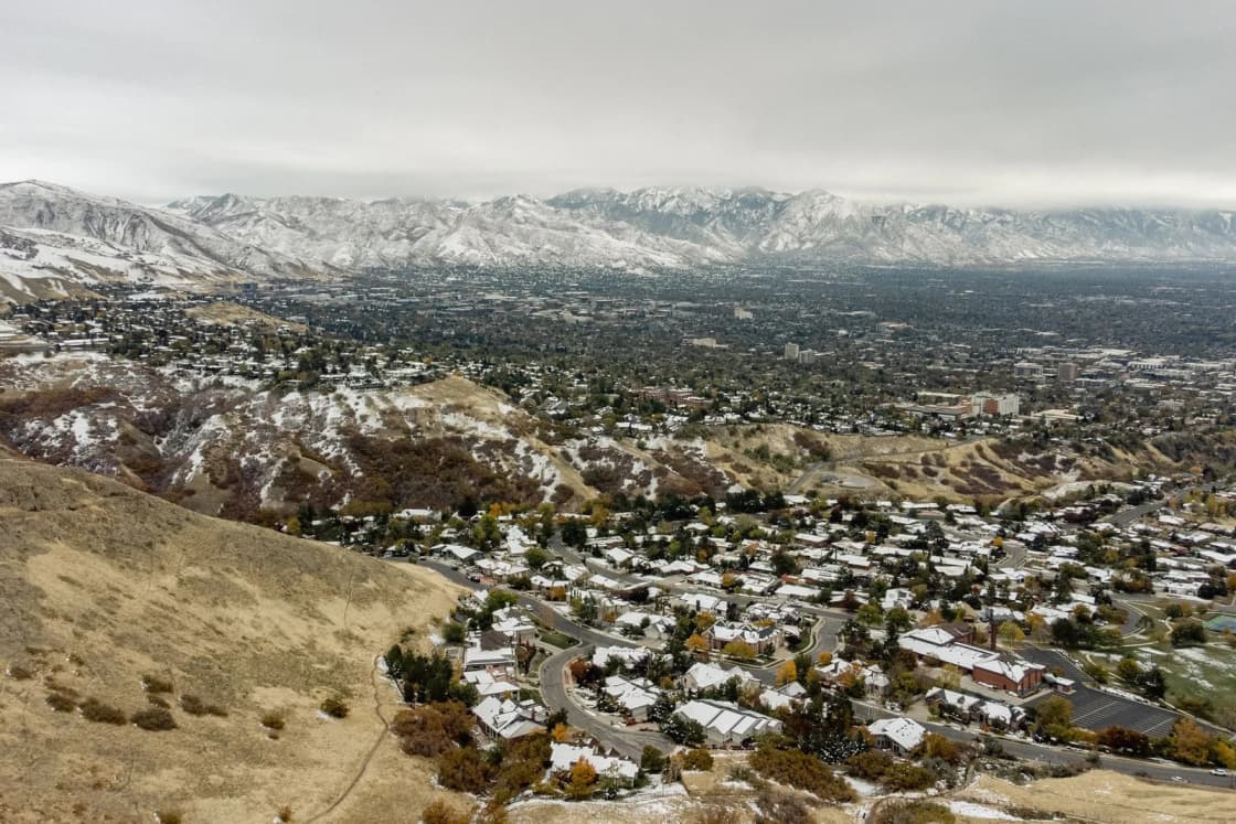
Alexander says that from a height near the present Spanish Oaks Golf Course the party first saw Utah Valley. Utah Humanities says that on September 23 they climbed a hill near today's Spanish Oaks Golf Course and saw a valley with "a sparkling emerald lake and ring of steep mountains." I Love History gives the arrival as September 22. We use September 22 or 23 and attribute each, since the pages do not say whether they mean the day they entered the valley or the day they saw the lake.
Escalante's journal, as quoted on I Love History, named it "Valley de Nuestra Senora de la Merced de los Timpanoautzis," with four rivers flowing down from the mountains into the lake at its center. He wrote of good pasture and of flax and hemp growing so thickly "it seems as though they had been planted deliberately." He wrote that the Timpanogotzis Lake was "teeming with several kinds of edible fish," noted geese, beaver and other animals, and estimated the lake at about six leagues wide and fifteen long. We did not read the journal itself, so those quotes are as the Utah Historical Society prints them.
People and the valley
Utah History to Go lists Silvestre and Joaquin, two Timpanogots from Utah Valley, among the party. It says Silvestre guided the party to his home, and that Joaquin, about twelve, guided them the whole way and was the only Utah native to do so. I Love History says the priests met Joaquin, a 12-year-old Timpanogot Ute boy born in Utah Valley, at a Ute village in Colorado, gave him the Spanish name Joaquin and did not record his Ute name, and that he stayed with them until they returned to Santa Fe. The National Park Service calls Silvestre and Joaquin two Ute guides given Spanish names. In other words, the guides' own names and words are not in the record the priests left, a point worth keeping in mind when reading the journal.
The priests found the Timpanogots friendly, Alexander says, living by fishing, hunting and gathering, and thought the valley could support a population as large as New Mexico's. He quotes their description of it as "a terrestrial paradise inviting Spanish settlement." They promised to return, possibly within a year. According to I Love History, the Timpanogots welcomed the party partly because of the Ute members in it, and the priests taught them about Christianity. I Love History also says thousands of Ute people already lived in the valley when the expedition arrived. Alexander says Silvestre stayed in Utah Valley while the party went on.
Our Timpanogos people guide and Utah Lake history go further, and Provo history places the visit in the timeline. For the lake itself, see our Utah Lake guide and Utah Lake State Park.
Miera's map and the latitude problem
Alexander says Miera took latitude readings by sighting the North Star with a quadrant, and that his readings put the party farther north than it really was. His September 24 estimate of 40 degrees 49 minutes near Utah Valley would have placed them near Sandy, in the Salt Lake Valley, Alexander says. The party believed Monterey lay at about 36 degrees 30 minutes north and so pushed southwest to reach it.
Miera's map was influential, per Alexander, and the German scientist Alexander von Humboldt later based his own map on it. Utah History to Go counts the Rivera journals, the Escalante diary and the Miera map as "the first documents in Utah history." The sources disagree on the map's date. The National Park Service says Miera produced it in 1777, while the caption on Utah Humanities' page calls it a c. 1779 route map. The caption's "c." suggests a hedge, but we cannot say which is right.
Why they turned back
Alexander says the party hired a new Timpanogot guide, Jose Maria, who deserted on October 5, and that a heavy snowstorm trapped them the same day. The National Park Service says their new guide abandoned them after witnessing the punishment of a servant, and that they lost their way. Utah Humanities says only that they hired a new guide who soon left, and that by October they were traveling through snow.
The priests wanted to return by way of the Havasupai and Hopi villages, but Miera and two others objected. Midway between Milford and Cedar City, they cast lots, and the lots pointed back to Santa Fe, per Alexander. I Love History says they decided they could not reach Monterey with winter coming. They then needed a Colorado River crossing. I Love History says they made a difficult crossing on November 7 at the place now called Crossing of the Fathers, after searching about twelve days at Glen Canyon. The National Park Service says they lost about a month in the canyons without a guide, carved steps into the stone for the livestock, and ate many of their horses to survive; the ford is now under Lake Powell. Alexander says they crossed the Colorado farther north than expected, near present-day Lake Powell, reached Oraibi and arrived in Santa Fe on January 2, 1777, and the Park Service says Hopi supplies helped them get home. The twelve-day and one-month figures differ and might be counting different stretches of the search.
Why Spain never came back
The priests said they would return, and the sources agree they did not. I Love History says they promised to return to the Timpanogots but never made another journey to Utah Valley, and that the Spanish never settled there. Alexander says the results were mostly unintended: traders later used the trails, and the padres' description of the valley did not bring Spanish settlement. He also notes Garces's earlier California route nearly stopped the trip in the first place.
None of the pages we read gives a stated reason for the missed return, and we did not find a source in this research that does. Treat any single-cause explanation, whether money, distance or politics, as unverified unless it cites a primary document. Utah History to Go adds that after the expedition there was no immediate follow-up, but that traders kept seeking new routes to California, and that by the early 1800s trade between Santa Fe and Indians in north-central Utah was fairly well established.
Did it lead to the Old Spanish Trail?
Not directly, as far as the sources we read say. The BLM describes the Old Spanish National Historic Trail as used between 1829 and 1848, about 2,700 miles long, designated America's 15th National Historic Trail in 2002, with a Northern Route through east-central Utah. The National Park Service's page on the trail does not mention Dominguez and Escalante, and the Park Service's Dinosaur page does not mention the Old Spanish Trail. The BLM says many of the trail's routes followed trails first pioneered by American Indians. A search result suggested that Antonio Armijo's 1829 party may have carried a copy of Escalante's map, but we found no page we could fetch that confirms it, so we do not claim it.
What the expedition did leave is documentary and cultural. I Love History says Miera's map and Escalante's diary helped open the region to traders, immigrants and settlers over the next 75 years, and that many Spanish names in Utah connect to it. Alexander says John C. Fremont discussed the journal in his 1843 to 1844 report and named the Spanish Fork River, and that Mormons who read his report learned of the Spanish explorations. Utah honored Escalante with place names, but Alexander says Dominguez was not honored until the 1976 bicentennial. Utah History to Go's separate page on explorers and trappers does not explain the origin of the names Spanish Fork or Utah Lake, so we do not either; our short history of Spanish Fork covers the town.
Visiting today from Provo
The easiest nearby stop is Spanish Fork Canyon, which the expedition descended. Our canyon guide puts the Fifth Water trailhead in Diamond Fork about 35 minutes from Provo. We did not find a source we could open that confirms current markers or trails tied to the expedition, so check with Spanish Fork City or the Forest Service before you go, especially in winter.
Our things to do in Spanish Fork and day trips from Provo pages can fill out the outing.
Farther afield, the Dinosaur National Monument area in northeastern Utah has the Park Service's stone marker and river crossing, and Crossing of the Fathers lies under Lake Powell. Neither is a Utah Valley day trip.
What a Utah Valley family or student needs to know
For a school report, use three layers of source: the state history pages for the narrative, the National Park Service for the Colorado River and Dinosaur sections, and the journal itself for quotes. The translation commonly cited is the Chavez translation edited by Ted Warner and published by BYU Press; we did not read it, so we point you to it rather than quote page numbers. A public or university library can get it. Where this page and a library book differ, trust the book and tell us.
For a family outing, pair Spanish Fork Canyon with a stop in town, and talk about what the valley looked like in 1776: a freshwater lake, four rivers and thousands of Ute residents, according to I Love History. Our Utah Lake history shows how much changed.
Utah Lake drains to the Great Salt Lake through the Jordan River, per our Antelope Island guide. The sources we read do not say the party saw it. If the two lakes interest you, our salinity explainer and water level explainer cover the larger one.
Where sources differ
| Question | Source A | Source B |
|---|---|---|
| Party size | About 12 colonials and 2 Indians (Utah History to Go) | Ten-man team (I Love History) |
| Arrival in Utah Valley | Sept. 22 (I Love History) | Sept. 23 (Utah Humanities) |
| Entered Utah | About Sept. 11 (I Love History) | Sept. 12 (Utah History to Go) |
| Miera map date | 1777 (National Park Service) | c. 1779 (Utah Humanities caption) |
| Search for river crossing | About 12 days (I Love History) | About a month lost (National Park Service) |
Who should skip it
Skip this if you want a day-by-day itinerary or a quotation from the journal; go to the journal. Skip the Escalante Cross if you are not up for a foothill drive or walk on an unconfirmed route. If you want the Ute and Timpanogots story from the Native side, start with our Timpanogos people guide, since the priests' account is one outsider's record.
What we could not confirm
We could not open Utah History to Go's original article at its first address and used the page's current version. We did not read the journal, so no page-specific journal claims appear here. We could not confirm a reason Spain never returned, a link between the expedition and the Old Spanish Trail, or the status of any markers or monuments.
Frequently Asked Questions
What was the Dominguez-Escalante expedition?
When did they reach Utah Valley?
Who was in the party?
Who were Joaquin and Silvestre?
What did the priests write about the valley?
Why did they turn back?
How long did the journey take?
Did Spain ever settle Utah Valley?
Can I see anything from the expedition near Provo?
Where can I learn more about Utah Lake and the Timpanogos?
Sources
The facts in this guide were checked against these sources. Hours, fees and rules change, so confirm anything time-sensitive with the source before you go. How we make Provo.com.
- Dominguez-Escalante Expedition, Utah Division of State History. Checked November 4, 2026.
- Explorers and Trappers, Utah Division of State History. Checked November 4, 2026.
- The Dominguez and Escalante Expedition, National Park Service, Dinosaur National Monument. Checked November 4, 2026.
- Old Spanish National Historic Trail, Bureau of Land Management. Checked November 4, 2026.
- 1776: The Dominguez-Escalante Expedition, Utah Historical Society. Checked November 4, 2026.
- Landscapes change over time, Utah Historical Society. Checked November 4, 2026.
- The Escalante-Dominguez Expedition, Utah Humanities. Checked November 4, 2026.