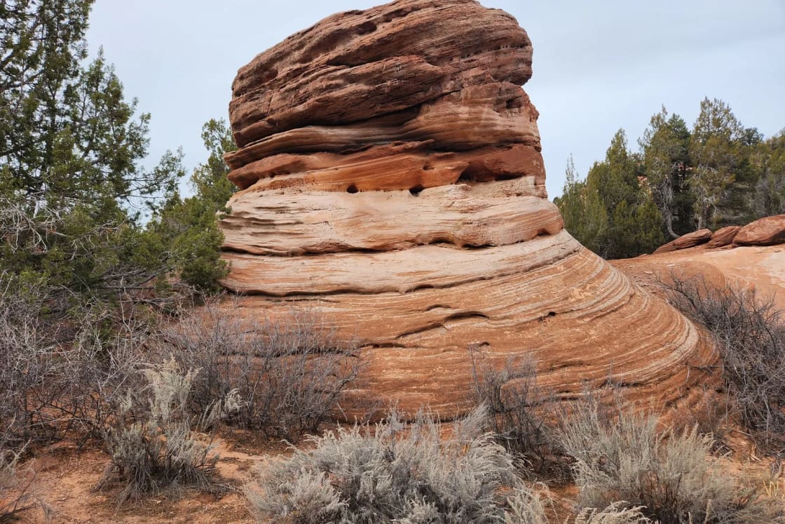
Bears Ears is a long way from Utah Valley and a different kind of trip than Arches or Zion: few developed facilities, thousands of archaeological sites, and rules that exist because the sites are fragile and, to several Tribes, sacred. This guide sticks to what the agencies say about where to start, what you need, and how to behave. It does not take a side on the monument's boundaries; where they changed, we say what the documents say and point you to the agency maps.
Quick facts
| Item | Detail | Source |
|---|---|---|
| Managing agencies | BLM Monticello Field Office and Forest Service, Manti-La Sal National Forest | BLM |
| Field office | 365 North Main, Monticello; 435-587-1500 | BLM |
| Boundaries | Modified by a proclamation dated July 13, 2026 | BLM, Proclamation 11043 |
| Nearest towns | Monticello, Blanding, Bluff, Mexican Hat | BLM |
| Drive from Provo | About 265 miles to Blanding, 5 hours 20 minutes | OpenStreetMap routing |
| Drones | Not allowed in the monument without a permit | BLM |
What changed in 2026
According to Proclamation 11043, published on the American Presidency Project and dated July 13, 2026, the monument is reduced to about 121,096 acres in two units: the Shash Jaa Unit (about 106,816 acres) and the Indian Creek Unit (about 14,279 acres). The proclamation says about 1,238,904 acres are excluded from the earlier 1.36 million acres. The Shash Jaa Unit includes separate parcels covering the Moon House complex, the Citadel, Doll House Ruin, Scorup Cabin and the Rig Canyon site.
The proclamation also says the Bears Ears Commission, made up of representatives of five Tribes, is "disbanded and terminated," and that the agencies must still consult Tribal Nations under other authorities. It says nothing in it affects the designation, maintenance and improvement of existing roads and trails. The BLM's monument page says interim guidance governs management while a plan is pending, and the agency's older materials may show the earlier boundaries. For a visit, the practical step is to check the BLM's current map and call the Monticello Field Office about the area you plan to enter.
Where visitors usually start
The BLM lists recreation pages for Cedar Mesa, the San Juan River and Indian Creek, with access from Highways 191, 211, 95, 261 and 163. Its Cedar Mesa page covers the Comb Ridge and Cedar Mesa canyons, where most permits apply.
- Day hikes: The BLM requires a day hiking pass in the Cedar Mesa and Comb Ridge canyons: $5 per person per day, $10 per person per week or $40 per car per year, sold online or at trailheads, the Monticello Field Office and the Kane Gulch Ranger Station.
- Moon House: A separate permit, limited to 20 people per day and $5 per person per trip, reserved on Recreation.gov. The BLM calls it the only day hike in the area that needs one.
- Backpacking: $15 per person per trip, limited to 20 people per trailhead per day. Reservations open three months ahead, and you can print permits at home starting 14 days before your entry date.
- Kane Gulch Ranger Station: Staffed spring and fall only, Thursday through Sunday, 8 a.m. to noon, per the BLM. Call the field office to confirm before you plan around it.
Rules and fees change, so confirm them on the BLM's Cedar Mesa permit page.
How to behave at sites
The BLM's Know Before You Go page asks visitors to:
- Leave rock art alone, and not make their own.
- Stay off walls and structures.
- Leave artifacts where they are. The BLM says "Artifacts are sacred to modern Indigenous peoples."
- Keep children close and pets leashed away from archaeological sites.
- Skip location tags: "GPS reveals too much."
Damaging sites or taking artifacts is illegal under federal law, as our guide to the Ancestral Puebloans explains in more detail.
Safety
The BLM lists flash floods as most common from July through September, says never to camp in a wash bottom, and warns that much of the area has no cell service, so tell someone your plan and return time. It also advises avoiding midday heat and treating all open-source water. Our Little Wild Horse and Bell Canyons guide covers the same flood rules for a slot canyon closer to Utah Valley.
Getting there from Provo
The route runs US-6 and US-191 through Price, Green River and Moab to Monticello and Blanding. Many families combine it with Moab or Capitol Reef rather than making it a single trip. The ranked guide to Utah's national parks from Provo shows how the drives compare.
Who should skip it
- Anyone who wants guaranteed services: there are few, and distances between them are long.
- Visitors in midsummer who are not prepared for heat and thunderstorms.
- Anyone who wants to go inside ruins. The BLM says to stay off structures.
Related on Provo.com
- The Ancestral Puebloans in Southeast Utah
- Moab from Provo
- Capitol Reef from Provo
- Escalante slot canyons from Provo
- Utah national parks from Provo, ranked
Frequently Asked Questions
Who manages Bears Ears National Monument?
Did the monument's boundaries change in 2026?
Do I need a permit to hike at Bears Ears?
How much do the Cedar Mesa permits cost?
Can I walk into the ruins and cliff dwellings?
Is it safe to drink the water?
Can I fly a drone?
How far is Bears Ears from Provo?
Sources
The facts in this guide were checked against these sources. Hours, fees and rules change, so confirm anything time-sensitive with the source before you go. How we make Provo.com.
- Bears Ears National Monument, Bureau of Land Management. Checked November 3, 2026.
- Bears Ears National Monument Management, Bureau of Land Management. Checked November 3, 2026.
- Cedar Mesa - Bears Ears National Monument Permit System, Bureau of Land Management. Checked November 3, 2026.
- Know Before You Go: Bears Ears National Monument, Bureau of Land Management. Checked November 3, 2026.
- Proclamation 11043 Modifying the Bears Ears National Monument, The American Presidency Project. Checked November 3, 2026.