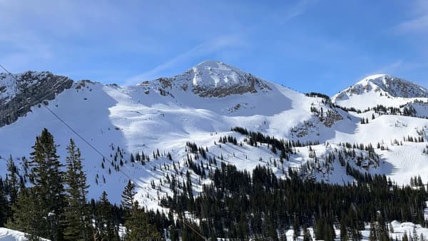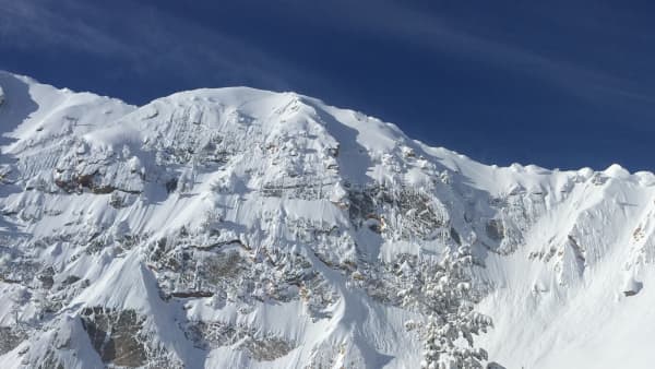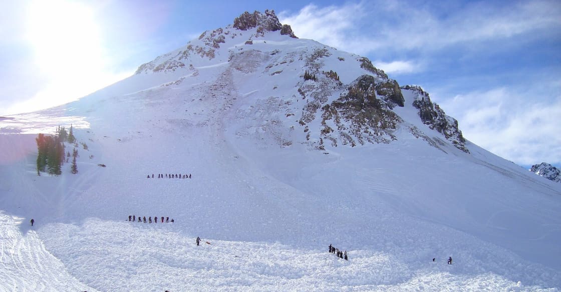

The Wasatch does not ease you into it. In most mountain towns there is a long approach, a gradual gain, a sense of leaving. In Provo, the range is at the end of the street. Avalanche terrain sits within about twenty minutes of most addresses in this valley, and that proximity is the single most important thing to understand about winter recreation here.
Convenience of access has nothing to do with severity of consequence. The terrain at the top of Rock Canyon does not become gentler because the trailhead is close to a neighborhood.
This guide covers the decision-making, not the certification. It is written to give you the vocabulary and, more importantly, to make the case for the field course that this article cannot replace.
The one habit that matters most
Before anything about snowpack, gear or forecasts, there is a single physical habit that separates people who manage this hazard from people who are exposed to it without knowing.
Look up.
Avalanche danger is a property of the slope above you, not of the ground under your feet. People die on flat ground with regularity, in meadows and clearings and on the low benches where you would naturally stop for lunch, because a slope above released and ran out to where they were standing.
So the question at every stopping point, every lunch spot, every place you gather a group, is: what is above me, how steep is it, and could it reach here? That question is free, takes three seconds, and is the foundation everything else builds on.
What avalanche terrain is
The working definition is usefully crisp.
Slope angle is the primary variable. Most avalanches release on slopes between roughly thirty and forty-five degrees, with the middle of that band being the most productive. Below about thirty degrees, slabs generally lack the steepness to release; well above forty-five, snow tends to shed continuously rather than accumulate into a slab. That thirty-degree threshold is the number worth memorizing.
Thirty degrees is less steep than most people picture. It is a slope that a competent hiker walks up without using hands, and it does not read as dangerous from below or from above. Estimating slope angle by eye is unreliable — almost everyone underestimates — which is why inclinometers exist and why slope-angle map layers have changed the practice so much.
Connected terrain is the second half. A slope you are not on can still reach you, and a slope above a slope you are on can trigger the one you are on remotely. Avalanche terrain is therefore not a set of individual slopes but a connected system, and evaluating it means tracing where snow could travel from any steep ground in view.
Aspect and elevation determine where the problem lives. The snowpack on a north-facing slope at 9,000 feet is a different material from the snowpack on a south-facing slope at 7,000 feet on the same day, because sun and wind have worked on them differently. This is why forecasts break the hazard down by aspect and elevation band rather than issuing one number for a range, and why "the forecast said Moderate" is an incomplete reading.
The forecast: how to read it
The Utah Avalanche Center publishes daily forecasts through the winter season for mountain ranges across the state, including the Wasatch terrain immediately east of Utah Valley. It is free and it is the best information available anywhere about the snowpack you are about to walk on.
Reading it well means going past the color.
The danger rating runs across five levels from Low through Extreme, and it is scaled by both likelihood and expected size. Two things about it are routinely misread. First, it is not a linear scale — the step from Moderate to Considerable represents a substantially larger jump in risk than the label suggests, and Considerable days account for a disproportionate share of accidents, because the hazard is real but the conditions still look inviting. Second, the rating is broken out by elevation band and aspect, and the summary color is the worst case rather than a uniform description.
The avalanche problem is the most useful part and the part most often skipped. The forecast names the specific type of instability in play — a persistent weak layer buried deep in the pack, a wind slab loaded onto a lee aspect overnight, wet snow instability during a spring thaw, a storm slab from the last twenty-four hours — and each behaves differently and demands a different response. A wind slab problem points you away from lee slopes near ridgelines. A persistent weak layer problem is the one that punishes people for concluding that the snow "seems fine," because it can lie dormant for weeks and then propagate a fracture hundreds of yards across.
The discussion written by the forecaster is where the reasoning lives, including what they saw in the field and how confident they are. Read it. It is the difference between having a number and understanding a situation.
Read the forecast the morning of the outing. Wind loading overnight can change conditions substantially, and a forecast read the previous evening may describe a snowpack that no longer exists.
Gear: what it does and what it does not
The standard set is three items, and the reason all three are required together is that each is useless alone.
A beacon — an avalanche transceiver — transmits a signal while you travel and switches to receive so you can locate a buried companion. Every member of a party carries one, worn against the body under a layer rather than in a pack, turned on at the trailhead and checked. A single person without one makes the whole party's system incomplete.
A probe is a collapsible pole used to pinpoint the burial once the beacon has narrowed the search to a few meters, and to establish depth before digging. Beacon search gets you close; probing gets you exact. Digging without probing wastes the minutes that matter.
A shovel is what performs the rescue. Burial depths of a meter or more require moving an enormous volume of dense debris quickly, and avalanche debris sets up hard almost immediately. Hands do not work. A plastic beach shovel does not work.
Add an airbag pack if you will and understand what it does: it improves the odds of staying nearer the surface during a ride. It does not prevent trauma against trees and rocks, it does not help in a terrain trap that buries deeply, and it does not change the terrain decision.
None of this is protection. It is what gives your companions a chance during a very short window. The protection is the decision made in the parking lot about where to go.
Companion rescue and the clock
Survival for a completely buried person falls off sharply with time, and the steepest part of that decline arrives within roughly the first fifteen minutes. After that, the odds worsen quickly as asphyxiation becomes the dominant mechanism.
The implication is total and it reshapes everything about how you plan. Organized rescue cannot arrive in that window. By the time a call is placed, a team assembled, and a location reached in winter conditions, the period in which a fully buried victim is likely to survive has passed. Search and rescue teams in mountain regions perform recoveries with genuine skill and dedication, and they will tell you the same thing.
This is why the following are not optional in avalanche terrain:
- Never travel alone. A solo traveler carries a beacon that nobody is listening for.
- Everyone carries the full set, and everyone can use it. A companion who has never performed a beacon search under pressure is close to no companion at all in the moment it counts.
- Expose one person at a time. Crossing a suspect slope one at a time means that if it releases, there is somebody left to perform the rescue rather than an entire party in the debris.
- Watch from a safe spot. Whoever is not crossing should be somewhere the slide cannot reach, watching the person who is, so the last-seen point is known.
Practice matters. Beacon searching is a physical skill that degrades without use, and the first time you should not be fumbling with mode switches is the only time it will ever count.
Terrain traps, and why small slides kill
A modest avalanche in benign terrain is a scare. The same avalanche in a terrain trap is a fatality.
Gullies and drainages concentrate flowing snow into a narrow channel, so debris that would spread thinly across an open apron instead piles deeply. Burial depth is the primary determinant of rescue difficulty.
Trees turn a ride into a series of collisions. A significant share of avalanche deaths involve trauma rather than asphyxiation.
Cliffs and abrupt drops below a slope add a fall to the slide.
Flat benches and road cuts at the base of a slope act as collection basins where debris stops and stacks.
Evaluating a slope means evaluating its runout. The question is not only "will this release?" but "if it does, where does the snow go and what does it do to me there?"
Human factors: the part that causes accidents
The uncomfortable finding across decades of avalanche accident analysis is that most victims were not ignorant. Many were experienced, equipped and had read the forecast. What went wrong was decision-making under social pressure.
The recurring patterns are worth naming because recognizing them in yourself is the only defense:
Familiarity. A slope skied twenty times without incident feels safe, though the snowpack has no memory of your previous visits.
Commitment. Having driven, hiked and gained elevation, turning around feels like waste. The sunk cost is real and it argues badly.
Social proof. Tracks on a slope mean somebody else went there. They do not mean it was safe then and they certainly do not mean it is safe now.
Group dynamics. In a group, nobody wants to be the one who raises the concern, and everyone assumes somebody more experienced would speak up if it mattered. Large groups make worse decisions than individuals with disturbing consistency.
Scarcity. The first clear day after a big storm, or the only free Saturday in a month, applies exactly the pressure that leads people onto slopes they would otherwise decline.
The countermeasure is procedural rather than heroic: decide the terrain plan before leaving, state a turnaround condition out loud, and give every member of the party an explicit veto that costs them nothing socially to use.
The resort boundary
The most common way people end up in avalanche terrain without intending to is by following tracks through a backcountry gate.
Inside open, patrolled resort boundaries, avalanche mitigation is performed as part of running the resort — control work, closures, sweeps. That protection ends at the rope, precisely and immediately. Terrain reached through a gate or over a boundary is unpatrolled, unmitigated and unswept, and its proximity to a groomed run confers nothing.
The gate is not a suggestion that the terrain beyond is manageable. It is the resort telling you that you are leaving.
Getting real training
Everything above is vocabulary. The skills are physical.
Introductory avalanche courses — typically a classroom component plus one or two field days — are offered widely across Utah through the winter season by guiding operations, university outdoor programs and nonprofit providers. They cover terrain recognition with map and inclinometer, snowpack observation, rescue practice under time pressure, and structured decision-making. Providers, schedules and prices vary season to season and are worth confirming directly.
Free avalanche awareness talks are also commonly offered around the region early in the season. They are a genuine service and a good first step, and they are not a substitute for the field day.
If you take one thing from this page, let it be this: the terrain decision is made before the boots come out of the car, and it is the only decision that reliably keeps people alive.
What the snowpack here does differently
Utah's snowpack has a regional character that shapes the hazard, and it is worth understanding because it explains why local forecasters emphasize what they emphasize.
This is a continental to intermountain snowpack, which is to say relatively cold, relatively dry and relatively shallow compared with a maritime range. That combination is exactly the recipe for persistent weak layers. When snow sits on the ground through long cold clear spells with a thin pack above it, the temperature difference between the warm ground and the cold surface drives water vapor upward through the snow, and the crystals it rebuilds along the way are large, angular and poorly bonded. Faceted snow and depth hoar are the technical names; structurally they behave like ball bearings.
A slab of dense wind-drifted or storm snow sitting on top of that layer is the classic Utah avalanche problem. It is dangerous for three reasons that compound. It can persist for weeks or months, long after the storm that created the slab. It gives poor feedback, so a slope can be crossed repeatedly and then fail. And it propagates, meaning a fracture initiated at one point can run laterally for hundreds of yards and release a slope far wider than the trigger point suggests.
This is why "it seemed fine, we'd been on it all week" appears so often in accident reports from this region, and why a forecast naming a persistent weak layer deserves a fundamentally more conservative response than one naming a storm slab that will stabilize in two days.
Wind is the other regional constant. The Wasatch is a windy range, and wind moves snow efficiently — commonly several times more efficiently than snowfall alone deposits it. A ridgeline that received six inches overnight may have two feet of dense drifted slab on its lee side and bare scoured ground on its windward side. Wind slabs form fast, they form where nobody watched them form, and they are frequently the reason a slope changed overnight without a single flake having fallen.
What to observe on the ground
Formal snowpack assessment is a course subject. But there are observations available to anyone that carry real information, and noticing them is worth more than the formal test that gets misread.
Recent avalanche activity is the single strongest signal available, and it needs no interpretation. If slopes of a similar angle, aspect and elevation have slid recently, the snowpack is telling you directly what it will do. Look across the drainage as you walk.
Collapsing and whumpfing. A hollow thud underfoot, sometimes felt as the ground dropping slightly, is the sound of a weak layer failing beneath you. On flat terrain it is merely alarming. It means that on any nearby slope steep enough to slide, the same layer would fail and there would be somewhere for the snow to go. This is an unambiguous instruction to leave steep terrain and terrain beneath it.
Shooting cracks running out from a boot or ski across the surface indicate a slab that is capable of propagating a fracture. Same instruction.
Recent loading. Heavy snowfall, strong wind, or rapid warming in the previous twenty-four to forty-eight hours all destabilize a pack. The period during and immediately after a storm is when most natural avalanches run.
Those four observations require no shovel, no pit and no training beyond knowing what they mean, and forecasters weight them heavily for exactly that reason.
Planning a day around the terrain
The practical shape of a well-planned outing in avalanche country is that the terrain decision is made at home, refined in the parking lot, and then defended on the ground.
At home, read the forecast and identify which aspects and elevations carry the problem. Choose a route that avoids that combination rather than one that samples it carefully. Map tools with slope-angle shading make this concrete in a way that eyeballing a contour map does not.
In the parking lot, do a beacon check for the whole party — every unit transmitting, every unit receiving, confirmed on each person — and state the plan aloud including the turnaround condition and what would cause you to abandon it.
On the ground, keep asking what is above you, expose one person at a time to anything suspect, and treat any of the four observations above as new information that supersedes the plan. A plan that cannot be abandoned is not a plan.
The most experienced people in this terrain are conspicuously the most willing to turn around, and it is not caution born of fear. It is that they have internalized how little the mountain cares about the effort already spent.
Related Guides
- Snowshoeing Near Provo — the activity most likely to put you in this terrain unprepared
- Winter Activities in Provo & Utah Valley — the wider seasonal picture
- Winter Tires & Canyon Driving in Utah — getting to the trailhead
- Rock Canyon Trail Guide — the closest steep terrain to Provo
- Provo Weather by Month — the snowpack context
- Backcountry Skiing 101 from Utah Valley
- Snowmobiling Near Provo
Frequently Asked Questions
What counts as avalanche terrain?
Where do I find the avalanche forecast for the mountains near Provo?
Do I need avalanche gear if I am only snowshoeing or hiking?
How long does a buried person have?
Is it safe if the forecast says Low?
What is a terrain trap?
Can I learn this from reading rather than taking a course?
Does this apply inside a ski resort?
Sources
The facts in this guide were checked against these sources. Hours, fees and rules change, so confirm anything time-sensitive with the source before you go. How we make Provo.com.
- Be Ready Utah (State of Utah). Checked October 12, 2026.
- State of Utah Hazard Mitigation. Checked October 12, 2026.
- National Weather Service / Forest Service Utah Avalanche Center. Checked October 12, 2026.
- Resuscitation (PubMed 27312137). Checked October 12, 2026.
- CMAJ (PubMed 21422139). Checked October 12, 2026.