
Search "Provo weather" and you will get a lot of numbers that do not agree with each other. One well-known climate site puts annual snowfall at 43 inches, another at 46, a third reports monthly figures that add up to considerably more. July's average high appears as 90°F, 91°F, 95°F and 96°F depending on where you look. January's high is variously 32°F, 37°F and 41°F.
Some of that is normal variation between weather stations and averaging periods. But one of those sites states its source plainly at the bottom of the page: its "Provo" data comes from Park City, 29 miles away. Park City sits nearly 2,500 feet higher, in the mountains, on the other side of the Wasatch crest. It is a different climate. If a page tells you Provo gets mountain-town snow, that is probably why.
The long-running official record for the city is a cooperative observing station on the BYU campus, cataloged by NOAA as PROVO BYU. What follows is built around that picture of the valley floor, with the ranges named where sources genuinely disagree rather than a single tidy number picked to look authoritative.
And there is one thing about Provo's weather that visitor guides almost never mention and residents talk about constantly. It is not the snow or the heat. It is in the winter section below.
The short version
Provo sits at roughly 4,500 feet in a basin with Utah Lake on one side and an eleven-thousand-foot wall of mountain on the other. That geography does most of the work:
- Summers are hot and very dry. Low-to-mid nineties in July and August, a handful of 100-degree days most years, and almost no humidity.
- Winters are cold but not brutal by mountain standards. Valley-floor snow is moderate — roughly 43 to 46 inches a year — and it does not usually linger for months on city streets.
- Spring and autumn are the good ones. Genuinely pleasant, and short.
- It is dry year-round. Somewhere between 15 and 19 inches of total precipitation, which is semi-arid.
- The daily temperature swing is large. Thirty degrees between afternoon high and overnight low is routine.
- The air is the caveat, and it works in opposite directions in summer and winter.
The best time to visit Provo
September, if you only get one month. The heat has broken, the canyon roads are still open, the university crowds have absorbed back into campus, and early autumn color starts on the high slopes by the third week. Late September into the first week of October is the best two-week window in the Provo year, and it is not close.
Mid-May through June is the other strong window. Everything is green from spring runoff, the waterfalls are at their loudest, and daytime highs sit in the seventies and low eighties. The trade-off is that the highest trails are still under snow and the Alpine Loop may not have opened yet.
July and early August are the peak-heat, peak-visitor stretch. This is when Provo's biggest events happen — the Freedom Festival and Stadium of Fire around the Fourth — so the city is at its liveliest and its hottest simultaneously. Plan outdoor activity for before 10 a.m.
Late November through February is the season to think twice about, and the reason is air quality rather than cold or snow. See below.
March and April are unpredictable in a way that catches people out. You can get seventy degrees and you can get eight inches of wet snow in the same week.
Month by month
January. The coldest month. Highs around freezing, lows in the teens. The wettest month by some measures. This is peak inversion season.
February. Marginally warmer than January and still firmly winter. Snow continues. The first genuinely bright days start appearing late in the month.
March. The transition, and the least predictable month of the year. Snowfall drops off sharply from February. Runoff begins in the canyons, which makes the waterfalls impressive and the trails muddy.
April. Spring properly arrives; highs move into the fifties and sixties. Still capable of a snow event. Blossom season in the orchards on the north bench.
May. One of the two best months. Warm days, cool nights, everything green. The high country is still melting out, so hiking is a valley-and-foothills proposition.
June. Warm and dry, before the real heat. The Alpine Loop is normally open by now. Long daylight — this is the month for evening activity.
July. Hottest and driest month of the year. Highs in the nineties, minimal rain, maximum sunshine. Afternoon thunderstorms are possible but brief.
August. Nearly as hot as July, with a better chance of afternoon storms. This is also when wildfire smoke is most likely to settle into the valley.
September. The best month. Warm days, cool nights, clear air, open roads, thinning crowds.
October. Autumn color peaks in the canyons early in the month and works down the mountain through the month. Cool, crisp, increasingly short days. The seasonal canyon roads usually close toward the end.
November. Gray and transitional. First valley snow typically arrives. Inversion season starts.
December. Cold, dark and snowy — one of the wettest months, and by some measures the wettest. Shortest days of the year.
The numbers, with the disagreement left in
Most weather pages print one confident table. Here is why this one prints ranges instead: reputable sources genuinely disagree about Provo, and the size of the gap tells you something useful about which station a page is quoting.
| published range | |
|---|---|
| July average high | 90–96°F |
| January average high | 32–41°F |
| January average low | around 15°F |
| Annual precipitation | 15–19 inches (incl. melted snow) |
| Annual snowfall, valley floor | 43–46 inches |
| Wettest month | December or January, depending on source |
| Driest month | July, on every source |
| Sunny days | roughly 220 a year |
Three things drive the spread. Station placement — a reading from the BYU campus bench differs from one near the lake or at the airport, and Provo's terrain changes fast over short distances. Averaging period — a 1991–2020 normal and a 1981–2010 normal are different numbers, legitimately. And the wrong-town problem described at the top of this page, which is the one that produces the really wild outliers.
Where sources agree, they agree strongly: July is the driest month, the summer is hot and rain-free, the winter is cold without being extreme, and the annual precipitation total is low enough to class the valley as semi-arid. Treat the ranges as the honest answer and ignore anyone offering a suspiciously precise one.
The winter inversion — the thing nobody tells you before you move here
This is the fact that belongs at the top of every honest guide to living in Utah Valley, and it is missing from nearly all of them.
What it is. Normally air is warmest near the ground and cools as you go up. In an inversion that flips: a pool of cold air settles on the valley floor and a layer of warmer air sits on top of it. The Utah Division of Air Quality describes that warm layer as a lid, and the description is exact. Air stops mixing vertically. Everything emitted under the lid — vehicle exhaust, wood smoke, industrial emissions — stays under the lid and accumulates, day after day, until a storm breaks it up.
Why Utah Valley is unusually good at producing them. Three things stack. The valley is a basin ringed by mountains, which physically shields the cold pool from winds that would otherwise scour it out. Snow on the valley floor reflects sunlight instead of absorbing it, so the ground never warms enough to restart the mixing. And long winter nights with clear skies cool the surface air further. For sixteen years that put Utah County outside federal limits for fine particulate pollution, alongside Salt Lake and Cache. That changed on December 19, 2025, when the EPA redesignated the Provo area to attainment for the 24-hour PM2.5 standard and approved a maintenance plan running to 2035. Read that carefully: it means three years of monitoring data met one federal standard, not that the inversion stopped. The basin, the snow and the long nights are all still here, and so are the episodes. Utah County also remains in nonattainment for the 2015 ozone standard as part of the Southern Wasatch Front — a summer problem, not a winter one, and the reason the valley's air story does not end in February.
How often. The Division of Air Quality's own figure for a typical Utah winter is about five to six multi-day inversion episodes, and roughly 18 days a year on which PM2.5 exceeds the national standard. Not the whole winter. Not a permanent fog. Several distinct episodes, each lasting days, mostly between December and February.
The counterintuitive part, and the most useful thing on this page. Two things about inversions surprise almost everyone:
First, the storm is the cure, not the cause. People assume snow means bad air. The opposite is true — a storm system mixes the atmosphere and clears the valley out. What happens is that the storm passes, leaves fresh snow on the ground, the skies clear, and that is when the next inversion sets up. A winter of frequent storms is a winter of good air. A long dry high-pressure spell in January is what fills the valley in.
Second, most of the pollution was never emitted as pollution. The particles that build up are mostly secondary — formed by chemical reactions in the air itself between precursor gases like nitrogen oxides, ammonia and volatile organic compounds, rather than coming out of a tailpipe as particles. That is why the haze keeps thickening for days after the emissions stayed flat. By the state's accounting of a typical inversion, mobile sources contribute the largest share at around 48 percent, smaller area sources around 39 percent, and large industrial point sources around 13 percent — which means the biggest single lever is ordinary traffic, not a factory.
What to actually do about it. Start with the reading rather than the season — conditions vary far more day to day than month to month.
Fetched live from AirNow when this page loads, so it is current whichever day you are reading this.
| AQI | Category | If you are in a sensitive group |
|---|---|---|
| 0–50 | Good | No restrictions. |
| 51–100 | Moderate | If you notice symptoms, make a long or hard outdoor workout an easier one. Unusually sensitive people are the ones who feel this band. |
| 101–150 | Unhealthy for Sensitive Groups | Cut back on long or intense activity outdoors. Take more breaks. Move the workout inside or move it up the canyon. |
| 151–200 | Unhealthy | Avoid long or intense outdoor activity. Move it indoors. |
| 201–300 | Very Unhealthy | Stay indoors and keep activity light. |
| 301+ | Hazardous | Stay indoors. |
The current-conditions AQI that AirNow reports is a NowCast, not a raw hourly average. It is a weighted average of recent hours that responds faster when conditions are changing quickly, which is why the displayed number can move within an hour during a storm break or a smoke plume.
The state also publishes hourly data by county and a free app, both listed at the bottom of this section. Move hard exercise indoors on bad days — the running routes worth doing in October are the wrong plan in a January inversion. Watch for mandatory no-burn days, which are enforced and are not advisory. If you have asthma, young children or heart or lung conditions, take the yellow and orange days seriously. And know that you can drive out of it in twenty minutes — the inversion is a valley-floor phenomenon, so the canyons and the ski resorts above the lid are frequently in clean air and sunshine while the valley sits under gray. Locals treat a bad inversion day as a reason to go up.
On a mandatory no-burn day in Provo, a fire in your fireplace is against state rule, not just discouraged.
- Unrestricted. Wood, pellet and coal stoves and fireplaces may be used, but should be used in a way that keeps smoke down.
- Voluntary. Voluntarily do not use wood, pellet or coal stoves or fireplaces.
- Mandatory. Wood, pellet and coal stoves and fireplaces are prohibited. Natural gas appliances and propane stoves are still allowed.
The rule is Utah Administrative Code R307-302. It covers 7 counties including Utah County — all regions of utah county west of the wasatch mountain range — which is the entire valley floor, provo included. The season runs November 1 to March 1, though no-burn actions are typically called inside that window, but udaq states they may be called at any time of year. UDAQ says it enforces no-burn actions with compliance officers using infrared cameras that detect heat plumes even where there is no visible smoke. UDAQ's published figure is fines of up to $150 for households found violating the ban. Households that rely on solid fuel as their only source of heat can register with UDAQ for an exemption.
Indoor air is the other half of it, because outdoor air becomes indoor air through normal ventilation — which is why filtration choices matter more here than the climate alone would suggest. That is covered in our guide to heating and cooling in Utah Valley.
Summer: heat, smoke and the other air-quality season
Summer has its own air problem, and it is a different one.
Wildfire smoke can settle into the same basin that traps winter pollution, arriving from fires anywhere upwind in the West. It is unpredictable year to year — some summers barely register, others have multi-day smoke events from July into September. Because the smoke source is often hundreds of miles away, local forecasts are a poor guide; check a current reading the morning you plan something.
The heat itself is dry, and dry heat at altitude is deceptive. You dehydrate faster than the temperature suggests because sweat evaporates before you notice it. The practical rule locals use is to be off the exposed trails by mid-morning in July and August, which is the same advice our summer activities guide gives for a different reason.
For scale on the extremes: BYU's weather station recorded August 2020 as the hottest month ever measured in Provo, averaging a daily high of 98.5°F, and September 5 that year became the latest calendar date on which the city had ever hit 100 degrees.
Snow: the valley figure and the mountain figure are not the same number
This distinction explains a lot about why people live here.
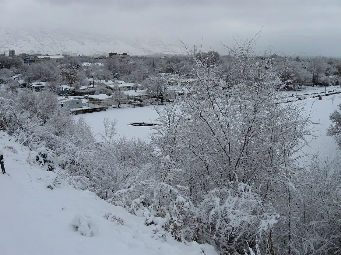
The valley floor gets a moderate amount of snow — the 43-to-46-inch range — and city streets are usually cleared quickly. Snow on the ground for a third of winter days is typical, but deep, persistent street-level snowpack is not the normal Provo winter.
The mountains immediately above the city get several times that. The Wasatch collects some of the most productive snowfall in North America, and the terrain rises so sharply from the valley edge that the transition happens within a few miles. Sundance is roughly twenty-five minutes from downtown Provo.
That gap — modest snow where you live, abundant snow where you play — is the single best argument for the location, and it is why winter activities here look the way they do.
Seasonal road closures follow the mountain snow, not the valley snow. The Alpine Loop and the Nebo Loop close for winter and reopen in late spring, with both ends determined by conditions rather than a published date. Provo Canyon on US-189 stays open all year.
What this means practically
If you are visiting, pack layers and sun protection regardless of season, and build your itinerary around the daily temperature swing rather than the daily high. Check canyon road status before planning a scenic drive between November and May. For a storm actually moving across the state — as opposed to a forecast for the week — an animated radar and satellite view such as LiveEarthViewer's weather map shows you what is arriving and roughly when, which matters more here than the daily high does.
If you are moving here, the climate facts that will actually shape your life are the dry air, the daily swing, and the winter inversion — in roughly that order. Humidifiers are near-universal in Provo homes in winter. Sun exposure adds up faster at altitude than most transplants expect. And you will develop, within a year, the local habit of glancing at the air quality reading the way people elsewhere glance at the chance of rain.
If you garden or landscape, the semi-arid precipitation total is the governing constraint, not the temperature. Fifteen to nineteen inches a year is not enough to support a conventional lawn without irrigation, which is the whole premise behind waterwise landscaping here.
Wind, storms and the things that actually cause problems
Provo's severe weather is not dramatic by national standards, but three patterns are worth knowing.
Afternoon thunderstorms in late summer. These build fast over the mountains and can drop a lot of water in a short time. In the canyons that matters more than it does in the city — a storm cell sitting over a drainage several miles upstream can send water down a narrow canyon while you are standing in sunshine. If you are in a canyon and the sky over the peaks turns dark, leave the drainage.
Canyon wind. Provo Canyon funnels air, and the wind through it can be considerably stronger than in the open valley. It is the same effect that gives Deer Creek Reservoir its reliable afternoon chop.
Spring instability. March and April can deliver a seventy-degree afternoon and a heavy wet snowfall in the same week. Wet spring snow is the kind that breaks tree limbs and takes down power lines.
What Provo largely does not get: tornadoes, hurricanes, ice storms, or prolonged humid heat.
The altitude is doing more than you think
At roughly 4,500 feet, visitors arriving from sea level notice three things within a day, and often blame the wrong cause.
You dehydrate faster. Dry air plus altitude means you lose water through breathing as well as sweating, and you do not feel it happening because sweat evaporates immediately.
The sun is stronger. There is measurably less atmosphere overhead. Combine that with 220 sunny days and snow reflection in winter and you can burn in February.
Exertion is harder. Not dramatically — this is not Colorado's high country — but enough that a hike you would find easy at home feels like more work. Give yourself a day before attempting anything strenuous.
How Provo compares to Salt Lake City
People moving to Utah often compare the two, and the honest answer is that they are similar climates with small consistent differences. Provo sits slightly higher and slightly further from the Great Salt Lake, so it gets less of the lake-effect snow that occasionally hits Salt Lake's east bench. Summer temperatures run comparably hot. Winter inversions affect both valleys, and a bad inversion week is a Wasatch Front event rather than a city-specific one. All three areas — Salt Lake, Provo and Logan — have now been redesignated to attainment for the 24-hour fine-particle standard, Logan in 2021 and the other two in December 2025. The redesignations track a genuine long-run improvement; they do not mean a January high-pressure spell has stopped filling the valleys in.
The meaningful difference is not weather but proximity: from Provo the canyons that get you above the inversion are closer to more of the city.
The honest summary
Provo's climate is better than its reputation in summer and worse than its reputation in winter — but not for the reason people assume. The winter problem is not the cold and it is not the snow. Both are mild by mountain-west standards. The winter problem is the air, several times a season, for several days at a stretch, in a valley whose shape makes it unavoidable.
Everything else is genuinely good: 200-plus sunny days, four distinct seasons, a dry heat, an autumn that is worth planning a trip around, and world-class snow twenty-five minutes up the canyon from a city that mostly does not have to shovel it.
Air quality, properly: the two seasons, the bands, and the rules that actually bind
The inversion section above is the weather mechanism. This is the health and legal layer, because in Utah County they are not the same thing and the second one has rules attached.
Provo has two bad-air seasons, not one
Winter is the particulate season. December through February, with November and March on the edges, the pollutant is PM2.5 — fine particles small enough to reach deep into the lungs. The mechanism is the one described above: cold air pools on the valley floor under a warmer layer, mixing stops, and everything emitted underneath accumulates for days. The storm that ends it is the cure, not the cause.
Summer is the ozone season, and most residents do not know it exists. From July into September, heat and sunlight cook vehicle and industrial emissions into ground-level ozone, and wildfire smoke arrives from fires that may be hundreds of miles away in California, Oregon or Idaho. A July afternoon with a clear-looking brown sky is not haze in the innocent sense.
The two seasons are worth separating because the advice differs. Winter particulates are worst in the morning and at the valley floor, so going uphill genuinely helps. Summer ozone peaks in the afternoon, and altitude does not save you from it.
The federal status changed recently, and only halfway
Provo left federal fine-particle nonattainment in December 2025 after sixteen years, redesignated to maintenance status for the 2006 24-hour PM2.5 standard. That is a real improvement and worth saying plainly.
It is also only half the story: the area remains in nonattainment for ozone. Anyone reading the PM2.5 news as "Utah County's air problem is solved" has read one of two designations. The winter problem improved; the summer one did not.
The six bands, and who should act at which one
Air quality is reported on the standard six-category scale — Good, Moderate, Unhealthy for Sensitive Groups, Unhealthy, Very Unhealthy, Hazardous. The band that catches people out is the third, because it sounds like a caveat and is actually an instruction.
"Sensitive groups" is a wider category than most people assume. It covers people with asthma or other lung disease, people with heart disease, children and teenagers whose lungs are still developing, adults over 65, people who are pregnant, and anyone doing sustained hard exercise outdoors — which means a healthy twenty-year-old on a training run is in the sensitive group for the duration of that run. In a college town, that is a large number of people who assume the warning is not about them.
The no-burn rule is law, not a suggestion
Utah runs a three-tier action system, and the top tier is enforceable.
- Unrestricted — wood, pellet and coal stoves and fireplaces may be used, though they should be used in a way that keeps smoke down.
- Voluntary — you are asked not to burn wood, pellets or coal, and asked to consolidate trips.
- Mandatory — wood, pellet and coal stoves and fireplaces are prohibited. Natural gas appliances and propane stoves are still allowed. Drivers are asked to consolidate trips and industry to minimize emissions.
The governing rule is Utah Administrative Code R307-302, and the declared season runs 1 November to 1 March. Note the caveat that catches people: the Division of Air Quality states that no-burn actions may be called at any time of year, so a November-to-March window is where they are typical, not where they are possible.
If you have moved here from somewhere a fireplace was simply a fireplace, this is the single local rule most likely to surprise you.
Where to check, and why this page does not print a number
This page carries no current air-quality reading and that is deliberate. Provo.com deploys in batches, so any number baked into a page at build time would be describing a day that has passed by the time you read it — and a stale air-quality figure is worse than none, because it is the kind of number someone plans a run or a child's afternoon around.
The live component fetches the current reading in your browser at page load. For the forecast rather than the current hour, the Utah Department of Environmental Quality runs a recorded line at 801-536-0072, toll-free 1-800-228-5434. On a smoke day, check a regional map rather than the Provo monitor alone: wildfire smoke moves in plumes and a single reporting station can lag the air outside your window by hours.
Related guides
- Power outages in Provo — who to call, and the one time the city really does want you to phone
- Provo's elevation, explained — what 4,549 feet does to cooking, sunburn, hydration and engines
- Provo's hard water
- Setting up utilities in Provo
- Chimneys and fireplaces in Utah Valley — the inversion days when burning wood is prohibited outright, and what an annual inspection finds
- Dry Cleaning & Alterations in Provo: Suits, Missions & Wedding Deadlines
- Nails & Lashes in Provo: Salons, Student Rates & What to Ask
- Vets in Utah Valley: The Midnight Gap Nobody Tells You About Until 1 a.m.
- Salons & Barbershops in Provo: Where to Get a Haircut
- The Fault Under Utah Valley: What the Forecast Actually Says, and What It Leaves Out
- Coworking Spaces & Remote Work in Provo (2026)
- Snow Removal in Provo: The One-Inch Rule & the Plow Order
- Canyon & commute conditions — live National Weather Service alerts for the valley and the mountains, side by side
- Visiting Provo: Start Here — the visitor hub, including which season closes what
- The Pros and Cons of Living in Provo
- Allergies and Asthma in Utah Valley — the inversion mechanism itself, and why the valley traps what it traps
- Spring Runoff and Flood Risk in Utah Valley
The inversion matters for anything you plan outdoors in December — a mile of walk-through lights is an hour of standing still at the valley floor. Our Christmas lights map marks which displays keep you in the car.
Frequently Asked Questions
What is the best time of year to visit Provo, Utah?
How much snow does Provo actually get?
What is the Utah inversion and how bad is it in Provo?
Does it rain much in Provo?
How hot does Provo get in summer?
Is wildfire smoke a problem in Provo?
What should I pack for a trip to Provo?
When does snow close the canyon roads near Provo?