
From Provo, the Cottonwood Canyons are about an hour away and a different world. Two glacial canyons cut into the Wasatch above Salt Lake Valley, holding alpine lakes, granite walls, and in late summer some of the best wildflower displays in the American West.
They are also the most tightly regulated recreation areas in northern Utah, and Utah Valley visitors arrive breaking rules they have never heard of. The most common is a dog in the back seat, which is a violation before the vehicle has parked.
This guide covers the summer canyons specifically. Winter is a separate subject with its own transport, and we cover the ski side elsewhere.
Fees, road openings, shuttle arrangements and closure rules change with the season and the year. Everything below describes how the canyons have been operating recently; verify current conditions with the Forest Service and UDOT before you drive.
The rule that catches Utah Valley visitors first
Big Cottonwood Canyon and Little Cottonwood Canyon are protected watershed for Salt Lake City. The creeks running down them supply drinking water to a large share of the Salt Lake Valley, and the regulations exist to keep that supply clean.
Three prohibitions matter to a visitor:
Dogs and other domestic animals are not permitted. This is a city ordinance, and it applies even to animals that remain inside a vehicle. Cats, horses and mules are named alongside dogs. Service animals and working dogs such as search-and-rescue and ski patrol teams are the exceptions.
Swimming and wading are prohibited in any stream or body of water in the canyons. That includes the alpine lakes people photograph and assume they can enter.
Camping within 200 feet of water is prohibited.
Enforcement is real, and a violation is a citable offense under Salt Lake City's watershed ordinance.
This is the correction most Utah Valley guides get wrong by generalizing. The Cottonwood ban is a Salt Lake County watershed rule; it does not describe canyon rules across Utah, and it does not describe the Pleasant Grove Ranger District trails closer to home. If you want a canyon hike with a dog, Mill Creek Canyon — immediately north, outside the protected watershed — is the standard answer, and Utah Valley has plenty of its own options.
Getting there from Provo
The canyon mouths sit on the east side of Salt Lake Valley, roughly 45 to 55 miles from Provo.
The route is straightforward: I-15 north, then I-215 east around the south-east side of the valley, then either 6200 South to Big Cottonwood or 9400 South and Little Cottonwood Road to Little Cottonwood.
Budget an hour to the canyon mouth in reasonable traffic, then add substantial time for the canyon itself. Big Cottonwood's road, SR-190, climbs about 14 miles to Brighton. Little Cottonwood's SR-210 runs roughly 11 miles to Alta. Both are slow, winding mountain roads with cyclists, and neither rewards hurry.
The realistic Utah Valley planning number for a trailhead in the upper canyon is 90 minutes to two hours door to trailhead, not one hour.
Why there is no summer bus, and what that means
In winter, UTA runs ski bus service into both canyons and it is useful. In summer, that service does not have an equivalent — there has been no regular public transit to most summer recreation destinations in either canyon.
Some resorts and specific attractions have run their own seasonal shuttles, but there is no general trailhead service. Summer visitors drive.
The practical consequence is congestion. Trailhead lots at the popular destinations fill early on summer weekends, and once they are full the overflow spills onto roadside parking that is itself restricted.
Carpooling is not a suggestion here. A group of six arriving in one vehicle instead of three is the difference between parking and driving back down.
Parking, fees and the white line
Parking in the Cottonwoods is more complicated than most Utah recreation, and it works two ways at once.
Fee areas. Several of the most popular recreation sites fall inside Forest Service fee zones established under the Recreation Enhancement Act. Where you are inside one, a per-vehicle fee applies or you need a valid pass — the fee is charged per vehicle rather than per person, which favors a full car. There have been a small number of these designated zones across the two canyons.
Roadside parking. Portions of both SR-190 and SR-210 allow roadside parking, but only in designated areas, and restrictions vary stretch by stretch. The published guidance is specific: park completely to the right of the white line, obey posted signs, and do not block traffic, trailhead access, gates or emergency routes.
Enforcement is active through the summer season. Signage flips from permitted to prohibited over short distances, and "everyone else parked here" is not a defense when the sign twenty feet back said otherwise.
The workable strategy from Utah Valley is to leave early enough to get a legitimate space rather than to arrive at 10 a.m. and improvise.
Big Cottonwood Canyon: what is up there
The gentler of the two, and the better first visit.
Donut Falls is the family classic — a short, popular hike to a waterfall that disappears into a hole in the rock. It is heavily trafficked, the last section involves scrambling on wet rock, and the parking situation is the hardest part of the day.
Lake Blanche is the serious hike: a sustained climb to a stunning alpine lake beneath Sundial Peak. It is long, steep and worth it, and it is not a casual family outing.
Brighton, at the top of the canyon, is the trailhead cluster for a series of lakes — Silver Lake has an accessible boardwalk loop that suits all ages and mobility levels, and it is one of the best low-effort payoffs in the Wasatch. Lakes Mary, Martha and Catherine climb progressively higher above it.
Solitude and Brighton resorts run summer operations of varying scope, including lift-served activities and mountain biking in some seasons.
Redman Campground sits roughly 13 miles up the canyon, opening seasonally, with the usual watershed restrictions in force.
Little Cottonwood Canyon: more dramatic, more constrained
Steeper walls, bigger granite, and a shorter usable season at the top.
Snowbird operates a summer program including an aerial tram to Hidden Peak, hiking, mountain biking, an alpine slide, zip line, dining and events. It is the most developed summer destination in either canyon and the easiest sell for a family that wants activity rather than a hike.
Alta sits at the top of the road and is the gateway to the canyon's most famous summer landscape.
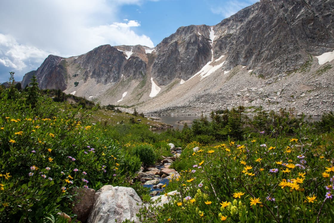
Albion Basin is that landscape: a high basin above Alta renowned for wildflowers. The access road is seasonal and often does not open until early July or later depending on snow depth, and the campground follows the same schedule. Peak bloom typically arrives in the second half of summer, and a wildflower festival with guided walks has run in that window.
Cecret Lake is the short hike from Albion Basin most visitors do, and it is short enough that people underestimate the altitude.
Rock climbing in Little Cottonwood is nationally significant — the granite here is a destination in its own right, and you will see climbers on the walls from the road.
The altitude problem nobody warns Utah Valley about
Provo sits around 4,500 feet. Brighton and Alta sit above 8,500 feet, and the trails climb from there.
That is a meaningful jump for a day trip. Visitors who hike comfortably around Utah Valley routinely find themselves short of breath on a Cottonwood trail rated easy, and children and older family members feel it faster.
The practical adjustments: drink more water than at home, start slower than feels necessary, and treat a two-mile alpine hike as equivalent in effort to a longer valley one. Afternoon thunderstorms are also a genuine hazard at elevation in Utah summers, which is a second reason to hike early.
Wildlife, and the moose in particular
Moose are common in both canyons and are the animal most likely to cause a problem.
They are far larger than they look in photographs, they are unpredictable around dogs — another reason the ban exists — and cows with calves are defensive. The standard guidance is to give them a very wide berth, never position yourself between a cow and a calf, and retreat rather than photograph if one moves toward you.
Mountain goats are visible on the high faces in Little Cottonwood, particularly around Albion Basin, and deer are everywhere. Bears are present in the Wasatch but rarely encountered.
What Utah Valley should compare this against
The Cottonwoods are excellent and they are also an hour away, before the canyon drive.
American Fork Canyon, the Alpine Loop, Timpanogos and the Provo Canyon system deliver comparable alpine terrain from Utah Valley without the watershed rules and without the Salt Lake weekend crowd. For a straightforward summer hike, home is usually the better answer.
The reasons to make the Cottonwood drive specifically are the ones nothing closer replicates: Albion Basin's wildflower display, Lake Blanche, Little Cottonwood's granite, Snowbird's tram, and the accessible Silver Lake boardwalk at Brighton.
Go for one of those. Do not go because you want a hike and forgot Utah County has mountains.
The season, month by month
May and early June. Lower canyon trails begin to open. Upper elevations are still under snow, the Albion Basin road is closed, and lakes are frozen or thawing. Waterfalls run hard with snowmelt.
Late June. Mid-canyon trails come in. Streams are high and crossings can be dangerous during heavy melt years.
July. The upper canyons open. Albion Basin's road typically becomes passable in the first half of the month in an average year. The alpine season begins in earnest.
Late July into August. Peak wildflowers, peak weather, peak crowds. This is the best time to visit and the hardest time to park.
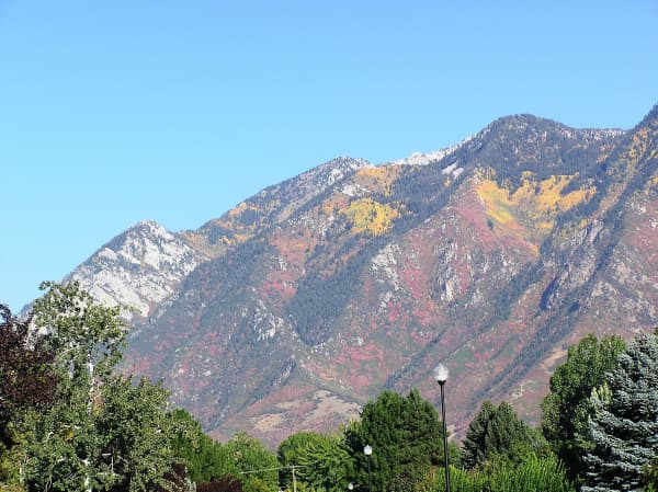
September. Quieter, cooler, and increasingly good for autumn color later in the month. Many people's favorite window.
October onward. Autumn color gives way to early snow, seasonal facilities close, and the canyons begin the transition to their winter identity.
The gondola argument, and why it matters to a summer visitor
Little Cottonwood's congestion has been the subject of one of the longest-running transport fights in Utah, and it is not over.
UDOT released its Record of Decision on the Little Cottonwood Canyon environmental impact statement in July 2023, selecting what it called Gondola Alternative B, a gondola running from a base station near the canyon mouth up to Snowbird and Alta with about 2,500 parking spaces at the base, to be delivered in phases, beginning with enhanced bus service and tolling rather than with the gondola itself.
The process drew roughly 50,000 formal public comments, described by UDOT as more than any previous environmental study in its history. UDOT's stated reasoning was that a gondola runs independently of SR-210 and so is unaffected by crashes, slide-offs and weather closures, with low watershed and wildlife impact, at the cost of high visual impact.
It has been contested since, and UDOT has said full implementation of the gondola depends on available funding.
A finished gondola is, at best, years away.
For a summer visitor from Utah Valley the practical read is this: nothing about the gondola changes your day. What might change your day sooner is the earlier phases — tolling and expanded bus service are the near-term tools, and if tolling arrives on SR-210 it will alter the arithmetic of driving up. Treat any specific date or fare you read as provisional, this one included.
Etiquette that locals care about
The Cottonwoods have a strong stewardship culture and visitors who ignore it get told.
Stay on the trail in Albion Basin. The wildflower meadows are fragile and heavily photographed, and the damage from people stepping off-trail for a better frame is visible year over year. There are designated viewing areas and boardwalk sections for a reason.
Pack out everything, including fruit peel and pet waste from the dog you did not bring.
Do not build cairns or move rocks. It confuses navigation and disturbs habitat.
Yield uphill. Standard trail convention, inconsistently observed by weekend crowds.
Do not play music aloud. This is the one that generates the most friction on busy Wasatch trails.
None of it is unique to these canyons. It is just enforced socially here more than in most places, because the local community has spent decades fighting about how these canyons are used and is not casual about them.
A day that works from Utah Valley
Leave Provo by 6:30 a.m. on a summer Saturday if you want a specific popular trailhead. That sounds excessive and it is the difference between parking at Donut Falls and parking a mile down the road.
Drive I-15 to I-215, up your chosen canyon, and hike in the cool part of the morning. Be off exposed high terrain by early afternoon because of storm risk.
Come down for a late lunch — Cottonwood Heights and the east-side suburbs at the canyon mouths have the food options, since in-canyon dining is limited to the resorts.
You are home in Utah Valley by mid-afternoon, having done a genuine alpine day rather than a long drive with a short walk at the end of it.
Food, fuel and facilities, which are thinner than you expect
There is very little in these canyons. Plan as though there is nothing.
No fuel stations exist up either canyon, so fill up in the valley before turning uphill. Mobile coverage is patchy in stretches and drops out entirely in some drainages, which matters if your plan depends on a map app or a meeting point.
Food is limited to the resorts, and resort dining runs on a seasonal schedule that does not match the hiking season — a restaurant open in February may be closed on a Tuesday in September. Snowbird has the widest summer food offering; elsewhere, assume you are carrying lunch.
Restrooms exist at developed trailheads and campgrounds and not between them. Water is not reliably available, and the streams are drinking-water supply you should not be filtering from casually.
The fix is unglamorous: fill the tank, pack a cooler, carry more water than the hike seems to need, and download the map before you leave the valley.
The short version
Two spectacular canyons, an hour from Provo, with rules that are stricter than anything Utah Valley residents are used to and are enforced.
Leave the dog at home — at home, not in the car. Do not swim. Park inside the lines and pay the fee where one applies. Carpool, go early, and check whether the Albion Basin road is open before you build a wildflower trip around it.
Do those things and the Cottonwoods reward the drive. Ignore them and the day ends with a citation and a long trip back down the canyon.
Related Guides
- Things to Do in Cottonwood Heights, Holladay and Millcreek, From Provo
- Things to Do in Sandy, Utah, From Provo
- Hikes You Can Take Your Dog On Near Provo, and the Watershed Rules
- Skiing Near Provo: Beyond Sundance (2026)
- Park City from Provo: The Year-Round Day Trip Guide
- Mountain Biking Near Provo: Trails & Guide (2026)
- Draper, Sandy and South Jordan From Utah County: The Near-North Day
Frequently Asked Questions
Can you take a dog into Big or Little Cottonwood Canyon?
How far are the Cottonwood Canyons from Provo?
Do you have to pay to park in the Cottonwood Canyons in summer?
Is there a summer bus up the canyons?
Can you swim in the lakes in the Cottonwood Canyons?
When do the Albion Basin wildflowers peak?
Which canyon is better for a first visit from Utah Valley?
Do the canyons close in summer?
Sources
The facts in this guide were checked against these sources. Hours, fees and rules change, so confirm anything time-sensitive with the source before you go. How we make Provo.com.
- Redman Campground - Salt Lake Ranger District, USDA Forest Service, Uinta-Wasatch-Cache National Forest. Checked October 12, 2026.
- Rules & Ordinances, Salt Lake City Department of Public Utilities. Checked October 12, 2026.
- Little Cottonwood Canyon EIS, Utah Department of Transportation. Checked October 12, 2026.
- UDOT releases EIS Record of Decision to improve transportation in Little Cottonwood Canyon, Utah Department of Transportation. Checked October 12, 2026.