The Slickrock Bike Trail is the ride that put Moab on the mountain biking map, and it is the one most first-time visitors want to try. It is also the one most first-time visitors should not start on. The trail's managers and the local tourism office describe it the same way: steep, sustained, technical and physically hard, with a practice loop that is nearly as demanding as the main loop. This guide lays out what Slickrock asks of a rider, what it costs to get in, which Moab trails are rated for beginners, what rentals run and how to build a first trip from Provo that ends with everyone still on speaking terms. For the drive and the national parks, start with our Moab from Provo guide.
The facts below come from the Bureau of Land Management's Moab Field Office pages for the Slickrock National Recreation Trail, the Bar M trail system and the Klonzo trailhead; Discover Moab, the Moab Travel Council's site, including its Sand Flats, trail map and e-bike pages; Grand County's Sand Flats fees page; Visit Utah; the National Park Service; Utah State Parks; and Poison Spider Bicycles. All were checked on Nov. 17, 2026. Where two sources disagree, this guide says so.
Quick facts
| Item | Detail | Source |
|---|---|---|
| Drive from Provo | About 191 miles, 3 hr 50 min to downtown Moab | OSRM routing estimate |
| Slickrock main loop | 10.5 miles | BLM; Discover Moab |
| Practice loop | 1.7 to 2.2 miles, depending on the page | Discover Moab; Visit Utah |
| Elevation gain | About 760 feet | Visit Utah |
| Rating | "Physically difficult, technically difficult" | Discover Moab |
| Typical ride time | 3 to 4 hours for most mountain bikers | Discover Moab |
| Sand Flats fee | $10 per vehicle or $5 per bike, each valid 7 days | Discover Moab |
| Passes accepted | Only the federal Access Pass | Discover Moab; Grand County |
| Best beginner system | Moab Brands (Bar M), about 30 miles, no fee | BLM; Discover Moab |
| Easiest named loop | Chuckwagon, 0.4 mile, about 2% grade | Discover Moab |
| Rental example | $80 a day, standard bike, helmet included | Poison Spider Bicycles |
| Prime seasons | March to May, September to November | Visit Utah |
Who this guide is for
This is for riders who have done some mountain biking, maybe on the trails around Provo, and want to know whether Moab's most famous trail is within reach. It is also for families and groups with mixed skill levels who want a Moab weekend where the newest rider is not walking a bike for three hours.
If you already ride confidently on technical terrain and are fit enough for a few hours of steep climbing, Slickrock is a realistic goal. If you are newer, or if "technical" is a word you hope to learn on this trip, the rest of this guide is the more useful part.
Who should skip Slickrock, at least for now
The sources are blunt about this. Discover Moab's Sand Flats page says the practice loop "is still difficult and not suited to novices or young children." Visit Utah says Slickrock "isn't a ride for beginners" and requires good fitness and solid bike-handling skills, and it describes the practice loop as "every bit as difficult" as the main loop.
That rules out:
- First-time mountain bikers. The difficulty comes from steep climbs and descents, ledges and sand, not from length alone.
- Young children. Discover Moab says so directly.
- Riders who struggle in heat. The trail is bare rock with no water.
- Anyone uncomfortable walking a bike down steep rock. Discover Moab says some sections may require walking.
Our broader Utah mountain biking destinations guide compares Moab with St. George and Park City, which may be a better first trip for some groups.
How to get there from Provo
The usual route runs southeast on US-6 through Spanish Fork Canyon to Price and Green River, then east on I-70 and south on US-191 into Moab. An OpenStreetMap routing estimate (OSRM) puts downtown Provo to downtown Moab at about 191 miles and 3 hours 50 minutes without stops. The Moab Brands (Bar M) trailhead area, north of town on US-191, comes up first, at about 181 miles and 3 hours 46 minutes by the same estimate.
From Moab, the BLM's directions to Slickrock start on 100 North or 400 East and wind through town to Mill Creek Drive and Sand Flats Road, which climbs about 2.5 miles to the entrance booth. Discover Moab puts the Sand Flats entrance station about 3 miles from Moab, a 9-minute drive. The Slickrock parking lot is just past the entrance station on the left, according to the BLM. Visit Utah notes you can ride from town, which adds about 3.5 miles of uphill travel.
Moab is a weekend from Provo, not a day trip, for most riders. Nearly eight hours of round-trip driving leaves little energy for a hard ride.
The Slickrock Bike Trail, in detail
History. The BLM says the trail was "originally established in 1969 for motorcycles" and is now popular with mountain bikers. It is a National Recreation Trail. Visit Utah traces the name to early settlers whose horses, in metal shoes, struggled for traction on the rock.
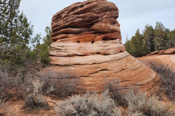
The rock. The trail crosses rolling Navajo Sandstone, petrified sand dunes, according to the BLM and Visit Utah. Visit Utah says the fine texture gives tires strong grip and that the trail has no huge drops, rock gardens or roots. The difficulty comes from steep pitches and sandpits between the domes. Cactus lines parts of the route.
Length and time. The BLM and Discover Moab list the main loop at 10.5 miles. Visit Utah gives 12.7 miles including the practice loop, about 760 feet of elevation gain and a riding time of 1 to 2.5 hours. Discover Moab says most mountain bikers need 3 to 4 hours, and motorcyclists about an hour or more. For planning, the longer estimate is the safer one, especially on a first visit.
The practice loop. This is the part that confuses people. Its length is listed three ways: 2.2 miles on Discover Moab's trail map page, 1.7 miles on its Sand Flats page and "only two miles" on Visit Utah. All three treat it as a test of whether you are ready for the main loop, not as an easy option. Discover Moab recommends it for first-time visitors to Slickrock but says it is not suited to novices.
Markings. Discover Moab says the trail is marked with white dashes painted on the rock, and that yellow dashes mark ledges and drop-offs. The trail crosses the Hell's Revenge 4x4 route six times, so watch for vehicles at those crossings. Maps are posted at the trailhead and entrance station, according to Discover Moab's trail map page.
Who else is out there. The BLM page says the trail is open to motorcycles and mountain bikes and closed to all four-wheeled vehicles. Visit Utah adds that hikers use it too. Discover Moab lists bicycles, motorcycles and Class 1 e-bikes on its Sand Flats page, though its separate e-bike page does not list Slickrock and suggests checking with Sand Flats.
Visit Utah's riding tips. Keep your weight close to the back tire on climbs and trust the tires on the rock. In sand, keep pedaling, stay loose and avoid oversteering. The page also says many riders get scraped by hopping off on steep sections and falling on an elbow, and that pedaling through is often safer than bailing. That advice assumes skills a beginner does not have yet, which is part of why the trail is rated the way it is.
Dogs. Visit Utah says dogs are allowed on a leash but not recommended, because the rock is hard on paws. Our guide to dogs in Utah's parks covers the rules on federal land more broadly.
Sand Flats fees, and why the numbers disagree
Slickrock sits inside Sand Flats Recreation Area, a site the BLM and Grand County manage together, and Sand Flats charges its own fee. The fee figures online do not agree, and the reason is age.
Current figures. Discover Moab's Sand Flats page lists:
- Day-use vehicle pass: $10, valid 7 days.
- Bicycle or motorcycle pass: $5, valid 7 days.
- Annual pass: $35, day use only, not camping.
- Camping: $20 per night per car, up to five people.
Older figures. The BLM's Slickrock page still lists $5 per vehicle for one day, $2 per bike per day and a $20 annual pass. Visit Utah gives $5 per vehicle or $2 per bike. A BLM news release from Dec. 15, 2015, raised camping and annual pass fees effective Jan. 1, 2016, and said the $5 vehicle day-use fee would not change at that time, which is consistent with those pages being out of date.
The official schedule. Grand County's Sand Flats fees page posts a "fee schedule for kiosks 2026," but it is an image, and its amounts could not be read from the page text. Check it, or call Grand County at 435-259-1321, before relying on any figure here.
Passes. Discover Moab and Grand County both say federal and Utah State Parks passes are not accepted at Sand Flats, with one exception: the federal Access Pass. An America the Beautiful pass that gets you into Arches will not get you onto Slickrock.
Hours and services. Discover Moab lists Sand Flats as open year-round, 8 a.m. to 5 p.m., but does not give separate entrance station hours. There is no water anywhere in Sand Flats. Vault toilets are at trailheads and campgrounds, and dumpsters are at the Slickrock trailhead and the Fins and Things parking area.
How Moab trails are rated
There is no single rating system for Moab trails, which is one reason first-timers end up on the wrong ride. Discover Moab's trail map pages, which credit Grand County's Trail Mix committee, describe trails with words like "easy," "intermediate," "advanced" and "expert," often split into physical and technical difficulty. Porcupine Rim gets a 4 on a 1 to 4 scale. Slickrock is "physically difficult, technically difficult." Monitor and Merrimac is "physically moderate, technically easier."
That two-part description is the useful part. A trail can be technically easy and still exhausting, like the Bar-M Loop, which Discover Moab calls "nontechnical but somewhat physical." A short trail can be technically hard. Read both halves before you choose.
Discover Moab also warns that some names mislead. Its trail map page says Baby Steps Loop at Klondike Bluffs is harder than its name suggests, with almost 1,700 feet of climbing and a semi-technical start.
Where beginners should start instead
All of the trails below are rated for beginners or as easy by Discover Moab's trail map pages unless noted.
Moab Brands (Bar M): the best first stop
The BLM says the Bar M system, just north of Moab off US-191, has about 31 miles of trails in several loops, "for beginners to experts all right out of the same trailhead," and no fee to ride. Discover Moab puts it at over 30 miles. It became a National Recreation Trail on Oct. 22, 2020, according to the BLM.
- Chuckwagon: 0.4 mile, "easy with gentle grades," about 2% average grade, dirt singletrack and two-track. Discover Moab warns that surfaces can be soft when dry.
- Rusty Spur: a 1.5-mile "easy loop with gentle grades," about 150 feet of climbing and an average grade near 3%, smooth dirt and rock with two cattle guards.
- Bar-M Loop: 7.9 miles, "nontechnical but somewhat physical," 625 feet of climbing either direction, with steep rolling hills at the north end. Discover Moab calls it "a mellow family ride on a dirt road with rocky sections." It is shared with motorized vehicles.
- Lazy EZ: the BLM names it as the beginner trail in the system and the Killer B trails as the most advanced.
Discover Moab notes Bar M has little shade, so carry plenty of water and snacks. The paved Moab Canyon Pathway runs about 10 miles from town to the trail system. The BLM asks riders to stay on trails and not to ride when trails are muddy.
Klondike: purpose-built beginner singletrack
Discover Moab says the Agate Loop (1.8 miles) and its 0.8-mile centerline two-track "was designed for beginning singletrack riders," with the west loop and centerline easier than the ridge-crest east loop. The Jasper Loop (1.7 miles) is "slightly more challenging than the Agate Loop, but still for beginning singletrack riders." Chilkoot Pass is also listed as gentle. These are a good second-day step up from Bar M.
Klonzo: short beginner pieces in an intermediate system
The BLM describes Klonzo as a 24-mile intermediate system built in 2012, mixing dirt singletrack with rolling slickrock, signed for counterclockwise riding with maps at every junction. Discover Moab names Wizard, Magician, Gypsy and Midway as short beginner options. Getting there takes some care: the BLM says the two trailheads are about 2.5 miles up Willow Springs Road, which crosses Courthouse Wash and often needs four-wheel drive. You can park before the wash and ride the extra 1.5 miles.
Horsethief: Wrangler
Discover Moab describes Wrangler as 0.8 mile of beginner singletrack with about 30 feet of elevation change, "smooth dirt trail with gentle dips and curves," looping just below the Horsethief campground.
Dead Horse Point: Intrepid
Discover Moab lists Intrepid at Dead Horse Point State Park as a 0.8-mile easy loop, "a great family ride, with tremendous views of the Colorado River," with longer extensions. Utah State Parks says Bighorn Rentals operates at the park's mountain bike trailhead and rents traditional and electric bikes, with reservations recommended. The park is open 6 a.m. to 10 p.m. and its visitor center 7 a.m. to 5 p.m., closed Thanksgiving, Christmas and New Year's Day. Dead Horse Point is a state park with its own entrance fee, which the park's page links to but does not list. Our Dead Horse Point guide covers the park and its trails.
The first taste of slickrock: Monitor and Merrimac
If the goal is to feel Moab's sandstone without committing to Slickrock, Discover Moab points to Monitor and Merrimac, a 7.5-mile lollipop from the Mill Canyon trailhead 16 miles north of Moab. It calls it "the best slickrock playground (stay on the rock!) in Moab for novice mountain bikers," rated physically moderate and technically easier, with about 550 feet of gain. About half the route is slickrock. Discover Moab warns it is easy to confuse with the nearby Monitor and Merrimac Jeep Trail.
Intermediate steps between beginner trails and Slickrock
Once Bar M and Klondike feel easy, Discover Moab lists Navajo Rocks as intermediate loops, with Ramblin' at 3.3 miles, Big Mesa at 3.4, Rocky Tops at 4.6 and Big Lonely at 3.2, ridden clockwise. Klonzo's longer loops and Raptor Route's four connected downhill trails sit in this range too. Discover Moab says Raptor Route can be ridden by parking at the bottom and pedaling the road, or by hiring a shuttle to the top of Eagle Eye. A rider comfortable on those is closer to ready for the Slickrock practice loop.
Rentals, guides and shuttles
Discover Moab says local shops and guide services rent bikes and helmets, run shuttles to popular trailheads and lead tours, and that guides often supply water, snacks and route knowledge.
For a concrete price example, Poison Spider Bicycles at 497 N. Main St. posts these daily rental rates:
- Standard: $80 a day, $225 for three days.
- High end: $100 a day.
- Premium: $120 a day.
- E-bike: $140 a day.
- Youth bikes: $30 for a 20-inch, $35 for a 24-inch, $50 for a kids' full suspension.
Each rental includes a helmet, a flat kit and pump and a choice of pedals. A warranty service plan is $6 a day; decline it and you are responsible for damage. The primary rider must be over 18 with a valid ID and credit card, and every rider attends a safety orientation. Cancel at least 48 hours ahead or you are charged for each day booked. The shop strongly recommends reservations, especially March through June and September through November, and says rental days run 8 a.m. to 5 p.m., 9 a.m. in winter. Other shops price differently, so compare.
For a first day, a guided ride is a reasonable choice. A guide matches the trail to the group and handles the logistics, which takes the guesswork out of the ratings problem described above.
If you bring your own bike, our Provo bike shops guide lists places to get it tuned before the drive.
E-bikes
E-bike rules around Moab depend on who manages the land. According to Discover Moab's e-bike page:
- BLM: Class 1 e-bikes are allowed on 17 listed trail systems, including Moab Brands, Klonzo, Navajo Rocks, Klondike Bluffs, Baby Steps, Amasa Back and three Raptor Route trails. Other e-bikes are limited to motorized routes.
- In town: Class 1 e-bikes may use city paths at up to 15 mph and the Moab Canyon Pathway.
- Arches and Canyonlands: E-bikes go where regular bikes go, which means roads only. Neither park has singletrack open to bikes.
- Dead Horse Point: Class 1 e-bikes are allowed on trails open to regular bikes.
- Forest Service: All e-bikes are treated as motorized.
The page does not state the rule for Slickrock; ask Sand Flats at 435-259-2444 before riding one there.
Biking in the national parks
New riders sometimes assume Arches has bike trails. It doesn't. The Park Service's Arches biking page says bikes and e-bikes are allowed on paved and unpaved park roads only, with no trail or off-road riding. There are no bike lanes or paved shoulders, so the park suggests riding early, single file, and watching for buses and RVs. The Salt Valley and Willow Springs dirt roads suit mountain bikes better, with washboard and deep sand. A paved path runs from Moab to the park entrance and on along US-191 to UT-313.
Canyonlands' White Rim Road is a 100-mile loop that the Park Service says usually takes mountain bikers three to four days, needs a permit for every trip and has no potable water. It is not a beginner ride. Our Island in the Sky guide covers that district.
When to go
Visit Utah calls March through May and September through November the prime seasons for Slickrock, with intense summer heat and winter that can be pleasant and quieter. The Park Service's Arches weather page gives monthly average highs of 64 degrees in March, 71 in April, 82 in May, 88 in September, 74 in October and 56 in November, against 93 in June, 100 in July and 97 in August. The park adds that "summer temperatures often exceed 100ºF, making strenuous exercise difficult," and that late-summer monsoon storms often cause flash floods.
For summer riding on Slickrock, Discover Moab says early morning and evening are best. Poison Spider Bicycles offers evening-before pickups in summer for that reason.
A first-timer plan for a Moab weekend
This assumes a rider with some trail experience and a group that may include a newer rider.
- Friday: Drive from Provo after work. Stop at the Moab Information Center at Center and Main, open 9 a.m. to 4 p.m. daily according to Discover Moab, if you arrive in time for maps and conditions.
- Saturday morning: Ride Rusty Spur and Chuckwagon at Bar M to get used to the bike and the dirt, then the Bar-M Loop if legs are fresh. Carry more water than seems necessary.
- Saturday afternoon: Rest. In warm months, stay off the rock in midday heat.
- Sunday morning: Step up to the Agate and Jasper loops at Klondike, or Monitor and Merrimac for a first ride on slickrock. Riders who found Saturday easy can try the Slickrock practice loop and turn back if it feels like too much.
- Sunday afternoon: Drive home.
Save the full Slickrock loop for a later trip, after the practice loop feels comfortable. The trail isn't going anywhere.
What to bring
- Water. Discover Moab's trail map page says to carry at least a gallon per person per day, because there is no water on the trails. Sand Flats has none at all.
- A helmet. Rentals at Poison Spider include one.
- Snacks. Discover Moab specifically mentions them for shadeless Bar M.
- A map, and the skill to read it. Discover Moab advises carrying one. The BLM says to bring your own maps at Klonzo even though junctions are signed.
- A repair kit. Discover Moab suggests checking your bike often for loose components.
- Cash or a card for Sand Flats, separate from any park pass.
Safety
Discover Moab's safety notes are short: wear a helmet, carry water, tell someone your plans, and if you get lost, retrace your route or stay put. Stay on marked trails, which on slickrock means following the paint. Off-route riding damages the crusted desert soil that trail pages repeatedly ask riders to protect, and Discover Moab's Sand Flats page says off-road riding there is a Class A misdemeanor.
On Slickrock, watch for the yellow-dash ledges and for vehicles at the Hell's Revenge crossings. Visit Utah advises against riding at night without a good lighting system.
What to check before you go
- Grand County's Sand Flats fees page, for the 2026 kiosk schedule.
- The BLM Moab Field Office, 435-259-2100, for trail conditions and closures.
- Sand Flats, 435-259-2444, for e-bike questions on Slickrock.
- Your rental shop's cancellation window and pickup times.
- The forecast, for heat and for rain, which closes trails to riding when muddy.
- Dead Horse Point's fee page, if you plan to ride Intrepid.
Related guides
- Moab From Provo: Planning the Drive, Arches and Canyonlands
- Utah Mountain Biking Destinations From Provo: Moab, St. George and Park City
- Dead Horse Point State Park: The Overlook, the Fees and the Intrepid Bike Trails
- Canyonlands Island in the Sky: Mesa Arch, Grand View Point and the Short Drive In
- Mountain Biking Near Provo
- Bike Shops in Provo
Frequently Asked Questions
Is the Slickrock Trail in Moab good for beginners?
How long is the Slickrock Trail?
How much does it cost to ride the Slickrock Trail?
Does my national parks pass work at Sand Flats?
Where should a first-time mountain biker ride in Moab?
How much does it cost to rent a mountain bike in Moab?
Can I ride an e-bike on Moab mountain bike trails?
When is the best time to mountain bike in Moab?
Sources
The facts in this guide were checked against these sources. Hours, fees and rules change, so confirm anything time-sensitive with the source before you go. How we make Provo.com.
- Slickrock National Recreation Trail, Bureau of Land Management. Checked November 17, 2026.
- Bar M Trail System, Bureau of Land Management. Checked November 17, 2026.
- Klonzo Trailhead, Bureau of Land Management. Checked November 17, 2026.
- Some Fees to Increase at Sand Flats Recreation Area, Bureau of Land Management. Checked November 17, 2026.
- Sand Flats Recreation Area Fees, Grand County, Utah. Checked November 17, 2026.
- Slickrock Trail of the Sand Flats Recreation Area, Visit Utah (Utah Office of Tourism). Checked November 17, 2026.
- Bicycling - Arches National Park, National Park Service. Checked November 17, 2026.
- Weather - Arches National Park, National Park Service. Checked November 17, 2026.
- White Rim Road - Canyonlands National Park, National Park Service. Checked November 17, 2026.
- Dead Horse Point State Park, Utah State Parks. Checked November 17, 2026.
- Sand Flats Recreation Area, Discover Moab (Moab Travel Council). Checked November 17, 2026.
- Mountain Biking Trail Maps, Discover Moab (Moab Travel Council). Checked November 17, 2026.
- Biking in Moab, Discover Moab (Moab Travel Council). Checked November 17, 2026.
- E-Bikes in Moab, Discover Moab (Moab Travel Council). Checked November 17, 2026.
- Moab Information Center, Discover Moab (Moab Travel Council). Checked November 17, 2026.
- Moab Bike Rentals, Poison Spider Bicycles. Checked November 17, 2026.